
Brandenburg, officially the State of Brandenburg, is a state in northeastern Germany. Brandenburg borders Poland and the states of Berlin, Mecklenburg-Vorpommern, Lower Saxony, Saxony-Anhalt, and Saxony. It is the fifth-largest German state by area and the tenth-most populous, with 2.5 million residents. Potsdam is the state capital and largest city. Other major towns are Cottbus, Brandenburg an der Havel and Frankfurt (Oder).
Kulmbach is a Landkreis (district) in Bavaria, Germany. It is bounded by the districts of Kronach, Hof, Bayreuth and Lichtenfels.
Hohen Neuendorf is a town in the Oberhavel district, in Brandenburg, Germany. It is located north west of Berlin.

Oranienburg is a railway station located in Oranienburg, Germany. The station was opened in 1877 is located on the Berlin Northern Railway and the now closed Nauen–Oranienburg railway and Oranienburg–Velten railway. The train services are operated by Deutsche Bahn and Niederbarnimer Eisenbahn.
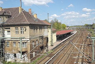
Birkenwerder is a railway station in the town of Birkenwerder, Brandenburg, Germany. The station lies of the Berlin Northern Railway and the train services are operated by Deutsche Bahn including Berlin S-Bahn services.

Berlin-Hermsdorf is a railway station in the neighbourhood of Hermsdorf, in the city of Berlin, Germany. It is served by the Berlin S-Bahn and by several local buses.

Berlin-Waidmannslust is a railway station in the neighbourhood of Waidmannslust, in the city of Berlin, Germany. It is served by the Berlin S-Bahn and by several local buses.

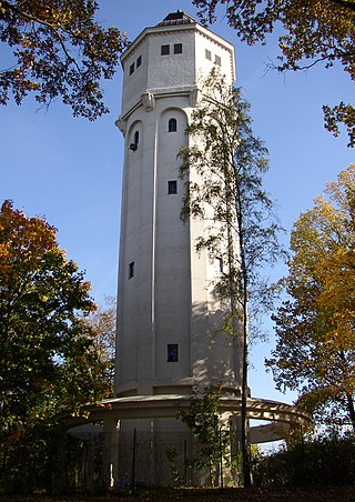
Birkenwerder is a municipality in the Oberhavel district, in Brandenburg, Germany.

Nieden is a municipality in the Vorpommern-Greifswald district, in Mecklenburg-Vorpommern, Germany.

Ralf Briese was a German politician for the Alliance '90/The Greens.
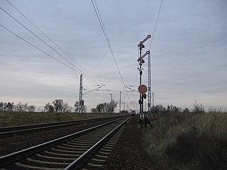
The Berlin Northern Railway is a 223-kilometre-long main line route, that runs from Berlin via Neustrelitz and Neubrandenburg to Stralsund on the Baltic Sea coast. Nowadays, long-distance and regional traffic on the Nordbahn is routed at Hohen Neuendorf onto the Berlin Outer Ring to the Karower Kreuz and on to Berlin Main Station or Berlin-Lichtenberg.

Berlin has developed a highly complex transportation infrastructure providing very diverse modes of urban mobility. 979 bridges cross 197 kilometers of innercity waterways, 5,334 kilometres (3,314 mi) of roads run through Berlin, of which 73 kilometres (45 mi) are motorways. Long-distance rail lines connect Berlin with all of the major cities of Germany and with many cities in neighboring European countries. Regional rail lines provide access to the surrounding regions of Brandenburg and to the Baltic Sea.

Hennigsdorf is a railway station in the Oberhavel district of Brandenburg, located in the town of Hennigsdorf. It is the northern terminus of the S-Bahn line S25 as well as a station for regional passenger trains and freight services.

The Berlin outer ring is a 125 km (78 mi) long double track electrified railway, originally built by the German Democratic Republic to bypass West Berlin in preparation for the building of the Berlin Wall during the division of Germany. It was developed by East Germany for economic, transport policy, and military reasons between 1951 and 1961 and included parts of some older lines.

The Berlin/Brandenburg metropolitan region or capital region is one of eleven metropolitan regions of Germany, consisting of the entire territories of the state of Berlin and the surrounding state of Brandenburg. The region covers an area of 30,545 square kilometres (11,793 sq mi) with a total population of about 6.2 million.

The Barnim Plateau is a plateau which is occupied by the northeastern parts of Berlin and the surrounding federal state of Brandenburg in Germany.
Heinrich Hildmann was a German plantsman who specialized in cactus. He trained as a gardener at the Haage and Schmidt nurseries in Erfurt. He went to Paris about 1866 to work in the cactus nursery of Charles Pfersdorff, before opening his own nursery in Lyon. Returning to Germany at the outbreak of the Franco-Prussian War he established a cactus nursery in Berlin, later locating in the nearby town of Birkenwerder. He sold the business in 1891 but continued as advisor to the new owner for several years. While 1895, the year of his last original published article on cacti is often given as the year of his death, he continued his annual membership in the Brandenburg Botanical Society from 1892 until 1911, but he was then still alive.
The Kreuz Oranienburg is a partial cloverleaf with a semi-direct link in the German state Brandenburg in the Metropolitan region of Berlin.

Oberhavel II is an electoral constituency represented in the Landtag of Brandenburg. It elects one member via first-past-the-post voting. Under the constituency numbering system, it is designated as constituency 8. It is located in the Oberhavel district

