Brighton, Tennessee

Last updated

Brighton, Tennessee
Brighton TN 2013-10-13 001.jpg
Tipton County Tennessee Incorporated and Unincorporated areas Brighton Highlighted 4708500.svg
Location of Brighton in Tipton County, Tennessee.
Coordinates: 35°28′58″N89°43′25″W / 35.48278°N 89.72361°W / 35.48278; -89.72361
Country United States
State Tennessee
County Tipton
Government
  MayorStephanie Chapman-Washam
Area
[1]
  Total3.04 sq mi (7.86 km2)
  Land3.04 sq mi (7.86 km2)
  Water0.00 sq mi (0.00 km2)
Elevation
[2]
341 ft (104 m)
Population
 (2020) [3]
  Total2,888
  Density951.25/sq mi (367.26/km2)
Time zone UTC-6 (Central (CST))
  Summer (DST) UTC-5 (CDT)
ZIP code
38011
Area code 901
FIPS code 47-08500 [4]
GNIS feature ID1278391 [2]
Website www.townofbrighton.com

Brighton is a town in Tipton County, Tennessee, United States. The population was 2,735 at the 2010 census. [5]

Contents

History

Brighton was established in the year 1873, along the newly completed tracts of the Memphis and Paducah Railroad upon the lands of A. W. Smith, Sr. who gave the initial five acres for the Depot grounds. The new town was named for Mr. Bright, the first conductor on the Memphis Division of the said road.

The new town grew quickly. By the late 1870s, Brighton had two dry goods stores, three grocery stores, two saloons, two blacksmith shops, two wagon shops, one brick yard, one steam saw and grist mill, one steam cotton gin, a Baptist church, two physicians, and a population of approximately 100.

In 1883, the veterans of the 7th Tennessee Cavalry, Confederate States of America made Brighton the permanent site of their annual reunion. At Brighton, the veterans reunion took on new dimensions and it grew into a reunion of all Confederate veterans of Tipton County and the surrounding region. Over the years, attendance of this annual August event grew, peaking at 15,000 in 1897. The Tipton County Confederate Veterans Reunion, as it came to be known, continued to be held at Brighton until 1940.

Brighton was incorporated by the Tennessee General Assembly in 1913 and the town today continues to operate under the same charter.

Notable person

Geography

Brighton is located at 35°28′58″N89°43′25″W / 35.48278°N 89.72361°W / 35.48278; -89.72361 (35.482847, -89.723563). [6]

According to the United States Census Bureau, the town has a total area of 2.7 square miles (7.0 km2), all land.

Demographics

Historical population
CensusPop.Note
1880 104
1890 214105.8%
1920 265
1930 29712.1%
1940 2990.7%
1950 3062.3%
1960 652113.1%
1970 95246.0%
1980 9762.5%
1990 717−26.5%
2000 1,719139.7%
2010 2,73559.1%
2020 2,8885.6%
Sources: [7] [8] [3]

2020 census

Brighton racial composition [9]
RaceNum.Perc.
White (non-Hispanic)2,11073.06%
Black or African American (non-Hispanic)46916.24%
Native American 40.14%
Asian 170.59%
Pacific Islander 20.07%
Other/Mixed 1836.34%
Hispanic or Latino 1033.57%

As of the 2020 United States census, there were 2,888 people, 987 households, and 723 families residing in the town.

2000 census

As of the census [4] of 2000, there were 1,719 people, 596 households, and 470 families residing in the town. The population density was 627.8 inhabitants per square mile (242.4/km2). There were 628 housing units at an average density of 229.3 per square mile (88.5/km2). The racial makeup of the town was 77.20% White, 20.65% African American, 0.23% Native American, 0.47% Asian, 0.06% Pacific Islander, 0.23% from other races, and 1.16% from two or more races. Hispanic or Latino of any race were 1.34% of the population.

There were 596 households, out of which 49.5% had children under the age of 18 living with them, 56.7% were married couples living together, 17.3% had a female householder with no husband present, and 21.1% were non-families. 18.3% of all households were made up of individuals, and 8.6% had someone living alone who was 65 years of age or older. The average household size was 2.88 and the average family size was 3.27.

In the town, the population was spread out, with 36.2% under the age of 18, 8.0% from 18 to 24, 34.0% from 25 to 44, 13.3% from 45 to 64, and 8.6% who were 65 years of age or older. The median age was 29 years. For every 100 females, there were 86.8 males. For every 100 females age 18 and over, there were 82.8 males.

The median income for a household in the town was $43,510, and the median income for a family was $46,538. Males had a median income of $36,012 versus $25,789 for females. The per capita income for the town was $15,432. About 7.8% of families and 8.3% of the population were below the poverty line, including 10.6% of those under age 18 and 7.9% of those age 65 or over.

Education

Brighton Public Schools are part of Tipton County Schools. The Tipton County School District has eight elementary schools, five middle schools and three high schools. [10]

Dr. John Combs is the Director of Schools. [11]

Schools located in Brighton include:

Related Research Articles

<span class="mw-page-title-main">Tipton County, Tennessee</span> County in Tennessee, United States

Tipton County is a county located on the western end of the U.S. state of Tennessee, in the Mississippi Delta region. As of the 2020 census, the population was 60,970. Its county seat is Covington. Tipton County, founded in 1823, is part of the Memphis, TN-MS-AR Metropolitan Statistical Area.

<span class="mw-page-title-main">Lauderdale County, Tennessee</span> County in Tennessee, United States

Lauderdale County is a county located on the western edge of the U.S. state of Tennessee, with its border the Mississippi River. As of the 2020 census, the population was 25,143. Its county seat is Ripley. Since the antebellum years, it has been developed for cotton as a major commodity crop.

<span class="mw-page-title-main">Hardeman County, Tennessee</span> County in Tennessee, United States

Hardeman County is a county located in the U.S. state of Tennessee. As of the 2020 census, the population was 25,462. Its county seat is Bolivar.

<span class="mw-page-title-main">Fayette County, Tennessee</span> County in Tennessee, United States

Fayette County is a county located in the U.S. state of Tennessee. As of the 2020 census, the population was 41,990. Its county seat is Somerville. The county was named after the Marquis de la Fayette, French hero of the American Revolution. A part of the Memphis, TN-MS-AR Metropolitan Statistical Area, Fayette County is culturally alike to the Mississippi Delta and was a major area of cotton plantations dependent on slave labor in the nineteenth century.

<span class="mw-page-title-main">Chickaloon, Alaska</span> Census-designated place in Matanuska-Susitna Borough, Alaska, United States

Chickaloon is a census-designated place (CDP) in Matanuska-Susitna Borough, Alaska, United States. It is part of the Anchorage, Alaska Metropolitan Statistical Area. The population was 254 at the 2020 census, down from 272 in 2010.

<span class="mw-page-title-main">Mount Pleasant Mills, Pennsylvania</span> CDP in Pennsylvania, United States

Mount Pleasant Mills is a census-designated place (CDP) in Snyder County, Pennsylvania, United States. The population was 342 at the 2000 census.

<span class="mw-page-title-main">Friendship, Tennessee</span> City in Tennessee, United States

Friendship is a city in Crockett County, Tennessee. The population was 668 at the 2010 census.

<span class="mw-page-title-main">Ridgely, Tennessee</span> Town in Tennessee, United States

Ridgely is a town in Lake County, Tennessee, United States. The population was 1,667 at the 2000 census and 1,795 at the 2010 census.

<span class="mw-page-title-main">Tiptonville, Tennessee</span> Town in Tennessee, United States

Tiptonville is a town in and the county seat of Lake County, Tennessee, United States. Its population was 2,439 as of the 2000 census and 4,464 in 2010, showing an increase of 2,025. It is also home to the Northwest Correctional Complex, a maximum security prison, known for once housing mass murderer Jessie Dotson.

<span class="mw-page-title-main">Henning, Tennessee</span> Town in Tennessee, United States

Henning is a town in Lauderdale County, Tennessee, United States. The population was 945 at the 2010 census.

<span class="mw-page-title-main">Powells Crossroads, Tennessee</span> Town in Tennessee, United States

Powells Crossroads is a town in Marion County, Tennessee, United States. The population was 1,322 at the 2010 census, up from 1,286 in 2000. It is part of the Chattanooga, TN-GA Metropolitan Statistical Area.

<span class="mw-page-title-main">Atoka, Tennessee</span> Town

Atoka is a local government area with a town charter in Tipton County, Tennessee, United States. In 1888, Atoka was a stop on the Newport News & Mississippi Valley Railroad. Today the City of New Orleans Amtrak passenger train makes its daily route between New Orleans and Chicago, through Atoka. The population was 10,008 at the 2020 census, making the Town of Atoka the largest municipality in Tipton County.

<span class="mw-page-title-main">Covington, Tennessee</span> City in Tennessee, United States

Covington is a city in central Tipton County, Tennessee, United States. Covington is the second largest city and county seat of Tipton County. The city is located in West Tennessee, 12 mi (19 km) east of the Mississippi River. The city's population was 9,038 at the time of the 2010 U.S. Census. Located 42 mi (68 km) northeast of Memphis, Covington is part of the Memphis, Tennessee Metropolitan Area.

Garland is a town in Tipton County, Tennessee. The population was 310 at the 2010 census.

Gilt Edge is a city in Tipton County, Tennessee. The population was 477 at the 2010 census and 456 in 2018, showing a decrease of 21.

<span class="mw-page-title-main">Mason, Tennessee</span> Town in Tennessee, United States

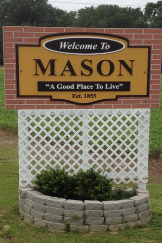
Mason is a town in Tipton County, Tennessee. The population was 1,609 at the 2010 census. Mason is located along U.S. Route 70, and is home to a federal detention facility.

<span class="mw-page-title-main">Munford, Tennessee</span> City in Tennessee, United States

Munford is a city in Tipton County, Tennessee. The population was 5,927 at the 2010 census, when it was listed as a town.

<span class="mw-page-title-main">West Odessa, Texas</span> Census-designated place in Texas, United States

West Odessa is an unincorporated area and census-designated place (CDP) in Ector County, Texas, United States, on the west side of the city of Odessa. The population was 22,707 at the 2010 census, up from 17,799 at the 2000 census. It is part of the Odessa metropolitan area.

<span class="mw-page-title-main">Bay View, Washington</span> CDP in Washington, United States

Bay View is a census-designated place (CDP) in Skagit County, Washington, United States. The population was 696 at the 2010 census. It is included in the Mount Vernon–Anacortes, Washington Metropolitan Statistical Area.

Watertown is a town in Jefferson County, Wisconsin, United States. The population was 1,975 at the 2010 census. The unincorporated community of Ebenezer is located in the town.

References

  1. "ArcGIS REST Services Directory". United States Census Bureau. Retrieved October 15, 2022.
  2. 1 2 U.S. Geological Survey Geographic Names Information System: Brighton, Tennessee
  3. 1 2 "Census Population API". United States Census Bureau. Retrieved October 15, 2022.
  4. 1 2 "U.S. Census website". United States Census Bureau . Retrieved January 31, 2008.
  5. Tennessee Department of Economic and Community Development, Certified Population of Tennessee Incorporated Municipalities and Counties Archived June 30, 2014, at the Wayback Machine , State of Tennessee official website, July 14, 2011. Retrieved: December 6, 2013.
  6. "US Gazetteer files: 2010, 2000, and 1990". United States Census Bureau. February 12, 2011. Retrieved April 23, 2011.
  7. "Census of Population and Housing: Decennial Censuses". United States Census Bureau . Retrieved March 4, 2012.
  8. "Incorporated Places and Minor Civil Divisions Datasets: Subcounty Resident Population Estimates: April 1, 2010 to July 1, 2012". Population Estimates. U.S. Census Bureau. Archived from the original on June 11, 2013. Retrieved December 11, 2013.
  9. "Explore Census Data". data.census.gov. Retrieved December 8, 2021.
  10. "Tipton County School District". GreatSchools Inc. Retrieved June 22, 2012.
  11. "Tipton County Schools". Tipton County Schools. Retrieved June 22, 2012.

35°28′58″N89°43′25″W / 35.482847°N 89.723563°W / 35.482847; -89.723563