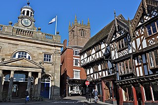
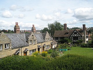
Ludlow is a market town and civil parish in Shropshire, England. It is located 28 miles (45 km) south of Shrewsbury and 23 miles (37 km) north of Hereford, on the A49 road which bypasses the town. The town is near the confluence of the rivers Corve and Teme.

The A49 is an A road in western England, which traverses the Welsh Marches region. It runs north from Ross-on-Wye in Herefordshire via Hereford, Leominster, Ludlow, Shrewsbury and Whitchurch, then continues through central Cheshire to Warrington and Wigan before terminating at its junction with the A6 road just south of Bamber Bridge, near the junction of the M6, M65 and M61 motorways.
Edgmond is a village in the borough of Telford and Wrekin and ceremonial county of Shropshire, England. The village population at the 2011 Census was 2,062. It lies 1 mile north-west of the town of Newport.

All Stretton is a village and a now separate civil parish in Shropshire, England. Much of it is covered by a Conservation Area.

Clungunford is a village and civil parish in south Shropshire, England, located near the border with Herefordshire.

Leintwardine is a small to mid-size village and civil parish in north Herefordshire, England, close to the border with Shropshire.

Little Hereford is a small village and civil parish in Herefordshire, England. The civil parish includes the hamlet of Middleton. The population of the civil parish at the 2011 census was 394.
Ashford Bowdler is a small village and civil parish in south Shropshire, England, near the county border with Herefordshire.

Bromfield is a village and civil parish in Shropshire, England.
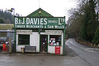
Bucknell is a village and civil parish in south Shropshire, England. The village lies on the River Redlake, within 660 yards (600 m) of the River Teme and close to the border of Wales and Herefordshire. It is about 6 miles (9.7 km) east of Knighton and is set within the Shropshire Hills Area of Outstanding Natural Beauty.

Wellington, a village in Herefordshire, England at grid reference SO494481 had a population of 1005 in the 2011 census.

Woofferton is a village to the south of Ludlow, in Shropshire, England. It is one of Shropshire's most southerly villages and lies on the border with Herefordshire. It is part of the civil parish of Richard's Castle. The larger Herefordshire village of Brimfield is just over the border to the south.
Ludford is a small village and civil parish in south Shropshire, England. The parish is situated adjacent to the market town of Ludlow and was, until 1895, partly in Herefordshire.
Wyson is a hamlet in north Herefordshire, England, situated west of the A49 road and the adjacent village of Brimfield.

Caynham is a village and civil parish in south Shropshire, England. The parish lies on the River Teme. It can be accessed via the A4117 or the A49 roads and is located 2+1⁄2 miles (4 km) southeast of the market town of Ludlow. The civil parish includes the village of Cleehill and has an area of 953 hectares.

Richard's Castle is a village, castle and two civil parishes on the border of the counties of Herefordshire and Shropshire in England. The Herefordshire part of the parish had a population of 250 at the 2011 Census, the Shropshire part, 424.
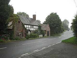
Ashton is a village in the Eye, Moreton and Ashton civil parish of Herefordshire, England, and is 3 miles (5 km) north from Leominster, 15 miles (24 km) north from the city and county town of Hereford, and in the catchment area of the River Lugg. The village is on the A49 road; to the north is Brimfield. Bordering the village to the south-west is Berrington Hall.

Kimbolton is a village and parish in Herefordshire, England, around 3 miles (5 km) north east of Leominster and 15 miles (24 km) north of Hereford. The village is on the A4112 road, near its junction with the A49 road. The church is dedicated to St James, has 13th-century features and has two Norman windows in the chancel. The spire is shingled.

Broadward is a dispersed hamlet in south Shropshire, England, situated by the border with Herefordshire. It is in the civil parish of Clungunford, a village approximately 2 miles (3.2 km) to the north.

Eye, Moreton and Ashton is a civil parish in the county of Herefordshire, England. The parish is 15 miles (24 km) north from the city and county town of Hereford. The closest large town is the market town of Leominster, 3 miles (5 km) to the south. Within the parish is the National Trust property of Berrington Hall, and the villages of Eye, Moreton, and Ashton.

