
South Walsham is a village and civil parish in the English county of Norfolk. It covers an area of 11.43 km2 (4.41 sq mi) and had a population of 738 in 303 households at the 2001 census. increasing to 845 living in 345 households at the 2011 Census. For the purposes of local government, it falls within the district of Broadland. Historically, the village comprised two separate parishes, that of St Mary and of St Lawrence. After fire damage in 1827, the church of St Lawrence slowly fell into disuse and the two parishes were combined in 1889.

Little Brington is a village in Brington and civil parish, in West Northamptonshire, England. It has one little school that currently holds around 50 children.

Great Brington is a village in Northamptonshire, England, in the civil parish of Brington, which at the 2011 Census had a population of about 200. St Mary the Virgin's church is the parish church.

Everdon is a village in West Northamptonshire in England, some 3 miles (4.8 km) south of Daventry. The population of the civil parish at the 2011 census was 356.

Chapel Brampton is a village and former civil parish in West Northamptonshire in England. Together with nearby Church Brampton, it is known as The Bramptons. At the time of the 2001 census, Chapel Brampton parish's population was 470 people. At the 2011 census the population was included in the civil parish of Church with Chapel Brampton.

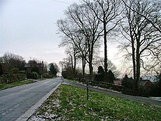
Nobottle is a hamlet in West Northamptonshire in England. The population is included in the civil parish of Brington. It borders the Althorp estate, which owns much of the property. Nobottle used to have a 600yd rifle range, now shut by the MOD some 20 years. The Midshires Way long distance footpath passes through Nobottle. A Roman building was excavated here in 1927-9 and a hoard of 814 coins found, spanning several hundred years, but mostly of the late 4th century.

A civil parish is a country subdivision, forming the lowest unit of local government in England. There are 264 civil parishes in the ceremonial county of Cambridgeshire, most of the county being parished; Cambridge is completely unparished; Fenland, East Cambridgeshire, South Cambridgeshire and Huntingdonshire are entirely parished. At the 2001 census, there were 497,820 people living in the parishes, accounting for 70.2 per cent of the county's population.

Seaton is a village and civil parish in the county of Rutland in the East Midlands of England. The population of the civil parish was 178 at the 2001 census, including Stoke Dry and Thorpe by Water, increasing to 250 at the 2011 census. Nearby is the large Seaton Viaduct, on the Oakham to Kettering railway line. It is three quarters of a mile long and took four years to build. It has 82 arches which are up to 72 feet (22 m) high. For many years the railway was only used for freight traffic, but a restricted passenger service from Oakham to London via Corby and Kettering was opened in 2010. Seaton railway station, on a different line, closed in 1966.

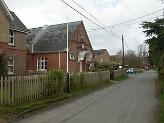
Molesworth is a village in the civil parish of Brington and Molesworth in Cambridgeshire, England. Molesworth is 10 miles (16 km) north-west of Huntingdon. The neighbouring village of Brington is 0.7 miles (1.1 km) from Molesworth. Molesworth is situated within Huntingdonshire which is a non-metropolitan district of Cambridgeshire as well as being a historic county of England. The civil parish covers an area of 2,842 acres. Just to the north of Molesworth and within the civil parish is RAF Molesworth. The village of Molesworth was designated a conservation area by Huntingdon District Council largely due to its typically rural English character that includes several listed buildings.
Aislaby is a village and civil parish in the Scarborough district of North Yorkshire, England. It is situated near the town of Whitby on the northern slopes of Eskdale just off the A171.

Bradenham is a village and civil parish, a conglomeration of East and West Bradenham, in the English county of Norfolk. It is situated some 5 miles (8.0 km) south-west of the town of East Dereham and 19 miles (31 km) west of the city of Norwich. The civil parish has an area of 16.55 km2 and in the 2001 census had a population of 722 in 301 households, the population decreasing to 700 in 293 households at the 2011 Census. For the purposes of local government, the parish falls within the Breckland district.
Whitsbury is a village and civil parish in Hampshire, England, close to Fordingbridge. Whitsbury is a part of a group of villages on the edge of the Cranborne Chase and West Wiltshire Downs Area of Outstanding Natural Beauty.
West Tanfield is a village and civil parish in the Hambleton district of North Yorkshire, England. The village is situated approximately six miles north of Ripon on the A6108, which goes from Ripon to Masham and Wensleydale. The parish includes the hamlets of Nosterfield, Thornborough and Binsoe.
Church with Chapel Brampton is a civil parish in West Northamptonshire in the English county of Northamptonshire. The population of the civil parish at the 2011 census was 808.

Kirkby Malzeard is a village and civil parish in the Harrogate district of North Yorkshire, England. There has been a creamery in the village making Wensleydale cheese for almost 100 years, first owned by Mrs Mason, then Kit Calvert, of Hawes, subsequently the Milk Marketing Board and more recently it was acquired by the Wensleydale Creamery.

West Heslerton is a village and former civil parish in North Yorkshire, England, 6 miles (10 km) southeast of Pickering. The village lies within the historic county boundaries of the East Riding of Yorkshire. In 1931 the parish had a population of 308. The village was named on early maps as Heslerton Magna.

Great Livermere is a village and civil parish in the West Suffolk district of Suffolk in eastern England. It is located around four miles north-east of the borough's largest town Bury St Edmunds.

Newborough is a village and civil parish in the county of Staffordshire, England. It is located 3 miles (5 km) south west of Hanbury and 8 miles (13 km) west of Burton-upon-Trent. Newborough has a pub, a school and a church. At the 2011 UK census, the population stood at 476, comprising 240 males and 236 females. Newborough is part of the Yoxall ward of East Staffordshire.
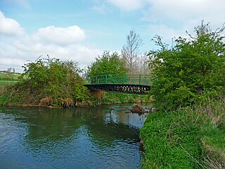
Nassington is a village and civil parish in North Northamptonshire, England. At the time of the 2001 census, the parish's population was 670 people, increasing to 827 at the 2011 Census The River Nene runs along the eastern side of the parish.

Brington is a village in Cambridgeshire, England. Brington lies approximately 9 miles (14 km) north-west of Huntingdon. Brington is in the civil parish of Brington and Molesworth. Brington is situated within Huntingdonshire which is a non-metropolitan district of Cambridgeshire as well as being a historic county of England.
