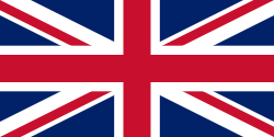
British Guinea

Last updated
Colony of Bolama and Bolama River
1792–1870
Status Crown colony
Capital Bolama
Common languagesEnglish (official), Beafada
Religion
Christianity
GovernmentCrown colony
Monarch  
 1792–1820
George III (first)
 1837–1870
Victoria (last)
Governor  
 1792
Philip Beaver
 1868–1870
James Craig Loggie (last)
Historical era First wave of European colonization
 Establishment
10 May 1792
 Change of sovereignty
1 October 1870
Succeeded by
Portuguese Guinea Blank.png
Today part of Guinea-Bissau

British Guinea [1] or Colony of Bolama and Bolama River, [2] was a colony of the United Kingdom in West Africa. Its capital was in the city of Bolama. [3]

Contents

The colony was founded in 1792, but was incorporated, after arbitration, into Portuguese Guinea in 1870. It basically comprised the islands adjacent to the island of Bolama, in the Bijagós Archipelago, and the strips of land on the banks of the Buba River. [4]

Its territories are currently components of the independent nation Guinea-Bissau. [5]

History

Guinea was already being gradually explored by the Portuguese from 1490 in Cacheu, from 1615 in Bafatá, from 1641 in Farim and from 1697 in Bissau. In this period, all the lands north of the Geba river were already colonized by Portugal. However, the Portuguese only became interested in the island of Bolama in 1753, and even so they did not start colonization. [4]

Beginning of British colonization

The Portuguese lack of interest in the island of Bolama and the Bijagós Archipelago opened opportunities for, on 10 May 1792, two British naval officers, Lieutenants Philip Beaver and Henry Dalrymple, to apply for a concession in London to found a model colony on Bolama Island (scarcely inhabited and apparently available for European settlement).

The Bulama Association, a philanthropic and financial organisation, hoped to create a colony that would remove the need for slave plantations in the Caribbean by resettling Black former slaves from the Americas on the island. [6] The expedition, which consisted of two ships and two hundred and seventy-five colonists, set sail from England on 14 April 1792. Philip Beaver, president of the council of the colonization society, was commander of HMS Hankey; Richard Hancorn, vice-president, was commander of HMS Calypso. Most of the settlers died and the survivors abandoned the colony in November 1793. [7] Hancorn died on the island weeks after the other leaders had decided to return home, on 21 July 1792. [8] [9]

After Darlymple gave up, Philip Beaver, on 27 July 1792, bought the ownership rights to Bolama's land, acquiring them from the king of Canhabaque. After the acquisition, he established a village with a population of 275 British, in the region of Ponta Oeste, current village of Bolama de Baixo, becoming the first colonial ruler of British Guinea. On November 29 of the same year he and the 275 Britons left the village. Bolama started to serve as the mooring coast for British ships that sailed between the Gambia and Sierra Leone. [4]

In 1816 Joseph Scott carried out an expedition to try to re-establish the village of Bolama, but he encountered resistance from the Bijagós peoples, who repopulated the island. Commander Scott gave up on colonizing the island and preferred to travel to Sierra Leone. [4]

Conflict for possession of Bolama

On 24 June 1827 the British colonial governor of Sierra Leone Neil Campbell, in an expedition to the island of Bolama and the Buba River, signed treaties ratifying the possession of Bolama with the kings of Bolola and Guinala. However, in opposition to the British, less than a year later, on 12 July 1828, King Damião, of the Kingdom of Canhabaque, and ambassadors of King Fabião, of the Kingdom of the Beafadas, signed a treaty authorizing the occupation of Bolama by the Portuguese. On 9 May 1830 Joaquim António de Mattos began the Portuguese military occupation of Bolama, the island's first permanent colony. Slave trading factories are built in Bolama. Portuguese colonization and the slave trade generated diplomatic reaction from the British. [4]

Between 1838 and 1859 the British attacked Bolama, Portuguese military posts and slave transport vessels, starting the Bolama Conflict, of a military and diplomatic nature. Some of these attacks managed to briefly occupy the island, sometimes freeing slaves, sometimes imprisoning Portuguese soldiers, in an unprecedented conflict in relations between Portugal and Great Britain, surpassed in diplomatic terms (but not in military escalation) later only by the dispute known as the Rose-Coloured Map. [4]

In February 1859 the British made their last and most destructive attack on the Bolama facility, causing the Portuguese to abandon the island. Thus, on 10 May 1860, the British colonial governor of Sierra Leone proclaims the restoration of British Guinea, but under the administration of the Colony and Protectorate of Sierra Leone. On 3 December 1860 Stephen Hill, governor of Sierra Leone, visits Bolama and establishes a fixed military contingent. On 14 December 1861 the British colony of Bolama was inaugurated. [4]

Arbitration and change of sovereignty

In 1868 the British government agreed to submit the Bolama question to international arbitration. On 21 April 1870 the dispute was resolved by an arbitration award of the President of the United States, Ulysses Grant, which gave Portugal victory, determining that the British withdraw from the region. The Portuguese representative at the arbitration court was António José de Ávila who, after the victory, was awarded the title of Duke of Ávila and Bolama. [4]

On 1 October 1870 the Bolama transfer of sovereignty ceremony took place, with the lowering of the British flag; then, the Portuguese flag was hoisted in Bolama, symbolizing the end of the conflict. [4]

Related Research Articles

<span class="mw-page-title-main">Guinea-Bissau</span> Country in West Africa

Guinea-Bissau, officially the Republic of Guinea-Bissau, is a country in West Africa that covers 36,125 square kilometres (13,948 sq mi) with an estimated population of 2,026,778. It borders Senegal to its north and Guinea to its southeast.

The region now known as Guinea-Bissau has been inhabited for thousands of years. In the 13th century, it became a province of the Mali Empire that later became independent as the Empire of Kaabu. The region was claimed by Portugal beginning in the 1450s. During most of this period, Portuguese control of the region was limited to a number of forts along the coast. Portugal gained full control of the mainland after the pacification campaigns of 1912–15. The offshore Bijago islands were not colonised until 1936. After independence in 1974, the country was controlled by a single-party system until 1991. The introduction of multi-party politics in 1991, brought the first multi-party elections in 1994. A civil war broke out from 1998 to 1999.

<span class="mw-page-title-main">Economy of Guinea-Bissau</span>

The economy of Guinea-Bissau comprises a mixture of state-owned and private companies. Guinea-Bissau is among the world's least developed nations and one of the 10 poorest countries in the world, and depends mainly on agriculture and fishing. Cashew crops have increased remarkably in recent years, and the country ranked ninth in cashew production for the year 2019.

<span class="mw-page-title-main">Bissau</span> Capital and largest city of Guinea-Bissau

Bissau is the capital and largest city of Guinea-Bissau. As of 2015, it had a population of 492,004. Bissau is located on the Geba River estuary, off the Atlantic Ocean, and is Guinea-Bissau's largest city, major port, its administrative and military center.

<span class="mw-page-title-main">Portuguese Guinea</span> 1588–1974 Portuguese colony in West Africa

Portuguese Guinea, called the Overseas Province of Guinea from 1951 until 1972 and then State of Guinea from 1972 until 1974, was a West African colony of Portugal from 1588 until 10 September 1974, when it gained independence as Guinea-Bissau.

<span class="mw-page-title-main">Guinea (region)</span> Region of West Africa

Guinea is a traditional name for the region of the African coast of West Africa which lies along the Gulf of Guinea. It is a naturally moist tropical forest or savanna that stretches along the coast and borders the Sahel belt in the north.

<span class="mw-page-title-main">Bissagos Islands</span> Archipelago in Guinea-Bissau

The Bissagos Islands, also spelled Bijagós, are a group of about 88 islands and islets located in the Atlantic Ocean off the coast of Guinea-Bissau. The archipelago was formed from the ancient delta of the Geba and Grande de Buba rivers and spans an area of 12,958 km2 (5,003 sq mi). 20 of its islands are populated year-round, including the most populated island, Bubaque, where the administrative capital is situated.

Articles related to Guinea-Bissau include:

<span class="mw-page-title-main">Bolama (town)</span> Town in Bolama Region, Guinea-Bissau

Bolama is the main town of Bolama Island and the capital of the Bolama Region. Though once the capital of Portuguese Guinea, it has a population of just 4,819 and much of its colonial era architecture is in a state of severe decay. The town is almost surrounded by mangrove swamps and is now mostly known for its production of cashew nuts.

<span class="mw-page-title-main">Galinhas</span>

Galinhas is an island in the Bijagós Archipelago of Guinea-Bissau. Galinhas is located about 25 km southwest of Bolama town. The Canal de Bolama separates it from Bolama Island, the easternmost island of the group that lies close to the mainland. The area of the island is 50 km2, its length is 10 km and its width is 6 km.

The lançados were settlers and adventurers of Portuguese origin in Senegambia, Cabo Verde, Guinea, Sierra Leone, and other areas on the coast of West Africa. Many were Jews—often New Christians—escaping persecution from the Portuguese Inquisition. Lançados often took African wives from local ruling families, securing protection and advantageous trading ties. They established clandestine trading networks in weaponry, spices, and slaves. This black market angered the Portuguese Crown by disrupting its ability to collect taxes.

<span class="mw-page-title-main">Sherbro Island</span> Place in Southern Province, Sierra Leone

Sherbro Island is in the Atlantic Ocean, and is included within Bonthe District, Southern Province, Sierra Leone. The island is separated from the African mainland by the Sherbro River in the north and Sherbro Strait in the east. It is 32 miles (51 km) long and up to 15 miles (24 km) wide, covering an area of approximately 230 square miles (600 km2). The western extremity is Cape St. Ann. Bonthe, on the eastern end, is the chief port and commercial centre.

Nuno Tristão was a 15th-century Portuguese explorer and slave trader, active in the early 1440s, traditionally thought to be the first European to reach the region of Guinea. Legend has it that he sailed as far as Guinea-Bissau, however, more recent historians believe he did not go beyond the Gambia River).

<span class="mw-page-title-main">Bolama Region</span> Region of Guinea-Bissau

Bolama is an administrative region in Guinea-Bissau, consisting primarily of the Bijagós Archipelago of the country's southern coast, together with a small coastal strip centred on the coastal town of São João. It has an area of 2,624 km2. Its capital is Bolama, on the island of the same name. It is a coastal region covered with Mangrove swamps, rain forest and tangled forest and receives an annual rainfall of more than 1,000 mm (39 in).

<span class="mw-page-title-main">Orangozinho</span> Island in the Bissagos Islands

Orangozinho is an island in the Bissagos Islands, Guinea-Bissau, it is part of the Bolama Region and the Bubaque sector. Its area is 107 km², its length is 19 km and its width is 11.8 km. It has a population of 706 ; the largest village is Wite. The island forms a part of the Orango National Park.

<span class="mw-page-title-main">Guinean Portuguese</span> Variety of Portuguese spoken in Guinea-Bissau

Guinean Portuguese is the variety of Portuguese spoken in Guinea-Bissau, where it is the official language.

<span class="mw-page-title-main">Philip Beaver</span> Royal Navy officer (1766–1813)

Philip Beaver was an officer of the Royal Navy, serving during the late eighteenth and early nineteenth centuries. He played a varied and active role in several notable engagements, and served under a number of the most notable figures of the Navy of the age.

João Vieira and Poilão Marine National Park is a national park in Guinea-Bissau. It was established in August 2000. It covers an area of 495.0 square kilometres (191.1 sq mi) and includes the uninhabited islands of João Vieira, Cavalos, Meio and Poilão, in the southeastern part of the Bijagós Archipelago. The beaches of the islands are frequented by the sea turtle species Chelonia mydas, Eretmochelys imbricata and Lepidochelys olivacea.

<span class="mw-page-title-main">Bolama Island</span> Island of the Bissagos Islands, Guinea-Bissau

Bolama is the closest of the Bissagos Islands to the mainland of Guinea-Bissau. The island has a population of 6,024. It shares its name with ist largest settlement, the town Bolama, which is the capital of the island and the Bolama Region.

Richard Hancorn was a British Royal Navy officer, serving during the late eighteenth century.

References

  1. Between Portuguese Guinea and British Guinea: Bolama in the 19th century. The Universidade Nova da Guiné. 2020.
  2. Guinea-Bissau. World Statesmen.org. 2021.
  3. Boolaky, P. K.. Accounting developments in Africa: a study of the impact of colonisation and the legal systems on accounting standards in sub-Saharan African countries. Universidade de Bournemouth, 2003.
  4. 1 2 3 4 5 6 7 8 9 Gomes, Américo. História da Guiné-Bissau em datas. Lisboa, 2012
  5. Bolama: a 1ª Capital da Guiné-Bissau. Aliança Nacional Democrática - AND. 15 de outubro de 2020.
  6. Humphries, Will (4 November 2020). "How Britain's colony without slaves ended in bloodshed". The Times . London.
  7. Hiscocks, Richard (3 January 2019). "Lieutenant Beaver and the Colonisation of Bulama 1792-4". More than Nelson. Web and Prosper. Retrieved 12 August 2023.
  8. Extracts describing the abortive colonization of Bulama island, in the mouth of the Rio Grande river (now Bolama island, Corubala river, Guinea Bissau), in 1792 at Glamorgan Archives
  9. Beaver, Philip (1805). African Memoranda: Relative to an Attempt to Establish a British Settlement on the Island of Bulama, on the Western Coast of Africa, in the Year 1792. With a Brief Notice of the Neighbouring Tribes, Soil, Productions, &c. and Some Observations on the Facility of Colonizing that Part of Africa, with a View to Cultivation; and the Introduction of Letters and Religion to Its Inhabitants: But More Particularly as the Means of Gradually Abolishing African Slavery. C. and R. Baldwin. p. 433 via Google Books.