
Catford is a district in south east London, England, and the administrative centre of the London Borough of Lewisham. It is southwest of Lewisham itself, mostly in the Rushey Green and Catford South wards. The population of Catford, including Bellingham, was 44,905 in 2011.

Highgate is a suburban area of London at the northeastern corner of Hampstead Heath, 4+1⁄2 miles north-northwest of Charing Cross.

The London Borough of Bromley is a borough in London, England. It borders the county of Kent, of which it formed part of until 1965. The borough's population in the 2021 census was 329,991. It is named after Bromley, its principal district. Other districts are Penge, Hayes, West Wickham, Chislehurst, Beckenham and Orpington. The local authority is Bromley London Borough Council.

The London Borough of Bexley is a London borough in south-east London, forming part of Outer London. It has a population of 248,287. The main settlements are Sidcup, Erith, Bexleyheath, Crayford, Welling and Old Bexley. The London Borough of Bexley is within the Thames Gateway, an area designated as a national priority for urban regeneration. The local authority is Bexley London Borough Council.

Abbots Bromley is a village and civil parish in the East Staffordshire district of Staffordshire and lies approximately 9.8 miles (15.8 km) east of Stafford, England. According to the University of Nottingham English Place-names project, the settlement name Abbots Bromley could mean 'clearing/wood frequented by broom'. The prefix 'abbots' was added because the village was held by Burton Abbey. The population of the civil parish at the 2011 census was 1,779.

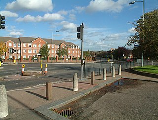
Bromley, commonly known as Bromley-by-Bow, is a district in the London Borough of Tower Hamlets in East London, located on the western banks of the River Lea, in the Lower Lea Valley in East London.

The Lansbury Estate is a large, historic council housing estate in Poplar and Bromley-by-Bow in the London Borough of Tower Hamlets. It is named after George Lansbury, a Poplar councillor and Labour Party MP.

Sunbury-on-Thames is a town on the north bank of the River Thames in the Borough of Spelthorne, Surrey, England, 13 mi (21 km) southwest of central London. Historically part of the county of Middlesex, in 1965 Sunbury and other surrounding towns were initially intended to form part of the newly created county of Greater London, but were instead transferred to Surrey. Sunbury adjoins Feltham to the north, Hampton to the east, Ashford to the northwest and Shepperton to the southwest. Walton-on-Thames is to the south, on the opposite bank of the Thames.

Bow is an area of east London, England, within the London Borough of Tower Hamlets, 4.6 miles (7.4 km) east of Charing Cross.

Swanley is a town and civil parish in the Sevenoaks District of Kent, England, 16 miles (26 km) southeast of central London, adjacent to the Greater London boundary and within the M25 motorway periphery. The population at the 2021 census was 17,826.

Northumberland House was a large Jacobean townhouse in London, so-called because it was, for most of its history, the London residence of the Percy family, who were the Earls and later Dukes of Northumberland and one of England's richest and most prominent aristocratic dynasties for many centuries. It stood at the far western end of the Strand from around 1605 until it was demolished in 1874. In its later years it overlooked Trafalgar Square.

Beckenham was a local government district in north west Kent from 1878 to 1965 around the town of Beckenham. The area was suburban to London, formed part of the Metropolitan Police District and from 1933 was included in the area of the London Passenger Transport Board.
Bow is a village and civil parish in the Mid Devon district of Devon, England, about 8 miles (13 km) west of Crediton. According to the 2001 census it had a population of 1,093 practically unchanged at the 2011 Census. There is an adjoining hamlet of Nymet Tracey which shares a church with Bow and much common history. Bow is a major part of Upper Yeo electoral ward. The total ward population at the above census was 1,708.

Bowes Park is situated on the borders of Wood Green, Palmers Green and Bounds Green in London, England. The postcodes for Bowes Park are N13 and N22. The border between the London boroughs of Enfield and Haringey goes through the area. Bowes Park "village" is defined as the triangle area between Bounds Green Road / Brownlow Rd, Green Lanes down to Trinity Road and the A406

Southborough is an area of South East London, within the London Borough of Bromley, Greater London. Prior to 1965 it was within the historic county of Kent. It is located south of Bickley and Bromley, east of Bromley Common, north of Locksbottom, and west of Petts Wood.
Chinbrook is an area of south east London, England, located 14 km (8.7 mi) southeast of Charing Cross in the London Borough of Lewisham. Chinbrook lies between Grove Park and Mottingham, approximately half a mile east of Grove Park centre and is generally considered part of Grove Park.

Andrew Mawson, Baron Mawson, is an English social entrepreneur.

High Elms Country Park is an extensive 250-acre (100 ha) public park on the North Downs in Farnborough in the London Borough of Bromley. It is a Local Nature Reserve, and together with the neighbouring Downe Bank, a Site of Special Scientific Interest. The park surrounds High Elms Golf Course, and has extensive woodland, chiefly oak and beech, chalk meadows and formal gardens. It also has a cafe, a visitor centre, nature and history trails and car parks.

St Gabriel's, Cricklewood, is an Anglican church in Cricklewood, Brent, London, United Kingdom.

Sir Anthony Herbert Everington, known as Sam Everington, is a GP at a health centre within the Bromley by Bow Centre, in Tower Hamlets, an area of East London.

