
Hyndburn is a local government district with borough status in Lancashire, England. Its council is based in Accrington, the largest town, and the borough also covers the outlying towns of Clayton-le-Moors, Great Harwood, Oswaldtwistle and Rishton. The borough was created in 1974 and takes its name from the River Hyndburn. It had a population of 80,734 at the 2011 Census. Elections to the council are held in three out of every four years, with one third of the 35 seats on the council being elected at each election. Both the Conservative and Labour parties have controlled the council at different times, as well as periods when no party has had a majority.

Congleton was, from 1974 to 2009, a local government district with borough status in Cheshire, England. It included the towns of Congleton, Alsager, Middlewich and Sandbach. The headquarters of the borough council were located in Sandbach.

A civil parish is a country subdivision, forming the lowest unit of local government in England. There are 333 civil parishes in the ceremonial county of Cheshire, most of the county being parished. Cheshire East unitary authority is entirely parished. At the 2001 census, there were 565,259 people living in 332 parishes, accounting for 57.5 per cent of the county's population.
A civil parish is a subnational entity, forming the lowest unit of local government in England. There are 219 civil parishes in the ceremonial county of Lancashire; Blackpool is completely unparished; Pendle and Ribble Valley are entirely parished. At the 2001 census, there were 587,074 people living in the 219 parishes, accounting for 41.5 per cent of the county's population.

Denby Dale is a village and civil parish in the metropolitan borough of Kirklees in West Yorkshire, England. It is 10 miles to the south-east of Huddersfield and 9 miles north-west of Barnsley.

Aysgarth is a village and civil parish in Wensleydale, in North Yorkshire, England. The village is in the Yorkshire Dales National Park, about 16 miles (26 km) south-west of Richmond and 22.6 miles (36.4 km) west of the county town of Northallerton.
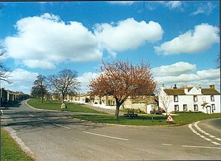
East Witton is a village and civil parish in Wensleydale in North Yorkshire, England. It lies south of Leyburn, in the Richmondshire district. Richard Whiteley is buried there; he and his partner, Kathryn Apanowicz, lived in the village.
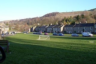
West Burton is a village in Bishopdale, a side valley of Wensleydale, in the Yorkshire Dales, North Yorkshire, England. It lies 6.2 miles (10 km) south-west of Leyburn and 22.3 miles (35.9 km) west of the county town of Northallerton. It is the largest settlement in the civil parish of Burton-cum-Walden.

Dodcott cum Wilkesley is a civil parish in the unitary authority of Cheshire East and the ceremonial county of Cheshire, England. The hamlet of Wilkesley lies 2+1⁄2 miles to the west of Audlem and 7 miles to the south west of Nantwich. The parish also includes the village of Burleydam, the largest settlement, as well as the small settlements of Butterley Heyes, Cheshire Fields, Combermere, Lightwood Green and Royal's Green. It also formerly contained the settlements of Pinsley Green and Smeaton Wood, now located in Wrenbury cum Frith civil parish. Nearby villages include Adderley and Calverhall in Shropshire and Audlem, Newhall and Wrenbury within Cheshire.

Shavington cum Gresty is a civil parish in the unitary authority of Cheshire East and the ceremonial county of Cheshire, England. It lies to the south of Crewe. It includes the large village of Shavington, which lies 2+1⁄2 miles south of Crewe, as well as the smaller settlements of Dodds Bank, Park Estate, Puseydale, Sugar Loaf and part of Goodall's Corner. Nearby villages include Basford, Hough, Willaston, Wistaston and Wybunbury. The total population of the civil parish is a little under 5,000.

Checkley cum Wrinehill is a former civil parish, now in the parish of Doddington and District, in the unitary authority area of Cheshire East and the ceremonial county of Cheshire, England, which lies adjacent to the boundaries with Shropshire and Staffordshire. The hamlet of Checkley lies to the south east of Crewe and to the west of Newcastle-under-Lyme. The parish is largely rural but also includes the small settlements of Bunkers Hill and Randilow. Wrinehill was formerly included in the parish, becoming part of Staffordshire in 1965. Nearby villages include Blakenhall, Bridgemere, Madeley and Woore. In 2001 the parish had a population of 129.
Doddington is a former civil parish, now in the parish of Doddington and District, in the unitary authority area of Cheshire East and the ceremonial county of Cheshire, England, which lies to the north east of Audlem and to the south of Crewe. Nearby villages include Blakenhall, Bridgemere, Checkley, Hatherton, Walgherton and Wybunbury. The A51 runs north–south through the parish.

Suffield-cum-Everley is a civil parish in the Scarborough district of North Yorkshire, England.
Hackness is a village and civil parish in the Scarborough district of the county of North Yorkshire, England. It lies within the North York Moors National Park. The parish population rose from 125 in the 2001 UK census to 221 in the 2011 UK census.

Silpho is a village and civil parish in the Scarborough district of the county of North Yorkshire, England.

Darncombe-cum-Langdale End is a civil parish in the former Scarborough district of North Yorkshire, England.
Harwood Dale is a village and civil parish in the Scarborough district of North Yorkshire, England. It lies within the North York Moors National Park. According to the 2001 UK census, Harwood Dale parish had a population of 134, which had risen to 140 at the 2011 Census, and remained at that number for an estimate by North Yorkshire County Council in 2015.

Carperby-cum-Thoresby is a civil parish in the Richmondshire district of North Yorkshire, England. The parish contains the village of Carperby and the hamlets of High and Low Thoresby. It is situated north of Aysgarth and the main village of Carperby is 22.8 miles (36.7 km) west of the County Town of Northallerton. The population at the 2011 Census by ONS was 200.
Hockham is a civil parish in the English county of Norfolk. It covers an area of 13.36 km2 (5.16 sq mi) and had a population of 620 in 252 households at the 2001 census. For the purposes of local government, it falls within the district of Breckland. The district's 2007/08 estimate suggests that the population had risen to 645. At the 2011 Census the population was measured at 603 only in 259 households.

Leeds, also known as the City of Leeds, is a metropolitan borough with city status in West Yorkshire, England. The metropolitan borough includes the administrative centre of Leeds and the towns of Farsley, Garforth, Guiseley, Horsforth, Morley, Otley, Pudsey, Rothwell, Wetherby and Yeadon. It has a population of 809,036 (2021), making it technically the second largest city in England by population behind Birmingham, since London is not a single local government entity. Local governance sits with Leeds City Council and the city's 32 Parish Councils.

