
Calabarzon, sometimes referred to as Southern Tagalog and designated as Region IV‑A, is an administrative region in the Philippines. The region comprises five provinces: Batangas, Cavite, Laguna, Quezon, and Rizal; and one highly urbanized city, Lucena. It is the most populous region in the Philippines according to the Philippine Statistics Authority (PSA), having over 16.1 million inhabitants in 2020, and is also the country's second most densely populated after the National Capital Region. It is situated southeast of Metro Manila, and is bordered by Manila Bay and South China Sea to the west, Lamon Bay and the Bicol Region to the east, Tayabas Bay and the Sibuyan Sea to the south, and Central Luzon to the north. It is home to places like Mount Makiling near Los Baños, Laguna, and Taal Volcano in Batangas.

Marinduque, officially the Province of Marinduque, is an island province in the Philippines located in Southwestern Tagalog Region or Mimaropa, formerly designated as Region IV-B. Its capital is the municipality of Boac. Marinduque lies between Tayabas Bay to the north and Sibuyan Sea to the south. It is west of the Bondoc Peninsula of Quezon province in mainland Luzon; east of Mindoro Island; and north of the island province of Romblon. Some parts of the Verde Island Passage, the center of the center of world's marine biodiversity and a protected marine area, are also within Marinduque's provincial waters.

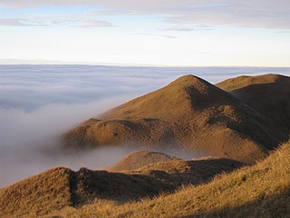
Mount Banahaw is an active complex volcano on Luzon in the Philippines. The three-peaked volcano is located at the boundary of Laguna and Quezon provinces. It is the highest mountain in both provinces and Calabarzon region, dominating the landscape for miles around.

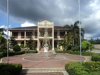
Buenavista, officially the Municipality of Buenavista, is a 4th class municipality in the province of Quezon, Philippines. According to the 2020 census, it has a population of 31,160 people.
Catanauan, officially the Municipality of Catanauan, is a 1st class municipality in the province of Quezon, Philippines. According to the 2020 census, it has a population of 72,752 people.

Mulanay, officially the Municipality of Mulanay, is a 1st class municipality in the province of Quezon, Philippines. According to the 2020 census, it has a population of 55,576 people.

Mount Makiling is an inactive stratovolcano located in the provinces of Laguna and Batangas on the island of Luzon in the Philippines. The mountain rises to an elevation of 1,090 meters (3,580 ft) above mean sea level and is the highest feature of the Laguna Volcanic Field. The volcano has no recorded historic eruption but volcanism is still evident through geothermal features like mud spring and hot springs. South of the mountain is the Makiling–Banahaw Geothermal Plant. The Philippine Institute of Volcanology and Seismology (PHIVOLCS) classifies the volcano as "Inactive".

The Bondoc Peninsula is a peninsula located in the southeastern part of Quezon Province in Calabarzon Region, southern part of Luzon, Philippines. The peninsula consists of 12 municipalities: Agdangan, Buenavista, Catanauan, General Luna, Macalelon, Mulanay, Padre Burgos, Pitogo, San Andres, San Francisco, San Narciso and Unisan, all in the 3rd Congressional District of Quezon. The peninsula is known for featuring beautiful beaches and historic churches.

Quezon, officially the Province of Quezon, is a province in the Philippines located in the Calabarzon region on Luzon. Kalilayan was the first known name of the province upon its creation in 1591. Around the middle of the 18th century, it was changed to Tayabas. In recognition of the second president of the Philippines, Manuel L. Quezon, the name of Tayabas Province is changed to Quezon. Lucena, the provincial capital, the seat of the provincial government, and the most populous city of the province, is governed independently from the province as a highly urbanized city. To distinguish the province from Quezon City, it is sometimes called Quezon Province, a variation of the province's official name.
Indigenous Philippine shrines and sacred grounds are places regarded as holy within the indigenous Philippine folk religions. These places usually serve as grounds for communication with the spirit world, especially to the deities and ancestral spirits. In some cases, they also function as safeguards for the caskets of ancestors, as well as statues or other objects depicting divine entities.
The Libunao Protected Landscape, also known as the Libunao Spring Protected Landscape, is a protected area in the Ilocos Region of the island of Luzon in the Philippines located on the western foothills of the Ilocos Mountain Range. It protects the Libunao Spring and surrounding forests, as well as the Nagcullooban River watershed. First proclaimed as the Libunao Spring Watershed Forest Reserve in 1931 through Proclamation No. 410 issued by Governor-General Dwight F. Davis, the park was reestablished as a protected landscape area under the National Integrated Protected Areas System in 2000 through Proclamation No. 280 signed by President Joseph Estrada. The Libunao watershed is the source of water supply for domestic use and irrigation of the surrounding farms and communities of northern Ilocos Sur province.
The Mati Protected Landscape is a protected area located in Davao Oriental on the southern Philippine island of Mindanao. It protects the watershed in Mati which is the source of water supply for the city's Mati Waterworks System. The protected area was established in 1967 when 890 hectares of forest in Central Mati was proclaimed as the Mati Watershed Forest Reserve through Proclamation No. 222 issued by President Ferdinand Marcos. Under the National Integrated Protected Areas System, the area was reclassified as a protected landscape with the signing of Proclamation No. 912 in 2005 by President Gloria Arroyo.
The Maulawin Spring Protected Landscape is a protected landscape area of forested hills and several rivers and streams located in the province of Quezon on southern Luzon island in the Philippines. It was originally created in 1939 to protect the watershed in the municipality of Guinayangan known as the Maulawin Spring Watershed Forest Reserve declared through Proclamation No. 365 by President Manuel Luis Quezon. It had an initial area of 60 hectares. In 2000, the forest reserve was enlarged and was redesignated as a protected landscape under the National Integrated Protected Areas System by virtue of Proclamation No. 295 issued by President Joseph Estrada. It is the only source of potable water for domestic consumption of the more than 40,000 residents of Guinayangan.

The Limestone Tombs of Kamhantik is an excavated remains of a thousand-year-old barangay found in the jungles of Mount Maclayao in Sitio Kamhantik within the Buenavista Protected Landscape of Mulanay, Quezon, Philippines. It is widely believed that pre-colonial Tagalog people were responsible for the creation of the tombs.

The La Mesa Watershed Reservation is a protected area that preserves the only major watershed in Metro Manila, Philippines. Also known as the Novaliches Watershed, it contains the last remaining rainforest of its size in Metro Manila surrounding the La Mesa Dam and Reservoir, the primary source of potable drinking water for 12 million residents in the Manila metropolitan area. The area is under the joint administration, supervision and control of the Department of Environment and Natural Resources and the Metropolitan Waterworks and Sewerage System. It was established in 2007 through Proclamation No. 1336 issued by President Gloria Arroyo.

The Sierra Madre is the longest mountain range in the Philippines. Spanning over 540 kilometers (340 mi), it runs from the province of Cagayan down to the province of Quezon, forming a north–south direction on the eastern portion of Luzon, the largest island of the archipelago. It is bordered by the Pacific Ocean to the east, Cagayan Valley to the northwest, Central Luzon to the midwest, and Calabarzon to the southwest. Some communities east of the mountain range, along the coast, are less developed and so remote that they could only be accessed by taking a plane or a boat.

Mounts Banahaw–San Cristobal Protected Landscape is a protected landscape park in the Calabarzon region of the Philippines, 120 kilometres (75 mi) south of Manila. It is the second largest protected area in Calabarzon, after the Upper Marikina River Basin Protected Landscape, with an area of 10,900.59 hectares. The park is located at the border of Laguna and Quezon provinces and includes the features it is named after: Mount Banahaw and, 7 kilometres (4.3 mi) to its west, Mount San Cristobal.

The Pantabangan–Carranglan Watershed Forest Reserve is a conservation area located in the upper reaches of the Pampanga River in Nueva Ecija, Philippines, and borders the Sierra Madre and Caraballo Mountains in Aurora and Nueva Vizcaya. It encompasses 84,500 hectares of the drainage basin surrounding the Pantabangan Lake, an impoundment of the Pampanga River by the Pantabangan Dam. The multi-purpose dam is situated at the confluence of Pampanga River's two headwaters, namely the Pantabangan and Carranglan Rivers in the municipality of Pantabangan. It stretches above the dam site for 21 kilometres (13 mi) to where Carranglan River originates in the Caraballo on the north, and for 18 kilometres (11 mi) to where Pantabangan River originates in the Sierra Madre on the east. It is considered a critical watershed for the agricultural economy and hydroelectric power generation in the region of Central Luzon.

The Samar Island Natural Park, in Samar, is the largest contiguous tract of old-growth forest in the Philippines. It is the country's largest terrestrial protected area, with an area of 333,300 hectares. The buffer is spread north to south over the island's three provinces and totals 458,700 hectares, about a third of the entire island of Samar.

Strongylodon juangonzalezii, commonly called JC's vine or purple jade vine, is a species of leguminous perennial liana endemic to the tropical forests of the Philippines. It bears a cluster of large flowers that are initially lilac to purple in color, but become a striking blue as they mature.
