
Bull and Mouth Street was a street in the City of London that ran between Edward Street (Hall Lane) and St Martin's Le Grand. On part of its site stands Postman's Park.

Bull and Mouth Street was a street in the City of London that ran between Edward Street (Hall Lane) and St Martin's Le Grand. On part of its site stands Postman's Park.

The street may once have been known as Stukeley's Street. [2] [3]
The street is named after the Bull and Mouth Inn which stood on the south side from at least the time of the Great Fire of London in 1666 when it was destroyed. It was subsequently rebuilt. [4] It may date even earlier as the original name of the inn was the Boulogne Mouth, a reference to the siege of the town and harbour of Boulogne by the English kings Henry VII and Henry VIII in 1544–46. Over time, the name became corrupted into Bull and Mouth. [5] The street was first recorded on John Ogilby and William Morgan's Large Scale Map of the City As Rebuilt By 1676. [4]

Bull and Mouth Street appears on Richard Horwood's map of London published in 1813. [7] An 1875 Ordnance Survey map shows there to have been a ward school on the north side at the western end and the French Protestant Chapel (1842) at the eastern end on the corner with St Martin's Le Grand. [6] On the south side was The Queen's Hotel on the corner with St Martin's Le Grand, formerly the Bull and Mouth Inn, rebuilt as a hotel by the coaching entrepreneur Edward Sherman at a cost of £60,000. [8] The architect was Savage. [4] The hotel provided accommodation for passengers and underground stabling for 700 horses. [9]
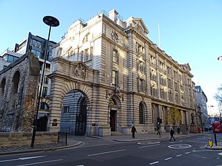
The street and the hotel and chapel were demolished in 1887 or 1888 to make way for new post office buildings at 1 St Martin's Le Grand, later Nomura House. [2] Bull and Mouth Street was located approximately where Postman's Park is today.
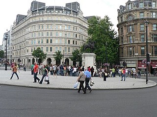
Charing Cross is the name of a junction in London, England, where six routes meet. Clockwise from north these are: the east side of Trafalgar Square leading to St Martin's Place and then Charing Cross Road; the Strand leading to the City; Northumberland Avenue leading to the Thames Embankment; Whitehall leading to Parliament Square; The Mall leading to Admiralty Arch and Buckingham Palace; and two short roads leading to Pall Mall. The name also commonly refers to the Queen Eleanor Memorial Cross at Charing Cross station.
Aldersgate is a Ward of the City of London, named after one of the northern gates in the London Wall which once enclosed the City.

The Tabard was an inn in Southwark established in 1307 that stood on the east side of Borough High Street, at the road's intersection with the ancient thoroughfare to Canterbury and Dover. It was built for the Abbot of Hyde, who purchased the land to construct a place for himself and his ecclesiastical brethren to stay when on business in London.
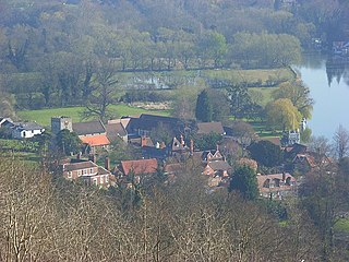
Streatley is a village and civil parish on the River Thames in Berkshire, England. The village faces Goring-on-Thames. The two places share in their shops, services, leisure, sports and much of their transport. Across the river is Goring & Streatley railway station and the village cluster adjoins a lock and weir. The west of the village is a mixture of agriculture and woodland plus a golf course. The village has a riverside hotel. Much of Streatley is at steeply varying elevations, ranging from 51m AOD to 185m at Streatley Warren, a hilltop point on its western border forming the eastern end of the Berkshire Downs. This Area of Outstanding Natural Beauty is topped by the 87-mile The Ridgeway path, which crosses the Thames at Goring and Streatley Bridge.

The coaching inn was a vital part of Europe's inland transport infrastructure until the development of the railway, providing a resting point (layover) for people and horses. The inn served the needs of travellers, for food, drink, and rest. The attached stables, staffed by hostlers, cared for the horses, including changing a tired team for a fresh one. Coaching inns were used by private travellers in their coaches, the public riding stagecoaches between one town and another, and the mail coach. Just as with roadhouses in other countries, although many survive, and some still offer overnight accommodation, in general coaching inns have lost their original function and now operate as ordinary pubs.

The Dorset Garden Theatre in London, built in 1671, was in its early years also known as the Duke of York's Theatre, or the Duke's Theatre. In 1685, King Charles II died and his brother, the Duke of York, was crowned as James II. When the Duke became King, the theatre became the Queen's Theatre in 1685, referring to James' second wife, Mary of Modena. The name remained when William III and Mary II came to the throne in 1689.

Gray's Inn Road is an important road in the Bloomsbury district of Central London, in the London Borough of Camden. The road begins at the City of London boundary, where it bisects High Holborn, and ends at King's Cross and St. Pancras Station.

St. Michael Queenhithe was a church in the City of London located in what is now Upper Thames Street. First recorded in the 12th century, the church was destroyed during the Great Fire of London in 1666. Rebuilt by the office of Sir Christopher Wren, it was demolished in 1876.

Gresham Street in the City of London is named after the English merchant and financier Thomas Gresham.

St. Martin's Le Grand is a former liberty within the City of London, and is the name of a street north of Newgate Street and Cheapside and south of Aldersgate Street. It forms the southernmost section of the A1 road.

St Leonard, Foster Lane, was a Church of England church dedicated to Leonard of Noblac on the west side of Foster Lane in the Aldersgate ward of the City of London. It was destroyed in the Great Fire of 1666 and not rebuilt.
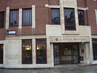
Little Britain is a street in the City of London running from St. Martin's Le Grand in the east to West Smithfield in the west. It is situated in the Aldersgate and Farringdon Within wards. Postman's Park is also bounded by Little Britain.

Swallow Street is a small street in the West End of London, running north from Piccadilly. It is about 341 feet (104 m) long.

Trump Street is a street in the City of London that was originally known as Trumpadere Street, probably after the trumpet or horn makers who once worked there or in the adjacent Trump Alley. It was built after the Great Fire of London (1666) but completely destroyed by bombing during the Second World War and has since been entirely rebuilt.

Blossom's Inn was a tavern which stood in Lawrence Lane in the City of London from the 14th century until 1855. It became a substantial coaching inn and was used as a staging post by carriers of goods. In the 19th century, the lease was bought and it became the parcel depot of the Great Eastern Railway. Its name was used for a major property development at the end of the 20th century and the site is now part of the large complex of 30 Gresham Street.
Edward Sherman was a coach proprietor from Berkshire who became the second largest operator of coaches in England after William Chaplin.
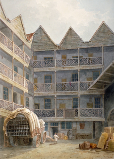
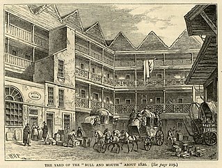
The Bull and Mouth Inn was a coaching inn in the City of London that dated from before the Great Fire of London in 1666. It was located between Bull and Mouth Street in the north and Angel Street in the south. It was once an important arrival and departure point for coaches from all over Britain, but particularly for the north of England and Scotland. It became the Queen's Hotel in 1830 but was demolished in 1887 or 1888 when new post office buildings were built in St Martin's Le Grand.
King Edward Street is a street in the City of London that runs from Newgate Street in the south to Little Britain in the north. It is joined by Greyfriars Passage in the west and Angel Street in the east. Postman's Park is on its east side where Bull and Mouth Street once lay and joined King Edward Street.

Angel Street, formerly known as Angel Alley, Angel Court, and Angell Street, is a street in the City of London that runs between King Edward Street in the west and St Martin's Le Grand in the east. Although dating back to at least 1542, no original buildings now remain due to the effects of the Great Fire of London, the London Blitz, and redevelopment.

Milk Street in the City of London, England, was the site of London's medieval milk market. It was the location of the parish church of St Mary Magdalen which was destroyed in the Great Fire of London in 1666 and then of Honey Lane Market and the City of London School. The street was seriously damaged by German bombing during the Second World War and has since been completely rebuilt. Nothing remains of its former buildings.
![]() Media related to Bull and Mouth Street at Wikimedia Commons
Media related to Bull and Mouth Street at Wikimedia Commons
Coordinates: 51°30′59.83″N0°5′51.92″W / 51.5166194°N 0.0977556°W