Related Research Articles

Great Zimbabwe is a medieval city in the south-eastern hills of the modern country of Zimbabwe, near Lake Mutirikwi and the town of Masvingo. It is thought to have been the capital of a great kingdom during the Late Iron Age, about which little is known. Construction on the city began in the 9th century and continued until it was abandoned in the 15th century. The edifices were erected by ancestors of the Shona and other groups located in Zimbabwe and nearby countries. The stone city spans an area of 7.22 square kilometres and could have housed up to 18,000 people at its peak, giving it a population density of approximately 2,500 per square kilometre. It is recognised as a World Heritage Site by UNESCO.

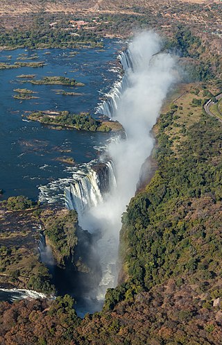
Victoria Falls is a waterfall on the Zambezi River in southern Africa, which provides habitat for several unique species of plants and animals. It is located on the border between Zambia and Zimbabwe and is one of the world's largest waterfalls, with a width of 1,708 m (5,604 ft).

Montezuma Castle National Monument protects a set of well-preserved dwellings located in Camp Verde, Arizona, which were built and used by the Sinagua people, a pre-Columbian culture closely related to the Hohokam and other indigenous peoples of the southwestern United States, between approximately AD 1100 and 1425. The main structure comprises five stories and about 20 rooms and was built over the course of three centuries.

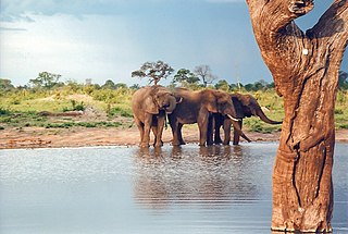
Hwange National Park is the largest natural reserve in Zimbabwe. It is around 14,600 sq km in area. It lies in the northwest of the country, just off the main road between Bulawayo and Victoria Falls. The nearest town is Dete. Histories of the region's pre-colonial days and its development as a game reserve and National Park are available online

The Matobo National Park forms the core of the Matobo or Matopos Hills, an area of granite kopjes and wooded valleys commencing some 35 kilometres (22 mi) south of Bulawayo, southern Zimbabwe. The hills were formed over 2 billion years ago with granite being forced to the surface, this has eroded to produce smooth "whaleback dwalas" and broken kopjes, strewn with boulders and interspersed with thickets of vegetation. Matopo/Matob was named by the Lozwi, who are the ancestors of Kalanga. A different tradition states that the first King, Mzilikazi Khumalo when told by the local residents that the great granite domes were called madombo he replied, possible half jest, "We will call them matobo" - an IsiNdebele play on 'Bald heads'.

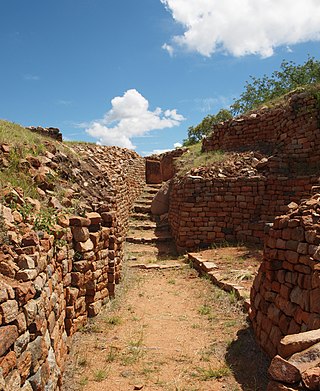
Khami is a ruined city located 22 kilometres west of Bulawayo, in Zimbabwe. It was once the capital of the Kingdom of Butwa of the Torwa dynasty. It is now a national monument, and became a UNESCO World Heritage Site in 1986.

Kilwa Kisiwani is an island, national historic site, and hamlet community located in the township of Kilwa Masoko, the district seat of Kilwa District in the Tanzanian region of Lindi Region in southern Tanzania. Kilwa Kisiwani is the largest of the nine hamlets in the town Kilwa Masoko and is also the least populated hamlet in the township with less than 1,000 residents.

Walnut Canyon National Monument is a United States National Monument located about 10 mi (16 km) southeast of downtown Flagstaff, Arizona, near Interstate 40. The canyon rim elevation is 6,690 ft (2,040 m); the canyon's floor is 350 ft lower. A 0.9 mi (1.4 km) long loop trail descends 185 ft (56 m) into the canyon passing 25 cliff dwelling rooms constructed by the Sinagua, a pre-Columbian cultural group that lived in Walnut Canyon from about 1100 to 1250 AD. Other contemporary habitations of the Sinagua people are preserved in the nearby Tuzigoot and Montezuma Castle national monuments.

Navajo National Monument is a National Monument located within the northwest portion of the Navajo Nation territory in northern Arizona, which was established to preserve three well-preserved cliff dwellings of the Ancestral Puebloan people: Keet Seel, Betatakin, and Inscription House. The monument is high on the Shonto plateau, overlooking the Tsegi Canyon system, west of Kayenta, Arizona. It features a visitor center with a museum, three short self-guided trails, two small campgrounds, and a picnic area.
The Kingdom of Mapungubwe was a medieval state in South Africa located at the confluence of the Shashe and Limpopo rivers, south of Great Zimbabwe. The name is derived from either TjiKalanga and Tshivenda. The name might mean "Hill of Jackals" or "stone monuments". The kingdom was the first stage in a development that would culminate in the creation of the Kingdom of Zimbabwe in the 13th century, and with gold trading links to Rhapta and Kilwa Kisiwani on the African east coast. The Kingdom of Mapungubwe lasted about 80 years, and at its height the capital's population was about 5000 people.

The wildlife of Zimbabwe occurs foremost in remote or rugged terrain, in national parks and private wildlife ranches, in miombo woodlands and thorny acacia or kopje. The prominent wild fauna includes African buffalo, African bush elephant, black rhinoceros, southern giraffe, African leopard, lion, plains zebra, and several antelope species.
The Dzata Ruins, an archaeological site in Dzanani in the Makhado municipality, Vhembe district, in the north of South Africa, is one of the national monuments in South Africa.

Zimbabwe boasts several tourist attractions, located in almost every region of the country. Before the economic changes, much of the tourism for these locations came to the Zimbabwean side but now Zambia benefits from the tourism. The Victoria Falls National Park is also a tourist attraction and is one of the eight main National Parks in Zimbabwe, largest of which is Hwange National Park. Zimbabwe is home to one of the Seven Natural Wonders of the World, the Victoria Falls.

The Kalanga or Bakalanga or Bakgatla or Bakgalakwena are a southern Bantu ethnic group mainly inhabiting Matebeleland in Zimbabwe, northeastern Botswana and Limpopo Province in South Africa. They are historically related to the Balobedu, Nambya, Karanga, Bapedi ,BaTsonga,Batswana and Vhavenda. They are all migrated from the Kingdom of Monomotapa. Their animal totem includes wild pig ,Birds
Kavango–Zambezi Transfrontier Conservation Area is the second-largest nature and landscape conservation area in the world, spanning the international borders of five countries in Southern Africa. It includes a major part of the Upper Zambezi River and Okavango basins and Delta, the Caprivi Strip of Namibia, the southeastern part of Angola, southwestern Zambia, the northern wildlands of Botswana and western Zimbabwe. The centre of this area is at the confluence of the Zambezi and Chobe Rivers where the borders of Botswana, Namibia, Zambia and Zimbabwe meet. It incorporates a number of notable national parks and nature sites, including Chobe National Park, Hwange National Park, and the Victoria Falls. The region is home to a population of approximately 250,000 animals, including the largest population of African Elephants in the world.

Thimlich Ohinga is a complex of stone-built ruins in Migori county, Nyanza Kenya, in East Africa. It is the largest one of 138 sites containing 521 stone structures that were built around the Lake Victoria region in Kenya. These sites are highly clustered. The main enclosure of Thimlich Ohinga has walls that are 1–3 m (3.3–9.8 ft) in thickness, and 1–4.2 m (3.3–13.8 ft) in height. The structures were built from undressed blocks, rocks, and stones set in place without mortar. The densely packed stones interlock. The site is believed to date to the 15th century or earlier.

The Ancestral Puebloans, also known as the Anasazi, were an ancient Native American culture that spanned the present-day Four Corners region of the United States, comprising southeastern Utah, northeastern Arizona, northwestern New Mexico, and southwestern Colorado. They are believed to have developed, at least in part, from the Oshara tradition, which developed from the Picosa culture. The people and their archaeological culture are often referred to as Anasazi, meaning "ancient enemies", as they were called by Navajo. Contemporary Puebloans object to the use of this term, with some viewing it as derogatory.

Leopard's Kopje is an archaeological site, the type site of the associated region or culture that marked the Middle Iron Age in Zimbabwe. The ceramics from the Leopard's Kopje type site have been classified as part of phase II of the Leopard's Kopje culture. For information on the region of Leopard's Kopje, see the "Associated sites" section of this article.

Thulamela is the most dramatic of the around 300 archaeological sites identified in Kruger National Park. It is located on heights south of the Levubu River offering a panoramic view. Sidney Miller led excavations from December 1993 to July 1995, and the site has also been partially reconstructed.
Kweneng’ ruins are the remains of a pre-colonial Tswana capital occupied from the 15th to the 19th century AD in South Africa. The site is located 30km south of the modern-day city of Johannesburg. Settlement at the site likely began around the 1400s and saw its peak in the 15th century. The Kweneng' ruins are similar to those built by other early civilizations found in the southern Africa region during this period, including the Luba–Lunda kingdom, Kingdom of Mutapa, Bokoni, and many others, as these groups share ancestry. Kweneng' was the largest of several sizable settlements inhabited by Tswana speakers prior to European arrival. Several circular stone walled family compounds are spread out over an area 10km long and 2km wide. It is likely that Kweneng' was abandoned in the 1820s during the period of colonial expansion-related civil wars known as the Mfecane or Difaqane, leading to the dispersal of its inhabitants.
References
- ↑ "Bumbusi National Monument". World Monuments Fund. 2008. Retrieved 2 September 2014.
- ↑ Valeix, Marion (2011). "Temporal dynamics of dry-season water-hole use by large African herbivores in two years of contrasting rainfall in Hwange National Park, Zimbabwe". Journal of Tropical Ecology. 27 (2): 163–170. doi:10.1017/S0266467410000647. ISSN 0266-4674. JSTOR 25790843. S2CID 85918271.
- ↑ Mcgregor, Joann (2005). "The social life of ruins: Sites of memory and the politics of a Zimbabwean periphery". Journal of Historical Geography. 31 (2): 316–337. doi:10.1016/j.jhg.2004.12.026 – via Researchgate.