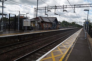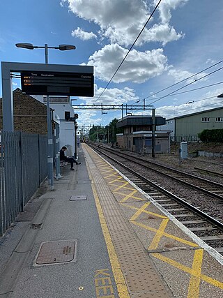
Northumberland Park railway station is on the Lea Valley line that forms part of the West Anglia Main Line,serving the ward of Northumberland Park in Tottenham,north London. It is 6 miles 73 chains (11.1 km) down the line from London Liverpool Street and is situated between Tottenham Hale and Meridian Water. Its three-letter station code is NUM and it is in Travelcard zone 3. It is one of the stations that can be used to access Tottenham Hotspur Stadium.

The Gainsborough line is the current marketing name of the Sudbury branch line,a railway branch line off the Great Eastern Main Line in the east of England,that links Marks Tey in Essex with Sudbury in Suffolk. It is 11 miles 53 chains (18.77 km) in length and single-track throughout. The line's Engineer's Line Reference is SUD.

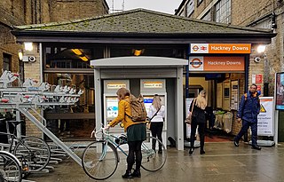
Hackney Downs is a London Overground and National Rail station in Hackney Central and serves the old common land of Hackney Downs in Lower Clapton in the London Borough of Hackney,it is on the Lea Valley lines and West Anglia Main Line. It is 2 miles 78 chains (4.8 km) down the line from London Liverpool Street and has a direct passenger link to Hackney Central station,providing interchange with the North London line of the Overground network.

Cheshunt is a National Rail and London Overground station in Cheshunt,Hertfordshire,England. On the National Rail network it is on the West Anglia Main Line,14 miles 1 chain (22.6 km) from London Liverpool Street and situated between Waltham Cross and Broxbourne. On the London Overground network it is one of three northern termini of the Lea Valley lines.

Cambridge railway station is the principal station serving the city of Cambridge in the east of England. It stands at the end of Station Road,1 mile (1.6 km) south-east of the city centre. It is the northern terminus of the West Anglia Main Line,55 miles 52 chains (89.6 km) down the line from London Liverpool Street,the southern terminus.

Marks Tey railway station is on the Great Eastern Main Line (GEML) in the East of England,serving the large village of Marks Tey,Essex. It is 46 miles 49 chains (75.02 km) down the line from London Liverpool Street and on the GEML is situated between Kelvedon to the west and Colchester to the east. Marks Tey is also the southern terminus of the Gainsborough Line to Sudbury. Its three-letter station code is MKT. The "up" (London-bound) platform 1 has an operational length for nine-coach trains,the "down" (Colchester-bound) platform 2 can accommodate 11-coach trains and platform 3 has an operational length for two-coach trains.

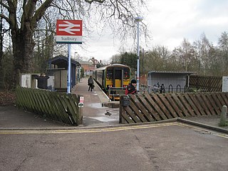
Sudbury railway station is the northern terminus of the Gainsborough Line,a branch off the Great Eastern Main Line in the East of England,serving the town of Sudbury,Suffolk. It is 11 miles 67 chains (19.05 km) down the line from the southern terminus of Marks Tey and 58 miles 32 chains (93.99 km) measured from London Liverpool Street;the preceding station on the branch is Bures. Its three-letter station code is SUY. The platform has an operational length for two-coach trains.

Kelvedon railway station is on the Great Eastern Main Line (GEML) in the East of England,serving the villages of Kelvedon and Feering,Essex. It is also the closest station to the settlements of Coggeshall and Tiptree. Kelvedon is 42 miles 18 chains (68.0 km) down the line from London Liverpool Street. It is situated between Witham to the west and Marks Tey and to the east. Its three-letter station code is KEL.

Chappel &Wakes Colne railway station is on the Gainsborough Line,a branch to Sudbury off the Great Eastern Main Line,in the East of England,serving the village of Wakes Colne and the neighbouring Chappel. It is 3 miles 49 chains (5.81 km) down the line from Marks Tey and 50 miles 18 chains (80.83 km) measured from London Liverpool Street. It is situated between Marks Tey and Bures. Its three-letter station code is CWC. Platform 1 has an operational length for five-coach trains. Platforms 2 and 3 are used by the East Anglian Railway Museum.

Weeley railway station is on the Sunshine Coast Line,a branch of the Great Eastern Main Line,in the East of England,serving the village of Weeley,Essex. It is 62 miles 78 chains (101.3 km) down the line from London Liverpool Street and is situated between Great Bentley to the west and Thorpe-le-Soken to the east. Its three-letter station code is WEE.

Diss railway station is on the Great Eastern Main Line in the East of England,serving the market town of Diss,Norfolk. It is 94 miles 43 chains (152.1 km) down the line from London Liverpool Street and is situated between Stowmarket to the south and Norwich to the north. It is approximately 20 miles (32 km) south of Norwich. Its three-letter station code is DIS.

Chelmsford railway station is on the Great Eastern Main Line in the East of England,serving the city of Chelmsford,Essex. It is 29 miles 60 chains (47.9 km) down the line from London Liverpool Street and is situated between Ingatestone to the west and Hatfield Peverel to the east. Its three-letter station code is CHM.

Shelford railway station is on the West Anglia Main Line serving the villages of Great Shelford,Little Shelford and Stapleford in Cambridgeshire,England. It is 52 miles 36 chains (84.4 km) down the line from London Liverpool Street and is situated between Whittlesford Parkway and Cambridge. Its three-letter station code is SED.

Sawbridgeworth railway station is on the West Anglia Main Line serving the town of Sawbridgeworth in Hertfordshire,England. It is 26 miles 57 chains (43.0 km) down the line from London Liverpool Street and is situated between Harlow Mill and Bishop's Stortford stations. Its three-letter station code is SAW.

Harlow Mill railway station is on the West Anglia Main Line serving the eastern part of Harlow in Essex,England. It is 24 miles 36 chains (39.3 km) down the line from London Liverpool Street and is situated between Harlow Town and Sawbridgeworth stations. Its three-letter station code is HWM.

Colchester railway station is on the Great Eastern Main Line (GEML) in the East of England,and is the primary station serving the city of Colchester,Essex. Its three-letter station code is COL. It is 51 miles 52 chains (83.1 km) down the line from London Liverpool Street and on the GEML is situated between Marks Tey to the west and Manningtree to the east. Colchester is also the location of a major junction where the GEML links to the Sunshine Coast Line,which runs south to Clacton-on-Sea and,via a short branch,to Walton-on-the-Naze;services to and from Colchester Town also join the GEML at the Colchester junction. The junction is grade-separated so trains branching to and from Colchester Town or the Sunshine Coast Line do not cross the main line.

Hythe railway station in Essex is on the Sunshine Coast Line,a branch of the Great Eastern Main Line in the East of England,serving Hythe and other eastern areas of Colchester. It is 53 miles 49 chains (86.3 km) down the line from London Liverpool Street. Its three-letter station code is HYH.

Thorpe-le-Soken railway station is on the Sunshine Coast Line,a branch of the Great Eastern Main Line,in the East of England,serving the village of Thorpe-le-Soken,Essex. It is 65 miles 7 chains (104.7 km) down the line from London Liverpool Street. Its three-letter station code is TLS. To the west the preceding station is Weeley and to the east the following stations are Clacton-on-Sea on the single-stop Clacton branch or Kirby Cross on the branch to Walton-on-the-Naze.
The Stour Valley Railway is a partially closed railway line that ran between Shelford,near Cambridge and Marks Tey in Essex,England. The line opened in sections between 1849 and 1865. The route from Shelford to Sudbury closed on 6 March 1967 leaving only the section from Sudbury to Marks Tey,known as the Gainsborough Line,in operation.

The Little Cornard derailment occurred on 17 August 2010 when a passenger train collided with a road vehicle on a level crossing on the Gainsborough Line near Little Cornard,Suffolk,and partly derailed. The vehicle,a tanker lorry,had begun crossing over the track when the Class 156 train from Sudbury destined for Marks Tey struck it whilst travelling at a speed of approximately 40 miles per hour (64 km/h).


