
Askham Richard is a village and civil parish in the unitary authority of City of York in the north of England, 6.5 miles (10.5 km) south-west of York, close to Copmanthorpe, Bilbrough and Askham Bryan. The population of the civil parish at the 2011 census was 351. The village became a Conservation Area in 1975. Nearby is Askham Bryan College of Agriculture.

Great and Little Hampden is a civil parish in Buckinghamshire, England, about three miles south-east of Princes Risborough. It incorporates the villages of Great Hampden and Little Hampden, and the hamlets of Green Hailey and Hampden Row. Great Hampden is the ancestral home of the Hobart-Hampden family, the most famous of whom was the English Civil War protagonist John Hampden.

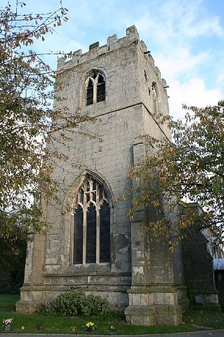
Hatfield is a town and civil parish in the City of Doncaster in South Yorkshire, England. It had a population of 17,236 at the 2011 Census. The town is located on the A18 road between Doncaster and Scunthorpe, and to the west of the M18 motorway. It shares a railway station with Stainforth on the line between Goole and Scunthorpe, and Doncaster. Recorded history in the parish extends as far back as 730, when Bede wrote about the Northumbrian King, Edwin, being killed in battle in the area.
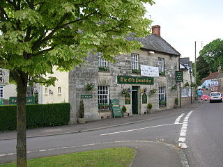
Aller is a village and civil parish in Somerset, England, situated 5 miles (8.0 km) west of Somerton on the A372 road towards Bridgwater. The village has a population of 410. The parish includes the hamlet of Beer and the deserted medieval village of Oath on the opposite bank of the River Parrett.

Westbere is a small village and civil parish in Kent, England, centred 4 miles (6.4 km) north-east of Canterbury city centre along the A28 road to the Isle of Thanet.

Skellow is a village in the Doncaster district, in the county of South Yorkshire, England. Historically part of the West Riding of Yorkshire, the village is roughly 5 miles (8 km) north-west of Doncaster. The village falls in the Askern Spa Ward of Doncaster MBC. To the north and south is mixed farmland, the A1 runs immediately along the western edge of the village, and to the east Skellow merges with the adjacent village of Carcroft along the B1220 road.
Sprotbrough and Cusworth is a civil parish in the City of Doncaster in South Yorkshire, England, with most of its settlements on the western edge of the Doncaster built-up area. It lies between 1 mile (1.6 km) and 4 miles (6.4 km) to the west of Doncaster and is split by the A1(M) motorway. It had a population of 12,166 in 2001 and 12,134 at the 2011 Census. The parish covers some of Doncaster's outlying western suburbs and commuter belt including the villages of Sprotbrough, Cusworth, and a small part of Scawsby, in addition to several rural hamlets and farmsteads.

Aldingham is a village and civil parish in the Westmorland and Furness Unitary Authority of Cumbria, England. Historically in Lancashire, it is situated on the east coast of the Furness peninsula, facing into Morecambe Bay, and is about 8 miles (13 km) east of Barrow-in-Furness, and 6 miles (9.7 km) south of Ulverston. The parish includes the nearby villages of Baycliff, Dendron, Leece, Gleaston, Newbiggin, Roosebeck, Scales and a number of smaller hamlets. According to the 2001 census the parish had a population of 1,187, reducing to 1,105 at the 2011 Census.

Burgh on Bain is a village and civil parish in the East Lindsey district of Lincolnshire, England. It is situated on the A157 road, 7 miles (11 km) west from Louth and 7 miles east from Market Rasen. According to the 2001 census it had a population of 114, increasing to 172 at the 2011 census. The parish includes the hamlet of Girsby.

Tixall is a small village and civil parish in the Stafford district, in the English county of Staffordshire lying on the western side of the Trent valley between Rugeley and Stone, Staffordshire and roughly 4 miles east of Stafford. The population of the civil parish taken at the 2011 census was 239.

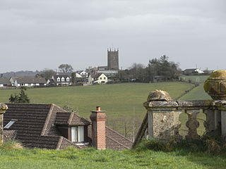
Sheriff Hutton is a village and civil parish in North Yorkshire, England. It lies about 10 miles (16 km) north by north-east of York.
Nun Monkton is a village and civil parish in the Harrogate district of North Yorkshire, England. It is situated 8 miles (13 km) northwest of York at the confluence of the rivers Ouse and Nidd. Cottages and houses are grouped around a village green of 20 acres (81,000 m2) with a duck pond and a maypole. The Ouse is navigable for another 19 miles (30 km) and river traffic played an important part in the village's life until the middle of the twentieth century.
St Giles in the Wood is a village and civil parish in the Torridge district of Devon, England. The village lies about 2.5 miles east of the town of Great Torrington, and the parish, which had a population of 566 in 2001 compared with 623 in 1901, is surrounded clockwise from the north by the parishes of Huntshaw, Yarnscombe, High Bickington, Roborough, Beaford, Little Torrington and Great Torrington. Most of the Victorian terraced cottages in the village, on the east side of the church, were built by the Rolle Estate.

Brinsworth is a village and civil parish in the Metropolitan Borough of Rotherham, in South Yorkshire, England. It is situated close to the River Rother between Rotherham and Sheffield. At the time of the 2001 census it had a population of 8,950, reducing to 8,789 at the 2011 Census.

Sprotbrough is a village in the City of Doncaster in South Yorkshire, England, with a population of 7,548 at the 2021 census. The village is transected by the A1(M) motorway and is situated at the top of the Don Gorge, some 3 miles (4.8 km) west of Doncaster city centre. With Cusworth to the north, it forms the civil parish of Sprotbrough and Cusworth, which had a population of 12,134 in 2011.
East Hardwick is a village and civil parish in the City of Wakefield in West Yorkshire, England. It has a population of 191, reducing to 173 at the 2011 Census. Until 1974 it was part of Osgoldcross Rural District.

Cusworth is a village and suburb of Doncaster in South Yorkshire, England, located 2 miles (3.2 km) to its north-west within the civil parish of Sprotbrough and Cusworth and the City of Doncaster, with a population of 4,728. It is home to Cusworth Hall, an 18th century country house, and its surrounding parkland. Some buildings in the old village can be dated back to the 16th century.

Staunton is a small village and civil parish in the Newark and Sherwood district of Nottinghamshire, England. It takes its name from the Vale of Belvoir and shares it with the local Staunton family, which has resided in the area since the Norman Conquest and possibly before, making them one of the few English families still resident on their estate.

South Wheatley is a village and former civil parish, now within the North and South Wheatley civil parish, of Bassetlaw district, in the county of Nottinghamshire, England. In 2001 South Wheatley parish had a population of 102. It is 130 miles north of London, 30 miles north east of the county town of Nottingham, and 5 miles north east of the Nottinghamshire town of Retford. There are 4 listed buildings in South Wheatley.
North and South Wheatley is a civil parish in the Bassetlaw district, in the county of Nottinghamshire, England. The parish includes the villages of North Wheatley and South Wheatley. In 2021 the parish had a population of 610 residents. It is 130 miles north of London, 30 miles north east of the county town of Nottingham, and 5 miles north east of the Nottinghamshire town of Retford. The parish touches Bole, Clarborough and Welham, Clayworth, Hayton, Saundby, Sturton Le Steeple and West Burton. There are 18 listed buildings in North and South Wheatley.

