Burkeville, British Columbia

Last updated
Burkeville (foreground) viewed from a plane departing Vancouver International Airport. Burkeville 2018-05.jpg
Burkeville (foreground) viewed from a plane departing Vancouver International Airport.

Burkeville, British Columbia is a village located on Sea Island in Richmond, British Columbia, Canada.

Contents

The village is the only residential area on Sea Island, [1] which is primarily covered by the Vancouver International Airport.

History

Development

The village was constructed from 1941 to 1943 by Wartime Housing Limited, the crown corporation responsible for the development of homes for workers in wartime industries. [1] [2] With rubber shortages and restrictions on gasoline usage, the government considered the community essential in order to house the employees of the Boeing Aircraft Factory close to their workplace. [1] [3] The land upon which the neighbourhood is built was expropriated from farmers who lived in the area. [1]

In an effort to expedite the construction process, the entire village was constructed with only three different floor plans for the original 328 houses. [1] [4] Houses were between 700 and 900 square feet, containing either four or six rooms depending on the layout, and came in three different exterior colours. [4] The homes lacked lawns, garages, insulation, and furnaces, relying on wood or coal burning kitchen stoves for heat. The first residents moved into the neighbourhood in January 1944. [1]

The community would later be named Burkeville, after then-President of Boeing Canada, Stanley Burke. [1] The street names have an aeronautical theme, many of which bear the names of airplane manufacturers, including Boeing Avenue, Douglas Crescent, and Handley Avenue, or of specific aircraft models, such as Hudson Avenue, Catalina Crescent, and Lysander Lane.

Politics

From its inception in 1944 until 1947, Burkeville was not considered a part of Richmond nor Vancouver. Initially, the Richmond Council was averse to absorbing the new village, due to concerns that pre-existing landowners would be saddled with an increased property tax to cover the costs of services required by Burkeville. It was even suggested that Burkeville become an independent village, leaving the federal Government responsible for the associated costs. The city council debated this issue from before the development was built until after the war had ended. [1]

Finally, in May 1947, a bylaw was passed by Richmond Council to incorporate Burkeville into the municipality of Richmond. Subsequently, the city took possession of the neighbourhood's houses and committed to resurfacing the community's roads and building an elementary school. The homes were then sold back to existing tenants and veterans returning to the country. [1]

Sea Island School

After the war, residents of Burkeville quickly began demanding an elementary school to accommodate their growing families and remove the need for children to be bused off of the island for education. [1] [5] The grand opening of the Sea Island School took place on October 17, 1947. The school's name was chosen by then-Reeve of Richmond, Rudy Grauer; the other proposed options were Princess Elizabeth School and Frasea School. [1] The facility was a cottage-style building located on Wellington Crescent, with six classrooms on the ground floor. [6]

Notable people

Burkeville was the hometown of aviation pioneer Dan McIvor.[ citation needed ]

Demographics

Burkeville is represented in Canadian census dissemination area 59153602, which covers the entirety of Sea Island. [7] Since Burkeville is the only residential area on the island, [8] census results from this area can be used to determine the demographic makeup of the village.

In 2021, Burkeville had 819 individuals living in 304 of its 315 total private dwellings, an increase of 0.61% from its 2016 population of 814. [9] [10] The employment rate in the village was 60.6% as of May 2021, slightly above the Canadian average of 57.1%, [11] while the median total income of residents in 2020 was $48,000. [9]

Ethnicity

Ethnic and panethnic groups in Burkeville, 2021
GroupsPopulation % of Total Population
Visible minority groups South Asian 455.1%
Chinese 17019.3%
Black 101.1%
Latin American 404.5%
Southeast Asian 151.7%
Japanese 151.7%
Total visible minority population32036.4%
Indigenous groups First Nations 354.0%
Métis 00.0%
Total Aboriginal population354.0%
European [note 1] 52559.6%
Total population880 [note 2] 100%
Source: 2021 Canadian census [9]

Languages

The 2021 census stated 625 persons or 76.2% of Burkeville's population have English as a mother tongue; Cantonese is the mother tongue of 45 persons or 5.5% of the population, followed by Mandarin (35 or 4.3%), Spanish (15 or 1.8%), Punjabi (15 or 1.8%), Hindi (10 or 1.2%), Japanese (10 or 1.2%), French (5 or 0.6%), Tagalog (5 or 0.6%), Vietnamese (5 or 0.6%), Polish (5 or 0.6%), and Thai (5 or 0.6%). [9]

Religion

ReligionPopulation % of Total Population
Buddhist 151.7%
Christian (total)25028.4%
Christian, not otherwise specified859.7%
Anglican 354.0%
Catholic 657.4%
United Church 202.3%
Other Christian traditions151.7%
Other religions and spiritual traditions202.3%
No religion and secular perspectives57565.3%
Total population880 [note 3] 100%
Source: 2021 Canadian census [9]

See also

Notes

  1. Statistic includes all persons that did not make up part of a visible minority or an Indigenous identity.
  2. Sum of ethnic or cultural groups may be higher than total population estimate due to rounding errors or individuals reporting more than one group
  3. Sum of religious groups may be higher than total population estimate due to rounding errors or individuals selecting more than one group

Related Research Articles

<span class="mw-page-title-main">Lower Mainland</span> Region in British Columbia, Canada

The Lower Mainland is a geographic and cultural region of the mainland coast of British Columbia that generally comprises the regional districts of Metro Vancouver and the Fraser Valley. Home to approximately 3.05 million people as of the 2021 Canadian census, the Lower Mainland contains sixteen of the province's 30 most populous municipalities and approximately 60% of the province's total population.

<span class="mw-page-title-main">Vancouver</span> City in British Columbia, Canada

Vancouver is a major city in western Canada, located in the Lower Mainland region of British Columbia. As the most populous city in the province, the 2021 Canadian census recorded 662,248 people in the city, up from 631,486 in 2016. The Metro Vancouver area had a population of 2.6 million in 2021, making it the third-largest metropolitan area in Canada. Greater Vancouver, along with the Fraser Valley, comprises the Lower Mainland with a regional population of over 3 million. Vancouver has the highest population density in Canada, with over 5,700 people per square kilometre, and fourth highest in North America.

<span class="mw-page-title-main">Richmond, British Columbia</span> City in British Columbia, Canada

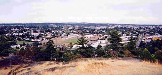
Richmond is a city in the coastal Lower Mainland region of British Columbia, Canada. Mainly a suburban city, it occupies almost the entirety of Lulu Island, between the two estuarine distributaries of the Fraser River. Encompassing the adjacent Sea Island and several other smaller islands and uninhabited islets to its north and south, the suburb neighbours Vancouver and Burnaby on the Burrard Peninsula to the north, New Westminster and Annacis Island to the east, Delta to the south, and the Strait of Georgia to the west.

<span class="mw-page-title-main">Burnaby</span> City in British Columbia, Canada

Burnaby is a city in the Lower Mainland region of British Columbia, Canada. Located in the centre of the Burrard Peninsula, it neighbours the City of Vancouver to the west, the District of North Vancouver across the confluence of the Burrard Inlet with its Indian Arm to the north, Port Moody and Coquitlam to the east, New Westminster and Surrey across the Fraser River to the southeast, and Richmond on the Lulu Island to the southwest.

<span class="mw-page-title-main">West Vancouver</span> District municipality in British Columbia, Canada

West Vancouver is a district municipality in the province of British Columbia, Canada. A member municipality of the Metro Vancouver Regional District, West Vancouver is to the northwest of the city of Vancouver on the northern side of English Bay and the southeast shore of Howe Sound, and is adjoined by the District of North Vancouver to its east. Together with the District of North Vancouver and the City of North Vancouver, it is part of a local regional grouping referred to as the North Shore municipalities, or simply "the North Shore".

<span class="mw-page-title-main">Esquimalt</span> Township in British Columbia, Canada

The Township of Esquimalt is a municipality at the southern tip of Vancouver Island, in British Columbia, Canada. It is bordered to the east by the provincial capital, Victoria, to the south by the Strait of Juan de Fuca, to the west by Esquimalt Harbour and Royal Roads, to the northwest by the New Songhees 1A Indian reserve and the town of View Royal, and to the north by a narrow inlet of water called the Gorge, across which is the district municipality of Saanich. It is almost tangential to Esquimalt 1 Indian Reserve near Admirals Road. It is one of the 13 municipalities of Greater Victoria and part of the Capital Regional District.

The settlement of Steveston, founded in the 1880s, is a neighbourhood of Richmond in Metro Vancouver. On the southwest tip of Lulu Island, the village is a historic port and salmon canning centre at the mouth of the South Arm of the Fraser River. The early 1900s style architecture attracts both the film and tourism industries.

<span class="mw-page-title-main">Lulu Island</span> Island of the Fraser River in British Columbia, Canada

Lulu Island is the name of the largest island in the estuary of the Fraser River, located south of Vancouver, British Columbia, Canada, and the second-most populous island in British Columbia, after Vancouver Island. The city of Richmond occupies most of the island, while a small section at the eastern tip, known as Queensborough, is part of the city of New Westminster.

<span class="mw-page-title-main">98 B-Line</span> Former express bus service in Metro Vancouver, Canada

The 98 B-Line was a bus rapid transit line in Metro Vancouver, British Columbia, Canada, that began service in September 2000. It linked Richmond to Downtown Vancouver, with a connection to Vancouver International Airport. It travelled mainly along Granville Street in Vancouver and a dedicated bus lane on No. 3 Road in Richmond. It was operated by Coast Mountain Bus Company and was funded by TransLink. The route was 16 kilometres (9.9 mi) long. The line carried over 18,000 passengers daily. It was discontinued in September 2009, shortly after the opening of the Canada Line, which replaced it.

<span class="mw-page-title-main">Marpole</span> Neighbourhood in Vancouver, British Columbia, Canada

Marpole, originally a Musqueam village named c̓əsnaʔəm, is a mostly residential neighbourhood of 23,832 in 2011, located on the southern edge of the city of Vancouver, British Columbia, immediately northeast of Vancouver International Airport, and is approximately bordered by Angus Drive to the west, 57th Avenue to the north, Ontario Street to the east and the Fraser River to the south. It has undergone many changes in the 20th century, with the influx of traffic and development associated with the construction of the Oak Street Bridge and the Arthur Laing Bridge.

<span class="mw-page-title-main">Sea Island (British Columbia)</span> Island in the Fraser River estuary in the city of Richmond, British Columbia, Canada

Sea Island is an island in the Fraser River estuary in the city of Richmond, British Columbia, Canada. It is located south of the city of Vancouver and northwest of Lulu Island.

<span class="mw-page-title-main">Golden Village, Richmond</span> Neighbourhood in Richmond, British Columbia, Canada

The Golden Village is a commercial district in Richmond, British Columbia, Canada, with a high concentration of Asian-themed shopping malls. According to the 2016 Canadian Census, 54 percent of Richmond's population identify their ethnic origin as Chinese. As such, the Golden Village boasts a high density of not only Chinese but all varieties of Asian shops and restaurants.

<span class="mw-page-title-main">Queensborough, New Westminster</span> Neighbourhood of New Westminster in Lower Mainland, British Columbia, Canada

Queensborough is a neighbourhood in the city of New Westminster, British Columbia, Canada. It is on the eastern tip of Lulu Island on the Fraser River.

Boeing Canada is the Canadian subsidiary of Boeing, with operations in Winnipeg, MB, Richmond, BC, Montreal, QC and Ottawa, ON. Boeing employs more than 1,600 people in Canada. Boeing Aircraft of Canada Limited was formed in 1929 by the American Boeing Airplane Company.

<span class="mw-page-title-main">Shaughnessy, Vancouver</span> Neighbourhood in Vancouver, British Columbia, Canada

Shaughnessy is an almost-entirely residential neighbourhood in Vancouver, British Columbia, Canada, spanning about 447 hectares in a relatively central locale. It is bordered by 16th Avenue to the north, 41st Avenue to the south, Oak Street to the east, and East Boulevard to the west. The older section of the neighbourhood, called "First Shaughnessy," is considered more prestigious and is bordered by 16th Avenue to the north, King Edward Avenue to the south, Oak Street to the east, and East Boulevard to the west. In 2016, the population was approximately 8,810. It was named after Thomas Shaughnessy, 1st Baron Shaughnessy, former president of the Canadian Pacific Railway.

<span class="mw-page-title-main">Cadboro Bay</span>

Cadboro Bay is a bay near the southern tip of Vancouver Island and its adjacent neighbourhood in the municipalities of Saanich and Oak Bay in Greater Victoria, British Columbia, Canada.

<span class="mw-page-title-main">Artificial Reef Society of British Columbia</span> Canadian non-profit to create artificial reefs for habitat enhancement and recreation

The Artificial Reef Society of British Columbia (ARSBC) is a registered non-profit society based in Vancouver, British Columbia (BC), and has been a registered tax-deductible charity in Canada since 1992.

Qualicum-Graham Park or Qualicum is a suburban neighbourhood in College Ward in the City of Ottawa, Ontario, Canada. It is located in the former City of Nepean in the west end of the city. Many of the residences in the area are executive homes situated on large lots (100x100) being built in the 1960s. Qualicum Street boasts large custom houses built by Bill Teron. The neighbourhood is bounded to the north by the Queensway, to the west by Richmond Road, to the south by Baseline Road, and to the east by Morrison Drive at the former Ottawa-Nepean border towards Redwood. Named after Qualicum Beach in British Columbia.

<span class="mw-page-title-main">University Endowment Lands</span> Unincorporated area in British Columbia, Canada

The University Endowment Lands (UEL) is an unincorporated area that lies to the west of the city of Vancouver, British Columbia, Canada, and adjacent to the University of British Columbia (UBC) and the lands associated with that campus. Pacific Spirit Regional Park lies within the UEL. The UEL is part of Metro Vancouver. Mail sent to the UEL is addressed to "Vancouver" rather than the UEL.

References

  1. 1 2 3 4 5 6 7 8 9 10 11 Keen, Mary (2002). A bridge to the world: The Life and Times of Sea Island. City of Richmond Archives. pp. 34–39. ISBN   0-9690031-5-3.
  2. "Burkeville - Sea Island, Richmond, BC". Sea Island Heritage Society. Retrieved 2024-05-24.
  3. Raphael, Philip (2016-11-09). "Remembrance Day special: Burkeville helped Boeing's war effort soar". Richmond News . Retrieved 2024-05-24.
  4. 1 2 "Family Homes for Workers". Richmond Museum. Retrieved 2024-05-26.
  5. "Sea Island Elementary School - City of Richmond, BC". City of Richmond . Retrieved 2024-05-24.
  6. "Sea Island School". Richmond Museum. 2022-05-26. Retrieved 2024-05-24.
  7. "More information: 59153602 [Dissemination area], British Columbia". Statistics Canada . Retrieved 2024-05-26.
  8. "3.0 Connected Neighbourhoods With Special Places" (PDF). City of Richmond. November 19, 2012. p. 27.
  9. 1 2 3 4 5 "Census Profile, 2021 Census of Population - 59153602 [Dissemination area], British Columbia". Statistics Canada . 2022-02-09. Retrieved 2024-05-25.
  10. "Census Profile, 2016 Census of Population - 59153602 [Dissemination area], British Columbia". Statistics Canada . Retrieved May 25, 2024.
  11. "Census Profile, 2021 Census of Population - Canada [Country]". Statistics Canada . Retrieved May 25, 2024.

49°11′20″N123°8′47″W / 49.18889°N 123.14639°W / 49.18889; -123.14639