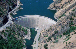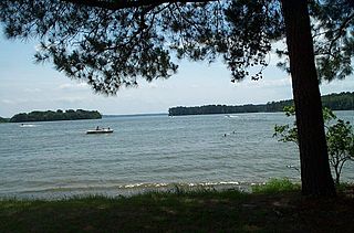
The Mount Morris Dam is a concrete dam on the Genesee River. It is located south of Rochester, New York in the towns of Leicester and Mount Morris in Livingston County, New York, next to Letchworth State Park.

Keystone Lake is a reservoir in northeastern Oklahoma on the Arkansas and Cimarron rivers. It is located upstream about 23 miles (37 km) from Tulsa. It was created in 1968 when the Keystone Dam was completed. The primary purposes are: flood control, hydroelectric power generation, wildlife management and recreation.

Table Rock Lake is an artificial lake or reservoir in the Ozarks of southwestern Missouri and northwestern Arkansas. The lake is impounded by Table Rock Dam, constructed from 1954 to 1958 on the White River by the U.S. Army Corps of Engineers.
Millwood Lake is a reservoir in southwestern Arkansas, United States. It is located 9 miles (14 km) from Ashdown. The lake is formed from the damming of the point where the Little River and the Saline River meet.

Wilson Lake is a reservoir in the U.S. state of Kansas, on the border of Russell County and Lincoln County. Built and managed by the U.S. Army Corps of Engineers for flood control, it is also used for wildlife management and recreation. Several parks are located along its shoreline, including Wilson State Park.

Monticello Dam is a 304-foot (93 m) high concrete arch dam in Napa County, California, United States constructed between 1953 and 1957. The dam impounded Putah Creek to create Lake Berryessa in the Vaca Mountains.

The Addicks Reservoir and Addicks Dam in conjunction with the Barker Reservoir prevent downstream flooding of Buffalo Bayou in the City of Houston. Both reservoirs were authorized under the Rivers and Harbors Act of June 20, 1938, which was modified by the Flood Control Acts of August 11, 1938; September 3, 1954; and October 27, 1965. The U.S. Army Corps of Engineers completed construction of Addicks Dam and the outlet facility in 1948.

Lake Livingston is a reservoir located in the East Texas Piney Woods. Lake Livingston was built, and is owned and operated, by the Trinity River Authority of Texas (TRA) under contract with the City of Houston for water-supply purposes. The lake is the second-largest lake located wholly within the state of Texas. The Livingston Dam, constructed across the Trinity River approximately 7 miles (11 km) southwest of the city of Livingston is 2.5 miles (4 km) in length and has an average depth of 55 feet (17 m).

Optima Lake was built to be a reservoir in Texas County, Oklahoma. The site is located just north of Hardesty and east of Guymon in the Oklahoma Panhandle.

Folsom Dam is a concrete gravity dam on the American River of Northern California in the United States, about 25 mi (40 km) northeast of Sacramento. The dam is 340 ft (100 m) high and 1,400 ft (430 m) long, flanked by earthen wing dams. It was completed in 1955, officially opening the following year.

Lake O’ the Pines is a reservoir on Big Cypress Bayou, also known as Big Cypress Creek, chiefly in Marion County, Texas, USA. The reservoir also occupies a small part of Upshur and Morris Counties. The dam is located approximately 8.5 miles (13.7 km) west of Jefferson.

Benbrook Lake is a reservoir on the Clear Fork of the Trinity River in Tarrant County, Texas, USA. The lake is located approximately 10 miles (16 km) southwest of the center of Fort Worth, where the Clear Fork and the West Fork of the Trinity River join. The lake is impounded by the Benbrook Dam. The lake and dam are owned and operated by the U.S. Army Corps of Engineers, Fort Worth District.

John Redmond Reservoir is a reservoir on the Neosho River in eastern Kansas. Built and managed by the U.S. Army Corps of Engineers, it is used for flood control, recreation, water supply, and wildlife management. It borders the Flint Hills National Wildlife Refuge to the northwest.
Pine Creek Lake is a lake in McCurtain County and Pushmataha County, Oklahoma, USA. It is 8 miles (13 km) north of Valliant, Oklahoma. It is located east of Rattan and north of Sobol.

John W. Flannagan Dam is a flood control dam located in the Cumberland Mountains of Dickenson County, Virginia. It forms the John W. Flannagan Reservoir behind it.

Pactola Dam is an embankment dam on Rapid Creek in Pennington County, South Dakota, about 10 miles (16 km) west of Rapid City. The dam was completed in 1956 by the U.S. Bureau of Reclamation to provide flood control, water supply and recreation. Along with the nearby Deerfield Dam, it is part of the Rapid Valley Unit of the Pick-Sloan Missouri Basin Program. U.S. Route 385 runs along the crest of the dam. The dam forms Pactola Lake, which at over 1,200 acres (490 ha) is the largest and deepest body of water in the Black Hills.

Lake Hudson, also known as Markham Ferry Reservoir, is a man-made reservoir in Mayes County, Oklahoma, United States, about 2 miles (3.2 km) northwest of Locust Grove, Oklahoma and 8 miles (13 km) southeast of Pryor, Oklahoma. It was created by the completion of the Robert S. Kerr Dam on the Grand River in 1964. It is managed by the Grand River Dam Authority (GRDA).

Lovewell Reservoir is a reservoir in Jewell County, Kansas, United States. Built and managed by the U.S. Bureau of Reclamation, it is used for flood control, irrigation, and recreation. Lovewell State Park is located on its north shore.

Kirwin Reservoir is a reservoir in Phillips County, Kansas, United States. It is located next to the city of Kirwin in northern Kansas. The U.S. Bureau of Reclamation built it and continues to operate it for the purposes of flood control and area irrigation. The Kirwin National Wildlife Refuge lies on its shores.

Council Grove Lake is a reservoir on the Neosho River in east-central Kansas. Built and managed by the U.S. Army Corps of Engineers, it is used for flood control, recreation, and water supply.


