Bx28 and Bx38 buses

Last updated

bx28, bx38
Gun Hill Road
Bedford Pk Blvd Overpass td (2019-03-29) 03a.jpg
Overview
System MTA Regional Bus Operations
Operator New York City Transit
Garage Gun Hill Depot
Vehicle Nova Bus LFS
Nova Bus LFS HEV
New Flyer Xcelsior XD40
Began serviceSeptember 18, 1933 (Bx28)
June 25, 2010 (Bx38)
Route
Locale The Bronx, New York, U.S.
Communities served Fordham, Kingsbridge Heights, Bedford Park, Norwood, Olinville, Williamsbridge, Baychester, Co-op City
Start Fordham - East 192nd Street & Valentine Avenue (Bx28 daytime & Bx38 Sunday mornings and late evenings)
Norwood - Norwood-205th Street station (Bx28 late nights & Bx38)
ViaGun Hill Road, Co-op City Boulevard (Bx38)
End Co-op City - Earhart Lane & Erskine Place (Bx28)
Co-op City - Bay Plaza (Bx38)
Length7.4 miles (11.9 km) (Bx28)
5.9 miles (9.5 km) (Bx38)
Other routes Bx25/Bx26 Bedford Park Boulevard/Allerton Avenue
Bx30 Boston Road
Service
OperatesAll times (Bx28)
All times except late nights (Bx38)
Annual patronage2,225,893 (2023) [1]
TransfersYes
Timetable Bx28/38
  Bx27
Bx36
 {{{system_nav}}}  Bx29
Bx39  

The Bx28 and Bx38 constitute a public transit line in The Bronx. These routes primarily run on Gun Hill Road between the northern part of West Bronx and Co-op City.

Contents

Route description

The Bx28 begins at 192nd Street and Valentine Avenue. It heads north onto Kingsbridge Road, turning north onto Jerome Avenue and running via Paul Avenue between Bedford Park Boulevard and Mosholu Parkway to serve Lehman College and turning southeast on Mosholu Parkway and then turning north onto Bainbridge Avenue. At 205th Street, it is joined by the Bx38, where both routes continue north on Bainbridge Avenue, before turning left onto Gun Hill Road, running on it until reaching Bartow Avenue, continuing east until reaching Baychester Avenue, where the routes split: [2]

During late nights when the Bx38 does not run, the Bx28 follows the Bx38 route between Bay Plaza and Baychester Avenue-Bartow Avenue, but terminates at Norwood-205th Street station instead of Fordham. [3]

Along the route, there are several connections to the New York City Subway at: [2]

History

The Bx28 began on September 18, 1933, under the designation of the Bx15. On July 1, 1974, the Bx15 was extended on its eastern end from Gunther Avenue-Bartow Avenue to its current terminus at Co-op City and extended on its western end from Mosholu Parkway-Jerome Avenue to its current terminus in Fordham, although select trips and all Sunday trips continued to terminate at Mosholu Parkway-Jerome Avenue. A branch of the Bx15 from Norwood-205th Street to Eastchester Road-Boston Road was relabeled to the Bx6. [4]

On February 19, 1984, as part of the Bronx bus revamp, [5] [6] [7] the Bx15 was renamed to the Bx28. [8] [9] The Metropolitan Transportation Authority (MTA) proposed simplifying the Bx26's and Bx28's complicated service patterns in March 2000. [10] The Mosholu Parkway short-turn would be discontinued and all daytime Bx28 trips would run to Fordham Center to replace Bx26 service there; whenever service had headways lower than 10 minutes, every other bus would terminate at Norwood. These changes took place on September 10, 2000. [11] [12] On June 25, 2010, due to the MTA's budget crisis, Norwood short turns and service to sections 1-2-3 in Co-op City were spun off into a new designation, the Bx38, which would terminate at Bay Plaza, with service through Asch Loop discontinued outright. [13] On June 29, 2014, Bx28 service via Asch Loop was restored. [13] [14]

In 2017, the MTA released its Fast Forward Plan, aimed at speeding up mass transit services. [15] As part of this program, a draft plan for a reorganization of Bronx bus routes was proposed in draft format in June 2019, with a final version published in October 2019. [16] [17] The draft plan proposed rerouting the Bx28 on Bainbridge Avenue and Bedford Park Boulevard instead of Mosholu Parkway and Paul Avenue to replace a rerouted Bx34, the discontinuation of the Bx38, the removal of closely spaced stops and the truncation of the Bx28 to Asch Loop, with the Bx23 taking over all Co-op City inter-section service. The final plan removed the Bx38 discontinuation and the Bx28 truncation, but kept the reroute via Bainbridge Avenue and Bedford Park Boulevard, which was also dropped in late 2021, and the stop removal, which was kept. [18] [19] Due to the COVID-19 pandemic in New York City, the changes were halted for over a year. [20] [21] [22] The modification took place on June 26, 2022. [23] [24]

See also

Related Research Articles

<span class="mw-page-title-main">Mosholu Parkway station</span> New York City Subway station in the Bronx

The Mosholu Parkway station is a local station on the IRT Jerome Avenue Line of the New York City Subway. Located at the intersection of Mosholu Parkway and Jerome Avenue in the Bronx, it is served by the 4 train at all times.

<span class="mw-page-title-main">183rd Street station (IRT Jerome Avenue Line)</span> New York City Subway station in the Bronx

The 183rd Street station is a local station on the elevated IRT Jerome Avenue Line of the New York City Subway. Located at the intersection of 183rd Street and Jerome Avenue in the Bronx, it is served by the 4 train at all times. This station was constructed by the Interborough Rapid Transit Company as part of the Dual Contracts and opened in 1917.

Baychester is a neighborhood geographically located in the northeast part of the Bronx, New York City. Its boundaries are East 222nd Street to the northeast, the New England Thruway (I-95) to the east, Gun Hill Road to the southwest, and Boston Road to the northwest. Eastchester Road is the primary thoroughfare through Baychester.

<span class="mw-page-title-main">Norwood, Bronx</span> Neighborhood of the Bronx in New York City

Norwood, also known as Bainbridge, is a residential neighborhood in the northwest Bronx, New York City, U.S. It is bound by Van Cortlandt Park and Woodlawn Cemetery to the north, the Bronx River to the east, and Mosholu Parkway to the southwest. The area is dominated topographically by what was once Valentine's Hill, the highest point being near the intersection of 210th Street and Bainbridge Avenue, where Gun Hill Road intersects, and around the Montefiore Medical Center, the largest landowner and employer of the neighborhood. Norwood's main commercial arteries are Gun Hill Road, Jerome Avenue, Webster Avenue, and Bainbridge Avenue.

The Concourse Line is an IND rapid transit line of the New York City Subway system. It runs from 205th Street in Norwood, Bronx, primarily under the Grand Concourse, to 145th Street in Harlem, Manhattan. It is the only B Division line in the Bronx, and also the only line in the Bronx with all stations underground.

<span class="mw-page-title-main">Bedford Park, Bronx</span> Neighborhood of the Bronx in New York City

Bedford Park is a residential neighborhood in the northwest Bronx, New York City, adjacent to the New York Botanical Garden. Its boundaries, starting from the north and moving clockwise, are: Mosholu Parkway to the north, Webster Avenue to the east, East 196th Street to the south, and Jerome Avenue to the west.

The IRT Jerome Avenue Line, also unofficially known as IRT Woodlawn Line, is an A Division New York City Subway line mostly along Jerome Avenue in the Bronx. Originally an Interborough Rapid Transit Company-operated route, it was built as part of the Dual Contracts expansion and opened in 1917 and 1918. It is both elevated and underground, with 161st Street–Yankee Stadium being the southernmost elevated station. The line has three tracks from south of the Woodlawn station to the 138th Street–Grand Concourse station. The Woodlawn Line also has a connection to the Jerome Yard, where 4 trains are stored, just north of the Bedford Park Boulevard–Lehman College station.

<span class="mw-page-title-main">Norwood–205th Street station</span> New York City Subway station in the Bronx

The Norwood–205th Street station is the northern terminal station on the IND Concourse Line of the New York City Subway. Located in Norwood, Bronx, it is served by the D train at all times. Due to changes in the street grid of the neighborhood, the station has exits to East 205th Street and Perry Avenue, as well as to East 206th Street and Bainbridge Avenue.

<span class="mw-page-title-main">Mosholu Parkway</span> Road in the Bronx, New York

Mosholu Parkway is a 3.03-mile-long (4.88 km) parkway in the borough of the Bronx in New York City, constructed from 1935 to 1937 as part of the roadway network created under Robert Moses. The roadway extends between the New York Botanical Garden and Van Cortlandt Park. The New York City Department of Transportation is responsible for the operation and maintenance of the roadway while the New York City Department of Parks and Recreation is responsible for the surrounding rights-of-way. The parkway is designated as New York State Route 908F (NY 908F), an unsigned reference route, by the New York State Department of Transportation.

<span class="mw-page-title-main">Q27 (New York City bus)</span> Bus route in Queens, New York

The Q27 bus route constitutes a public transit line in Queens, New York City, running primarily along 46th Avenue, Rocky Hill Road and Springfield Boulevard between a major bus-subway hub in Flushing and Cambria Heights. The route is operated by MTA Regional Bus Operations under the New York City Transit brand.

<span class="mw-page-title-main">Bx1 and Bx2 buses</span> Bus routes in the Bronx, New York

The Bx1 and Bx2 are two bus routes that run on the Grand Concourse in the Bronx, New York City. The routes, which are operated by the MTA Regional Bus Operations, also follow Sedgwick Avenue and Mosholu Parkway for a short distance at their northern end. As the numbers suggest, these were the first two bus routes in the Bronx.

<span class="mw-page-title-main">Gun Hill Road (road)</span> Street in the Bronx, New York

Gun Hill Road is a major thoroughfare in the New York City borough of the Bronx. The road stretches for 3.5 miles (5.6 km) from Mosholu Parkway in Norwood to Stillwell Avenue in Baychester, near an exit for the Hutchinson River Parkway. Van Cortlandt Park and the Mosholu Golf Course are both located at the western terminus of Gun Hill Road.

<span class="mw-page-title-main">Jerome Avenue</span> Avenue in the Bronx, New York

Jerome Avenue is one of the longest thoroughfares in the New York City borough of the Bronx, New York, United States. The road is 5.6 miles (9.0 km) long and stretches from Concourse to Woodlawn. Both of these termini are with the Major Deegan Expressway which runs parallel to the west. Most of the elevated IRT Jerome Avenue Line runs along Jerome Avenue. The Cross Bronx Expressway interchanges with Jerome and the Deegan. Though it runs through what is now the West Bronx neighborhood, Jerome Avenue is the dividing avenue between nominal and some named "West" and "East" streets in the Bronx; Fifth Avenue, and to a lesser extent, Broadway, also splits Manhattan into nominal "West" and "East" streets.

<span class="mw-page-title-main">Select Bus Service</span> Bus service in New York City

Select Bus Service is a brand used by the Metropolitan Transportation Authority (MTA)'s Regional Bus Operations for limited-stop bus routes with some bus rapid transit features in New York City. The first SBS route was implemented in 2008 to improve speed and reliability on long, busy corridors.

<span class="mw-page-title-main">Bx15 and M125 buses</span> Bus routes in Manhattan and the Bronx, New York

The Bx15 and M125 bus routes constitute the Third Avenue/125th Street Line, a public transit line in New York City. The Bx15 runs between Fordham Plaza and the Hub in the Bronx, running primarily along Third Avenue. The M125 runs between the Hub in the Bronx and Manhattanville in Manhattan, running along Willis Avenue in the South Bronx and along 125th Street in Harlem, Manhattan.

<span class="mw-page-title-main">Q20 and Q44 buses</span> Bus routes in Queens and the Bronx, New York

The Q20A and Q20B and Q44 bus routes constitute the Main Street Line, a public transit line in Queens, New York City, running primarily along Main Street between two major bus-subway hubs in the neighborhoods of Jamaica and Flushing. The Q20A/B terminates in College Point at the north end of Queens. The Q44 continues north into the borough of the Bronx, terminating in the West Farms neighborhood near the Bronx Zoo. The Q44 is one of two Queens bus routes to operate between the two boroughs.

<span class="mw-page-title-main">Bx23 and Q50 buses</span> Bus routes in Queens and the Bronx, New York

The Bx23 and Q50 bus routes constitute a public transit corridor in New York City, running from the Flushing neighborhood in Queens to the Pelham Bay and Co-op City neighborhoods in the Bronx. The Bx23 provides local service in Pelham Bay and Co-op City, while the Q50 provides limited-stop service between Co-op City and subway hubs in Pelham Bay and Flushing. Both routes are city-operated under the MTA Bus Company brand of MTA Regional Bus Operations, and are the only two local routes in the Bronx to operate under the MTA Bus brand, rather than under the MaBSOTA brand that all other Bronx bus routes operate under.

<span class="mw-page-title-main">Union Turnpike express buses</span> Express bus routes in Queens and Manhattan, New York

The QM1, QM5, QM6, QM7, QM8, QM31, QM35, and QM36 bus routes constitute a public transit line in New York City, operating express between Northeast Queens and Midtown or Downtown Manhattan. The routes operate primarily on Union Turnpike in Queens, and travel non-stop via Queens Boulevard, the Long Island Expressway, and the Midtown Tunnel or Queensboro Bridge between Queens and Manhattan.

<span class="mw-page-title-main">Bx25 and Bx26 buses</span> Bus routes in the Bronx, New York

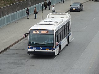
The Bx25 and Bx26 constitute a public transit line in The Bronx. These routes primarily run on Bedford Park Boulevard and Allerton Avenue between Lehman College in Bedford Park and Co-op City.

References

  1. "Subway and bus ridership for 2023". mta.info. April 29, 2024. Retrieved May 2, 2024.
  2. 1 2 3 4 "Bronx Bus Map" (PDF). Metropolitan Transportation Authority. October 2018. Retrieved December 1, 2020.
  3. "Bronx Bus Service" (PDF). Metropolitan Transportation Authority. October 2018. Retrieved December 1, 2020.
  4. "2 BOROUGHS' BUSES GET NEW NUMBERS". The New York Times. June 20, 1974. ISSN   0362-4331. Archived from the original on August 1, 2017. Retrieved October 2, 2016.
  5. Reyes, Lennin (October 2, 2011). "Busses and Trains A Go-Go". Bronx Journal. Archived from the original on December 24, 2015. Retrieved December 24, 2015.
  6. "1976 Bronx Bus Map". wardmaps.com. New York City Transit Authority. 1976. Archived from the original on March 10, 2016. Retrieved March 3, 2016.
  7. Old MTA bus timetables http://acm.jhu.edu/~sthurmovik/Railpics/NYCSubway/Maps/Bronx_Bus_1977_Rear-1.jpg
  8. "Bronx Bus Service Changes Effective February 19, 1984". New York City Transit Authority. February 1984. Archived from the original on April 18, 2022. Retrieved February 19, 2019.
  9. "Bronx Bus Service Changes Effective February 19, 1984". New York City Transit Authority. February 1984. Archived from the original on April 18, 2022. Retrieved February 19, 2019.
  10. March 2000 NYC Transit Committee Agenda. New York City Transit. March 21, 2000. pp.  101, 102, 103-104, 105-106, 107-108, 109-110, 111, 112, 113.
  11. "Bx25 Bx26 Bx28 Improved bus service for Co-op City". New York Daily News. September 13, 2000. Archived from the original on August 18, 2018. Retrieved August 17, 2018.
  12. "Bus Service Advisories". mta.nyc.ny.us. November 9, 2000. Archived from the original on November 9, 2000. Retrieved August 17, 2018.
  13. 1 2 2010 budget crisis information, archived February 25, 2011
  14. "Bx28 Effective Sunday, June 29, 2014 Service adjustment in Co-op City". mta.info. Metropolitan Transportation Authority. 2014. Archived from the original on June 28, 2019. Retrieved June 28, 2019.
  15. "Fast Forward: The Plan to Modernize New York City Transitt" (PDF). MTA. Retrieved September 12, 2023.
  16. "Draft Plan, Bronx Bus Network Redesign" (PDF). Metropolitan Transportation Authority. December 2019. Retrieved January 1, 2020.
  17. "Final Plan, Bronx Bus Network Redesign". Metropolitan Transportation Authority. December 2019. Archived from the original on October 28, 2019. Retrieved January 1, 2020.
  18. Spivack, Caroline (October 22, 2019). "MTA's Bronx bus redesign will chop 400 stops and add new routes". Curbed NY. Archived from the original on November 28, 2019. Retrieved December 1, 2019.
  19. "MTA releases final Bronx bus system overhaul proposal". ABC7 New York. October 22, 2019. Archived from the original on January 1, 2020. Retrieved December 1, 2019.
  20. Duggan, Kevin (August 19, 2021). "MTA revives borough bus network redesigns, starting with the Bronx – Bronx Times". Bronx Times. Archived from the original on April 8, 2022. Retrieved September 4, 2021.
  21. "NYC officials announce ambitious plan to expand MTA bus service". ABC7 New York. August 16, 2021. Archived from the original on September 4, 2021. Retrieved September 4, 2021.
  22. Duggan, Kevin (February 20, 2022). "MTA sets June date for Bronx bus redesign rollout". amNewYork. Archived from the original on February 24, 2022. Retrieved May 16, 2022.
  23. Duggan, Kevin (June 26, 2022). "What to know about the Bronx bus redesign". AMNewYork. Archived from the original on June 27, 2022. Retrieved June 27, 2022.
  24. "MTA launches redesigned bus network in the Bronx". CBS News. June 26, 2022. Archived from the original on June 27, 2022. Retrieved June 27, 2022.