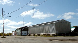
Canadian Forces Station Moosonee (CFS Moosonee) was a military installation located in Moosonee, Ontario.
RCAF Station Moosonee was opened in 1962 as part of NORAD's Pinetree Line chain of radar stations. Moosonee was one of five stations built to close radar coverage gaps in the original Pinetree system. The base was originally operated by the Royal Canadian Air Force's 15 Aircraft Control and Warning Squadron, later redesignated 15 Radar Squadron.
In 1967, RCAF Station Moosonee was renamed CFS Moosonee with the unification of the Canadian Forces. The base was closed in 1975 as a cost-saving measure. Some buildings were used by the Town after the closure, including the base swimming pool and recreation centre.
Sources
Ozorak, Paul. Abandoned Military Installations of Canada: Volume I: Ontario. 1991. ISBN0-9695127-1-6.
A Canadian Forces base or CFB is a military installation of the Canadian Armed Forces. For a facility to qualify as a Canadian Forces base, it must station one or more major units.
Canadian Forces Station Barrington, also referred to as CFS Barrington, was a Canadian Forces Station located in the unincorporated community of Baccaro, Nova Scotia, at Baccaro Point near the southwesternmost point of the province.
Canadian Forces Base Gander, is a Canadian Forces base located in Gander, Newfoundland and Labrador. It is operated as an air force base by the Royal Canadian Air Force and is home to search and rescue operations that cover a vast swath of the western North Atlantic and southern Arctic and a Canadian Coastal Radar station amongst other things. It is home to 9 Wing Gander.
Canadian Forces Station Armstrong is a former General Surveillance Radar station. It is located 1.1 miles (1.8 km) east of Armstrong, Thunder Bay District, Ontario. It was closed in 1974.
Canadian Forces Station Lowther is a closed General Surveillance Radar station. It is located 12.7 miles (20.4 km) east-southeast of Mattice-Val Côté, Ontario. It was closed in 1987.
Canadian Forces Station Falconbridge was a military radar station in the Canadian province of Ontario, active from 1952 to 1985.
Canadian Forces Station Foymount was a military radar station in Foymount, Ontario, Canada,.
Canadian Forces Station Lac St. Denis is a former Canadian Forces Station that was located by Lac St. Denis, 60 miles north of Montreal in the Laurentian Mountains.
CFS Chibougamau, or RCAF Station Chibougamau (pre-1967), housed the 10 Radar Squadron. The facility was a military radar installation in Chibougamau, Quebec, Canada, that formed part of the Pinetree Line. Shortly after opening, in 1963, it was converted to semi-automated operation using the NORAD SAGE system. The station was operated exclusively by the Royal Canadian Air Force.
Canadian Forces Station Sydney, also known as CFS Sydney, is a former Canadian Forces Station located in the community of Lingan Road, Nova Scotia.
RCAF Station St. Margarets is a former Royal Canadian Air Force station and later a Canadian Forces detachment located in the community of St. Margarets, New Brunswick.
Canadian Forces Station Ramore is a closed General Surveillance Radar station. It is located 4 miles (6.4 km) east of Ramore, Ontario. It was closed in 1974. It was operated as part of the Pinetree Line network controlled by NORAD. It has since been sold and is now private property.
Canadian Forces Station Sioux Lookout is a closed General Surveillance Radar station. It is located 3.7 miles (6.0 km) west of Sioux Lookout, Ontario. It was closed in 1987.
Canadian Forces Station Beaverlodge is a closed General Surveillance Radar station. It is located 4.9 miles (7.9 km) east-northeast of Beaverlodge, Alberta. It was closed in 1988.
Canadian Forces Station Beausejour is a closed General Surveillance Radar station. It is located 45.1 miles (72.6 km) east-northeast of Winnipeg, Manitoba. It was closed in 1986.
Canadian Forces Station Baldy Hughes is a closed General Surveillance Radar station. It is located 22.3 miles (35.9 km) south-southwest of Prince George, British Columbia. It was closed in 1988.
Canadian Forces Station Kamloops is a closed General Surveillance Radar station. It is located 12.8 miles (20.6 km) northeast of Kamloops, British Columbia on the peak of Mount Lolo. It was closed in 1988 due to advances in military technology which made it obsolete.
Royal Canadian Air Force Station Yorkton was a Long Range Radar (LRR) and Ground Air Transmitter Receiver (GATR) facility of the Pinetree Line. The site was SAGE compatible from day one. It was located near Yorkton, Saskatchewan, Canada.
Royal Canadian Air Force Station St. Sylvestre was a Radar station of the Canadian Pinetree Line, located at Saint-Sylvestre, Quebec, in the Lotbinière Region, sixty-nine kilometres south Quebec City. Construction starting in 1952, the Station opened on 15 September 1953, first as RCAF Station Ste-Marie, being renamed RCAF Station St. Sylvestre, on 1 August 1955.
Canadian Forces Station Moisie, also known as CFS Moisie, is a former Canadian Forces Station located in the community of Moisie, Quebec.
This page is based on this Wikipedia article Text is available under the CC BY-SA 4.0 license; additional terms may apply. Images, videos and audio are available under their respective licenses.