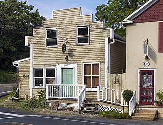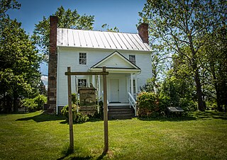
Shadwell is a census-designated place (CDP) in Albemarle County, Virginia, United States, located by the Rivanna River near Charlottesville. The site today is marked by a Virginia Historical Marker to mark the birthplace of President Thomas Jefferson. It is listed on the National Register of Historic Places along with Clifton.

Poinsett Bridge is the oldest bridge in South Carolina and perhaps in the entire southeastern United States. Named for Joel Roberts Poinsett, it was built in 1820 as part of a road from Columbia, South Carolina, to Saluda Mountain. The stone bridge, which includes a 14-foot (4.3 m) Gothic arch and stretches 130 feet (40 m) over Little Gap Creek, may have been designed by Robert Mills, architect of the Washington Monument. Though no longer in use, the bridge remains largely intact and is part of the 120-acre (48.6 ha) Poinsett Bridge Heritage Preserve. There is a nature trail a few hundred yards from the bridge.The bridge, about which ghost stories have been told for decades, is located off U.S. Highway 25 north of Greenville, South Carolina. The bridge was added to the National Register of Historic Places in 1970.

Millwood Commercial Historic District is a national historic district located at Millwood, Clarke County, Virginia.

Berryville Historic District is a national historic district located at Berryville, Clarke County, Virginia. It encompasses 313 contributing buildings and 1 contributing object in the town of Berryville. They include a variety of residential, commercial, and industrial buildings dating from the late 18th century to the 1930s. Notable buildings include the Treadwell Smith House, Sarah Stribling House, Crow's Nest (1830s), Berryville Presbyterian Church, Grace Episcopal Church (1857), Coiner's Department Store, Clarke Milling Company, H. W. Baker Grain Warehouse, H. B. Whiting Brothers Warehouse, Berryville railroad depot (1910), the First National Bank, the Farmers and Merchants National Bank, and the U.S. Post Office (1938). The contributing object is the Clarke County Confederate Memorial on the grounds of the courthouse. Located in the district and separately listed is the Old Clarke County Courthouse.

Long Marsh Run Rural Historic District is a national historic district located just outside Berryville, in Clarke County, Virginia. It encompasses 315 contributing buildings, 16 contributing sites, and 35 contributing structures. The district includes the agricultural landscape and architectural resources of an area distinctively rural that contains numerous large antebellum and postbellum estates, and several smaller 19th-century farms, churches, schools and African-American communities.

Bear's Den Rural Historic District is a national historic district located at Bluemont, Clarke County and Loudoun County, Virginia. It encompasses 152 contributing buildings, 12 contributing sites, 8 contributing structures, and 1 contributing object. The district includes a collection of late-19th- and early-20th-century dwellings that were constructed primarily as summer homes by wealthy Washingtonians who were attracted by the mountain's cooler summer climate. Their architecture reflects a number of popular styles, primarily American Craftsman / Bungalow, Colonial Revival, and Queen Anne styles. Other contributing buildings include: farm outbuildings such as barns and stables; domestic outbuildings such as spring houses, meat houses, guest cottages, root cellars, and garages; a former school; and a former church. The contributing sites include the ruins of buildings; including picnic shelters, above-ground cisterns, an old road bed; and the contributing object is a county boundary marker.

Delaplane Historic District is a national historic district located at Delaplane, Fauquier County, Virginia.

Markham Historic District is a national historic district located at Markham, Fauquier County, Virginia. It encompasses 44 contributing buildings and 4 contributing sites in the rural villages of Farrowsville and Markham. The majority of resources in the district were constructed in the mid- and late 19th century and include multiple dwellings, a hotel, as well as commercial buildings, and a train station. The district also contains early-20th-century dwellings. Notable buildings include Mountain View, Wolfs Crag, Rosebank, Markham School (1918), the 1819 stone Upper Goose Creek Church, and the former Markham Freight Station.

Paris Historic District is a national historic district located at Paris, Fauquier County, Virginia. It encompasses 53 contributing resources in the rural village of Paris. The district includes primarily residences, although the district also includes some commercial buildings, churches, a former school, and a cemetery. Fifty-two of the 53 contributing resources are already listed as part of the Crooked Run Valley Rural Historic District. Notable buildings include "Wagoner's Stand", the Josiah Murray House, the William Peck House, Old Paris Meeting House, the Willis-Carr House, the former Rogers Store, and Trinity United Methodist Church (1892).

Newport Historic District is a national historic district located at Newport, Giles County, Virginia. It encompasses 50 contributing buildings and 3 contributing sites in the rural village of Newport. The district includes primarily freestanding single-family dwellings or store buildings of one or two stories, featuring wood-frame construction, wood siding or ornamental metal sheathing, front porches, and associated outbuildings. Notable buildings include the Epling-Dunkley[or Dunklee]-Smith House (1820s-1830s), Keister-Miller House (1846), Robert Payne House (1850s), Payne-Price House, the Miller Building, the Pent Taylor Store, the Miller Brothers General Mercantile Store, F.E. Dunkley [Dunklee] Store, Pasterfield House (1903), Dr. Walter Miller House (1903-1904), Albert Price House (1904), Methodist Parsonage (1909), Newport Methodist Church, and Sinking Creek Valley Bank (1927).

Greater Newport Rural Historic District is a national historic district located near Newport, Giles County, Virginia. It encompasses a total of 737 contributing buildings and 25 contributing structures in the rural area near the village of Newport. It encompasses the previously listed Newport Historic District. The district includes primarily 19th- and early-20th-century farmsteads and complexes. Notable buildings include the "Camper" Cabin, Albert Meredith Cabin, E. L. Lucas House, Moses Atkins House (1837), William Lafon House (1855), Doak Lucas House (1860), Leonard Kessinger House (1871), Martin Farrier House (1905), Steve and Lori Taylor House (1938), Upper Spruce Run School (1890), Clover Hollow Christian Church (1921), Sherry Memorial Church, Old Cook Mill, three standing diminutive Burr covered bridges, a smelting furnace (1871), the Mountain Lake Hotel Resort, and the Biological Station of the University of Virginia (1934).

Village of Morattico Historic District is a national historic district located at Morattico, Lancaster County, Virginia. The district encompasses 69 contributing buildings, 1 contributing site, and 3 contributing structures in the village of Morattico. The district includes residential, commercial, and institutional buildings in a community whose economy was based on water-borne transportation, seafood extraction, and seafood processing. The village developed after 1890. Notable buildings include the Morattico General Store, Dr. Lewis' Office, Morattico Post Office (1949), Jackson Seafood (1950), Shelton Crab House, and Emmanuel United Methodist Church (1898).

Vestal's Gap Road and Lanesville Historic District is a national historic district located in Claude Moore Park at Sterling, Loudoun County, Virginia. It encompasses 1 contributing building and 1 contributing structure. They are "Lanesville," a two-story side-gabled frame house on a solid stone-rubble foundation built about 1807, and a section of the former Vestal's Gap Road, an 18th-century road.

Urbanna Historic District is a national historic district located at Urbanna, Middlesex County, Virginia. It encompasses 65 contributing buildings and 1 contributing site in the central business district and surrounding residential areas of Urbanna. Notable buildings include the Old Tavern, Gressitt House, Genders House (1876), Fitchett (1884), Van Wagenen House, C. H. Palmer Garage, Sentinel Building, Urbanna Town Office, Taylor Hardware (1921-1925), Bank of Middlesex (1900-1901), Urbanna Baptist Church (1896), Located in the district and separately listed are the Old Courthouse, Lansdowne, James Mills Storehouse, Sandwich, and Wormeley Cottage.

Buffalo Forge, also known as the Forge Complex, is a historic iron forge complex and national historic district located near Glasgow, Rockbridge County, Virginia. The district encompasses 11 contributing buildings, 1 contributing site, and 3 contributing structures. The manor house is known as Mount Pleasant and was built in two sections of similar stone construction. The earlier section dates to about 1819, and the wing was added about 1830. A frame wing was added in the late-19th century and a kitchen wing in the early-20th century. The district also includes the contributing kitchen, two slave quarters, garage, spring house / dairy, stone cabin (pre-1865), shed (pre-1900), stables / barn (pre-1865), corn crib (pre-1920), hen house (pre-1920), and the ruins of the merchant mill and mill race. Iron production at Buffalo Forge ceased in the fall of 1868.

Saltville Battlefields Historic District is a historic American Civil War battlefield and national historic district located around Saltville, in Smyth County and Washington County, Virginia. The district includes 3 contributing buildings, 31 contributing sites, 4 contributing structures, and 1 contributing object near Saltville. It encompass the core areas of two battles, fought on October 2 and December 20, 1864, known as the Battle of Saltville I and Battle of Saltville II, where Confederate and Union forces contested control of the South's most important salt production facilities. Notable resources include the sites of salt furnaces, Well Fields, Fort Statham, Lover's Leap Defenses, Saltville Gap Overlooks, Mill Cliff gun emplacements, Fort Breckinridge, Fort Hatton, Sanders’ House/Williams Site Battlefield/field hospital, William A. Stuart House, and the Elizabeth Cemetery.

Old Kentucky Turnpike Historic District is a national historic district located at Cedar Bluff, Tazewell County, Virginia. The district encompasses 35 contributing buildings, 3 contributing sites, and 3 contributing structures along Indian Creek Road and Indian Creek. They date from the late-19th to mid-20th centuries. Notable resources include the concrete bridge, steel railroad trestle, Cecil-Watkins House, Ratliff House, Cedar Bluff Presbyterian Church, the boyhood home of Governor George C. Peery (1873–1952), Thomas Cubine House, Gillespie House, the Old Cedar Bluff High School, Cedar Bluff High School (1906), and the Old Cedar Bluff Town Hall. Also located in the district is the separately listed Clinch Valley Roller Mills.

Driver Historic District is a national historic district located at Suffolk, Virginia. The district encompasses 20 contributing buildings in the crossroads community of Driver in Suffolk. The district includes eight residences, two churches, two school structures, a train depot, a lodge, an outbuilding, and five commercial structures. They are in a variety of popular 19th and early-20th century architectural styles including Federal, Queen Anne, and Colonial Revival. Notable buildings include the Parker House (1820-1840), Norfolk and Carolina Railroad depot and station master's house, Brannon House, Arthur's Store, Randy's Rods, Driver Variety Store, Beech Grove United Methodist Church, Berea Congregational Christian Church, Dejarnette High School (1926), and Harmony Lodge #149 (1938).
The original Maggoty Gap was a wind gap in the Blue Ridge Mountains in the counties of Roanoke, Virginia and Franklin, Virginia. Over time, as roads were improved and relocated, the identified location of the gap moved with them. It is now mapped at a spot in Roanoke County.
The Carolina Road or the "Old Carolina Road" are names for various sections of the Great Wagon Road and other routes in colonial America. "The 'Old Carolina Road', extending from Lancaster, Pennsylvania to the Yadkin Valley, was one of the most heavily traveled roads in eighteenth century America." Parts of the 180-mile-long (290 km) Journey Through Hallowed Ground National Heritage Area scenic byway follow the Old Carolina Road through Pennsylvania, Maryland and Virginia.


