
The Mississippi River is the primary river of the largest drainage basin in the United States. From its traditional source of Lake Itasca in northern Minnesota, it flows generally south for 2,340 miles (3,766 km) to the Mississippi River Delta in the Gulf of Mexico. With its many tributaries, the Mississippi's watershed drains all or parts of 32 U.S. states and two Canadian provinces between the Rocky and Appalachian mountains. The river either borders or passes through the states of Minnesota, Wisconsin, Iowa, Illinois, Missouri, Kentucky, Tennessee, Arkansas, Mississippi, and Louisiana. The main stem is entirely within the United States; the total drainage basin is 1,151,000 sq mi (2,980,000 km2), of which only about one percent is in Canada. The Mississippi ranks as the world's tenth-largest river by discharge flow, and the largest in North America.

The Great River Road is a collection of state and local roads that follow the course of the Mississippi River through ten states of the United States. They are Minnesota, Wisconsin, Iowa, Illinois, Missouri, Kentucky, Tennessee, Arkansas, Mississippi and Louisiana. It formerly extended north into Canada, serving the provinces of Ontario and Manitoba. The road is designated as both a National Scenic Byway and an All-American Road in several states along the route.
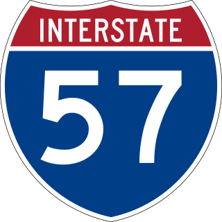
Interstate 57 (I-57) is a north–south Interstate Highway that currently exists in two segments. It runs through Arkansas, Missouri, and Illinois. I-57 parallels the old Illinois Central Railroad for much of its route north of I-55. The Interstate begins at I-40 in North Little Rock, Arkansas, traveling northward concurrently with U.S. Highway 67 (US 67) until it reaches Walnut Ridge, Arkansas, where the Interstate ends for now. I-57 will run northward to meet up with the existing segment in southeastern Missouri. I-57 resumes its run from Sikeston, Missouri, at I-55 to Chicago, Illinois, at I-94. I-57 essentially serves as a shortcut route for travelers headed between the Southern United States and Chicago, bypassing St. Louis, Missouri, and Springfield, Illinois. Between the junction of I-55 and I-57 in Sikeston and the junction of I-55 and I-90/I-94 in Chicago, I-55 travels for 436 miles (702 km), while the combination of I-57 and I-94 is only 396 miles (637 km) long between the same two points. In fact, both the control cities on the overhead signs and the destination mileage signs reference Memphis along southbound I-57, even as far north as its northern origin at I-94 in Chicago. Likewise, at its southern end in Missouri, Chicago is the control city listed for I-57 on signs on northbound I-55 south of Sikeston, even though I-55 also goes to Chicago.
Cairo is the southernmost city in Illinois and the county seat of Alexander County. A river city, Cairo has the lowest elevation of any location in Illinois and is the only Illinois city to be surrounded by levees. It is in the river-crossed area of Southern Illinois known as "Little Egypt", for which the city is named, after Egypt's capital on the Nile. The city is coterminous with Cairo Precinct.

U.S. Route 45 is a major north-south United States highway and a border-to-border route, from Lake Superior to the Gulf of Mexico. A sign at the highway's northern terminus notes the total distance as 1,297 miles (2,087 km).

Southern Illinois is a region of the U.S. state of Illinois comprising the southern third of the state, principally south of Interstate 70. Part of downstate Illinois, it is bordered by the two most voluminous rivers in the United States: the Mississippi below its connection with the Missouri River to the west and the Ohio River to the east and south, with the tributary Wabash River, extending the southeastern border. Some areas of Southern Illinois are known historically as Little Egypt.

The Stan Musial Veterans Memorial Bridge is a bridge across the Mississippi River in the United States between St. Clair County, Illinois, and the city of St. Louis, Missouri. Built between April 19, 2010, and July 2013, the bridge opened on February 9, 2014. The cable-stayed bridge has a main span of 1,500 feet (460 m).

U.S. Route 62 or U.S. Highway 62 (US 62) is an east–west United States Highway in the southern and northeastern United States. It runs from the Mexican border at El Paso, Texas, to Niagara Falls, New York, near the Canadian border. It is the only east–west United States Numbered Highway that connects Mexico and Canada. Parts of US 62 follow what once was the Ozark Trail, including the historic bridge across the South Canadian River in Newcastle, Oklahoma. This bridge was damaged beyond repair by the 2013 Moore tornado that struck Newcastle and Moore, Oklahoma. The highway is signed north–south in New York and Pennsylvania reflecting its directional orientation in both states, and is signed east-west the remainder of its course.

U.S. Route 51 or U.S. Highway 51 is a major south–north United States highway that extends 1,277 miles (2,055 km) from the western suburbs of New Orleans, Louisiana, to within 150 feet (46 m) of the Wisconsin–Michigan state line. As most of the United States Numbered Highways ending with "1", it is a cross-country north–south route extending from the Gulf Coast region to the Great Lakes region. Much of the highway in northern Illinois and southern Wisconsin runs parallel to or is cosigned with Interstate 39 (I-39) and much of the route in several states also parallels the Illinois Central Railroad. From LaPlace, Louisiana, Mississippi, to Memphis, Tennessee, much of that portion of US 51 runs largely parallel or is concurrent with Interstate 55 (I-55). The highway's northern terminus is between Hurley, Wisconsin, and Ironwood, Michigan, where it ends with a roundabout at US 2. Its southern terminus is in Laplace, Louisiana, ending at US 61. US 51 is routed through the states of Louisiana, Mississippi, Tennessee, Kentucky, Illinois, and Wisconsin.
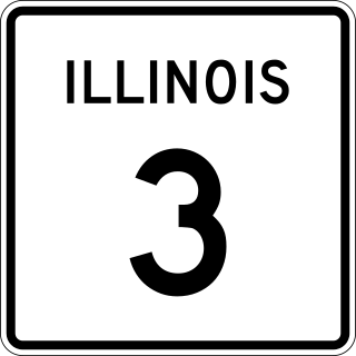
Illinois Route 3 (IL 3) is a 187.44-mile-long (301.66 km) major north–south arterial state highway in southwestern Illinois. It has its southern terminus at Cairo Junction at the intersection of U.S. Route 51 (US 51) and Illinois Route 37, and its northern terminus in Grafton at IL 100.

The Caruthersville Bridge is a single tower cantilever bridge carrying Interstate 155 and U.S. Route 412 across the Mississippi River between Caruthersville, Missouri, and Dyersburg, Tennessee. Completed in 1976, it is the only bridge that connects Missouri and Tennessee, and the northernmost bridge on the Lower Mississippi River. It stands downstream of the Cairo Mississippi River Bridge and upstream of the Hernando de Soto Bridge.

The Cairo Mississippi River Bridge is a steel truss through deck bridge carrying U.S. Route 60 and U.S. Route 62 across the Mississippi River. Located in the tri-state area of Illinois, Kentucky, and Missouri, it connects Cairo, Illinois at its northern terminus to Bird's Point, Missouri at its southern terminus. The bridge is currently closed for renovation until October 1, 2024. The bridge measures 5,175.5 feet in length with a main span of 700.9 feet and a width of 20 feet. At its apex, the bridge stands 114 feet above the river with a 675-foot (206-meter) navigation channel. In the years since the construction of the bridge, the town of Cairo has experienced an 81% population decline, the most dramatic decrease of any principal city in the United States. The bridges initially played a part in the town's demise as the ferry and railroad industries were severely impacted.

The Cairo Ohio River Bridge is a cantilever bridge carrying U.S. Route 51, U.S. Route 60, and U.S. Route 62 across the Ohio River between Wickliffe, Kentucky and Cairo, Illinois. Of all the Ohio River crossings, it is the furthest downstream; the Mississippi River can be seen while crossing the bridge and looking westward.

The Sergeant John F. Baker Jr. Bridge, also known as the Baker Bridge or Interstate 280 Bridge, carries Interstate 280 (I-280) across the Mississippi River between Davenport, Iowa, and Rock Island, Illinois. The bridge opened in 1973 with a blue and yellow color scheme, thought to be unique in the state. In 2007, it was repainted all blue. On July 30, 2010, the bridge was officially named the Sergeant John F. Baker Jr. Bridge.

Illinois Route 9 is a 218.31-mile-long (351.34 km) cross-state, east–west rural state highway in the central part of the U.S. state of Illinois. It travels from Niota at the Fort Madison Toll Bridge, that crosses the Mississippi River into Iowa, eastward across central Illinois to State Road 26 at the Indiana state line.
The Old Clark Bridge was a bridge that carried U.S. Route 67 across the Mississippi River between West Alton, Missouri and Alton, Illinois. It was constructed beginning in 1927, was replaced by the Clark Bridge and was demolished in 1994. The bridge was initially a toll bridge.

The Dorena–Hickman Ferry is a ferry across the Mississippi River between Dorena, Missouri and Hickman, Kentucky. A single boat takes vehicular traffic across the river seven days a week during daylight hours. Missouri Route 77 connects to the Missouri side while Kentucky Route 1354 connects to the Kentucky side.

U.S. Route 60 and U.S. Route 62 (US 60/US 62) run for a very short distance within the state of Illinois. The highways run concurrently for their entire existence within the state. The joint highway runs around Fort Defiance in Cairo, from the Cairo Mississippi River Bridge over the Mississippi River east to the Cairo Ohio River Bridge over the Ohio River; the Ohio River Bridge also carries US 51. The bridges cross the two rivers just north of the mouth of the Ohio.

