

Caldbergh with East Scrafton is a civil parish in the Richmondshire district of North Yorkshire, England. [1] The parish includes the settlements of Caldbergh and East Scrafton.
The population of the parish was estimated at 40 in 2013. [2]
Caldbergh with East Scrafton is a civil parish in the Richmondshire district of North Yorkshire, England. [1] The parish includes the settlements of Caldbergh and East Scrafton.
The population of the parish was estimated at 40 in 2013. [2]

Redcar and Cleveland is a unitary authority area with borough status in North Yorkshire, England.

Cornsay is a hamlet and civil parish in County Durham, England. The population of the Civil Parish taken at the 2011 census was 1,128. It is 6 miles (9.7 km) southeast of Consett and 7 miles (11 km) southwest of Durham. It consists of nineteen dwellings, including four farms & is the home of Greenacres nudist club. All formerly belonged to Ushaw College for the training of Catholic priests, hence the organised nomenclature. East and West Farms are now in private hands as homes but the other two are still active, South Farm run by the Suddes family and North Farm by the Tweddle family.

Hilton is a village and civil parish in the borough of Stockton-on-Tees and the ceremonial county of North Yorkshire, England. It is a small village with an estimated population of around 400, measured at 374 in the 2011 census. Despite its proximity to Teesside, the village retains its rural feel, and has a number of public footpaths surrounding it.

Angram Grange is a small civil parish in the Hambleton district of North Yorkshire, England, about 7 miles south-east of Thirsk. According to the 2001 census it had a population of 17. In 2015 the population was estimated at 20.
Barmston is a village and civil parish in the East Riding of Yorkshire, England. It is situated on the Holderness coast, overlooking the North Sea and to the east of the A165 road. Barmston is approximately 6 miles (10 km) south of Bridlington town centre. The parish includes the village of Fraisthorpe, the former villages of Auburn and Hartburn have been abandoned due to coastal erosion. Barmston is mentioned in the Domesday Book as having eight ploughlands and belonging to Drogo of la Beuvrière. The name of the village derives from Beorn's Tūn. According to the 2011 UK census, Barmston and Fraisthorpe parish had a population of 275, a slight decrease on the 2001 UK census figure of 277. The parish covering an area of 1,765.014 hectares.

Bilton-in-Ainsty with Bickerton is a civil parish in the Harrogate district of North Yorkshire, England. According to the 2001 census it had a population of 512, reducing to 463 at the 2011 Census.

Buttercrambe with Bossall is a civil parish in North Yorkshire, England. The parish had a population of 100 according to the 2001 census, increasing to 105 at the 2011 census. The parish is near Stamford Bridge, and contains Buttercrambe and Bossall.

Conistone is a small village in the Craven district of North Yorkshire, England. It lies 3 miles (5 km) north of Grassington, 3 miles (5 km) south of Kettlewell and 12 miles (19 km) north of Skipton beside the River Wharfe, in Upper Wharfedale.
Willerby is a village and civil parish located on the western outskirts of the city of Kingston upon Hull in the East Riding of Yorkshire, England.

West Scrafton is a village and civil parish in Coverdale in the Yorkshire Dales, England. It is located 4 miles (6.4 km) south west of Leyburn. It falls within the Richmondshire district of North Yorkshire. The population was estimated at 70 in 2013.

East Scrafton is a hamlet in the Yorkshire Dales in the Richmondshire district of North Yorkshire, England. It is about 3 miles (5 km) south-west of Leyburn. There is also a larger West Scrafton to the south.

Coverham is a village in Coverdale in the Yorkshire Dales in North Yorkshire, England. It lies 2 miles (3.2 km) west of the town of Middleham.

Caldbergh is a hamlet within the Yorkshire Dales, North Yorkshire, England. It lies about four miles south of Leyburn. East Scrafton and Coverham are nearby.

Thwing is a village and civil parish in the Yorkshire Wolds, in the East Riding of Yorkshire, England.

Kirby Sigston is a village and civil parish in the Hambleton district of North Yorkshire, England, approximately 4 miles (6.4 km) east of Northallerton. The village is situated on the Cod Beck river, and the wider parish contains the hamlet of Jeater Houses due east of the village on the trunk A19 road.
Lunedale is the dale, or valley, of the River Lune, on the east side of the Pennines in England, west of Middleton-in-Teesdale. Its principal settlements are Grassholme, Thringarth and Bowbank.
Ferrensby is a village and civil parish in the Harrogate district of North Yorkshire, England. The population of the civil parish at the 2011 census was 187. It is about 3 miles (4.8 km) north-east of Knaresborough and near the A1(M) motorway. Nearby attractions include a balloon centre and a maze.

Coverdale is a dale in the far east of the Yorkshire Dales, North Yorkshire, England. It takes its name from the River Cover, a tributary of the River Ure. The dale runs south-west from the eastern end of Wensleydale to the dale head at a pass, known as Park Rash Pass, between Great Whernside to the south and Buckden Pike to the north. It is accessible by a single track road, which runs the length of the dale and over the pass to Kettlewell in Wharfedale. The name is taken from that of the River Cover, which is of Brittonic origin. Ekwall suggested that it might mean "hollow stream", but more recently Andrew Breeze has argued that it is cognate with Welsh gofer "streamlet".

Hambleton is a hamlet on the A170 road between Thirsk and Pickering in North Yorkshire, England. It lies on the Hambleton Hills 1 mile east of Sutton Bank.
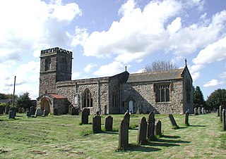
Caldbergh with East Scrafton is a civil parish in the former Richmondshire district of North Yorkshire, England. It contains seven listed buildings that are recorded in the National Heritage List for England. All the listed buildings are designated at Grade II, the lowest of the three grades, which is applied to "buildings of national importance and special interest". The parish contains the hamlets of Caldbergh and East Scrafton and the surrounding countryside. The listed buildings consist of the ruins of a chapel, three farmhouses, a former packhorse bridge, a limekiln and a telephone kiosk.
54°15′47″N1°51′32″W / 54.263°N 1.859°W
| | This North Yorkshire location article is a stub. You can help Wikipedia by expanding it. |