
State Route 120 is a state highway in the central part of California, connecting the San Joaquin Valley with the Sierra Nevada, Yosemite National Park, and the Mono Lake area. Its western terminus is at Interstate 5 in Lathrop, and its eastern terminus is at U.S. Route 6 in Benton. While the route is signed as a contiguous route through Yosemite, the portion inside the park is federally maintained and is not included in the state route logs. The portion at Tioga Pass at Yosemite's eastern boundary is the highest paved through road in the California State Route system. This part is not maintained in the winter and is usually closed during the winter season.

State Route 23 is a state highway in the U.S. state of California that connects the Pacific coast and the Santa Monica Mountains to the Conejo and Santa Clara River valleys. It runs from Pacific Coast Highway in Malibu in Los Angeles County to Ventura Street in Fillmore in Ventura County.
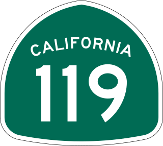
State Route 119, named as the Taft Highway along its entire length, is a state highway in the U.S. state of California that runs in an east–west direction from State Route 33 in Taft to State Route 99 in Bakersfield. SR 119 is part of the former U.S. Route 399, which ran along SR 33 and State Route 166 before ending at SR 99. Today, it serves as the main connector between the extreme southwestern corner of the San Joaquin Valley and Bakersfield.

State Route 36 is an east–west state highway in the U.S. state of California that is routed from U.S. Route 101 in Humboldt County to U.S. Route 395 just east of Susanville in Lassen County. The highway passes through Red Bluff, the county seat of Tehama County, on the northern edge of the Sacramento Valley. The portion of SR 36 travelling past Lassen Volcanic National Park and Lake Almanor is part of the Volcanic Legacy Scenic Byway, a National Scenic Byway. Also, Route 36 between Alton and Susanville is a designated Blue Star Memorial Highway.

State Route 43 is a north–south state highway in the U.S. State of California, routed along the southern San Joaquin Valley between SR 119 southwest of Bakersfield and SR 99 in Selma. SR 43 runs roughly parallel to SR 99, connecting the towns of Shafter, Wasco, Corcoran, Hanford, and Selma.

State Route 184, locally known as Weedpatch Highway, is a state highway in the U.S. state of California. Located in Kern County, it runs from the intersection of SR 223 and Wheeler Ridge Road near Arvin north to SR 178 in Bakersfield. It is mainly a 2-lane conventional highway, expanding to four lanes in Lamont and Bakersfield. The highway serves local agricultural land south of Bakersfield.

State Route 204 is a state highway in the U.S. state of California that connects SR 58 and SR 99 in the Bakersfield area. Passing through downtown Bakersfield, SR 204 also connects Bakersfield's three major freeways together. Only the northern 1.4 miles (2.3 km) has been built to freeway standards; the rest is a six-lane arterial road.

State Route 104 is a west–east state highway in the U.S. state of California that runs from the Central Valley to the Sierra Foothills. It connects State Route 99 near Galt to State Route 49 in Sutter Creek via the city of Ione. It is known as Twin Cities Road from its western terminus up until just before Ione. West of the SR 104/SR 99 interchange, Twin Cities Road continues to Interstate 5 and then eventually end at State Route 160 north of Walnut Grove.

State Route 127 is a state highway in the U.S. state of California that connects Interstate 15 in Baker to Nevada State Route 373 at the Nevada state line, passing near the eastern boundary of Death Valley National Park. The entire length of the highway closely follows the central portion of the former Tonopah and Tidewater Railroad and loosely follows the Amargosa River.

State Route 128 is a state highway in the U.S. state of California, connecting the Mendocino coast to the Sacramento Valley, through the state's Wine Country. It runs from State Route 1 near Albion to Interstate 505 in Winters.

State Route 190 is a state highway in the U.S. state of California that is split into two parts by the Sierra Nevada. The western portion begins at Tipton at a junction with State Route 99 and heads east towards Porterville before ending at Quaking Aspen in the Sequoia National Forest. The eastern portion begins at US 395 southeast of Olancha, heads east through Death Valley National Park, and ends at State Route 127 at Death Valley Junction. The 43.0-mile (69.2 km) portion over the Sierra Nevada remains unconstructed, and the California Department of Transportation (Caltrans) has no plans to build it through the wilderness areas. SR 190 is a National Scenic Byway known as the Death Valley Scenic Byway.

State Route 168 is an east-west state highway in the U.S. state of California that is separated into two distinct segments by the Sierra Nevada. The western segment runs from State Routes 41 and 180 in Fresno east to Huntington Lake along the western slope of the Sierra. The eastern segment connects Lake Sabrina in the Eastern Sierra to State Route 266 in the community of Oasis, just to the west of the Nevada border. The eastern segment of SR 168 also forms a concurrency with U.S. Route 395 between Bishop and Big Pine.

State Route 269 is a state highway in the U.S. state of California. It runs in the San Joaquin Valley from State Route 33 in Avenal to State Route 145 in the community of Five Points.

State Route 229 is a state highway in the U.S. state of California, running in San Luis Obispo County from State Route 58 to State Route 41. It connects the small community of Creston with the rural state routes. Also, in conjunction with SR 58 and SR 41, it provides a slower, more scenic route between the Central Coast and the San Joaquin Valley.
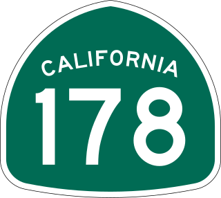
State Route 178 is a state highway in the U.S. state of California that exists in two constructed segments. The gap in between segments is connected by various local roads and State Route 190 through Death Valley National Park. The western segment runs from State Route 99 in Bakersfield and over the Walker Pass in the Sierra Nevada to the turnoff for the Trona Pinnacles National Natural Landmark. The eastern segment runs from the southeasterly part of Death Valley to Nevada State Route 372 at the Nevada state line.

State Route 155 is a state highway in the U.S. state of California connecting State Route 99 and State Route 178, going through the southern part of the Sierra Nevada mountain range. This highway runs from west to east. Its western terminus is in Delano and its eastern terminus is in the small town of Lake Isabella. Locally it is known as the Garces Highway.
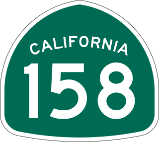
State Route 158 is a state highway in the U.S. state of California. Known as the June Lake Loop, it is a loop route of U.S. Route 395 in Mono County that serves the community of June Lake.

State Route 227 is a state highway in the U.S. state of California and located in San Luis Obispo County. It is an alternate route of U.S. Route 101 between Arroyo Grande and the city of San Luis Obispo, serving the community of Edna and San Luis Obispo County Regional Airport. There is also an unconstructed routing from Route 1 south of Oceano to its present terminus in Arroyo Grande.

U.S. Route 6 (US 6) is a transcontinental United States Numbered Highway, stretching from Bishop, California, in the west to Provincetown, Massachusetts, in the east. The California portion of US 6 lies in the eastern portion of the state, running between Bishop in the Owens Valley to the Nevada state line in Mineral County. Prior to the 1964 state highway renumbering, US 6 extended to the Pacific Ocean in Long Beach, California, as part of the historic auto trail named the Grand Army of the Republic Highway.

U.S. Route 395 (US 395) is a United States Numbered Highway, stretching from Hesperia, California to the Canadian border in Laurier, Washington. The California portion of US 395 is a 557-mile (896 km) route which traverses from Interstate 15 (I-15) in Hesperia, north to the Oregon state line in Modoc County near Goose Lake. The route clips into Nevada, serving the cities Carson City and Reno, before returning to California.

