A bike path or a cycle path is a bikeway separated from motorized traffic and dedicated to cycling or shared with pedestrians or other non-motorized users. In the US a bike path sometimes encompasses shared use paths, "multi-use path", or "Class III bikeway" is a paved path that has been designated for use by cyclists outside the right of way of a public road. It may or may not have a center divider or stripe to prevent head-on collisions. In the UK, a shared-use footway or multi-use path is for use by both cyclists and pedestrians.

The Sepulveda Dam is a dry dam constructed by the U.S. Army Corps of Engineers to withhold winter flood waters along the Los Angeles River. Completed in 1941, at a cost of $6,650,561, it is located south of center in the San Fernando Valley, approximately eight miles (13 km) east of the river's source in the western end of the Valley, in Los Angeles, California.

John Forester was an English-American industrial engineer, specializing in bicycle transportation engineering. A cycling activist, he was known as "the father of vehicular cycling", for creating the Effective Cycling program of bicycle training along with its associated book of the same title, and for coining the phrase "the vehicular cycling principle" – "Cyclists fare best when they act and are treated as drivers of vehicles". His published works also included Bicycle Transportation: A Handbook for Cycling Transportation Engineers.

Bicycle transportation planning and engineering are the disciplines related to transportation engineering and transportation planning concerning bicycles as a mode of transport and the concomitant study, design and implementation of cycling infrastructure. It includes the study and design of dedicated transport facilities for cyclists as well as mixed-mode environments and how both of these examples can be made to work safely. In jurisdictions such as the United States it is often practiced in conjunction with planning for pedestrians as a part of active transportation planning.

The Arroyo Seco Bicycle Path is an approximately 2-mile (3.2 km) long Class I bicycle path along the Arroyo Seco river channel and canyon in the Northeast Los Angeles region of Los Angeles County, California. It parallels the Arroyo Seco Parkway, which is also a part of the canyon.
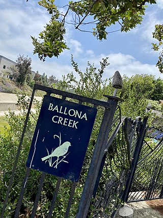
The Ballona Creek Bike Path is a 6.7-mile (10.8 km) Class I bicycle path and pedestrian route in California. The bike path follows the north bank of Ballona Creek until it reaches Santa Monica Bay at the Pacific Ocean. The route is defined by, and recognized for, the dramatic contrast between the channelized waterway’s stark cement geometry and the abundant wildlife of the verdant Ballona Wetlands.

A bicycle boulevard, sometimes referred to as a neighborhood greenway, neighborway, neighborhood bikeway or neighborhood byway is a type of bikeway composed of a low-speed street which has been "optimized" for bicycle traffic. Bicycle boulevards discourage cut-through motor-vehicle traffic but allow local motor-vehicle traffic. They are designed to give priority to bicyclists as through-going traffic. They are intended as a low-cost, politically popular way to create a connected network of streets with good bicyclist comfort and/or safety.

A cycle track or cycleway (British) or bikeway, sometimes historically referred to as a sidepath, is a separate route for cycles and not motor vehicles. In some cases cycle tracks are also used by other users such as pedestrians and horse riders. A cycle track can be next to a normal road, and can either be a shared route with pedestrians or be made distinct from both the pavement and general roadway by vertical barriers or elevation differences.
Silver Strand bikeway 9-mile (14 km) bicycle and pedestrian path in the San Diego area of California. it is part of the larger Bayshore Bikeway which begins at the USS Midway Museum. The bikeway travels from Ferry Landing Marketplace to Imperial Beach at sea level with no elevation gain, providing a relatively easy ride. An entry point and parking area is located at Ferry Landing Marketplace.

The National Association of City Transportation Officials (NACTO) is a coalition of the Departments of Transportation in North American cities.

Cycling infrastructure is all infrastructure cyclists are allowed to use. Bikeways include bike paths, bike lanes, cycle tracks, rail trails and, where permitted, sidewalks. Roads used by motorists are also cycling infrastructure, except where cyclists are barred such as many freeways/motorways. It includes amenities such as bike racks for parking, shelters, service centers and specialized traffic signs and signals. The more cycling infrastructure, the more people get about by bicycle.
The history of cycling infrastructure starts from shortly after the bike boom of the 1880s when the first short stretches of dedicated bicycle infrastructure were built, through to the rise of the automobile from the mid-20th century onwards and the concomitant decline of cycling as a means of transport, to cycling's comeback from the 1970s onwards.
CROW Design Manual for Bicycle Traffic is a publication on bicycle transportation planning and engineering in the Netherlands. It is published by CROW, a non-profit agency advising Directorate-General for Public Works and Water Management formerly Ministry of Transport and Water Management (Netherlands). It is the most influential bicycle traffic planning manual, both worldwide and on cycling in the Netherlands. It was last updated in 2016. It is considered best practice in the Netherlands.

Cycling infrastructure in the Canadian city of Halifax, Nova Scotia includes most regular streets and roads, bike lanes, protected cycle tracks, local street bikeways, and multi-use pathways.

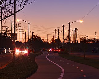
The Expo Bike Path is a 12-mile-long (19 km) rail with trail bicycle path and pedestrian route in Los Angeles County, California that travels roughly parallel to the Los Angeles Metro Rail's E Line between La Cienega/Jefferson and 17th Street/SMC stations. The Expo Bike Path is one of two major bicycle routes in Los Angeles that share dedicated rights-of-way with public transport, the other being the G Line Bikeway in the San Fernando Valley.
Browns Creek Bike Path is a Class I bike path that is “tucked away from the surrounding hustle and bustle” of the San Fernando Valley, “hugging the side” of the Browns Canyon Wash.

The Kenneth Newell Bikeway in Pasadena is one of the first bike paths established in Los Angeles County. This “popular, well-marked bikeway” has been called “one of the premier inland trips.” The path travels through the canyon of the Arroyo Seco river, a tributary of the Los Angeles River.
The Chandler Boulevard Bike Path is a Class I rail trail off-street bike route that runs from North Hollywood to Burbank in Los Angeles County, California.