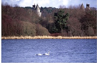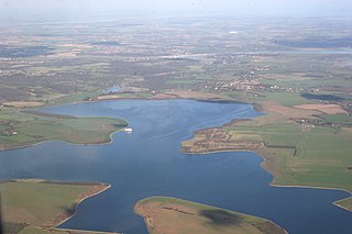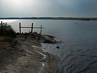
Rutland Water is a reservoir in Rutland, England, east of the county town, Oakham. It is filled by pumping from the River Nene and River Welland and provides water to the East Midlands. It is one of the largest artificial lakes in Europe. By surface area it is the largest reservoir in England, but by capacity it is exceeded by Kielder Water.

Loch of Skene is a large lowland, freshwater loch in Aberdeenshire, Scotland. It lies approximately 1 mi (1.6 km) to the west of the village of Kirkton of Skene and 9 mi (14 km) west of Aberdeen.

Insh Marshes are an area of floodplain of the River Spey between Kingussie and Kincraig in Badenoch and Strathspey, Highland, Scotland. The marshes are said to be one of the most important wetlands in Europe. They lie at altitude of approximately 240 to 220 m above sea level, and form one of the largest areas of floodplain mire and fen vegetation in Scotland.

Abberton Reservoir is a large, shallow freshwater storage reservoir located close to the coast of Essex on the east of England. It is the largest freshwater body in Essex. It lies 5 miles (8.0 km) south-west of Colchester near the village of Layer de la Haye. The reservoir is the fourth largest reservoir in England with an area of 4.9 square kilometres. It is a Site of Special Scientific Interest, and also a Ramsar site, designated an internationally important wetland. It is a Special Protection Area, and it is listed in the Nature Conservation Review. A small part of the site is managed by the Essex Wildlife Trust.

Westwater Reservoir is an artificial reservoir in the Pentland Hills, Scottish Borders, 3 kilometres (1.9 mi) west of West Linton, and 26 kilometres (16 mi) south west of Edinburgh. It is a drinking water reservoir for Edinburgh and the Lothians and is located 320 metres (1,050 ft) above sea level. It is an important site for wildfowl and is designated as a SSSI and a Ramsar site.

Wraysbury Reservoir is a water supply reservoir for London, just west of the M25 near the village of Wraysbury, and directly under the western approach path of Heathrow Airport. The reservoir was begun in 1967 and completed by W. & C. French in 1970 with a capacity of 34,000 million litres.

Kempton Park Reservoirs are a Site of Special Scientific Interest in the London Borough of Hounslow and Kempton Park in Surrey. It is owned by Thames Water. It is part of South West London Waterbodies Ramsar site and Special Protection Area Kempton Park East reservoir is also a local nature reserve.

Staines Moor is a 510.8-hectare (1,262-acre) biological Site of Special Scientific Interest north of Staines-upon-Thames in Surrey. It is part of South West London Waterbodies Ramsar site and Special Protection Area

Gladhouse Reservoir, formerly known as Moorfoot Loch, is a reservoir in Midlothian, Scotland, five miles (8 km) south of Penicuik. It is the most southerly reservoir in Midlothian, as well as being the largest area of freshwater in the Lothians. It is used to supply Edinburgh with drinking water.

Many parts of Scotland are protected in accordance with a number of national and international designations because of their environmental, historical or cultural value. Protected areas can be divided according to the type of resource which each seeks to protect. NatureScot has various roles in the delivery of many environmental designations in Scotland, i.e. those aimed at protecting flora and fauna, scenic qualities and geological features. Historic Environment Scotland is responsible for designations that protect sites of historic and cultural importance. Some international designations, such as World Heritage Sites, can cover both categories of site.
Bridgend Flats is an area of mudflats and saltmarsh near the village of Bridgend on the island of Islay off the west coast of Scotland. Covering an area of 331 hectares, it is situated around the outflow of the River Sorn into Loch Indaal.

The Caithness and Sutherland Peatlands is a large area of blanket bog and peatland, covering a number of disconnected regions across the historic counties of Caithness and Sutherland in the far north of Scotland, across an area known as the Flow Country. With a total area of 143,503 hectares, it is one of the largest recognised conservation sites in the UK, and is the largest Ramsar Site in Scotland.

Castle Loch is a shallow eutrophic loch covering an area of around 100 hectares in the town of Lochmaben in Dumfries and Galloway, Scotland. It lies to the west of Mochrum Loch and has 2 islets. The ruined Lochmaben Castle lies at the southern end of the loch.

Caithness Lochs is a protected wetland area in the historic county of Caithness in the far north of Scotland. With a total area of 1,379 hectares, it covers six freshwater lochs and a complex area of fen and swamp, and has been protected as a Ramsar Site since 1998.
Greenlaw Moor is an area of raised heather moorland in the foothills of the Lammermuir Hills, in the Scottish Borders area of Scotland. Located north of the town of Greenlaw and with an area of 248 hectares, the moor has been protected as a Ramsar Site since 1996.
Lewis Peatlands is a large area of blanket bog covering more than one third of the Isle of Lewis, off the west coast of Scotland. With a total area of 58,984 hectares, it is one of the largest and most intact known areas of blanket bog in the world, and is the second largest Ramsar site in Scotland.

Loch of Lintrathen is a man-made loch occupying a glacial basin at the southern end of Glen Isla, approximately 13 kilometres (8.1 mi) west of town of Kirriemuir in Angus, Scotland. The small village of Bridgend of Lintrathen lies on the southern shore of the loch, which is owned by Scottish Water and used as a water supply reservoir as well as an important wildlife site. The loch has been the main water supply for the city of Dundee and Angus since 1875. The water in the Loch of Lintrathen feeds down from Backwater Reservoir 4 kilometres (2.5 mi) to the north and exits it via sluices at Bridgend of Lintrathen, flowing southward past Lintrathen Mill in the ‘Melgam Water’, which has a confluence with the River Isla 3 kilometres (1.9 mi) farther south at Airlie Castle. The loch has a surface area of 151.1 hectares and its dam is an earthworks dam.

Great Meadow National Nature Park covers historic steppe terrain in southeast Ukraine. It is on the south bank of the Dnieper River's Kakhovka Reservoir, which was created by the Dnieper Hydroelectric Station. The meadows and reed beds on the shore support one of the largest transmigration spots for birds in Eastern Europe. The park is in the administrative district of Vasylivka Raion in Zaporizhia Oblast.

Silver Flowe is an area of patterned blanket mire in the Galloway Hills, in Dumfries and Galloway, Scotland. Located around 16km north northeast of Newton Stewart, it forms part of the Galloway Forest Park. An area of 620 hectares has been designated as a Ramsar Site.


