Related Research Articles

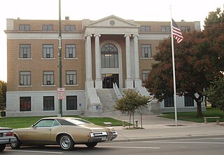
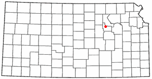
Pawnee County is a county located in the U.S. state of Kansas. As of the 2020 census, the county population was 6,253. The largest city and county seat is Larned.

Scouting in Kansas has a long history, from the 1910s to the present day, serving thousands of youth in programs that suit the environment in which they live.

Pawnee Rock is a city in Barton County, Kansas, United States. As of the 2010 census, the city population was 252.

Larned is a city in and the county seat of Pawnee County, Kansas, United States. As of the 2020 census, the population of the city was 3,769.

Fort Riley is a United States Army installation located in North Central Kansas, on the Kansas River, also known as the Kaw, between Junction City and Manhattan. The Fort Riley Military Reservation covers 101,733 acres (41,170 ha) in Geary and Riley counties. The portion of the fort that contains housing development is part of the Fort Riley census-designated place, with a residential population of 7,761 as of the 2010 census. The fort has a daytime population of nearly 25,000. The ZIP Code is 66442.

Pawnee Rock, one of the most famous and beautiful landmarks on the Santa Fe Trail, is located in Pawnee Rock State Park, just north of Pawnee Rock, Kansas, United States. Originally over 150 feet (46 m) tall, railroad construction stripped it of some 15 to 20 feet (6.1 m) in height for road bed material. A memorial monument, picnic area, and pergola have been constructed on the top. From the top of the pergola is a view the Arkansas river valley and the route of the Santa Fe trail. Today it is a prominence rising 50 or 60 feet above the surrounding plains. Matt Field, who traveled the Santa Fe Trail in 1840, later wrote, "Pawnee Rock springs like a huge wart from the carpeted green of the prairie." Traders, soldiers, and emigrants who stopped, carved their names into the brown sandstone. Some of these names are still visible among the graffiti of the more recent visitors.

The Santa Fe Trail was a 19th-century route through central North America that connected Franklin, Missouri, with Santa Fe, New Mexico. Pioneered in 1821 by William Becknell, who departed from the Boonslick region along the Missouri River, the trail served as a vital commercial highway until 1880, when the railroad arrived in Santa Fe. Santa Fe was near the end of El Camino Real de Tierra Adentro, which carried trade from Mexico City.

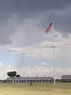
Fort Larned National Historic Site preserves Fort Larned which operated from 1859 to 1878. It is approximately 5.5 miles (8.9 km) west of Larned, Kansas, United States.

Fort Caspar was a military post of the United States Army in present-day Wyoming, named after 2nd Lieutenant Caspar Collins, a U.S. Army officer who was killed in the 1865 Battle of the Platte Bridge Station against the Lakota and Cheyenne. Founded in 1859 along the banks of the North Platte River as a trading post and toll bridge on the Oregon Trail, the post was later taken over by the Army and named Platte Bridge Station to protect emigrants and the telegraph line against raids from Lakota and Cheyenne in the ongoing wars between those nations and the United States. The site of the fort, near the intersection of 13th Street and Wyoming Boulevard in Casper, Wyoming, is listed in the National Register of Historic Places and is now owned and operated by the City of Casper as the Fort Caspar Museum and Historic Site.
K-156 is a 175.663-mile-long (282.702 km) west–east state highway in the U.S. state of Kansas. K-156's western terminus is at U.S. Route 50 Business and US-83 Bus. in Garden City and the eastern terminus is at Interstate 70 (I-70) and U.S. Route 40 (US-40) northeast of Ellsworth. Along the way, it intersects several major highways including US-50, US-83 and US-400 in Garden City; US-283 in Jetmore; and US-183 near Rozel, and it overlaps its implied parent, US-56, from Larned to east of Great Bend.

Fort Harker, located in Kanopolis, Kansas, was an active military installation of the United States Army from November 17, 1866 to October 5, 1872. The fortification was named after General Charles Garrison Harker, who was killed in action at the Battle of Kennesaw Mountain in the American Civil War. Fort Harker replaced Fort Ellsworth, which had been located 1.6 km (0.99 mi) from the location of Fort Harker and was abandoned after the new fortifications at Fort Harker were constructed. Fort Harker was a major distribution point for all military points farther west and was one of the most important military stations west of the Missouri River.
K-19 is a 33.915-mile-long (54.581 km) state highway in the U.S. state of Kansas. From U.S. Route 50 (US-50) to K-19 Spur it is signed as north–south and from K-19 Spur to US-281 it is signed as east–west. K-19's southern terminus is at US-50 in Belpre, and the eastern terminus is at US-281 east of Seward.
Kansas has always been home to many forts and military posts.
Council Grove's Post is a trading post on the Santa Fe Trail that operated in Council Grove, Kansas. It was established around 1861 and decommissioned around 1864, with ties to the Civil War.

The site of Fort Dodge in the U.S. state of Kansas was originally an old campground for wagons traveling along the Santa Fe Trail, just west of the western junction of the Wet and Dry Routes and near the middle or Cimarron Cutoff. On March 23, 1865, Major General Grenville M. Dodge, who commanded the 11th and 16th Kansas Cavalry Regiments, wrote to Colonel James Hobart Ford to propose establishing a new military post west of Fort Larned. On orders of Col. Ford, Captain Henry Pearce, with Company C, Eleventh Cavalry Regiment, and Company F, Second U.S. Volunteer Infantry, from Fort Larned, occupied and established Fort Dodge on April 10, 1865.
In 1864 Gen. Samuel R. Curtis established a military camp at the Fort Riley-Fort Larned Road crossing of the Smokey Hill River in what is now Ellsworth County, Kans.

Guide Rock, whose Pawnee name is Pa-hur or Pahur, is a hill in south central Nebraska in the United States. In the traditional Pawnee religion, it was one of five dwelling places of spirit animals with miraculous powers.
The Pawnee River or Pawnee Fork is a river in western Kansas in the United States, about 198 miles (319 km) long. It is a tributary of the Arkansas River, which in turn is a branch of the Mississippi River.

Henry Inman was an American soldier, frontiersman, and author. He served the military during the Indian campaigns and the American Civil War, having earned distinction for gallantry on the battlefield. He was commissioned lieutenant general during the Indian wars. He settled in Kansas and worked as a journalist and author of short stories and books of the plains and western frontier. He was a friend and associate of Buffalo Bill and served under General Custer.
References
- ↑ Oliva, Leo E. (1982). Fort Larned on the Santa Fe Trail. Topeka: Kansas State Historical Society. pp. 5–9.
- ↑ Oliva 1982, p. 5-9.
- ↑ Utley, Robert M. (January 1, 1993). Fort Larned National Historic Site. Tucson: Western National Press Assn. pp. 5–6.
- ↑ Oliva 1982, p. 9.
- ↑ Utley 1993, p. 5-6.
- ↑ "Camp Alert, Kansas," undated flyer (from the Kansas State Historical Society, Topeka).