
Map
The Canajoharie and Catskill Rail Road (C&C) ran from Catskill, NY to Potter's Hollow, NY. Originally it was intended to extend the railroad to Canajoharie, New York.
Chartered in 1830, [1] it never achieved its intended goal of connecting its namesake villages. [2] A ground breaking ceremony was held in 1831, [1] but construction did not begin in earnest until 1836 when the route was surveyed by George H. Cook. [3] By the end of construction a total of 261⁄4 miles of track had been laid. [2]
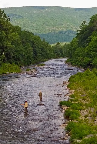
The track consisted of wooden rails topped with strap iron. [2] The track generally followed Catskill Creek, and the communities served included Cairo and Leeds. The first trains, consisting of cars hauled by horses, ran in 1839. [2] The line's only locomotive, Mountaineer, began operation in 1840. [2] It was never very satisfactory. [1] The C&C carried both passengers and freight. [2] Commodities carried included iron, brick, wood, various agricultural products, and household goods including such items as candles, tea, salt, snuff and raisins. [2]
On 4 May 1840 the High Rock covered bridge over Catskill Creek collapsed under the weight of the train, killing one Jehiel Tyler and injuring a number of others. This disaster is marked by a New York State historic plaque on Route 145, about two and half miles west of East Durham.
Following the bridge collapse, the line collapsed financially and was sold and scrapped in 1842. [2]
Starting in Catskill, NY, known mileposts along the route are:
Mile - Description
26.05 - Rail Road Office
25.73 - First bridge over the Catskill Creek
25.23 - Second bridge over the Catskill Creek
23.93 - Paper Mill
23.03 - Third bridge over the Catskill Creek
22.78 - Lime kiln
22.25 - Henry M. Vedder's residence
21.43 - Toll Gate
20.83 - Wolcott's Mills (Montgomeryville). [4]
19.35 - Scotch Rock
19.18 - South Cairo
18.90 - Depot
18.63 - Opposite Mr. Blackmar's (Inn run owned by Elisha Blackmar built in 1816) [4]
17.65 - rock excavations
15.15 - Cairo
14.63 - Samuel Bennett's
14.00 - opposite Woodstock (Polulated Place in Cairo, NY).
13.60 - Road
12.73 - Bridge, 26 ft. over small stream
9.15 - Hay Press
8.23 - Winansville, now (East Durham)
7.58 - Hedges
6.09 - Bridge over Catskill Creek
5.40 - Bridge over Catskill Creek
4.80 - Opposite Tremain's tannery
4.50 - Mr. Stanard's
3.93 - Oak Hill Station
3.43 - Richardson's Mill
1.93 - Brown's Fulling Mill
.90 - Hands Tannery
.75 - Road to Potters Hollow
.49 - Cooksburg Depot
0 - 26 Chains north of Cooksburg Depot
The only known depiction of the railroad is Thomas Cole's River in the Catskills at the Museum of Fine Arts in Boston. [2]
Cairo is a hamlet and census-designated place (CDP) in the town of Cairo in Greene County, New York, United States. The population of the CDP was 1,402 at the 2010 census, out of 6,610 people in the entire town.

Cairo is a town in Greene County, New York, United States. The population was 6,644 at the 2020 census. The town is in the southern part of the county, partly in the Catskill Park. The town contains a hamlet, also named Cairo.

New York State Route 208 (NY 208) is a state highway located in southern New York in the United States. The southern terminus is at an intersection with NY 17M in the Orange County village of Monroe. Its northern terminus is located at an intersection with NY 32 and NY 299 in the Ulster County village of New Paltz.

New York State Route 214 (NY 214) is a 12.48-mile (20.08 km) long state highway through the Catskill Park sections of Ulster and Greene counties. The route begins at an intersection with NY 28 in the town of Shandaken, just southwest of the hamlet of Phoenicia. The route runs through the narrow mountain pass called Stony Clove Notch before reaching the town of Hunter, where it ends at NY 23A.

New York State Route 32A (NY 32A) is a state highway in the Hudson Valley region of New York in the United States. It serves as a connector between NY 32 in the town of Saugerties and NY 23A in the town of Catskill. The road allows traffic from the Saugerties area, particularly from the New York State Thruway, to directly reach the interior of the Greene County portion of Catskill Park. The majority of traffic is tourism-oriented, from hikers in summer to skiers bound for Hunter Mountain in winter. If NY 32A did not exist, drivers would have to go several miles out of their way to the intersection of NY 32 and NY 23A.
Esopus Creek is a 65.4-mile-long (105.3 km) tributary of the Hudson River that drains the east-central Catskill Mountains in the U.S. state of New York. From its source at Winnisook Lake on the slopes of Slide Mountain, the Catskills' highest peak, it flows across Ulster County to the Hudson at Saugerties. Many tributaries extend its watershed into neighboring Greene County and a small portion of Delaware County. Midway along its length, it is impounded at Olive Bridge to create Ashokan Reservoir, the first of several built in the Catskills as part of New York City's water supply system. Its own flow is supplemented 13 miles (21 km) above the reservoir by the Shandaken Tunnel, which carries water from the city's Schoharie Reservoir into the creek.

New York State Route 42 (NY 42) is a north–south, discontinuous state highway in the Catskill Mountains region of New York in the United States. The southernmost of the highway's two segments begins at an intersection with U.S. Route 6 (US 6) and US 209 in Port Jervis and ends at a junction with NY 55 near the Rondout Reservoir in Neversink. NY 42's northern segment runs from NY 28 in Shandaken to NY 23A in Lexington. The 41-mile (66 km) southern segment is located in Orange County and Sullivan County, while the 11-mile (18 km) northern segment is in Ulster County and Greene County.
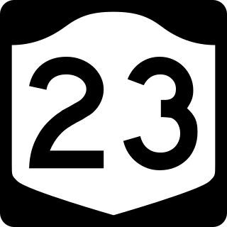
New York State Route 23 (NY 23) is an east–west state highway in the eastern portion of New York in the United States. It extends for 156.15 miles (251.30 km) from an intersection with NY 26 in the Central New York town of Cincinnatus in Cortland County to the Massachusetts state line in the Berkshire Mountains, where it continues east as that state's Route 23. Along the way, it passes through many communities, including the cities of Norwich and Oneonta. Outside of the communities, the route serves largely rural areas of the state and traverses the Catskill Mountains in the state's Central New York Region. NY 23 crosses the Hudson River at Catskill via the Rip Van Winkle Bridge.

New York State Route 23A (NY 23A) is an east–west state highway in Greene County, New York, in the United States. It serves as a 34.56-mile (55.62 km) alternate route of NY 23 through the northern Catskill Mountains. The route passes several of the Catskill High Peaks, including Hunter Mountain, before dropping into the Hudson Valley via Kaaterskill Clove and ending at an intersection with U.S. Route 9W (US 9W) in the village of Catskill. NY 23A was assigned in the mid-1920s and has not been changed since. A portion of the route through Kaaterskill Clove was closed for several months in 2006 after landslides triggered by heavy rains damaged the route.

New York State Route 81 (NY 81) is an east–west state highway in the Capital District of New York in the United States. The western terminus of the route is at an intersection with NY 145 and Potter Hollow Road in the hamlet of Cooksburg within the town of Rensselaerville. Its eastern terminus is at a junction with U.S. Route 9W (US 9W) in the town of Coxsackie. East of US 9W, the right-of-way of NY 81 continues southeast to the village of Coxsackie as NY 385. NY 81 intersects NY 32 north of the hamlet of Cairo.

New York State Route 145 (NY 145) is a state highway in eastern New York in the United States. The highway extends for 47 miles (76 km) from NY 23 in the Greene County town of Cairo to U.S. Route 20 (US 20) in the Schoharie County town of Sharon. Along the way, NY 145 intersects NY 30 in Middleburgh and Interstate 88 (I-88) east of Cobleskill. NY 145 is a two-lane highway its entire length, with a passing lane on hills leaving Middleburgh in both directions. The route follows parts of the Susquehannah Turnpike from Cairo through East Durham and west.

New York State Route 385 (NY 385) is a state highway in Greene County, New York, in the United States. It runs from the village of Catskill to the village of Coxsackie, serving as an alternate route of U.S. Route 9W between the two locations. While US 9W follows a more inland routing, NY 385 runs along the Hudson River and serves the village of Athens. Modern NY 385 is the original routing of US 9W between Catskill and Coxsackie. NY 385 was originally assigned c. 1932 to what is now US 9W between Catskill and Coxsackie; however, the alignments of both routes were flipped by the following year.

The Ulster & Delaware Railroad Historical Society is a chapter of the National Railway Historical Society (NRHS). It focuses on the history of the railroads and related social, economic, and cultural institutions of the Catskill and Hudson Valley regions. That history, which began with the charter of the Catskill & Ithaca Railroad in 1828, encompasses numerous proposed and built railroads and trolley lines within Ulster, Delaware, Greene, Schoharie, Albany and Otsego counties.
Ashokan High Point is a 3,061 feet (933 m) summit in the Catskill Mountains of New York. High Point is the loftiest part of a massif that includes the adjacent Mombaccus Mountain, Little Rocky and South Mountain. The summit can be accessed via the Kanape Brook Trail, which ascends from Ulster County Road 42 to the saddle between High Point and Mombaccus. This trail, named for 19th-century farmer John Canape, was formerly a wagon track connected to the present-day Freeman Avery Road on the south side of the mountain, providing a route between Watson Hollow and Samsonville in the days of the Catskills tanneries. High Point was once known as "Samson", and is so identified on a 1942 United States Coast and Geodetic Survey benchmark at the summit. Nowadays, Samson Mountain is the name given to a nearby peak above the upper reaches of Rondout Creek.
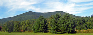
Mount Tremper, officially known as Tremper Mountain and originally called Timothyberg, is one of the Catskill Mountains in the U.S. state of New York. It is located near the hamlet of Phoenicia, in the valley of Esopus Creek.
The Susquehannah Turnpike is a historic 25 mile turnpike beginning at Catskill on the Hudson River and stretching through the town of Durham in Greene County, New York. East of the Hudson River, the road was taken over by the Ancram Turnpike Company in 1804. The route was extended west by the Susquehannah and Bath Turnpike Company, and further branches reached to Buffalo and Erie, Pennsylvania; the whole route became known as the Catskill Turnpike. Part of the Susquehannah Turnpike follows the Mohican Trail and it features a number of stone arch bridges. Nine of the 25 original milestones remain.

Deep Notch, sometimes West Kill Notch, or Echo Notch, is a mountain pass in Lexington, New York, United States. It divides two Catskill peaks, both subpeaks of high peaks of the range. The narrow groove between the steep, high slopes on either side is traversed by state highway NY 42 and the Shandaken Tunnel, part of the New York City water supply system. It has been called "striking" and "a marvel of grandeur and beauty".

The Canajoharie Creek is a river that flows into the Mohawk River in the Village of Canajoharie in the U.S. State of New York. The name "Canajoharie" is a Mohawk language term meaning "the pot that washes itself", referring to the "Canajoharie Boiling Pot", a 20-foot (6.1 m) wide and 10-foot (3.0 m) deep pothole in the Canajoharie Creek, just south of the village of Canajoharie. Bowmans Creek is one main tributary that enters the creek east of the Hamlet of Sprout Brook. The other main tributary is Brimstone Creek which enters the creek north-northwest of the Village of Ames.
East Kill, a 16-mile-long (26 km) tributary of Schoharie Creek, flows across the town of Jewett, New York, United States, from its source on Stoppel Point. Ultimately its waters reach the Hudson River via the Mohawk. Since it drains into the Schoharie upstream of Schoharie Reservoir, it is part of the New York City water supply system. East Kill drains the southern slopes of the Blackhead Mountains, which include Thomas Cole Mountain, Black Dome, and Blackhead Mountain, the fourth-, third-, and fifth-highest peaks in the Catskills, respectively.

The West Kill, an 11-mile-long (18 km) tributary of Schoharie Creek, flows through the town of Lexington, New York, United States, from its source on Hunter Mountain, the second-highest peak of the Catskill Mountains. Ultimately its waters reach the Hudson River via the Mohawk. Since it drains into the Schoharie upstream of Schoharie Reservoir, it is part of the New York City water supply system. It lends its name to both a mountain to its south and a small town midway along its length.
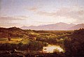 River in the Catskills