Canteen Kopje is an archaeological site, formally protected as a grade 2 provincial heritage site, and approved in 2017 for re-grading to national status, situated outside Barkly West in the Northern Cape, South Africa. The place was previously known as Klipdrift, meaning stony drift, a translation from a still earlier !Ora name,!a |aub. Canteen Kopje is best known for its long and exceptionally rich Earlier Stone Age sequence, spanning circa >0.5 to 1.7 million years, occurring within gravels exposed in late nineteenth/early twentieth century mining pits. Also attracting attention are more recent archaeological levels in the overlying Hutton Sands, which contain material known as Fauresmith, Middle Stone Age, Later Stone Age, and late Iron Age with evidence of protocolonial/colonial contact and interaction, probably, with nineteenth century diamond diggers.
The importance of Canteen Kopje as a heritage site was recognized, and a 9 hectares (22 acres) area known as Erf 91 was proclaimed as a protected reserve in 1948. Gideon Retief, Mining Commissioner of Barkly West from 1942 to 1951, was instrumental in preserving the site and creating the first open air exhibit here. Subsequently, in 2000, information panels were erected by the McGregor Museum. These were refurbished in 2016. A walking trail was laid out for visitors to view the early diamond diggings and archaeological research sites. The Barkly West Museum contains further information and examples of artefacts from the site, while material excavated by archaeologists is housed principally by the McGregor Museum, the approved archaeological repository for the Northern Cape Province in nearby Kimberley.
In 2016 the protected heritage site was directly threatened after the Department of Minerals and Energy issued a permit for part of the site to be mined. Although a heritage permit had not been issued by the South African Heritage Resources Agency, mining commenced on 18 March 2016. An urgent interdicted was granted by the Northern Cape Division of the High Court of South Africa on 19 March, being made final on 19 April 2016.[1]
In the 1940s the archaeologist Clarence Van Riet Lowe predicted: "When the last diamond claim has been abandoned, archaeologists throughout the world will be interested in Canteen Kopje, in the Vaal River diggings, where lie the prehistoric remains of a million years of human evolution".
Alluvial diamond diggings
One of the hills in the vicinity of Canteen Kopje was the site of the first alluvial diamond diggings (as opposed to surface prospecting) on the Diamond Fields of South Africa, which precipitated the rush to these parts in 1870.[2] Digging continued here until the early 1940s.
BatlhapingKgosi (Chief) Jantjie Mothibi controlled, for as long as he could, the influx of white "diamond seekers" to the region. Prospectors were allowed to use sharp sticks, but were not permitted to "touch the ground with pick and shovel". For their part, as noted by Jerome Babe in his 1872 book, The South African Diamond Fields, "Natives would form themselves in long lines, joined hand in hand, and walk slowly over the ground and look for diamonds, especially after rain; and if they found one they would take it to a trader...[Finds were exchanged for] horses, wagons, cows, sheep, cash, goods, etc at a deuce of a pace".[2]
In January 1870 diggers from KwaZulu-Natal were working their way along the Vaal River, finding diamonds at Klipdrift, on the "Old Koppie", upslope from Canteen Kopje. Using "pick and shovel, in spite of the natives", they unearthed more, precipitating the diamond rush. Soon both banks of the Vaal River were thronging with diggers of many nationalities, and by the end of the year there were five thousand people at Klipdrift alone.[2]
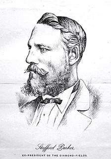
The diggers formed a Mutual Protection Association and elected Stafford Parker as their leader. Klipdrift was renamed Parkerton (from 1873 it was called Barkly West), and a Diggers' Republic was proclaimed in July 1870.
A popular early cradle sieve for recovery of diamonds was the so-called "Long Tom", which was reliant on large quantities of water. An improved version less dependent on water was developed by the American digger, author of The South African Diamond Fields, Jerome Babe. His 'dry sifter', known as the "Yankee Baby", is still used in the twenty first century by some small-scale diggers. At the time, its inventor was said to be "the first Babe to rock his own cradle".
The centrifugal or rotary washing machine – now standard on diggings in the area – is more sophisticated. In a slurry, a concentrate of heavy diamond-bearing deposit is separated from lighter waste.
Diggers staked their claims near the river, and dug the gravel where it was exposed at or near the surface. Where the gravel was buried deeper under silt and sand – such as at Canteen Kopje – large pits were dug. From these and from vertical shafts, the diggers tunnelled out precarious passageways in which a man could hardly stand.
Geology
The sequence of geological deposits in the vicinity of Canteen Kopje comprises:
Resistant 2 800 million year old andesitic lavas of the Ventersdorp Supergroup, underlying the entire area.
Thin patches of circa 280 million year old basal Karoo Sequence sediments made up of tillite and shale locally.
Shallow remnants of 19-17 million year old Older Gravels on the tops and upper slopes of adjacent hills.
Up to circa 10 metres (33ft) thickness of >0.5 to 1.7 million year old Younger Gravels formed largely from rock debris washed from adjacent hillsides.
Up to 4 metres (13ft) thick reddish windblown Hutton Sands that accumulated during drier intervals since about 0.3-0.5 million years ago.
Diamonds at or near Canteen Kopje are confined to the Older and Younger Gravels. Around 90-120 million years ago, a swarm of volcanic pipes, centred on Kimberley to the east, brought diamond-bearing kimberlite to a higher surface formed of Karoo Sequence sediments. Subsequent erosion has lowered the entire regional landscape by over 1,200 metres (3,900ft) and in the process the diamonds were released from their host rock. It has been estimated that at least 50 million carats of diamonds were set free in this way from the five kimberlite pipes in the vicinity of Kimberley alone. Most of those were flushed away to the sea long ago in past and present river channels, but along the way some were trapped in alluvial deposits such as the Older and Younger Gravels along rivers in this region.
Recognition of archaeological significance
general view of Canteen Kopje site from the nearby hill
Earlier Stone Age artefacts were noted in the area by Colonel James Henry Bowker and Mary Elizabeth Barber at the time of the earliest diamond diggings. Eminent prehistorians including C. van Riet Lowe, the French prehistorian, the Abbé Henri Breuil and J. Desmond Clark visited and described it.[3][4][5][6] Breuil was here in 1929 and again in the 1940s, when he famously noted that "not only are there enough specimens [there] to fill a museum to overflowing but to build it of them also."
Preserved and almost lost
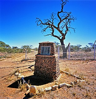
On account both of the mining history as well as the finding of Acheulean artefacts at this spot, a 10 morgen portion of Canteen Kopje was declared a National Monument (since 2000 known as a provincial heritage site) in 1948.[7] Mining recommenced in the vicinity in the 1990s and Canteen Kopje was nearly lost. Pressure was exerted for the site to be de-proclaimed as a heritage site, to allow for renewed diamond digging and 'empowerment' of small scale miners. The local community recognised the value of conserving heritage and supported the efforts of the then National Monuments Council and the McGregor Museum to preserve the site, which was then developed as an open-air museum. The new Barkly West Museum was created at the same time.[8]
Renewed threat was experienced in 2016. In 2014 the Department of Minerals (DMR) issued a permit for mining to take place on part of the declared site. The South African Heritage Resources Agency (SAHRA) was alerted and in response, because of the existing formal declaration, a Cease Works Order was put in place to prevent mining from taking place. Pressure was exerted however and in March 2016 the Cease Works Order was lifted, following which, on 16 March 2016, a diamond mining operation commenced work by fencing off an area around that for which they have a DMR mining permit. Public access to the remainder of the heritage site was blocked. Section 27(18) of the National Heritage Resources Act (NHRA) (Act 25 of 1999) states that: "No person may destroy, damage, deface, excavate, alter, remove from its original position, subdivide or change the planning status of any heritage site without a permit issued by the heritage resources authority responsible for the protection of such site." Section 51. (1) of the NHRA states that: "Notwithstanding the provisions of any other law, any person who contravenes— (a) sections 27(18), 29(10), 32(13) or 32(19) is guilty of an offence and liable to a fine or imprisonment or both such fine and imprisonment as set out in item 1 of the Schedule." Since the mining concern has commenced mining operations without such a permit issued by SAHRA, it is clearly in contravention of an Act of the Republic of South Africa and therefore is guilty of an offence.[9][10][11][12]
Archaeological and geological investigations from the 1990s
Excavations in the late 1990s were carried out by Peter Beaumont of the McGregor Museum. John McNabb from the University of Southampton worked with Beaumont in analysing the Acheulean stone artefact technology.[13][14][15][16] Further excavations have been carried out by archaeologists from the University of the Witwatersrand (inter alia for application of cosmogenic nuclide burial dating) and the University of Toronto. The current active programme of research has yielded an as yet unpublished basal date of some 2.3 million years, while excavations involving students from the Sol Plaatje University in Kimberley investigate the most recent circa 19th century contact period archaeology showing interaction between local communities and colonial diggers.
Crucial to the interpretation of the archaeology of the site, is an understanding of site formation in relation to the adjacent hill and the Vaal River which at different periods cut down first to the north of the site and then the south west.[17][18][19][20]
In 2007-9 a 7-metre sequence through Hutton Sands and Gravels was excavated to carry out dating and a detailed analysis of the lithic profile. There is a marked 'Victoria West' Acheulean horizon (named for the town in the Karoo where these stone tools were first described) in the upper part of the gravels, subject to a current Southampton PhD project. The lower part of the sequence contains simpler, older Acheulean technology.
Later Stone Age material at and just below the surface has been studied in two excavations by archaeologists from the University of the Witwatersrand and Toronto.
Canteen Kopje Skull
The Canteen Kopje Skull was found in the vicinity in 1925 by diamond digger Kenneth Kemp, working 2.4 m down at an unrecorded locality at Canteen Kopje. A number of fitting skull fragments were presented by Kemp to the magistrate J.G. van Alphen, who in turn donated them to the McGregor Museum. They were studied soon afterwards by Robert Broom, who described it in Nature in 1929.[21][22]
In Broom's reconstruction, the skull appeared to have features similar to an allegedly archaic skeleton found at Boskop near Johannesburg. In 2011-12 X-ray Computerised Tomography scans of the skull, carried out at the South African Nuclear Energy Corporation near Pretoria, suggested it falls within the range of variation of Khoe-Sān populations of the Holocene (last 12 000 years), and is not 'archaic' as Broom had suggested. Reconsideration of the evidence also points to it having come from the Hutton Sands and not the Younger Gravels, as previously presumed.[23]
Kimberley is the capital and largest city of the Northern Cape province of South Africa. It is located approximately 110 km east of the confluence of the Vaal and Orange Rivers. The city has considerable historical significance due to its diamond mining past and the siege during the Second Anglo-Boer war. British businessmen Cecil Rhodes and Barney Barnato made their fortunes in Kimberley, and Rhodes established the De Beers diamond company in the early days of the mining town.
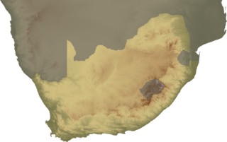
The Northern Cape is the largest and most sparsely populated province of South Africa. It was created in 1994 when the Cape Province was split up. Its capital is Kimberley. It includes the Kalahari Gemsbok National Park, part of the Kgalagadi Transfrontier Park and an international park shared with Botswana. It also includes the Augrabies Falls and the diamond mining regions in Kimberley and Alexander Bay.
Kathu is a town in South Africa, and the iron ore capital of the Northern Cape province. Its name means "town under the trees", after the Camel Thorn forest it is situated in. The phrase "the town under the trees" was coined by an engineer working in the town in the early-1990s as part of a tourist marketing drive, together with the accompanying graphic. It was intended to be a marketing slogan. The meaning of the word "Kathu" has anecdotically been attributed to a porridge brewed by the local population from the powder found in the pods of the Camel Thorn trees.
Griqualand West is an area of central South Africa with an area of 40,000 km2 that now forms part of the Northern Cape Province. It was inhabited by the Griqua people – a semi-nomadic, Afrikaans-speaking nation of mixed-race origin, who established several states outside the expanding frontier of the Cape Colony. It was also inhabited by the pre-existing Tswana and Khoisan peoples.
Christiana is an agricultural town of about 3,000 inhabitants on the banks of the Vaal River in North West province, South Africa. The town is located on the N12 national route between Bloemhof and Warrenton, on the way to Kimberley. It is the administrative centre and seat of Lekwa-Teemane Local Municipality.
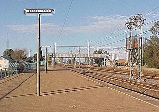
Barkly West is a town in the Northern Cape province of South Africa, situated on the north bank of the Vaal River west of Kimberley.
The Harts River is a northern tributary of the Vaal River, which in turn is the largest tributary of the Orange River. Its source is in the North West Province, but the greater part of its basin is located in the Northern Cape Province, which it enters a few kilometers downstream from the Taung Dam.
The McGregor Museum in Kimberley, South Africa, originally known as the Alexander McGregor Memorial Museum, is a multidisciplinary museum which serves Kimberley and the Northern Cape, established in 1907.
Koffiefontein Mine is a diamond mine situated in the Free State province, about 80 km from Kimberley, South Africa. It is one of the many Kimberley mines of which Kimberley mine, de Beers mine, Dutoitspan, Bultfontein and Wesselton are its more famous neighbours.
Wildebeest Kuil Rock Art Centre is a rock engraving site with visitor centre on land owned by the !Xun and Khwe San situated about 16 km from Kimberley, Northern Cape, South Africa. It is a declared Provincial Heritage Site managed by the Northern Cape Rock Art Trust in association with the McGregor Museum. The engravings exemplify one of the forms often referred to as ‘Bushman rock art' – or Khoe-San rock art – with the rock paintings of the Drakensberg, Cederberg and other regions of South Africa being generally better known occurrences. Differing in technique, the engravings have many features in common with rock paintings. A greater emphasis on large mammals such as elephant, rhino and hippo, in addition to eland, and an often reduced concern with depicting the human form set the engravings apart from the paintings of the sub-continent.
Wonderwerk Cave is an archaeological site, formed originally as an ancient solution cavity in dolomite rocks of the Kuruman Hills, situated between Danielskuil and Kuruman in the Northern Cape Province, South Africa. It is a National Heritage Site, managed as a satellite of the McGregor Museum in Kimberley. Geologically, hillside erosion exposed the northern end of the cavity, which extends horizontally for about 140 m (460 ft) into the base of a hill. Accumulated deposits inside the cave, up to 7 m (23 ft) in-depth, reflect natural sedimentation processes such as water and wind deposition as well as the activities of animals, birds, and human ancestors over some 2 million years. The site has been studied and excavated by archaeologists since the 1940s and research here generates important insights into human history in the subcontinent of Southern Africa. Evidence within Wonderwerk cave has been called the oldest controlled fire. Wonderwerk means "miracle" in the Afrikaans language.
The concept of the Northern Cape as a distinct geo-political region of South Africa coalesced in the 1940s when a "Northern Cape and Adjoining Areas Regional Development Association" was formed and the first map featuring the name "Northern Cape" was published. The geographic spread to which the term applied was not fixed until 1994, however, when it attained precise definition as the Northern Cape Province, one of South Africa's nine post-apartheid provinces. Since then there have been boundary adjustments to include parts of the former Bophuthatswana adjacent to Kuruman and Hartswater. Vryburg and Mafikeng, in the north eastern extremity of the former Cape Province - and hence regarded as part of the pre-1994 "Northern Cape" - are excluded, being part, now, of the North West Province in the North.
The Nooitgedacht Glacial Pavements comprise a geological feature between Kimberley and Barkly West, South Africa, pertaining to the Palaeozoic-age Dwyka Ice Age, or Karoo Ice Age, where the glacially scoured ancient bedrock was used, substantially more recently, during the Later Stone Age period in the late Holocene as panels for rock engravings.
The Barkly West Museum was established in 2000 in the old Toll House beside the Barkly Bridge which crosses the Vaal River at Barkly West in the Northern Cape, South Africa.
Delportshoop is a town in Frances Baard District Municipality in the Northern Cape Province of South Africa. It lies next to the Vaal River. The Harts River runs by closely.
The Kathu Archaeological Complex is a cluster of significant archaeological, principally Stone Age, exposures situated in and near Kathu, a mining town in the Northern Cape Province, South Africa. The sites include a suite of sinkhole exposures, the Kathu Pan sites, north west of the town, the immensely rich spread of artefacts at what is referred to as Kathu Townlands on the eastern side of Kathu, and surface and subsurface horizons including handaxes on farms further eastward. These are subject to on-going archaeological research.
Bakerville is a town in Ditsobotla Local Municipality in the North West province of South Africa.
Stafford Parker was a British artist, miner and the only President of the small and short-lived "Diggers Republic" on the diamond fields of southern Africa.
Leopard's Kopje by is an archaeological site, the type site of the associated region or culture that marked the Middle Iron Age in Zimbabwe. The ceramics from the Leopard's Kopje type site have been classified as part of phase II of the Leopard's Kopje culture. For information on the region of Leopard's Kopje, see the "Associated sites" section of this article.
Peter Bernhard Beaumont was a South African archaeologist noted for his excavation and finds at Wonderwerk Cave, Kathu, Canteen Kopje and Border Cave, all in South Africa. His work led to the conviction that, rather than trailing Europe and Asia, Southern Africa's Stone Age technology and culture had set the pace.
↑ Johnson, J.P.; Young, R.B. (1906). "The relation of ancient deposits of the Vaal River to the palaeolithic period of South Africa". Transactions of the Geological Society of South Africa. 9: 53–56.
↑ Péringuey, Louis (1911). "The stone ages of South Africa as represented in the collections of the South African Museum". Annals of the South African Museum. 8: 1–218.
↑ Power, J.H. (1949). "The contribution of the northern Cape to the study of prehistoric man". South African Journal of Science. 46: 107–116.
↑ Söhnge, P.G.; Visser, D.J.L.; van Riet Lowe, C. (1937). "The geology and archaeology of the Vaal River basin". Geological Survey of South Africa Memoir. 35: 1–134.
↑ Oberholster, J.J. 1972. The historical monuments of South Africa. Stellenbosch: The Rembrandt van Rijn Foundation for Culture for the National Monuments Council.
↑ Turkington, T. (2000). "Realising a dream: Canteen Kopje and the new Barkly West Museum". The Digging Stick. 17 (3): 1–3.
↑ Beaumont, P.B. 1990. Canteen Koppie (Klipdrift). In Beaumont, P. & Morris, D. (eds.) Guide to Archaeological sites in the Northern Cape. 14–16. McGregor Museum: Kimberley
↑ Beaumont, P. & McNabb, J. (2000a.) Report for the National Monuments Council of South Africa on excavations by Peter Beaumont at Canteen Koppie, Barkly West, Northern Cape Province, South Africa. Unpublished report, with supplement by Peter Beaumont
↑ Beaumont, P.; McNabb, J. (2000b). "Canteen Kopje: the recent excavations". The Digging Stick. 17 (3): 3–6.
↑ McNabb, J. (2001) The shape of things to come: a speculative essay on the role of the Victoria West phenomenon at Canteen Koppie during the South African Earlier Stone Age. In Milligen, S. & Cook, J. (eds) "A very remote period indeed": papers on the Palaeolithic presented to Derek Roe. Oxford: Oxbow Books.
↑ Helgren, D.M. (1979) River of diamonds: an alluvial history of the lower Vaal basin, South Africa. Chicago: University of Chicago. Department of Geography. Research Paper 185
↑ De Wit, M.C.J., Ward, J.D. & Jacob, J.R. (1997) Diamond-bearing deposits of the Vaal-Orange River System. Field Excursion Guidebook 6th International Conference on Fluvial Sedimentology, University of Cape Town, September 1997 2, 1–61
Wikimedia Commons has media related to Canteen Kopje.
This page is based on this Wikipedia article Text is available under the CC BY-SA 4.0 license; additional terms may apply. Images, videos and audio are available under their respective licenses.