
Sydney is a former city and urban community on the east coast of Cape Breton Island in Nova Scotia, Canada within the Cape Breton Regional Municipality. Sydney was founded in 1785 by the British, was incorporated as a city in 1904, and dissolved on 1 August 1995, when it was amalgamated into the regional municipality.

The Greenland cod, commonly known also as ogac, is a species of ray-finned fish in the cod family, Gadidae. Genetic analysis has shown that it may be the same species as the Pacific cod. It is a bottom-dwelling fish and is found on the continental shelf in the Arctic Ocean and northwestern Atlantic Ocean, its range extending from Alaska to West Greenland, then southwards along the Canadian coast to the Gulf of St. Lawrence and Cape Breton Island. It is a commercially harvested food fish, but landings have been greatly reduced in recent years.

Qikiqtaaluk (ᕿᑭᖅᑖᓗᒃ), formerly White Island, is one of the uninhabited Canadian arctic islands in the Kivalliq Region, Nunavut, Canada. Located in Foxe Basin off the northern tip of Southampton Island, it measures 789 km2 (305 sq mi) in area.
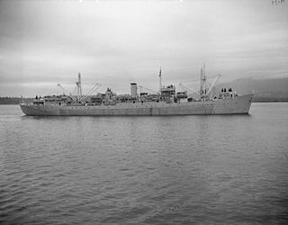
HMCS Cape Breton was a Royal Canadian Navy Cape-class maintenance ship. Originally built for the Royal Navy as HMS Flamborough Head in 1944, she was transferred in 1952. Upon her commissioning she was the second ship to bear the name Cape Breton. She served operationally from 1953–1964, when she was laid up. She was used as a floating machine shop until the late-1990s, before being sold for use as an artificial reef off the coast of British Columbia.

The Kitimat Ranges are one of the three main subdivisions of the Coast Mountains in British Columbia, Canada, the others being the Pacific Ranges to the south and the Boundary Ranges to the north.

Officially Good Hope Mountain but commonly known as Mount Good Hope is one of the principal summits of the Pacific Ranges of the southern Coast Mountains in British Columbia, Canada. It stands immediately west of Chilko Lake, with the highest peak on the massif rising between the lake's southern arms.

Cape Ray is a headland located at the southwestern extremity of the island of Newfoundland in the Canadian province of Newfoundland and Labrador.

The Town of Cape Broyle is an incorporated community located on the Avalon Peninsula in Newfoundland and Labrador, Canada. During King William's War, the village was destroyed in the Avalon Peninsula Campaign.

North Mountain is a narrow southwest-northeast trending volcanic ridge on the mainland portion of southwestern Nova Scotia, stretching from Brier Island to Cape Split. It forms the northern edge of the Annapolis Valley along the shore of the Bay of Fundy. Together with South Mountain, the two ranges form the Annapolis Highlands region.
Cape Lisburne LRRS Airport is a military airport located on Cape Lisburne, at the northwest point of the Lisburne Peninsula in the North Slope Borough of the U.S. state of Alaska. The airport is owned by the U.S. Air Force. It is also known as Cape Lisburne Airport.
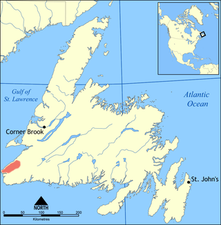
The Anguille Mountains are a section of the Long Range Mountains located on the west coast of the island of Newfoundland, Canada, along the Gulf of St. Lawrence.

Cape Anguille is a headland and the westernmost point in Newfoundland, reaching into the Gulf of Saint Lawrence. It is the southern edge of St. George's Bay. Its name is derived from the French word anguille, which means eel. Close to the cape is the community of Cape Anguille.
Neyaashiinigmiing, formerly Cape Croker, is a reserve within Bruce County, Ontario. It is one of the parcels of land administered by the Chippewas of Nawash Unceded First Nation.
Brevoort Island is a small, uninhabited island located in the Davis Strait off the eastern coast of Baffin Island in the Qikiqtaaluk Region of northern Canada's territory of Nunavut. The island is a member of the Arctic Archipelago and lies north of Cape Murchison, opposite the Cumberland Peninsula.
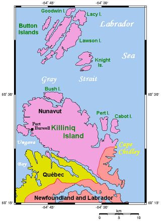
The Cape Chidley Islands are members of the Arctic Archipelago in the territory of Nunavut. They are located in the Labrador Sea at the south end of the entrance to the Hudson Strait, north of Killiniq Island's Cape Chidley, and separated from Killiniq Island by the MacGregor Strait.
Cape Blomidon is a headland located on the Bay of Fundy coast of the Canadian province of Nova Scotia.
Saqajaa {Inuktitut syllabics: ᓴᖃᔮ) formerly Sakkiak Island is one of the uninhabited Canadian arctic islands located in Hudson Strait, Nunavut, Canada. It is a Baffin Island offshore island in the Qikiqtaaluk Region, separated by deep water from Cape Dorset 64°10′40″N76°29′00″W, 1.5 mi (2.4 km) to the south-southwest. The island is approximately 6 km2 (2.3 sq mi) in size, 2.25 mi (3.62 km) long, and 1 mi (1.6 km) wide. The elevation is approximately 65 m (213 ft) above sea level.
The Cape Hope Islands are an uninhabited Canadian arctic islands group located within the midsection of James Bay in Nunavut, Canada. They are situated south of Vieux-Comptoir.
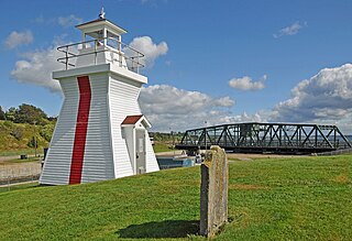
Balache Point Lighthouse, also known as Balache Point Range Rear Lighthouse, is an active Canadian lighthouse located next to the Canso Canal, near Port Hastings, Inverness County, Nova Scotia. The salt shaker style light, which sits on a small hillock on the Cape Breton side of the canal, is the second lighthouse to be built on the site.
Michael J. "Mike" Kelloway is a Canadian politician who was elected to represent the riding of Cape Breton—Canso as a member of the Liberal Party in the House of Commons of Canada in the 2019 Canadian federal election.
