Region of the Avalon Peninsula in Newfoundland and Labrador, Canada
Cape Shore (in green), on the southeastern shore of Placentia Bay and the southwestern shore of St. Mary's Bay. St. John's, the provincial capital, is approximately 160 km to the northeast
Often confused or conflated with the Southern Shore (a rural district with strong Irish-Newfoundland heritage stretching south from St. John's to Trepassey), the Cape Shore is similarly rural and populated by Irish Newfoundlanders, but is geographically distinct. It is named for Cape St. Mary's, the southeastern tip of Placentia Bay, celebrated in the famous Newfoundland balladLet Me Fish Off Cape St. Mary's.
The Cape Shore begins in the Town of Placentia and continues along the eastern shore of Placentia Bay, rounding Cape St. Mary's to include the St. Mary's Bay communities of Point Lance and Branch (because Branch and Point Lance are approximately 40km away from the next St. Mary's Bay community, North Harbour, but only 16km from the largest Cape Shore community, St. Bride's, they are included in the Cape Shore despite technically being in a different bay).
History
Although nearby to Placentia, French capital of Newfoundland until 1713 and important English town afterwards, the Cape Shore was largely uninhabited until the late 18th and early 19th centuries, when the Placentia merchants Saunders and Sweetman began bringing settlers there from the area around Waterford, Ireland. The river valleys of the Cape Shore are relatively fertile areas suitable for types of small-scale farming, a rarity in Newfoundland, and communities like St. Bride's and Angels Cove were originally settled as farming communities, not fishing communities like most settlements in Newfoundland. To this day, commercial sheep, dairy, and vegetable farms are in operation on the Cape Shore.
However, the Cape Shore is adjacent to what were some of the richest fishing grounds in the world, as exhibited in the old Newfoundland saying Cape St. Mary's pays for all (meaning, losses incurred during a poor fishing year could be recouped by a quick fishing trip to Cape St. Mary's). By the latter part of the 19th century, fishing was the main occupation, and continues to be important today, despite the fishing industry's woes in the last 15 years (including the devastating Atlantic cod moratorium).
Today, tourism is an important industry. The Cape St. Mary's Ecological Reserve, just south of St. Bride's, draws thousands of visitors every year. Its rolling green hyper-oceanicbarrens and meadows drop 400 feet (120m) down dramatic sea-cliffs to the pounding surf below. The bird colony on 'bird rock' is the reserve's largest draw, however.
During the breeding season, it is home to 24,000 Northern gannet, 20,000 black-legged kittiwake, 20,000 common murre, and 2,000 thick-billed murre. In addition, more than 100 pairs of razorbill, more than 60 pairs of black guillemot, plus double-crested and great cormorant, and Northern fulmar nest there.
All of these birds nest on or around a 400-foot (120m) high stack of rock, mere metres from the shore. A pleasant 15 minute walk along the coast from the Interpretation Centre's parking lot brings visitors to the observation point, a mere 10 metres from as many as 60,000 nesting birds. It is one of North America's largest seabird colonies, but it is, without doubt, the very most accessible.
Communities on the Cape Shore
The communities of the Cape Shore include, from north to south:
Sometimes Placentia, on the northern edge of the region, is also considered part of the Cape Shore. This large and originally French town however has a totally different history.
Population
According to the 2006 census, Division 1 Subdivision C includes the unincorporated communities from Big Barasway/Great Barasway south to Cuslett. Its population was 185 in 2006 .
St. Bride's had a population of 386 in 2006 . Point Lance had 119 , and Branch had 309 .
Thus, it is possible to estimate the population of the Cape Shore as 999 people in 2006. This is an 11% decline from 2001, when the sum of these 3 towns and one census subdivision was 1,117.
Division 1, Newfoundland and Labrador is a census division covering the entire Avalon Peninsula including the Isthmus of Avalon of the Canadian province of Newfoundland and Labrador. Like all census divisions in Newfoundland and Labrador, but unlike the census divisions of some other provinces, the division exists only as a statistical division for census data, and is not a political entity.
Placentia—St. Mary's is a provincial electoral district for the House of Assembly of Newfoundland and Labrador, Canada. As of 2011, there were 7,361 eligible voters living within the district.
Ferryland is a provincial electoral district for the House of Assembly of Newfoundland and Labrador, Canada. As of 2011, there are 8,571 eligible voters living within the district.
St. Bride's is a town on the Cape Shore of Newfoundland, Canada. Located 166 km Southwest of the capital of Newfoundland and Labrador, St. John's, St. Bride's is a fishing community with a population of approximately 318 persons as of 2021. The largest codfish ever caught, weighing in at 125 lbs, was landed here in 1905.
The East Coast Trail (ECT) is a long-distance coastal footpath located in the Canadian province of Newfoundland and Labrador. It is a developed trail over 336 kilometres (209 mi) long, creation of which began in 1994. It is made up of 25 linked wilderness paths and passes through more than 30 communities. It was named one of the best adventure destinations by National Geographic in 2012 and is extended and improved yearly.
The Town of Branch is an incorporated community on the Cape Shore of Newfoundland and Labrador, Canada and had a population of 177.
The Bonavista Peninsula is a large peninsula on the east coast of the island of Newfoundland in the Canadian province of Newfoundland and Labrador. It consists of 50 incorporated towns/unincorporated communities which have a population of 12,176 as of the 2016 Canadian Census. Bonavista is the largest population centre on the peninsula.
Bay de Verde is an incorporated town in Conception Bay on the northern tip of the Bay de Verde Peninsula of Newfoundland and Labrador, Canada. The first recorded inhabitants at Bay de Verde arrived in 1662. Bay de Verde became an incorporated town in 1950.
Articles related to the Canadian province of Newfoundland and Labrador include:
Cape St. Mary's Ecological Reserve is an ecological reserve located near Cape St. Mary's on the Cape Shore, on the southwestern Avalon Peninsula of Newfoundland.
St. Mary's Bay is one of many bays in Newfoundland, Canada, where bay is taken as a regional subdivision, somewhat along the lines of county divisions. It is the most southern and eastern of Newfoundland's major bays.
Witless Bay is a town on the Avalon Peninsula in the Canadian province of Newfoundland and Labrador. Located on the Irish Loop, 35 km south of the provincial capital, St. John's, Witless Bay is a small, scenic, traditional Newfoundland outport community. The town had a population of 1640 in the Canada 2021 Census. It is connected to the Witless Bay Ecological Reserve.
Patrick's Cove-Angels Cove is a local service district and designated place in the Canadian province of Newfoundland and Labrador. It is on the Cape Shore of the Avalon Peninsula. The area was first settled by James Coffey in the early 19th century. Coffey had moved to Newfoundland from County Waterford, Ireland to work at Placentia's Saunders and Sweetman firm. Sweetman's firm had sent some of their employees outward from Placentia to start farms in which to supply Sweetman's with produce. Coffey became the first resident of this community.
Division No. 1, Subdivision B is an unorganized subdivision on the Avalon Peninsula in Newfoundland and Labrador, Canada. It is in Division 1 and contains the unorganized communities of Iona, Little Barasway, Placentia Junction, Point Verde and Ship Harbour.
Division No. 1, Subdivision C is an unorganized subdivision on the Avalon Peninsula in Newfoundland and Labrador, Canada. It is in Division 1 and contains the unincorporated communities of Cape St. Mary's, Cuslett, Gooseberry Cove, Great Barasway, Lears Cove, Patrick's Cove-Angels Cove, Ship Cove and Stoney House.
Division No. 1, Subdivision G is an unorganized subdivision on the Avalon Peninsula in Newfoundland and Labrador, Canada. It is in Division 1 and contains the unincorporated communities of Baccalieu Island, Besom Cove, Bradley's Cove, Burnt Point, Caplin Cove, Daniel's Cove, Grates Cove, Gull Island, Job's Cove, Kingston, Long Beach, Lower Island Cove, Low Point, Northern Bay, Ochre Pit Cove, Red Head Cove, Riverhead, Smooth Cove and Western Bay.
Long Island is a long narrow island located in the inner portion of Placentia Bay. The longest axis of the island lies in a north-south direction. It is approximately 24 kilometres long and just over 3 kilometres at its widest point. Long Island along with Merasheen Island and Red Island make up the majority of the islands in Placentia Bay. Long Island is located approximately 22 kilometres northwest of Argentia. It is separated from Merasheen Island to the west by a 24 kilometre long channel that narrows to within 2.12 kilometres. Red Island is approximately 10 kilometres to the southwest of Long Island.
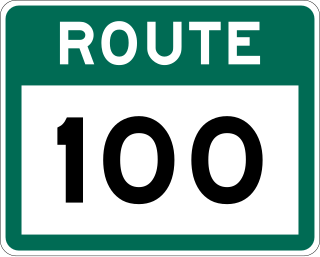
Route 100 is a major highway in Newfoundland and Labrador. The highway begins at its northern terminus at the Trans-Canada Highway in the town of Whitbourne, runs for 108 kilometres (67 mi) until it ends at its southern terminus, the town of Branch, where it transitions into Route 92. Motorists can drive along the coast of Placentia Bay and eventually the Atlantic Ocean once traveling south of Point Verde.
This page is based on this Wikipedia article Text is available under the CC BY-SA 4.0 license; additional terms may apply. Images, videos and audio are available under their respective licenses.