Appleton is a town in the northeastern part of Newfoundland in the province of Newfoundland and Labrador, Canada.
Port Kirwan is a small incorporated fishing community located on the southern shore of the Avalon Peninsula, Newfoundland, Canada.
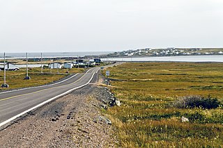
Terra Nova is a town located southwest of Glovertown on the island of Newfoundland. It was served by the Canadian National Railway in the 1950s. The population in 2006 was 68, this from a historic low of just 28 in 1996. By 2016, the population had risen to 73, down slightly from the total of 83 recorded in 2011. There is a sizable leisure and summer population here seasonally as well as the stable permanent population.
Triton is a town that lies on Triton Island just off the coast of northeastern Newfoundland, in the Canadian province of Newfoundland and Labrador. Triton is the economic center of Green Bay South. According to Statistics Canada, Triton's population fell from 983 in 2016 to 896 in 2021.
Baine Harbour is a Canadian community in the province of Newfoundland and Labrador northeast of Marystown.
St. Bride's is a town on the Cape Shore of Newfoundland, Canada. Located 166 km Southwest of the capital of Newfoundland and Labrador, St. John's, St. Bride's is a fishing community with a population of approximately 318 people as of 2021. The largest codfish ever caught, weighing in at 125 lbs, was landed here in 1905.
Colinet is an incorporated town located on the northwest arm of St. Mary's Bay in Newfoundland and Labrador, Canada.

Point May is the most southerly community on the Burin Peninsula in Newfoundland and Labrador with a population of 254 in 2021. It is a Catholic community with a church, town hall, fire hall, softball and soccer field. It is known for its close proximity, 19 km (12 mi), to the French islands of St. Pierre and Miquelon, where the smuggling of liquor and tobacco has been a way of life since before Canada was a country. The tiny Canadian Green Island lies 10 km (6 mi) west of Point May, roughly halfway to St. Pierre.

Small Point-Adam's Cove-Blackhead-Broad Cove is a town in the Canadian province of Newfoundland and Labrador, located in the Trinity-Conception Bay District north of Carbonear.

Hare Bay is a Canadian town on Newfoundland's Route 320 in the province of Newfoundland and Labrador. It is in Division No. 7 on Bonavista Bay.
Noggin Cove is a local service district and designated place in the Canadian province of Newfoundland and Labrador. It is west of Carmanville on the south side of Hamilton Sound. It is said to be named after Noggin Island, about 5 km off its eastern point.
Cottlesville is a rural community just outside Summerford on New World Island, Newfoundland and Labrador.

Comfort Cove-Newstead is a small fishing community located outside Campbellton, on the east coast of Newfoundland and Labrador, Canada,.
Lamaline is a town in the Canadian province of Newfoundland and Labrador. The town had a population of 480 in 1940, 643 in 1956 and 218 in the Canada 2021 Census. Lamaline was a small place with 10 families in 1864. The Way Office was established in 1863 and the first Waymaster was James Pittman.
Little Bay East is a town in the Canadian province of Newfoundland and Labrador. The town had a population of 84 in the Canada 2021 Census.
Miles Cove is a town on Sunday Cove Island in the Canadian province of Newfoundland and Labrador. The town had a population of 104 in 2016, down from 140 in the Canada 2006 Census.
Morrisville is a town in the Canadian province of Newfoundland and Labrador. The town had a population of 93 in the Canada 2021 Census. Morrisville is located in the Bay d'Espoir region and is 169 km from Grand Falls-Windsor.
Mount Carmel-Mitchells Brook-St. Catherines is a town in the Canadian province of Newfoundland and Labrador. The town had a population of 382 in the Canada 2021 Census.
Lower Lance Cove is a local service district and designated place in the Canadian province of Newfoundland and Labrador.
Main Point-Davidsville is a local service district and designated place in the Canadian province of Newfoundland and Labrador. It consists of the communities of Main Point and Davidsville.


