
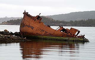
Dildo is a local service district and designated place in the Canadian province of Newfoundland and Labrador on the island of Newfoundland. It is located on the southeastern Dildo Arm of Trinity Bay about 100 kilometres (62 mi) west of St. John's. South Dildo is a community located to the south, and in 2021 had 195 residents. It is known for its unusual name.
Division No. 1, Subdivision O is an unorganized subdivision on the Avalon Peninsula in Newfoundland and Labrador, Canada, in Division 1. It's divided into two parts, the northern portion touches Conception Bay. It includes the unincorporated communities of Marysvale and Salmonier Line.
Conception Harbour is a town on the Avalon Peninsula in Newfoundland and Labrador, Canada. It is in Division 1 on Conception Bay and can be accessed via Newfoundland and Labrador Route 60.
Division No. 1, Subdivision A is an unorganized subdivision on the Avalon Peninsula in Newfoundland and Labrador, Canada. It is in Division No. 1, and lies between Trinity Bay and Placentia Bay.
Sunnyside is a town on the Avalon Peninsula in Newfoundland and Labrador, Canada. It is in Division 1 on Bull Arm.
Upper Island Cove, Newfoundland and Labrador is a town in Newfoundland and Labrador. It is located in Division 1, Newfoundland and Labrador census division. It is north east of Bay Roberts. The Way office was established in 1864. The population was 942 in 1940; 1,346 in 1951, 1,563 in 1956, and 1762 in 1966. As of 2021, the population is 1,401.
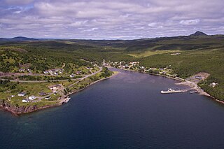
Happy Adventure is an outport village on the Eastport Peninsula in the Canadian province of Newfoundland and Labrador. As of 2021, the population was 118.
Victoria is an incorporated town in Conception Bay located approximately midway on the Bay de Verde Peninsula of Newfoundland and Labrador, Canada.
Virgin Arm–Carter's Cove is a local service district and designated place on New World Island in the Canadian province of Newfoundland and Labrador. Virgin Arm-Carter's Cove is located approximately 90 km Northwest of Gander in Subdivision H of Division No. 8.
Garden Cove is a local service district and designated place in the Canadian province of Newfoundland and Labrador. It is southeast of Swift Current. The residents of Sound Island moved without government assistance during a period around 1953. They moved to the mainland into Garden Cove and surrounding communities. Today Garden Cove has an active close community. There is a tour boat, Merasheen which is part of the Woody Island Resort hotel which gives people a Newfoundland outport experience. Garden Cove has hiking trails passing by Big Rock Hill and Placentiamans Point. There is an inshore fishery operating there. Some species caught are lobster, cod, mackerel, herring, crab, scallops, mussels, flounder and trout. Late in summer Tuna chase bill fish just off shore.
The Bonavista Peninsula is a large peninsula on the east coast of the island of Newfoundland in the Canadian province of Newfoundland and Labrador. It consists of 50 incorporated towns/unincorporated communities which have a population of 12,176 as of the 2016 Canadian Census. Bonavista is the largest population centre on the peninsula.
Admirals Beach is a rural community located in Newfoundland and Labrador, Canada.

Humber Arm South is a town in the Canadian province of Newfoundland and Labrador. The town consists of the communities of Halfway Point, Benoit's Cove, John's Beach, and Frenchman's Cove. The town had a population of 1,537 in the Canada 2021 Census. The Town's Post Office is located in Benoit's Cove. Humber Arm South is located in the Bay of Islands and is in the Humber-Bay of Islands electoral district. The town's residents are of Mi'kmaw, Innu, and European descent.
Winterton is a town in the Canadian province of Newfoundland and Labrador. It was originally named Sille Cove or Scilly Cove. In 1912 the town was named Winterton for Sir James Spearman Winter, former Prime Minister of Newfoundland.
Beau Bois is a local service district and designated place in the Canadian province of Newfoundland and Labrador near Burin. It is 40 miles (64 km) from Placentia and 190 miles (310 km) from St. John's. The existence of Beau Bois can be documented at least as early as 1841 and probably existed for decades before. In 1844 widow Ann Farrell petitioned the Supreme Court of Newfoundland for redress of damages done to her by William Ryan and James Shock who went to her meadow at nearby Moorings Cove, Mortier Bay and stole her hay. She had been widowed in 1841 when her husband and sons drowned on a trip getting winter supplies from St. John's. Her cattle, hay, gardens and meadowland were her sole means of support. It is now a suburb of Marystown.
Cavendish is a local service district and designated place in the Canadian province of Newfoundland and Labrador.
Patrick's Cove-Angels Cove is a local service district and designated place in the Canadian province of Newfoundland and Labrador. It is on the Cape Shore of the Avalon Peninsula. The area was first settled by James Coffey in the early 19th century. Coffey had moved to Newfoundland from County Waterford, Ireland to work at Placentia's Saunders and Sweetman firm. Sweetman's firm had sent some of their employees outward from Placentia to start farms in which to supply Sweetman's with produce. Coffey became the first resident of this community.

Division No. 1, Subdivision G is an unorganized subdivision on the Avalon Peninsula in Newfoundland and Labrador, Canada. It is in Division 1 and contains the unincorporated communities of Baccalieu Island, Besom Cove, Bradley's Cove, Burnt Point, Caplin Cove, Daniel's Cove, Grates Cove, Gull Island, Job's Cove, Kingston, Long Beach, Lower Island Cove, Low Point, Northern Bay, Ochre Pit Cove, Red Head Cove, Riverhead, Smooth Cove and Western Bay.
Division No. 1, Subdivision H is an unorganized subdivision on the Avalon Peninsula in Newfoundland and Labrador, Canada. It is in Division 1 and contains the unincorporated communities of Clowns Cove, Flatrock, Freshwater, Halfway House, Perry's Cove and Spout Cove.
Division No. 1, Subdivision L is an unorganized subdivision on the Avalon Peninsula in Newfoundland and Labrador, Canada. It is in Division 1 and contains the unincorporated communities of Bareneed, Black Duck Pond, Blow Me Down, Coley's Point South, Hibb's Cove, Pick Eyes, Port de Grave, Ship Cove and The Dock
