Division No. 1, Subdivision G is an unorganized subdivision on the Avalon Peninsula in Newfoundland and Labrador, Canada. It is in Division 1 and contains the unincorporated communities of Baccalieu Island, Besom Cove, Bradley's Cove, Burnt Point, Caplin Cove, Daniel's Cove, Grates Cove, Gull Island, Job's Cove, Kingston, Long Beach, Lower Island Cove, Low Point, Northern Bay, Ochre Pit Cove, Red Head Cove, Riverhead, Smooth Cove and Western Bay.
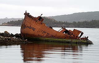
1871: BRADLEY'S COVE - A fishing settlement on the north shore of Conception Bay, district of Bay de Verds. Distant from Carbonear by road 16 miles. Mail weekly. Population 135. During the 1950s families began moving out of Bradley's Cove to nearby Western Bay, Adam's Cove and area mainly due to the lack of electricity and telephone. There are still house foundations and several root cellars intact, however is now an area where only sheep and cattle graze during the summer.[1]
Daniel's Cove lies in two small valleys treed with two rivers running through it, and it is probable that it was settled about the same time as Old and New Perlican in the late 18th century.
The economic base for this community was the small-boat inshore cod fishery, but serves as a summer home community for a number of family descendants of the community.
1810 – According to tradition, a Patrick Howard settles at Daniel's Cove.
1836 – Census reports twenty-seven inhabitants, all Roman Catholic, in three houses.
1857 – The small-boat inshore fishery numbered 36, with two Irish-born residents.
1864 – Hutchinson's Newfoundland Dictionary (1864–1865) lists six planters in the community.
1897 - Post Office was established and John Howard was the Postmaster.
1921 - Born - Expedite Joseph Howard, son of Lawrence Howard and Margaret Howard (Kehoe) - (Served with the Newfoundland Rangers/Royal Canadian Mounted Police/Newfoundland & Labrador Government) - died April 17, 2011.
1925 – Rev. Father Jeremiah Howard ordained.
1931 – Fr. Howard, with money from his father's estate, financed the construction of a one-room school which is still standing.
School house - Constructed somewhere between 1925 and 1928. The school house still stands as of 2009 - converted to a summer home in the 1970s
The community of Job's Cove for the most part is on gently sloping area much higher than the coast where the wharf and fishing boats are kept. The Droke, a very steep ravine (a valley from the road to the beach) is one of the outstanding geological features in this community.
Ray Johnson, a singer/songwriter, is from Job's Cove
Kingston
47°49′N53°07′W / 47.817°N 53.117°W / 47.817; -53.117Kingston was established as Upper Small Point c. 1793 and its earliest permanent settlers were John Conroy King, Michael Hurley and Timothy O'Leary. The name was changed to Kingston in 1918. It had a population of 129 in 1940 and 158 in 1956.
Legend says that a treasure was buried by the pirates at Flambro Head.
Lower Island Cove was once a thriving economic centre. Located on the northern entrance to Conception Bay, it once boasted three cod liver factories. And, before 1992, it had a thriving local fish plant. Photos at the Flambro Head Museum and Cafe attest to so many fish flakes at the turn of 1900 that hardly a spot of green grass was found in the settlement.
1600s – European migratory fishermen visit the area.
1796 – The community is first referred to as Lower Island Cove instead of just Island Cove to differentiate it from Upper Island Cove near Bay Roberts.
1836 – The population is 551.
1944 – Salvation Army establishes itself in the community.
1990 – The community's boundaries are extended about 3km along the highway from Redlands to Flambro Head.
Three local attractions are the Flambro Head Museum and Cafe, the Lower Island Cove Regatta and the Old Methodist Church Cemetery.
Operated by the Flambo Head Heritage Society, the Museum hosts a 1/2km walking trail, a coffee shop, a playground complete with picnic tables. The original building housed the "Lower Island Cove" telephone exchange. Today with help from Government, the site the Museum displays local artifacts, photos donated by residents, including "tools and implements depicting the early lifestyles of our area".[2]
The annual Lower Island Cove Regatta once competed for calendar dates with the Royal St. John's regatta. In the 1970s, the LIC Regatta faded away. However, in the 1980s, the Association for Youth and Leisure (AYLA) revived the regatta, which is now held during the second weekend of August. In 2008 the regatta at Lower Island Cove stopped due to no people to row. The AYLA now holds a "Fun Day", which consists of Games Of Chance Food and family fun, something similar to the Regatta but without the boat races.[3]
In the Old Methodist Church Cemetery, a memorial stands to local 13 men who drowned on the schooner "Six Brothers", which left Lower Island Cove for Trinity Bay on May 25, 1883, never to return. The memorial is a reminder of the large number of men along the shore who have lost their lives to the sea.[3]
In 2006, a Christmas tree farm was established. Since the closure of the Cod Fishery in 1992, while there has been some fish plant employment, there remains very little industry. Subsequently, the farm started out with 600 Fraser and Balsam Fir seedlings (9"-12" 2006) from Quebec, where the industry is quite lucrative. Nonetheless, the provincial government's Wooddale Tree Nursery, in Grand Falls, Newfoundland, began growing Fraser, Balsam and Bracken fir to provide future stock. Yearly, a large quantity of Christmas trees are imported to Newfoundland from nearby Nova Scotia. Christmas tree farming, therefore, marks a new industry for the province of Newfoundland and Labrador, as well as hope for the settlement.
Aubrey and Elizabeth Crowley Property, Ochre Pit Cove
Ochre Pit Cove is located in Conception Bay in the Bay de Verde area.
The community derives its name from the red colour of its soil which is caused by its high iron content.
The area was originally inhabited by the Beothuk tribe.
The Beothuks of Ochre Pit Cove had an annual ochring ceremony. Once a year all members of the tribe received a new application of red ochre on the face and body.
The Post office was located in Carbonear around 1864. The first Waymaster in 1882 was Josiah Garlkand. In 1891 the first Postmistress was Bridget Perfect on May 30, 1891. It had a population of 158 in 1956.
The wharf at Ochre Pit Cove has some of the best anchoring facilities in the Conception Bay area. Because ships that were berthed at the harbour were exposed to wave agitation during storm conditions, the breakwater was extended in 2009.
The settlement is mostly Roman Catholic. During the 1900s many of the nearby communities were increasing their involvement in the Labrador fishery, however, Red Head Cove remained primarily an inshore fishing community.
In 1954, brothers Morris Quinlan and Patrick Quinlan bought the business of James F. O'Neill of Bay de Verde and established Quinlan Brothers Limited. In due course, they built a relatively small ‘fish plant’ on the waterfront at Foreside. Even though fish had been caught and sold in a variety of ways since early settlement, this was the first fresh codfish processing operation in Bay de Verde. By the early 1960s, the salt cod industry had virtually come to an end and consequently, the ‘fish plant’ became the mainstay of the fishery in Bay de Verde. In time, along with cod, many other species were processed. After the cod moratorium of 1992 Quinlan Bros. turned their attention to the processing of snow crab and shrimp. With their base of operation in Bay de Verde, they are now one of the largest producers of these products in Newfoundland and Labrador. Many residents of Red Head Cove obtained employment at this fish plant or on the long-liner fleet at that port.
1817 – Local tradition has it that this year saw the arrival of the first year-round settler, Richard Hatch (or Hutch), who had visited the cove from Trinity in the past. Family names of other early settlers who probably used the Cove as a summer station before settlement include: Hyde, Quinlan and Rice.
1836 – Census reports two families at Red Head Cove with a total population of 14. These are the families of Hatch and Patrick Rice, who live on both sides of the Main River.
1845 – The population increases to 48.
1872 – A road is established between Red Head Cove, Bay de Verde and Old Perlican.
1874 – The population increases to 89. Three of these were born in Ireland.
1901 – The population is 174.
1935 – The population is 240.
1956 - The population is 195.
1980's – The inshore fishery is still the largest employer in Red Head Cove, but some residents leave as a result of the declining fish and crab stocks.
1992 – Most of the services are provided to Red Head Cove by the larger surrounding communities, including Old Perlican Cottage Hospital and a central high school located at Bay de Verde
Western Bay is a town in Conception Bay, about 13 miles north of Carbonear. It was originally a farming and fishing settlement and was established as a Postal town in 1864. It had a population of 965 in 1901 and 508 in 1956.
Conception Harbour is a town on the Avalon Peninsula in Newfoundland and Labrador, Canada. It is in Division 1 on Conception Bay and can be accessed via Newfoundland and Labrador Route 60.
Cuper's Cove, on the southwest shore of Conception Bay on Newfoundland's Avalon Peninsula was an early English settlement in the New World, and the third one after Harbour Grace, Newfoundland (1583) and Jamestown, Virginia (1607) to endure for longer than a year. It was established in 1610 by John Guy on behalf of Bristol's Society of Merchant Venturers, who had been given a charter by King James I of England to establish a colony on the island of Newfoundland. Most of the settlers left in the 1620s, but apparently a few stayed on and the site was continuously inhabited.
Division 1, Newfoundland and Labrador is a census division covering the entire Avalon Peninsula including the Isthmus of Avalon of the Canadian province of Newfoundland and Labrador. Like all census divisions in Newfoundland and Labrador, but unlike the census divisions of some other provinces, the division exists only as a statistical division for census data, and is not a political entity.
Avalon is a federal electoral district on Newfoundland Island in Newfoundland and Labrador, Canada. It has been represented in the House of Commons of Canada since 2004.
Carbonear-Trinity-Bay de Verde is a provincial electoral district of the House of Assembly of Newfoundland and Labrador, Canada. The district covers the eastern edge of Trinity Bay and the tip of Conception Bay. As of 2011, there are 6,968 eligible voters living within the district.
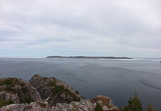
Baccalieu Island or Bacalhoo Island is a 5 km2 uninhabited island at the northern extremities of Conception Bay in Subdivision 1G, near the community of Red Head Cove, Newfoundland and Labrador, Canada. It is separated from the island of Newfoundland by Baccalieu Tickle, a small strait and an abundant fishing ground. The island has some trees but is mostly rocky.
Conception Bay (CB) is a bay on the southeast coast of Newfoundland, Canada.
Grates Cove is a local service district and designated place in the Canadian province of Newfoundland and Labrador. It is the most northerly community on the Avalon Peninsula, located on the tip of the Bay de Verde Peninsula on the island of Newfoundland. Called "the Grates" by John Guy as early as 1612, the origin of the name is unknown.
Caplin Cove is a small community on the north shore of Conception Bay, Newfoundland and Labrador, Canada. It is surrounded on the north by Low Point near the end of the Bay de Verde Peninsula, and on the south by Lower Island Cove. Caplin Cove was probably named for the large body of capelin in its waters.
New Chelsea-New Melbourne-Brownsdale-Sibley's Cove-Lead Cove is a local service district and designated place in the Canadian province of Newfoundland and Labrador.
The Bay de Verde Peninsula is the largest peninsula that makes up part of the Avalon Peninsula, of the province of Newfoundland and Labrador, Canada. The peninsula separates both Trinity and Conception Bay.
Hant's Harbour is an incorporated town located on the east side of Trinity Bay on the Bay de Verde Peninsula in the province of Newfoundland and Labrador, Canada. It has a population of 318 according to the 2021 Canadian census.
Victoria is a landlocked town on the Avalon Peninsula in Newfoundland and Labrador, Canada, located approximately midway on the Bay de Verde Peninsula portion of the Avalon Peninsula.
Trinity Bay is a large bay on the northeastern coast of Newfoundland in the Canadian province of Newfoundland and Labrador. The Bay along with Placentia Bay to the southwest define the isthmus of Avalon from which the Avalon Peninsula lies to the east of the main landmass of Newfoundland Island. The maximum depth of the bay is about 580 metres (1,900 ft).
Northern Bay is a small community on the northern tip of Conception Bay on the Bay de Verde Peninsula, Subdivision 1G, Newfoundland and Labrador, Canada.
Gooseberry Cove is a settlement in the Trinity Bay area of Newfoundland located on an area of land known as the Southwest Arm, which extends off the Trans Canada Highway on Route 204. It is neighbored by the communities of Butter Cove and Southport.
Bay de Verde is an incorporated town in Conception Bay on the northern tip of the Bay de Verde Peninsula of Newfoundland and Labrador, Canada. The first recorded inhabitants at Bay de Verde arrived in 1662. Bay de Verde became an incorporated town in 1950.
New Perlican is a town in the Canadian province of Newfoundland and Labrador. The town had a population of 200 in the Canada 2021 Census.
Division No. 1, Subdivision L is an unorganized subdivision on the Avalon Peninsula in Newfoundland and Labrador, Canada. It is in Division 1 and contains the unincorporated communities of Bareneed, Black Duck Pond, Blow Me Down, Coley's Point South, Hibb's Cove, Pick Eyes, Port de Grave, Ship Cove and The Dock
Route 70, also known as Roaches Line and Conception Bay Highway, is a 109-kilometre-long (68 mi) north-south highway on the Avalon Peninsula of Newfoundland. The highway also carries the designation of Baccalieu Trail for its entire length.
This page is based on this Wikipedia article Text is available under the CC BY-SA 4.0 license; additional terms may apply. Images, videos and audio are available under their respective licenses.