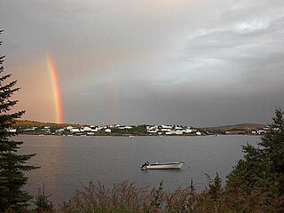
Bonavista is a town on the Bonavista Peninsula, Newfoundland in the Canadian province of Newfoundland and Labrador. Unlike many Newfoundland coastal settlements, Bonavista was built on an open plain, not in a steep cove, and thus had room to expand to its current area of 31.5 km2 (12.2 sq mi). Bonavista is located approximately 300km from the provincial capital of St. John's.

Ferryland is a town in Newfoundland and Labrador on the Avalon Peninsula. According to the 2016 Statistics Canada census, its population is 414.

St. Anthony is a town on the northern reaches of the Great Northern Peninsula of the Canadian province of Newfoundland and Labrador. St. Anthony serves as a main service centre for northern Newfoundland and southern Labrador. St. Anthony had a population of 2,180 in 2021, compared with 2,258 in 2016, 2,418 in 2011, 2,476 in 2006 and 2,730 in 2001.
Cape Ray is a local service district and designated place in the Canadian province of Newfoundland and Labrador. It is on the southwest coast of the island of Newfoundland.

St. George's is a Canadian community in the St. George's Bay on the southwest coast of Newfoundland of the province of Newfoundland and Labrador.
St. Bride's is a small town on the Cape Shore of Newfoundland, Canada. Located 166 km Southwest of the capital of Newfoundland and Labrador, St. John's, St. Bride's is a fishing community with a population of approximately 252 persons as of 2016. The largest codfish ever caught, weighing in at 125 lbs, was landed here in 1905.

The Town of Branch is an incorporated community on the Cape Shore of Newfoundland and Labrador, Canada and had a population of 177.

The Town of Cape Broyle is an incorporated community located on the Avalon Peninsula in Newfoundland and Labrador, Canada. During King William's War, the village was destroyed in the Avalon Peninsula Campaign.

Bay Bulls is a small fishing town in the province of Newfoundland and Labrador, Canada.

Burnt Islands is a small coastal community found in God Bay on the southwest coast of Newfoundland, Canada.
Cape St. George is a headland and community of the same name, located at the southwestern tip of the Port au Port Peninsula on the Canadian island of Newfoundland.
Embree is a small community just outside Lewisporte. It is a drive-through town that eventually leads into neighbouring Little Burnt Bay.

Logy Bay-Middle Cove-Outer Cove is a town in the Canadian province of Newfoundland and Labrador. It is located about a 10 minutes' drive from downtown St. John's and adjacent to the Town of Torbay on the eastern tip of the Avalon Peninsula.

Mary's Harbour is a town in the Canadian province of Newfoundland and Labrador. The town had a population of 312 in the Canada 2021 Census, down from 341 in the Canada 2016 Census. It is serviced by Mary's Harbour Airport.
Portugal Cove South is a small fishing town on the southern shore of the Avalon Peninsula of Newfoundland in the province of Newfoundland and Labrador, Canada. Portugal Cove South had a population of 225 in the Canada 2006 Census, down to 160 in Canada 2011 Census and 150 in Canada 2016 Census.
Milltown–Head of Bay d'Espoir is a town in the Canadian province of Newfoundland and Labrador. The town had a population of 669 in the Canada 2021 Census.
Mainland is a local service district and designated place in the Canadian province of Newfoundland and Labrador. It is on the western shore of the Port au Port Peninsula approximately 50 kilometres (31 mi) from the Stephenville International Airport. Mainland is a coastal community, bordered by both the ocean and forest. The main industry in the community has traditionally been fishing, but currently (2016) a large portion of the inhabitants leave the community seasonally to earn income.
Route 437, also known as Cape Onion Road, is a 22.1-kilometre-long (13.7 mi) north-south highway on the northern edge of the Great Northern Peninsula of Newfoundland in the Canadian province of Newfoundland and Labrador. It connects the communities of Cape Onion-Ship Cove and Raleigh, along with Pistolet Bay Provincial Park, with Route 436 and St. Anthony.
Wild Cove is a local service district and designated place in the Canadian province of Newfoundland and Labrador. It is on the Baie Verte Peninsula of the island of Newfoundland.
Burnt Cove, St. Michael's, Bauline South is a local service district and designated place in the Canadian province of Newfoundland and Labrador.


