List of islands of Newfoundland and Labrador

Last updated

Bell Island Bell Island Newfoundland.jpg
Bell Island
Village on Fogo Island Carlb-fogo-newfoundland-2002.jpg
Village on Fogo Island
Keats Island Keats Island 2007.JPG
Keats Island
Dock on Little Bay Islands Little Bay Islands Dock.jpg
Dock on Little Bay Islands
Coast of Paul's Island Paul Island from onboard the Northern Ranger.jpg
Coast of Paul's Island
Twillingate Twillingate.jpg
Twillingate

The Canadian province of Newfoundland and Labrador is composed of mainland Labrador and the large island of Newfoundland. The coast of both the island and the Labrador Peninsula are lined with islands of various magnitudes.

Contents

List

NameWater bodyArea km²LocationRemarks
Allan's Island Atlantic Ocean 46°51′2.8″N55°48′9.7″W / 46.850778°N 55.802694°W / 46.850778; -55.802694 Part of the town of Lamaline
Baccalieu Conception Bay 5 48°07′49″N52°48′05″W / 48.13028°N 52.80139°W / 48.13028; -52.80139 (Baccalieu Island) Uninhabited
Balcalhoa Notre Dame Bay 2.2 49°41′37″N54°32′47″W / 49.69369°N 54.54646°W / 49.69369; -54.54646 (Balcalhoa Island) Lighthouse
Bell Conception Bay34 47°39′N52°56′W / 47.650°N 52.933°W / 47.650; -52.933 (Bell Island) Includes town of Wabana
Bell Atlantic Ocean88 50°44′N55°34′W / 50.733°N 55.567°W / 50.733; -55.567 (Bell Island) One of the Grey Islands
Belle Isle Strait of Belle Isle 52 51°55′44″N55°21′33″W / 51.92889°N 55.35917°W / 51.92889; -55.35917 (Belle Isle) Uninhabited
Brunette Fortune Bay 20 47°16′47″N55°54′02″W / 47.27972°N 55.90056°W / 47.27972; -55.90056 (Brunette Island) Uninhabited
Bull, Cow and Calf Atlantic Ocean 46°46′33″N54°05′56″W / 46.77583°N 54.09889°W / 46.77583; -54.09889 (Bull, Cow and Calf) Avalon Peninsula island cluster
Carbonear Conception Bay0.3 47°44′15″N53°10′01″W / 47.73750°N 53.16694°W / 47.73750; -53.16694 (Carbonear Island) Uninhabited
Change Notre Dame Bay24.4 49°40′19″N54°24′28″W / 49.67194°N 54.40790°W / 49.67194; -54.40790 (Change Islands) Consists of South and North Island
Cod Labrador Sea 132.71 57°47′00″N61°46′56″W / 57.783455°N 61.782345°W / 57.783455; -61.782345 (Cod Island) Uninhabited
Dildo Trinity Bay 0.9 47°33′59″N53°35′27″W / 47.56639°N 53.59083°W / 47.56639; -53.59083 (Dildo Island)
Fogo Notre Dame Bay254 49°40′N54°10′W / 49.667°N 54.167°W / 49.667; -54.167 (Fogo Island) Population in 2006: 2,706
Funk Labrador Sea 0.024 49°45′07″N53°11′32″W / 49.75194°N 53.19222°W / 49.75194; -53.19222 (Funk Island)
Gannet Labrador Sea2 53°56′02″N56°30′18″W / 53.934°N 56.505°W / 53.934; -56.505 (Gannet Islands) Ecological reserve
Glover Grand Lake 190 48°47′49″N57°39′29″W / 48.79694°N 57.65806°W / 48.79694; -57.65806 (Glover Island) 18th-largest lake island in the world by area
Granby White Bay 0.5 52°34′18″N55°46′04″W / 52.5716406°N 55.7677249°W / 52.5716406; -55.7677249 (Granby Island) Uninhabited
Green (Catalina) Atlantic Ocean0.6 48°30′17″N53°02′46″W / 48.5047°N 53.0460°W / 48.5047; -53.0460 (Green Island) East of Bonavista Peninsula
Green (Fortune) Fortune Bay0.3 46°53′N56°05′W / 46.883°N 56.083°W / 46.883; -56.083 (Green Island) West of Burin Peninsula
Grey Atlantic Ocean88 50°50′N55°35′W / 50.833°N 55.583°W / 50.833; -55.583 (Grey Islands) Consists of Bell and Groais Islands
Groais Atlantic Ocean41 50°56′N55°36′W / 50.933°N 55.600°W / 50.933; -55.600 (Groais Island) One of the Grey Islands
Hawke Island Labrador Sea56 53°03′N55°50′W / 53.05°N 55.83°W / 53.05; -55.83 (Hawke Island) Former whaling station
Home Labrador Sea12 60°10′28″N64°16′16″W / 60.17444°N 64.27111°W / 60.17444; -64.27111 (Home Island)
Horse Atlantic Ocean25 50°12′37″N55°44′58″W / 50.21028°N 55.74944°W / 50.21028; -55.74944 (Horse Islands) North of Baie Verte Peninsula
Horse Chops Labrador Sea5.9 53°52′N57°02′W / 53.86°N 57.04°W / 53.86; -57.04 (Horse Chops Islands)
Hunt's Island south west coast 47°35′58″N57°36′41″W / 47.5994445°N 57.6113889°W / 47.5994445; -57.6113889 (Hunt's Island) Uninhabited
Island of Ponds Labrador Sea91 53°28′N55°53′W / 53.46°N 55.89°W / 53.46; -55.89 (Island of Ponds) Includes settlement of Black Tickle
Keats Bonavista Bay 0.7 48°39′10″N53°38′50″W / 48.65278°N 53.64722°W / 48.65278; -53.64722 (Keats Island) Uninhabited
Kelly's Conception Bay1.9 47°32′39″N53°00′41″W / 47.54417°N 53.01139°W / 47.54417; -53.01139 (Kelly's Island) Uninhabited
Killiniq Ungava Bay 24 60°22′N64°37′W / 60.367°N 64.617°W / 60.367; -64.617 (Killiniq Island) land border between Nunavut and Newfoundland (Newfoundland side)
Landsat Labrador Sea0.001 60°10′37″N64°02′30″W / 60.17694°N 64.04167°W / 60.17694; -64.04167 (Landsat Island)   [1] Discovered using Landsat 1 satellite imagery; forms easternmost part of Canada; [1] uninhabited
Little Bay Notre Dame Bay7.1 49°38′41″N55°47′55″W / 49.64477°N 55.79853°W / 49.64477; -55.79853 (Little Bay Islands)
Long Island Hermitage Bay 100 47°38′45″N55°58′54″W / 47.64583°N 55.98167°W / 47.64583; -55.98167 (Long Island) Includes town of Gaultois. Population in 2021: 100
Merasheen Placentia Bay 47°30′N54°15′W / 47.5°N 54.25°W / 47.5; -54.25 (Merasheen Island)
Millers White Bay 0.1 49°33′32″N56°51′11″W / 49.558875°N 56.853083°W / 49.558875; -56.853083 (Millers Island) Uninhabited
New World Notre Dame Bay 49°34′34″N56°51′42″E / 49.57614°N 56.8617406°E / 49.57614; 56.8617406 (New World Island) Includes the towns of Newville, Carter's Cove and Pike's Arm
Newfoundland Atlantic Ocean111,390 49°N56°W / 49°N 56°W / 49; -56 (Newfoundland) Most populous part of Newfoundland and Labrador
Newfoundland Labrador Sea 53°51′N56°56′W / 53.85°N 56.94°W / 53.85; -56.94 (Newfoundland Island) A small island near Sandwich Bay
North Star Labrador Sea1 60°22′02″N64°24′13″W / 60.36722°N 64.40361°W / 60.36722; -64.40361 (North Star Island) The province's northernmost island, off the Labrador coast
Nunaksaluk Island Labrador Sea 55°48′N60°18′W / 55.8°N 60.3°W / 55.8; -60.3 (North Star Island) Island off the Labrador coast
Oderin Placentia Bay1.7 47°17′36″N54°48′16″W / 47.29322°N 54.80444°W / 47.29322; -54.80444 (Oderin Island)
Old Perlican Trinity Bay 48°05′12″N53°01′18″W / 48.08667°N 53.02167°W / 48.08667; -53.02167 (Old Perlican Island)
Paul's Labrador Sea 56°31′N61°30′W / 56.517°N 61.500°W / 56.517; -61.500 (Paul's Island) Off the Labrador coast; source of the mineral labradorite
Pouch Bonavista Bay0.2 49°09′58″N53°28′29″W / 49.16601°N 53.47482°W / 49.16601; -53.47482 (Pouch Island)
Puffin Conception Bay 48°07′32.41″N52°48′43.35″W / 48.1256694°N 52.8120417°W / 48.1256694; -52.8120417 (Puffin Island)
Quirpon Strait of Belle Isle9.5 51°36′N55°26′W / 51.60°N 55.43°W / 51.60; -55.43 (Quirpon Island) Off the Great Northern Peninsula
Random Trinity Bay255 48°7′N53°44′W / 48.117°N 53.733°W / 48.117; -53.733 (Random Island) Surrounded by the Bonavista Peninsula
Sandy Point St. George's Bay 3 48°27′N58°29′W / 48.450°N 58.483°W / 48.450; -58.483 (Sandy Point)
Silver Fox Bonavista Bay2 49°01′06″N53°41′02″W / 49.01842°N 53.68388°W / 49.01842; -53.68388 (Silver Fox Island)
South Aulatsivik Atlantic Ocean 56°45′51″N61°30′59″W / 56.76417°N 61.51639°W / 56.76417; -61.51639 (South Aulatsivik Island)
South Wolf Labrador Sea 53°40′N55°55′W / 53.667°N 55.917°W / 53.667; -55.917 (South Wolf Island) Uninhabited
Spotted Labrador Sea 53°31′N55°47′W / 53.51°N 55.78°W / 53.51; -55.78 (Spotted Island) Former Pinetree Line site
Stony Labrador Sea 52°59′N55°49′W / 52.99°N 55.81°W / 52.99; -55.81 (Stony Islands)
Square Labrador Sea 52°44′01″N55°50′14″W / 52.73352°N 55.83715°W / 52.73352; -55.83715 (Square Islands) By White Bear Arm off the Labrador coast
Swain's Bonavista Bay 49°08′21″N53°32′45″W / 49.13929°N 53.54579°W / 49.13929; -53.54579 (Swain's Island) Group of eight islands
Trump Islands (Newfoundland and Labrador) Notre Dame Bay 49°34′30″N54°46′09″W / 49.57500°N 54.76917°W / 49.57500; -54.76917 Uninhabited
Twillingate Notre Dame Bay 49°39′N54°45′W / 49.650°N 54.750°W / 49.650; -54.750 (Twillingate) From the French name, Toulinquet
Venison Labrador Sea1 52°58′12″N55°46′30″W / 52.970°N 55.775°W / 52.970; -55.775 (Venison Island) Former wireless telegraph station
Wadham Atlantic Ocean 49°35′30″N53°45′49″W / 49.59178°N 53.76360°W / 49.59178; -53.76360 (Wadham Islands)
Woody Island Placentia Bay

Natural bays

See also

Related Research Articles

<span class="mw-page-title-main">Labrador</span> Mainland portion of Newfoundland and Labrador

Labrador is a geographic and cultural region within the Canadian province of Newfoundland and Labrador. It is the primarily continental portion of the province and constitutes 71% of the province's area but is home to only 6% of its population. It is separated from the island of Newfoundland by the Strait of Belle Isle. It is the largest and northernmost geographical region in the four Atlantic provinces.

<span class="mw-page-title-main">Gambo, Newfoundland and Labrador</span> Town in Newfoundland and Labrador, Canada

Gambo is a town and designated place in the Canadian province of Newfoundland and Labrador. Located in the northeastern portion of the island of Newfoundland on Freshwater Bay, it is in Division No. 7.

Red Bay is a fishing village in Labrador, notable as one of the most precious underwater archaeological sites in the Americas. Between 1530 and the early 17th century, it was a major Basque whaling area. Several whaling ships, both large galleons and small chalupas, sank there, and their discovery led to the designation of Red Bay in 2013 as a UNESCO World Heritage Site.

<span class="mw-page-title-main">Eastern Canada</span> Region of Canada

Eastern Canada is generally considered to be the region of Canada south of Hudson Bay/Hudson Strait and east of Manitoba, consisting of the following provinces : Newfoundland and Labrador, Nova Scotia, Prince Edward Island, New Brunswick, Quebec and Ontario.

Charlottetown is a town in Labrador with a population of 292 in the Canadian province of Newfoundland and Labrador. It was said to be founded by Benjamin Powell in 1950 and named for Charlottetown, Prince Edward Island: "I thought that maybe someday the place would be the capital of the bay, the same way Charlottetown is the capital of Prince Edward Island."

<span class="mw-page-title-main">Change Islands</span> Town in Newfoundland and Labrador, Canada

Change Islands is an outport community in the Canadian province of Newfoundland and Labrador.

Deep Bay is a designated place in the Canadian province of Newfoundland and Labrador.

Charlottetown, Bonavista Bay is a local service district and designated place in the Canadian province of Newfoundland and Labrador. It is on the island of Newfoundland within Terra Nova National Park.

<span class="mw-page-title-main">Humber Arm South</span> Town in Newfoundland and Labrador, Canada

Humber Arm South is a town in the Canadian province of Newfoundland and Labrador. The town consists of the communities of Halfway Point, Benoit's Cove, John's Beach, and Frenchman's Cove. The town had a population of 1,537 in the Canada 2021 Census. The Town's Post Office is located in Benoit's Cove. Humber Arm South is located in the Bay of Islands and is in the Humber-Bay of Islands electoral district. The town's residents are of Mi'kmaw, Innu, and European descent.

Great Brehat is a local service district and designated place in the Canadian province of Newfoundland and Labrador. It is on the Great Northern Peninsula of the island of Newfoundland, 10 km north of St. Anthony. As fishing has declined, the village has become a tourist attraction.

Flat Bay is a local service district and designated place in the Canadian province of Newfoundland and Labrador. It is a Mi'kmaq community in southwestern Newfoundland.

<span class="mw-page-title-main">Newfoundland (island)</span> Island portion of Newfoundland and Labrador, Canada

Newfoundland is a large island situated off the eastern coast of the North American mainland and the most populous part of the Canadian province of Newfoundland and Labrador. The island contains 29 percent of the province's land area. The island is separated from the Labrador Peninsula by the Strait of Belle Isle and from Cape Breton Island by the Cabot Strait. It blocks the mouth of the Saint Lawrence River, creating the Gulf of Saint Lawrence, the world's largest estuary. Newfoundland's nearest neighbour is the French overseas collectivity of Saint Pierre and Miquelon.

Bay St. George South is a local service district and designated place in the Canadian province of Newfoundland and Labrador on the south coast of Bay St. George, a large bay on the west coast of the island of Newfoundland. Bay St. George South consists nine communities, namely Heatherton, Robinsons, Cartyville, McKay's, Jeffrey's, St. David's, St. Fintan's, Lock Leven en Highlands.

<span class="mw-page-title-main">Fogo Island, Newfoundland and Labrador</span> Town in Newfoundland and Labrador, Canada

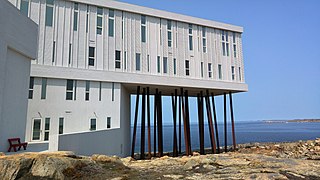
Fogo Island is a town located on Fogo Island, the largest of the offshore islands in the province of Newfoundland and Labrador, Canada.

<span class="mw-page-title-main">Division No. 1, Subdivision G, Newfoundland and Labrador</span> Unorganized territory in Newfoundland and Labrador, Canada

Division No. 1, Subdivision G is an unorganized subdivision on the Avalon Peninsula in Newfoundland and Labrador, Canada. It is in Division 1 and contains the unincorporated communities of Baccalieu Island, Besom Cove, Bradley's Cove, Burnt Point, Caplin Cove, Daniel's Cove, Grates Cove, Gull Island, Job's Cove, Kingston, Long Beach, Lower Island Cove, Low Point, Northern Bay, Ochre Pit Cove, Red Head Cove, Riverhead, Smooth Cove and Western Bay.

Wild Cove is a local service district and designated place in the Canadian province of Newfoundland and Labrador. It is on the Baie Verte Peninsula of the island of Newfoundland.

Burnt Point-Gull Island-Northern Bay is a local service district and designated place in the Canadian province of Newfoundland and Labrador.

Little Harbour (East) is a local service district and designated place in the Canadian province of Newfoundland and Labrador on the Placentia Bay of the island of Newfoundland.

North Harbour is a local service district and designated place in the Canadian province of Newfoundland and Labrador on St. Mary's Bay of the island of Newfoundland.

References

  1. 1 2 David H. Gray, "Discovering Rocks off Labrador: A Photo Essay", IBRU Boundary and Security Bulletin, Summer 2000.
Map all coordinates using: OpenStreetMap