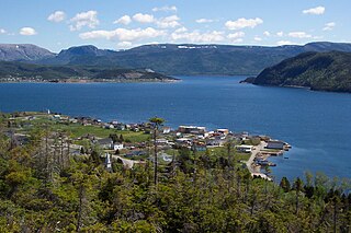
Deer Lake is a town in the western part of the island of Newfoundland in the province of Newfoundland and Labrador, Canada.
Division No. 8 is a census division on the north coast of the island of Newfoundland in the province of Newfoundland and Labrador, Canada. It has a land area of 9,314.57 km² and had a population of 33,940 at the 2016 census. Its largest communities are the towns of Lewisporte, Springdale, and Twillingate.
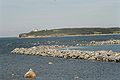
Hant's Harbour is an incorporated town located on the east side of Trinity Bay on the Bay de Verde Peninsula in the province of Newfoundland and Labrador, Canada. It has a population of 318 according to the 2021 Canadian census.

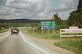
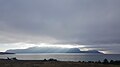
The Great Northern Peninsula is the largest and longest peninsula of Newfoundland, Canada, approximately 270 km long and 90 km wide at its widest point and encompassing an area of 17,483 km2. It is defined as that part of Newfoundland from Bonne Bay northwards around Cape Norman and Cape Bauld and thence southwards to the head of White Bay, bounded by the Gulf of St. Lawrence on the west, the Strait of Belle Isle on the north and the Labrador Sea and White Bay on the east.
Englee is a small fishing community on the east side of the Great Northern Peninsula in a sheltered harbour on the northern headland of Canada Bay, on the island of Newfoundland in the Canadian province of Newfoundland and Labrador.
Woody Point is a town located in the heart of Gros Morne National Park, on the western coast of Newfoundland. Situated on Bonne Bay, the Town of Woody Point encompasses three areas: Curzon Village, Woody Point and Winterhouse Brook. It has a total population of 244 residents. Woody Point is a Registered Heritage District and has a waterfront with many heritage buildings and four Registered Newfoundland and Labrador Heritage Structures. The community is served by Route 431.

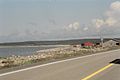
Trout River is a small rural fishing town located on the southern coastal edge of Gros Morne National Park in Newfoundland, near the Tablelands. Trout River was settled in 1815 by George Crocker and his family, who were its only inhabitants until 1880. The community is served by Route 431.
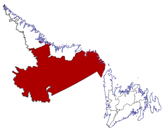
Census Division No. 10 of Newfoundland and Labrador is composed of the Labrador region of the province, excluding Nunatsiavut. It has a land area of 199,703 km² (77,105.8 sq mi) and at the 2016 census had a population of 24,639, up from 24,111 in 2011. Its two major population centres are the towns of Happy Valley-Goose Bay and Labrador City.
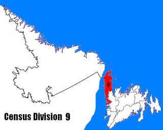
Census Division No. 9 is composed of the area of the province of Newfoundland and Labrador called the Northern Peninsula. It has a land area of 13,527.12 km² and had a population of 15,607 at the 2016 census. The largest community is the town of St. Anthony, near its northern tip, on the Atlantic Ocean coast.
Carmanville is a Canadian community in the province of Newfoundland and Labrador.

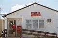
Nipper's Harbour is a town located on the east coast of the Baie Verte Peninsula of Newfoundland in the Canadian province of Newfoundland and Labrador. This incorporated community of 85 people is located on a rocky inlet that combines Nipper's Harbour and Noble's Cove, and where the primary industry is the inshore fishery. The town is approximately 58 km from Baie Verte.
New-Wes-Valley is a municipality in Newfoundland and Labrador, Canada.

Norris Point is a community in the Canadian province of Newfoundland and Labrador.
Parson's Pond is a community in the province of Newfoundland and Labrador in Canada.

Frederickton is a designated place in the Canadian province of Newfoundland and Labrador.

Burnt Islands is a small coastal community found in God Bay on the southwest coast of Newfoundland, Canada.
Purcell's Harbour is a local service district and designated place in the Canadian province of Newfoundland and Labrador. It is on the southern Twillingate island, about 4 km (2.5 mi) outside the town of Twillingate, near the community of Little Harbour.

Cow Head is a town in the Canadian province of Newfoundland and Labrador. The town had a population of 478 in the Canada 2016 Census.
Sally's Cove is a town in the Canadian province of Newfoundland and Labrador. It is located on the west coast of the island of Newfoundland, and is surrounded by Gros Morne National Park. The town had a population of 15 in the Canada 2021 Census.

St. Jacques-Coomb's Cove is a town in the Canadian province of Newfoundland and Labrador. The town had a population of 546 in the Canada 2021 Census. It is located on the south coast of the island of Newfoundland on the north side of Fortune Bay, on the southern tip of the Connaigre Peninsula in what is now known as the Coast of Bays Region. The town consists of six communities, St. Jacques, English Harbour West, Mose Ambrose, Boxey, Coomb's Cove, and Wreck Cove, all nestled within the inlets along the coast. They all had their beginnings in the fisheries and the fisheries have always been the mainstay of employment in the communities. In recent years aquaculture was introduced in the area, providing employment for its residents.