Little Bay, Newfoundland and Labrador

Last updated

Little Bay
Town
Photograph of Little Bay in 1884 by Simeon H. Parsons.jpg
Country Flag of Canada (Pantone).svg  Canada
Province Flag of Newfoundland and Labrador.svg  Newfoundland and Labrador
Government
Population
 (2021)
  Total100
Time zone UTC-3:30 (Newfoundland Time)
  Summer (DST) UTC-2:30 (Newfoundland Daylight)
Area code 709

Little Bay is a town located on the island of Newfoundland in the Canadian province of Newfoundland and Labrador. Its current population is roughly 100 people. It is located in Green Bay, which is part of Notre Dame Bay, and located in the central part of Newfoundland.

Contents

Founded in 1878 and incorporated in 1966, the town of Little Bay is a historic mining community which boomed during the last decades of the 19th century and declined due to the loss of its primary industry and disaster by fires at the turn of the 20th century.

Some towns near Little Bay include Beachside, St Patrick's, Little Bay Islands, and the main center for Green Bay, Springdale.

History

Little Bay was founded in the summer of 1878 by Baron Franz von Ellershausen, a German industrialist, after the accidental discovery of a copper ore deposit by a local hunter named Robert Colbourne. The town site which was previously an unoccupied wilderness claimed a population of over 500 people by the end of its first year and would witness a peak population of over 2,000 residents by 1891 making it one of the largest communities on the island at the time. The town became a hub of culture and commerce and was recognized as the unofficial capitol of the Northern mining region. Little Bay mine was among the top copper producers in the world and referred to as “the gem of the island” and "the el Dorado of Newfoundland” in media coverage from the era. Newfoundland mining was expected to overtake fishing as the colony’s main export with Little Bay leading this effort. The mining town attracted both local and international media attention as a result and plans were made to connect Little Bay to St. John’s by railroad. [1]

Historic Little Bay could boast several late 19th century luxuries such as a telegraph office, hospital, public hall, court house, hotel, advanced industrial wharfage, and a regionally competitive cricket team. [2] During its boom years Little Bay hosted several notable visitors including Lurana W. Sheldon, Gustav Kobbé, William Kennedy, John McDonald, James Patrick Howley, Wilfred Grenfell, John Hawley Glover, Henry Arthur Blake, Terence O’Brien, and even Prince George although the last didn't make shore and remained in Little Bay's harbour onboard HMS Canada. [3]

Little Bay's heyday was not to last. Mining operations declined and the late 1890s saw a mass exodus of miners to the mines in Glace Bay, Nova Scotia. The closing of Little Bay mine was followed by two devastating fires in 1903 and 1904. The population was reduced to less than 200 people from a population of over 2,000 in short order. Among those to depart were the literate and educated members of the upper class. The loss of documents to the fires, the subsequent lack of written records that followed, and the loss of media attention both locally and internationally resulted in Little Bay being largely forgotten by the rest of the world while locally living memories were gradually reduced to snippets of oral history.

The town saw a brief resurgence of mining operations during the 1960s but never returned to its former 19th century population or influence.

Heritage

Little Bay’s contribution to Newfoundland's heritage may have remained in the domain of lost history were it not for a couple of sluthey researchers. The first was Wendy Martin with her work “Once Upon a Mine” in 1983 which placed Little Bay's mine in context by exploring Newfoundland’s mining history. The second was Doyle Wells who transcribed and published the diaries of his ancestor, Little Bay’s 19th century police Sergeant Thomas Wells in his text “All Quiet” in 2012 thereby showing the day to day life of the town. However, the true scale of the town’s forgotten history was finally uncovered by Grand Falls-Windsor based heritage researcher Ian Evans. Evans, benefitting from modern efforts to digitize historic media documents, approached Little Bay's history as a lost media project. Little Bay was unusual in that it had been excessively documented during its first decades. Those sources were now uploaded onto various online archives. Evans was thereby able to construct a catalogue containing thousands of late 19th century newspaper references and personal accounts of the town during its historic boom. [4]

Current efforts are underway in Little Bay to highlight the town's unique place in Newfoundland history and to thereby demonstrate the potential benefit it holds for local heritage tourism. This work is championed by Little Bay Mayor Phyllis Dobbin Simms and aided greatly by Conestoga College’s Dea Watson. Their efforts have engaged with and been supported by the community of Little Bay and are now attracting a growing public interest in the town and its history. Through Little Bay's ongoing community efforts the town has recently formed a heritage society, established the el Dorado walking trail, and have set the date for Little Bay's first Summer Heritage Day as August 12th of 2023 in celebration of the town's 145th birthday.

Demographics

It can be difficult to compare historical demographic information on the town to current information as other nearby communities such as St. Patricks, Shoal Arm, Coffee Cove, and Otter Island were once considered to be part of Little Bay.

In the 2021 Census of Population conducted by Statistics Canada, Little Bay had a population of 100 living in 49 of its 69 total private dwellings, a change of

Notable people

Sister Towns

See also

Related Research Articles

<span class="mw-page-title-main">Newfoundland and Labrador</span> Province of Canada

Newfoundland and Labrador is the easternmost province of Canada, in the country's Atlantic region. The province comprises the island of Newfoundland and the continental region of Labrador, having a total size of 405,212 square kilometres. In 2023, the population of Newfoundland and Labrador was estimated to be 533,710. The island of Newfoundland is home to around 94 per cent of the province's population, with more than half residing in the Avalon Peninsula. Labrador borders the province of Quebec, and the French overseas collectivity of Saint Pierre and Miquelon lies about 20 km (12 mi) west of the Burin Peninsula.
<span class="mw-page-title-main">Sunnyside, Newfoundland and Labrador</span> Town in Newfoundland and Labrador, Canada

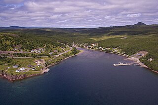
Sunnyside is a town on the Avalon Peninsula in Newfoundland and Labrador, Canada. It is in Division 1 on Bull Arm.

<span class="mw-page-title-main">Fogo Island (Newfoundland and Labrador)</span>

Fogo Island is the largest of the offshore islands of Newfoundland and Labrador, Canada. The Town of Fogo Island encompasses Fogo, Joe Batt's Arm-Barr'd Islands-Shoal Bay, Seldom-Little Seldom and Tilting, with the unincorporated areas of Fogo Island. It lies off the northeast coast of Newfoundland, northwest of Musgrave Harbour across Hamilton Sound, just east of the Change Islands. The island is about 25 km (16 mi) long and 14 km (8.7 mi) wide. The total area is 237.71 km2 (91.78 sq mi).

Red Bay is a fishing village in Labrador, notable as one of the most precious underwater archaeological sites in the Americas. Between 1530 and the early 17th century, it was a major Basque whaling area. Several whaling ships, both large galleons and small chalupas, sank there, and their discovery led to the designation of Red Bay in 2013 as a UNESCO World Heritage Site.

<span class="mw-page-title-main">Bell Island (Newfoundland and Labrador)</span> Canadian island in Conception Bay

Bell Island is an island that is part of Newfoundland and Labrador, Canada's easternmost province. With an area of 34 square kilometres (13 sq mi), it is by far the largest island in Conception Bay, a large bay in the southeast of the island of Newfoundland. The provincial capital of St. John's is less than 20 kilometres (12 mi) to the east.
<span class="mw-page-title-main">Harbour Grace</span> Town in Newfoundland and Labrador, Canada

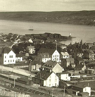
Harbour Grace is a town in Conception Bay on the Avalon Peninsula in the province of Newfoundland and Labrador, Canada. With roots dating back to the 16th century, it is one of the oldest towns in North America.
<span class="mw-page-title-main">Tilting, Newfoundland and Labrador</span> Community in Newfoundland and Labrador, Canada

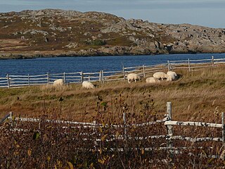
Tilting is a community on the eastern end of Fogo Island off the northeast coast of Newfoundland. It was incorporated as a town before becoming part of the Town of Fogo Island through an amalgamation in 2011. The community has been designated as a National Historic Site of Canada, and has also been designated as a Registered Heritage District by the Heritage Foundation of Newfoundland and Labrador.

<span class="mw-page-title-main">Boyd's Cove, Newfoundland and Labrador</span> Settlement in Newfoundland, Canada

Boyd's Cove, also known as Boyd's Harbour, is a local service district and designated place in the Canadian province of Newfoundland and Labrador that is near Lewisporte. There is an interpretive centre dedicated to the earlier indigenous Beothuk settlement at this location.

The Burin Peninsula is a peninsula located on the south coast of the island of Newfoundland in the province of Newfoundland and Labrador. Marystown is the largest population centre on the peninsula.

Baie Verte is a town located on the north coast of the island portion of the Canadian province of Newfoundland and Labrador on the Baie Verte Peninsula.

Springdale is a town in Newfoundland and Labrador, Canada, which had a population of 2,965 people in 2021, up from 2,764 in the Canada 2006 Census. The community is located on the Northwestern shores of Hall's Bay in Central Newfoundland, near the mouth of Indian River.

<span class="mw-page-title-main">Tilt Cove</span> Town in Newfoundland and Labrador, Canada

Tilt Cove is a town located southeast of Baie Verte on Notre Dame Bay and was founded in 1813. With an official population of 5 at the 2021 census, Tilt Cove is known as "Canada's smallest town." A source of gold, copper, and zinc ores, Tilt Cove was the site of the first mine in Newfoundland. The Tilt Cove mine opened in 1864 and "was soon employing several hundred men at good wages". Postal service was established in 1869.
<span class="mw-page-title-main">Pilley's Island</span> Town in Newfoundland and Labrador, Canada

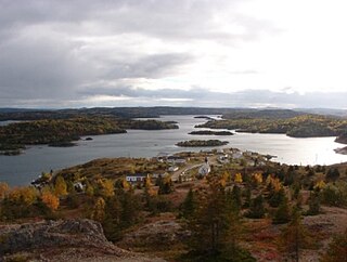
Pilley's Island is a town located on the island of the same name in the Canadian province of Newfoundland and Labrador. It is located in Division No. 8, Newfoundland and Labrador.

St. Lawrence is a town located on the Burin Peninsula of Newfoundland and Labrador. As of the 2021 Canadian Census, the population of St. Lawrence was 1,115, down from the 2011 Canadian Census of 1,244. Popular family names in the town include Turpin, Tarrant, Slaney, Pike, Lake, Drake and Edwards.
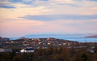
<span class="mw-page-title-main">Bay Roberts</span> Town in Newfoundland and Labrador, Canada

Bay Roberts is a town located on the north shore of Conception Bay on the northeastern Avalon Peninsula in the province of Newfoundland and Labrador, Canada. The growth of the local economy can be connected to the town's proximity to other major Newfoundland markets, by road and by water.

New-Wes-Valley is a municipality in Newfoundland and Labrador, Canada.

<span class="mw-page-title-main">Wabana, Newfoundland and Labrador</span> Town in Newfoundland and Labrador, Canada

Wabana is a Canadian town and the largest, and only incorporated, community on Bell Island in the province of Newfoundland and Labrador.

Beachside is a town in the Canadian province of Newfoundland and Labrador, in Notre Dame Bay. The town had a population of 97 in the Canada 2021 Census, down from 150 in 2011.

<span class="mw-page-title-main">Brig Bay</span>

Brig Bay is a local service district and designated place in the Canadian province of Newfoundland and Labrador. It was first mapped by Captain James Cook in September 1764. The name "Brig" was adopted by the French who occupied the bay prior to English occupation. It provided a safe and well-sheltered harbour.

<span class="mw-page-title-main">Newfoundland (island)</span> Island portion of Newfoundland and Labrador, Canada

Newfoundland is a large island situated off the eastern coast of the North American mainland and the most populous part of the Canadian province of Newfoundland and Labrador. The island contains 29 percent of the province's land area. The island is separated from the Labrador Peninsula by the Strait of Belle Isle and from Cape Breton Island by the Cabot Strait. It blocks the mouth of the Saint Lawrence River, creating the Gulf of Saint Lawrence, the world's largest estuary. Newfoundland's nearest neighbour is the French overseas collectivity of Saint Pierre and Miquelon.

References

  1. "Once Upon a Mine" (PDF).
  2. "History of Little Bay".
  3. "All Quiet".
  4. "Religion in Little Bay".
  5. "Population and dwelling counts: Canada, provinces and territories, census divisions and census subdivisions (municipalities), Newfoundland and Labrador". Statistics Canada. February 9, 2022. Retrieved March 15, 2022.


49°35′56″N55°57′04″W / 49.599°N 55.951°W / 49.599; -55.951