
The Gulf of St. Lawrence fringes the shores of the provinces of Quebec, New Brunswick, Nova Scotia, Prince Edward Island, Newfoundland and Labrador, in Canada, plus the islands Saint-Pierre and Miquelon, possessions of France, in North America.

Cape Spear is a headland located on the Avalon Peninsula of Newfoundland near St. John's in the Canadian province of Newfoundland and Labrador. At a longitude of 52°37' W, it is the easternmost point in Canada and North America, excluding Greenland.

Cape Race is a point of land located at the southeastern tip of the Avalon Peninsula on the island of Newfoundland, in Newfoundland and Labrador, Canada. Its name is thought to come from the original Portuguese name for this cape, "Raso", meaning flat or low-lying. The Cape appeared on early sixteenth century maps as Cabo Raso and its name may derive from a cape of the same name at the mouth of the Tagus River in Portugal. The cape was the location of the Cape Race LORAN-C transmitter until the system was decommissioned in 2010. It is also home to the Cape Race Lighthouse, notable for having received the distress call from the RMS Titanic.

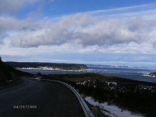
Grand Bank or 'Grand Banc' as the first French settlers pronounced it, is a small rural town in the Canadian province of Newfoundland and Labrador, with a population of 2,580. It is located on the southern tip or "toe" of the Burin Peninsula, 360 km from the province's capital of St. John's.

Cape Leeuwin is the most south-westerly mainland point of the Australian continent, in the state of Western Australia.
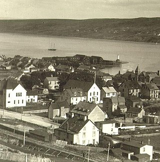
Harbour Grace is a town in Conception Bay on the Avalon Peninsula in the province of Newfoundland and Labrador, Canada. With roots dating back to the 16th century, it is one of the oldest towns in North America.
Cape Norman is a barren, limestone headland located at the northernmost point of insular Newfoundland in the Canadian province of Newfoundland and Labrador.
Cape Bauld is a headland located at the northernmost point of Quirpon Island, an island just northeast of the Great Northern Peninsula of Newfoundland in the Canadian province of Newfoundland and Labrador.
The Burin Peninsula is a peninsula located on the south coast of the island of Newfoundland in the province of Newfoundland and Labrador. Marystown is the largest population centre on the peninsula.
Conche is a community on the Northern Peninsula of Newfoundland and Labrador, Canada. Its population in 2021 was 149.
Nova Central School District was a school district headquartered in Gander in the Canadian province of Newfoundland and Labrador. The district had 66 schools located in 50 different communities, and served about 13,000 students, including a significant rural population. The District was formed by the merger of the Lewisporte-Gander and Baie Verte-Central-Connaigre school boards in 2004. The largest school in the district was Gander Academy. The district was replaced by the Newfoundland and Labrador English School District upon provincial amalgamation in 2013.

The East Coast Trail (ECT) is a long-distance coastal footpath located in the Canadian province of Newfoundland and Labrador. It is a developed trail over 336 kilometres (209 mi) long, creation of which began in 1994. It is made up of 25 linked wilderness paths and passes through more than 30 communities. It was named one of the best adventure destinations by National Geographic in 2012 and is extended and improved yearly.
Green Island is a rocky island near the mouth of Fortune Bay, Newfoundland. It is located about 10 km (6 mi) west of the Burin Peninsula of Newfoundland near Point May, and 10 km (6 mi) east of Saint Pierre Island in the French overseas collectivity of Saint Pierre and Miquelon.

La Scie is a town in the Canadian province of Newfoundland and Labrador. The town had a population of 820 in the Canada 2021 Census, down from 872 in 2016.
The Headland of Point Riche is located near the community of Port au Choix on the Great Northern Peninsula of the island of Newfoundland in the Canadian province of Newfoundland and Labrador.
The history of lighthouses in Canada dates to 1734.

Newfoundland is a large island within the Canadian province of Newfoundland and Labrador. It is situated off the eastern coast of the North American mainland and the geographical region of Labrador.
Division No. 1, Subdivision B is an unorganized subdivision on the Avalon Peninsula in Newfoundland and Labrador, Canada. It is in Division 1 and contains the unorganized communities of Iona, Little Barasway, Placentia Junction, Point Verde and Ship Harbour.

Division No. 1, Subdivision G is an unorganized subdivision on the Avalon Peninsula in Newfoundland and Labrador, Canada. It is in Division 1 and contains the unincorporated communities of Baccalieu Island, Besom Cove, Bradley's Cove, Burnt Point, Caplin Cove, Daniel's Cove, Grates Cove, Gull Island, Job's Cove, Kingston, Long Beach, Lower Island Cove, Low Point, Northern Bay, Ochre Pit Cove, Red Head Cove, Riverhead, Smooth Cove and Western Bay.
