
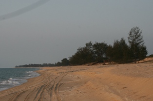
Cape York is the northernmost point of the mainland of Australia. It is within the locality of Somerset in the Shire of Torres, Queensland. [1] [2]
Cape York is the northernmost point of the mainland of Australia. It is within the locality of Somerset in the Shire of Torres, Queensland. [1] [2]
Cape York was named by Lieutenant James Cook on his first voyage of exploration along the eastern coast of Australia in 1770. He named it on 21 August 1770 "in honour of His Royal Highness, the Duke of York" referring to Prince Edward, Duke of York and Albany. [1]
Although its name derives from Cape York, the Cape York Peninsula was not named by Cook and refers to the much larger peninsula that lies between the Gulf of Carpentaria and the Coral Sea. Cook did not enter the Gulf of Carpentaria. [3]

Cape York Peninsula is a peninsula located in Far North Queensland, Australia. It is the largest wilderness in northern Australia. The land is mostly flat and about half of the area is used for grazing cattle. The relatively undisturbed eucalyptus-wooded savannahs, tropical rainforests and other types of habitat are now recognised and preserved for their global environmental significance. Although much of the peninsula remains pristine, with a diverse repertoire of endemic flora and fauna, some of its wildlife may be threatened by industry and overgrazing as well as introduced species and weeds.

The Gulf of Carpentaria is a sea off the northern coast of Australia. It is enclosed on three sides by northern Australia and bounded on the north by the eastern Arafura Sea, which separates Australia and New Guinea. The northern boundary is generally defined as a line from Slade Point, Queensland in the northeast, to Cape Arnhem on the Gove Peninsula, Northern Territory in the west.

Thursday Island, colloquially known as TI, or in the Kawrareg dialect, Waiben or Waibene, is an island of the Torres Strait Islands, an archipelago of at least 274 small islands in the Torres Strait. TI is located approximately 39 kilometres north of Cape York Peninsula in Far North Queensland, Australia.

Weipa is a coastal mining town in the local government area of Weipa Town in Queensland. It is the largest town on the Cape York Peninsula. It exists because of the enormous bauxite deposits along the coast. The Port of Weipa is mainly involved in exports of bauxite. There are also shipments of live cattle from the port.
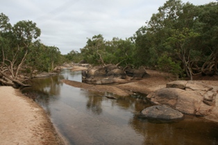
The Pennefather River is a river located on the western Cape York Peninsula in Far North Queensland, Australia.
Somerset is a coastal locality split between the Shire of Torres and the Northern Peninsula Area Region, Queensland, Australia. In the 2021 census, Somerset had a population of 0 people.

Kowanyama is a town and coastal locality in the Aboriginal Shire of Kowanyama, Queensland, Australia.

Pormpuraaw is a coastal town and a locality in the Aboriginal Shire of Pormpuraaw, Queensland, Australia. Pormpuraaw is an Aboriginal community situated on the west coast of Cape York Peninsula approximately halfway between Karumba and Weipa on the Edward River. It is 650 kilometres (400 mi) by road from Cairns. Pormpuraaw currently has a 4-man police station.

Mapoon is a coastal town in the Aboriginal Shire of Mapoon and a locality split between the Aboriginal Shire of Mapoon and the Shire of Cook in Queensland, Australia. In the 2016 census, Mapoon had a population of 317 people.

Albany Island or Pabaju is an island off the north-eastern coast of Cape York Peninsula in the Adolphus Channel of Queensland, Australia. It is within the locality of Somerset in the Shire of Torres.

Mount Adolphus Island, also called Muri or Mori in the native language, is an island of the Torres Strait Islands archipelago that is located at the very tip of Cape York Peninsula on the northern side of the Adolphus Channel, across from Albany Island and about 40 kilometres (25 mi) northeast of Bamaga in the far north region of Queensland, Australia.

The Shire of Burke is a local government area in North West Queensland, Australia. The shire lies on the south coast of the Gulf of Carpentaria and abuts the border with the Northern Territory. It covers an area of 39,864 square kilometres (15,391.6 sq mi), and has existed as a local government entity since 1885. The major town and administrative centre of the shire is Burketown.
The Ducie River is a river located on the Cape York Peninsula in Far North Queensland, Australia.
Cape Grafton is a cape located to the north-east of Cairns in Queensland, Australia. The cape was named by Lieutenant James Cook during his first voyage of discovery in 1770. It was named after Augustus FitzRoy, 3rd Duke of Grafton, the British prime minister when Cook sailed. Cook set anchor two miles from the shore and briefly inspected the cape with botanists Joseph Banks and Daniel Solander.

Cooktown is a coastal town and locality in the Shire of Cook, Queensland, Australia. Cooktown is at the mouth of the Endeavour River, on Cape York Peninsula in Far North Queensland where James Cook beached his ship, the Endeavour, for repairs in 1770. Both the town and Mount Cook which rises up behind the town were named after James Cook.
Yarraden is a coastal rural locality in the Shire of Cook, Queensland, Australia. In the 2016 census Yarraden had a population of 11 people.
Archer River is a rural locality in the Shire of Cook, Queensland, Australia. In the 2016 census Archer River had a population of 22 people.
Edward River is a rural locality in the Shire of Cook, Queensland, Australia. In the 2016 census Edward River had a population of 0 people.

Carpentaria is a coastal locality in the Shire of Carpentaria, Queensland, Australia. In the 2021 census, Carpentaria had a population of 25 people.
Duyfken Point is a point in the locality of Mission River, Shire of Cook, Queensland, Australia.
10°41′19″S142°31′54″E / 10.688611°S 142.531667°E
| | This Queensland location article is a stub. You can help Wikipedia by expanding it. |