
Burnaby is a city in the Lower Mainland region of British Columbia, Canada. Located in the centre of the Burrard Peninsula, it neighbours the City of Vancouver to the west, the District of North Vancouver across the confluence of the Burrard Inlet with its Indian Arm to the north, Port Moody and Coquitlam to the east, New Westminster and Surrey across the Fraser River to the southeast, and Richmond on the Lulu Island to the southwest.

Burrard Inlet is a relatively shallow-sided fjord in northwestern Lower Mainland, British Columbia, Canada. Formed during the last Ice Age, it separates the City of Vancouver and the rest of the lowland Burrard Peninsula to the south from the coastal slopes of the North Shore Mountains, which span West Vancouver and the City and District of North Vancouver to the north.

The Burrard Peninsula is a peninsula in the Lower Mainland region of British Columbia, Canada, bounded by the Burrard Inlet to the north, the Georgia Strait to the west, the North Arm of Fraser River to the south, and the Pitt River and Douglas Island to the east. The City of Vancouver occupies almost all of the western half of the peninsula, and the Cities of Burnaby and New Westminster occupy more than half of the eastern half. At its northeastern end, the peninsula is connected to the Eagle Mountain and Mount Burke of the Coast Mountains via a small isthmus at the center of the Tri-Cities.

The District of North Vancouver is a district municipality in British Columbia, Canada, and is part of Metro Vancouver. It surrounds the City of North Vancouver on three sides. It is largely characterized as a relatively quiet, affluent suburban hub home to many middle and upper-middle-class families. Homes in the District of North Vancouver generally range from mid-sized family bungalows to very large luxury houses. A number of dense multi-family and mixed-use developments have popped up across the district in recent years; however, the district remains a primarily suburban municipality. It is served by the Royal Canadian Mounted Police, British Columbia Ambulance Service, and the District of North Vancouver Fire Department.

The 98 B-Line was a bus rapid transit line in Metro Vancouver, British Columbia, Canada, that began service in September 2000. It linked Richmond to Downtown Vancouver, with a connection to Vancouver International Airport. It travelled mainly along Granville Street in Vancouver and a dedicated bus lane on No. 3 Road in Richmond. It was operated by Coast Mountain Bus Company and was funded by TransLink. The route was 16 kilometres (9.9 mi) long. The line carried over 18,000 passengers daily. It was discontinued in September 2009, shortly after the opening of the Canada Line, which replaced it.

Downtown Vancouver is the central business district and the city centre neighbourhood of Vancouver, Canada, on the northwestern shore of the Burrard Peninsula in the Lower Mainland region of British Columbia. It occupies most of the north shore of the False Creek inlet, which cuts into the Burrard Peninsula creating the Downtown Peninsula, where the West End neighbourhood and Stanley Park are also located.

East Vancouver is a region within the city of Vancouver, British Columbia, Canada. Geographically, East Vancouver is bordered to the north by Burrard Inlet, to the south by the Fraser River, and to the east by the city of Burnaby. East Vancouver is divided from Vancouver's "West Side" by Ontario Street.

Renfrew–Collingwood is a large neighbourhood that lies on the eastern side of Vancouver, British Columbia, Canada, on its boundary with Burnaby and encompassing an area that was one of the earlier developed regions of the city. It is a diverse area that includes a substantial business community in several areas, as well as some of the fastest-growing residential sectors of Vancouver. In 2011, the neighbourhood had a population of 50,500, 38.4% of whom claim Chinese as their first language.

Burnaby Mountain, elev. 370 m (1,214 ft), is a low, forested mountain in the city of Burnaby, British Columbia, overlooking the upper arms of Burrard Inlet. It is the location of Simon Fraser University Burnaby Campus, the Discovery Park research community, and the System Control Tower of BC Hydro and a residential neighbourhood with retail shops development called UniverCity. In November 1995, the Province of British Columbia and Simon Fraser University reached an agreement to transfer 330 hectares of university land to the City of Burnaby for inclusion into Burnaby Mountain Conservation Area.
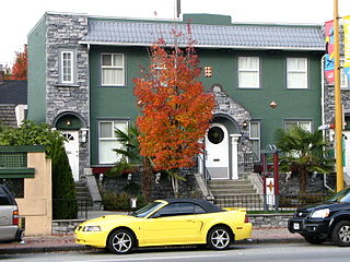
North Burnaby is a general name for a large neighbourhood in the City of Burnaby, British Columbia, that includes a number of smaller ones. It stretches from Boundary Road in the west to Burnaby Mountain with Simon Fraser University in the east and is bounded by Burrard Inlet to the north and the Lougheed Highway to the south. It is a desirable place to live for many local and immigrant families, which is reflected by real-estate prices that keep climbing and have doubled in the last 15 years.
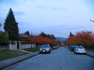
Parkcrest is a hillside neighbourhood in North Burnaby, British Columbia adjacent to Kensington Park which gave it its name. It has a long rectangular shape stretched north to south and is bounded by Springer Avenue to the west and Kensington Avenue to the east. To the north its border runs along Hastings Street, its southern border lies along the Lougheed Highway and Skytrain tracks. Its elevation gradually lowers to the south and ends up in Central Valley, quite low above the level of Burnaby Lake.

Georgia Street is an east–west street in the cities of Vancouver and Burnaby, British Columbia, Canada. Its section in Downtown Vancouver, designated West Georgia Street, serves as one of the primary streets for the financial and central business districts, and is the major transportation corridor connecting downtown Vancouver with the North Shore by way of the Lions Gate Bridge. The remainder of the street, known as East Georgia Street between Main Street and Boundary Road and simply Georgia Street within Burnaby, is more residential in character, and is discontinuous at several points.

Hastings Street is one of the most important east-west traffic corridors in the cities of Vancouver and Burnaby, British Columbia, Canada, and used to be a part of the decommissioned Highway 7A. In the central business district of Downtown Vancouver, it is known as West Hastings Street; at Carrall Street it becomes East Hastings Street and runs eastwards through East Vancouver and Burnaby. In Burnaby, there is no east-west designation. The street ends in Westridge, a neighbourhood at the foot of Burnaby Mountain where it joins the recently built Burnaby Mountain Parkway and diverges from the continuation of the former Highway 7A as the Barnet Highway, to Port Moody, British Columbia.
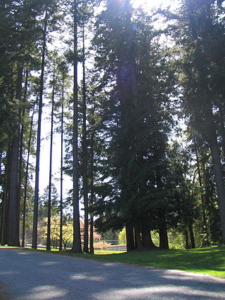
Robert Burnaby Park is a 48 hectare public park in East Burnaby, just south of Burnaby Lake, located off Edmonds and 4th Street in British Columbia, Canada. It is open all year around from dawn to dusk. It has an extensive trail system, as well as tennis courts and a swimming pool in the cleared upper slope area. The north end of the park contains the Robert Burnaby Park Disc Golf Course, one of only a handful in Metro Vancouver. It is a favourite picnic spot for many residents of Burnaby and New Westminster. Dogs are welcome in the park as long as they are on leash and are kept out of areas marked ecologically sensitive. There is also an off-leash zone for dogs in the northern part of the park. Propane barbeques as well as charcoal and open fire barbeques are allowed in the park. Hot ash can be disposed of in the ash pits within the park.

Montecito, for administrative and planning purposes also known as "Sperling-Broadway", is a neighbourhood in Burnaby, British Columbia, Canada.

Westridge is a residential neighbourhood in Burnaby, British Columbia, Canada.
The Central Valley Greenway (CVG) is a 24-kilometre pedestrian and cyclist route in Metro Vancouver, running from Science World in Vancouver to New Westminster, through Burnaby. The greenway officially opened on June 27, 2009, with opening celebrations, guided bike tours, and walking tours on sections of the route. Despite its official opening, some sections are complete on an interim basis and are anticipated to be upgraded in the future.
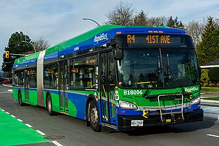
The R4 41st Ave is an express bus route with bus rapid transit elements in Metro Vancouver, British Columbia, Canada. Part of TransLink's RapidBus network, it replaced the 43 Express that travelled along 41st Avenue, a major east–west route that connects the University of British Columbia (UBC) to the SkyTrain system's Oakridge–41st Avenue station on the Canada Line and Joyce–Collingwood station on the Expo Line.
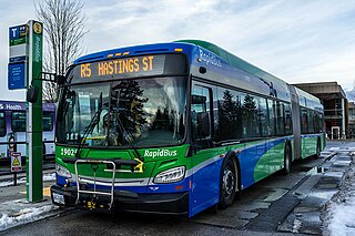
The R5 Hastings St is an express bus service with bus rapid transit elements in Metro Vancouver, Canada. Part of TransLink's RapidBus network, it travels along Hastings Street, a major east–west route, and connects Simon Fraser University to the SkyTrain system's Burrard station on the Expo Line in Downtown Vancouver. It replaced the 95 B-Line route on January 6, 2020.
The Thornton Tunnel is a freight railway tunnel in Burnaby, British Columbia, running under the Willingdon Heights and Vancouver Heights neighbourhoods. It was built in 1969 by Canadian National to connect Second Narrows Bridge to the main line in Willingdon, and is 3.4 km long.


