Carnot wall

Last updated
The Carnot wall at Forte Altavilla, Ancona, Italy Ancona - Forte Altavilla 1863.jpg
The Carnot wall at Forte Altavilla, Ancona, Italy

A Carnot wall is a type of loop-holed wall built in the ditch of a fort or redoubt. It takes its name from the French mathematician, politician, and military engineer, Lazare Carnot. Such walls were introduced into the design of fortifications from the early nineteenth century. As conceived by Carnot they formed part of an innovative but controversial system of fortification intended to defend against artillery and infantry attack. [1] Carnot walls were employed, together with other elements of Carnot's system, in continental Europe in the years after the final defeat of Napoleon in 1815, especially by the Prussians, other Germans and Austrians. [1] [2] [3] Their adoption was initially resisted by the French themselves and by the British. [4] [5]

Contents

Lazare Carnot and his system of fortification

Lazare Carnot Lazare carnot.jpg
Lazare Carnot

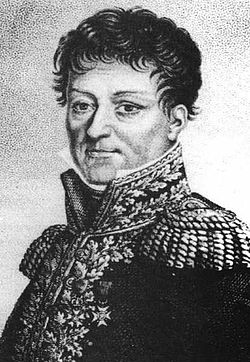
Carnot was born in 1753. He became a military engineer at the age of 20. He became a politician during the French Revolution in 1789. He was responsible for the organization of the campaigns of the French Revolutionary Army, and later served under Napoleon. Carnot's "A treatise on the defence of fortified places" was published in 1810 with an English translation by Baron de Montalembert published in 1814. [6]

In this period the design of fortifications was based on the bastion "trace" or ground-plan. This had originated in Italy in the 16th century. [7] From the late 17th century the model system of fortification was considered to be that based on the bastion trace of Vauban, Louis XIV's military engineer. [8]

Carnot opposed the Bastion system. [9] The elements of his system were:

A conventional fort would have ramparts on which the cannon were mounted. The ramparts were surrounded by a ditch with vertical, or near vertical, sides, called the scarp (inner wall) and counterscarp (outer wall). The outer side of the ditch would have a glacis, a gently outwardly sloping earth bank at a slightly lower level than the ramparts. The glacis would be topped by a parapet with a flat area called the "covered way" (because it was "covered" by fire from defenders on the ramparts). This arrangement was intended to make it difficult for attackers to approach the fort while allowing defenders to observe, and fire on, approaching besiegers at some distance from the fort. [13]

As against this method Carnot's system did away with the covered way and steep counterscarp and made the glacis slope back into the ditch. (This is referred to as a countersloping glacis). [10] He placed a loop-holed wall in the ditch of the fortification. This had a chemin des rondes , or sentry path, to the rear allowing defenders to move along behind the wall. As well as firing at attackers the defenders were able to make sorties from behind the wall up the countersloping glacis.

Objections to Carnot's system

Objections to Carnot's system included that:

Adoption of Carnot's ideas in continental Europe

The Austrians built impressive fortifications in the 1830s, using Carnot's ideas, at Verona in Italy. These consisted of massive ramparts with a Carnot wall at their foot. [19] In the same period the Russians used the walls in fortifying Warsaw. [19] In Germany examples were built at Coblenz [20] and Ulm. [21]

The Woolwich experiments

Illustration of the replica Carnot Wall constructed at Woolwich in 1823 - showing the effect of bombardment. Carnot Wall at Woolwich.jpg
Illustration of the replica Carnot Wall constructed at Woolwich in 1823 - showing the effect of bombardment.

Whilst the Carnot wall was extensively employed in fortifications in continental Europe there was resistance to its use in Britain, for the reasons stated above. [4]

In 1823 a replica Carnot wall was constructed at Woolwich, Kent to test Carnot's theories. This wall was 21 feet (6.4 m) high and 22 feet (6.7 m) long. The tapering wall was 7 feet (2.1 m) thick at its base and 6 feet (1.8 m) thick at the top. [22] A rampart of equal height with the wall was built in front of it to represent that of a real fort. [23] The idea was that the gunners would be unable to see the wall itself when firing.

Experiments with this wall took place in August 1824. Their object was to test whether artillery at a distance could breach the walls by firing at high angles. [22] Those conducting the experiments concluded that the wall could be severely damaged even if the besiegers' gunners could not see it. [24] However it was objected that the Woolwich experiments did not really prove what was claimed. The tests used far more artillery fire than would be likely to be possible in a real siege. [25]

Later British forts with a Carnot wall

The Carnot wall in the fort at Littlehampton Littlehampton Redoubt 2.JPG
The Carnot wall in the fort at Littlehampton
Yaverland Battery Overgrown section of Yaverland Battery.JPG
Yaverland Battery
Sandown Barrack Battery Sandown Barrack Battery 2.JPG
Sandown Barrack Battery

The objectors did not hold sway indefinitely however and forts with Carnot walls were eventually built in Britain. In his 1849 book James Fergusson outlined the advantages of the Carnot wall, though without wholly endorsing its use. [26] He said that such walls would be cheaper to construct. They would last longer than the usual scarp wall with a "mass of earth at its back always tending to overthrow it". In addition it would be difficult to scale the wall as the besiegers would have to use ladders to reach the top and the same ladders to descend the other side, while all the time facing assault by defenders. [26] Fergusson also commented that the 1824 Woolwich experiments, which had influenced subsequent fort design, had given "every possible advantage in favour of the attack". [27] He argued that, even were a breach to be made in the wall, the defenders could easily attack the besiegers, making an assault on the fort hazardous. His final point was that in any case the wall would be hidden behind a rampart far higher, in relation to the height of the wall, than that at Woolwich, so that the enemy artillery would be not able to significantly damage it. [27]

The first fort to be built in Britain with a Carnot wall was in 1854 at the mouth of the river Arun at Littlehampton in West Sussex. This was 12 feet (3.7 m) high with open-angled bastions. [28] In 1857 a very similar fort was constructed at Shoreham along the coast from Littlehampton. The wall there included Caponiers, as also advocated by Carnot. [29] Following the Royal Commission on the Defence of the United Kingdom of 1859 several forts with Carnot walls were built. These included:

See also

Palmerston Forts

Related Research Articles

Fortification Military defensive construction

A fortification is a military construction or building designed for the defense of territories in warfare, and is also used to establish rule in a region during peacetime. The term is derived from Latin fortis ("strong") and facere.

Bastion Outward structure of a fortification

A bastion or bulwark is a structure projecting outward from the curtain wall of a fortification, most commonly angular in shape and positioned at the corners of the fort. The fully developed bastion consists of two faces and two flanks, with fire from the flanks being able to protect the curtain wall and the adjacent bastions. Compared with the medieval fortified towers they replaced, bastion fortifications offered a greater degree of passive resistance and more scope for ranged defence in the age of gunpowder artillery. As military architecture, the bastion is one element in the style of fortification dominant from the mid 16th to mid 19th centuries.

Fortifications of Portsmouth

The fortifications of Portsmouth are extensive due to its strategic position on the English Channel and role as home to the Royal Navy. For this reason, Portsmouth was, by the 19th century, one of the most fortified cities in the world. The fortifications have evolved over the centuries in response to changes in tactics and technology and the area defended has increased. While the first defences focused on Portsmouth harbour, in step with the fortifications of Gosport, later defensive structures protected the whole of Portsea Island and an increasing distance inland. At the same time, the fortifications of Portsmouth and Gosport became part of the wider fortifications of the Solent. Old Portsmouth, on the southwest corner of Portsea Island, has been walled for much of its history.

Shoreham Redoubt

Shoreham Redoubt is a historical military defensive structure and scheduled monument at the entrance to Shoreham harbour, at the mouth of the River Adur in West Sussex, England. It was planned in the 1850s during a period of political alarm in the United Kingdom. Construction of the fort was completed in June 1857 at a cost of £11,685. The design is similar to that of Littlehampton Fort, which had been built in 1854.

Littlehampton Redoubt Fort at entrance to the River Arun at Littlehampton

Littlehampton Redoubt, usually known as Littlehampton Fort, was built in 1854 to protect the entrance to the River Arun at Littlehampton on the south coast of England, against possible attack by the French under the Emperor Napoleon III. There had been a previous battery on the east bank of the river, but the new fort was built on the west bank. It consisted of a platform from which cannon could sweep the harbour mouth, with a barracks behind and a surrounding defensive ditch and wall. The fort was an innovative military structure, incorporating the new feature of a Carnot wall. Its active use as a fort was short at only about 20 years, owing to technical changes in armaments, but it was a precursor of the later Palmerston Forts and therefore is NOT the First Palmerston Fort as has been alleged. The Palmerston Forts were built after the 1860 commission. Littlehampton Fort is now in a ruinous and overgrown state but largely protected by the Ivy that now grows over the walls.

National Redoubt (Belgium) Strategic defensive belt of fortifications in Belgium

The National Redoubt was a strategic defensive belt of fortifications built in Belgium. The National redoubt was the infrastructural cornerstone of Belgian defensive strategy from 1890–1940.

Fort Cumberland (England)

Fort Cumberland is a pentagonal artillery fortification erected to guard the entrance to Langstone Harbour, east of the Dockyard of Portsmouth on the south coast of England. It was sited to protect the Royal Navy Dockyard, by preventing enemy forces from landing in Langstone Harbour and attacking from the landward side. Fort Cumberland is widely recognised as the finest example of a bastion trace fort in England. It is a scheduled monument and a Grade II* listed building

Royal Commission on the Defence of the United Kingdom

The Royal Commission on the Defence of the United Kingdom was a committee formed in 1859 to enquire into the ability of the United Kingdom to defend itself against an attempted invasion by a foreign power, and to advise the British Government on the remedial action required. The appointment of the Commission had been prompted by public concern about the growing military and naval power of the French Empire and was instigated by the Prime Minister, Henry Temple, 3rd Viscount Palmerston, who came to be closely associated with the project. In the following year, the Commission's report recommended a huge programme of fortification to defend the country's arsenals and naval bases. Many of the recommendations were acted upon; however, the great expense, the length of time taken to complete the various works and their perceived usefulness were all subjects of critical political, press and public debate.

Bastion fort early modern fortification style built to withstand cannon fire

A bastion fort or trace italienne is a fortification in a style that evolved during the early modern period of gunpowder when the cannon came to dominate the battlefield. It was first seen in the mid-fifteenth century in Italy. Some types, especially when combined with ravelins and other outworks, resembled the related star fort of the same era.

Séré de Rivières system Fortifications in France

The Séré de Rivières system was named after Raymond Adolphe Séré de Rivières, its originator. The system was an ensemble of fortifications built from 1874 along the frontiers and coasts of France. The fortresses were obsolescent by 1914 but were used during the First World War.

Fort Glanville Conservation Park Protected area in South Australia

Fort Glanville Conservation Park is a protected area located in the Australian state of South Australia located in Semaphore Park, a seaside suburb of Adelaide consisting of a functional 19th century fort listed on the South Australian Heritage Register and some adjoining land used as a caravan park. The fort was built after more than 40 years of indecision over the defence of South Australia. It was the first colonial fortification in the state and is the best preserved and most functional in Australia. Fort Glanville was designed by Governor Major General Sir William Jervois and Lieutenant Colonel Peter Scratchley, both important figures in early Australian colonial defence. When built it was designed to defend both Semaphore's anchorage and shipping entering the Port River from naval attack.

Ditch (fortification)

A ditch in military engineering is an obstacle, designed to slow down or break up an attacking force, while a trench is intended to provide cover to the defenders. In military fortifications the side of a ditch farthest from the enemy and closest to the next line of defence is known as the scarp while the side of a ditch closest to the enemy is known as the counterscarp.

Thiers wall

The Thiers wall was the last of the defensive walls of Paris. It was an enclosure constructed between 1841 and 1846 and was proposed by the French prime minister Adolphe Thiers but was actually implemented by his successor. The 33 kilometres (21 mi) long wall and ditch made a complete circuit around the city as it stood at the time of the July Monarchy. It was bombarded by the Prussian Army during the Franco-Prussian War, captured by government troops during the Paris Commune and refortified at the start of the First World War. However, by then it had become obsolete as a fortification, was a barrier to the expansion of the city, and the area immediately outside of it, known as "the zone", had become a shanty town. The wall was demolished in the interwar period; its path today can be traced by the Boulevards of the Marshals which originally ran just behind the fortifications and by the Boulevard Périphérique which was later built just outside. A few remnants of the wall can still be seen.

North Bastion, Gibraltar

The North Bastion, formerly the Baluarte San Pablo was part of the fortifications of Gibraltar, in the north of the peninsula, protecting the town against attack from the mainland of Spain. The bastion was based on the older Giralda tower, built in 1309. The bastion, with a mole that extended into the Bay of Gibraltar to the west and a curtain wall stretching to the Rock of Gibraltar on its east, was a key element in the defenses of the peninsula. After the British took Gibraltar in 1704 they further strengthened these fortifications, flooding the land in front and turning the curtain wall into the Grand Battery.

Couvreface

A couvreface in fortification architecture is a small outwork that was built in front of the actual fortress ditch before bastions or ravelins. It usually just consisted of a low rampart with a breastwork that protected its defending infantry. Another ditch in front of the work guarded it from immediate frontal assault. The function of couvrefaces was to protect the faces of the higher ravelin or bastion behind it from direct artillery fire. So that the couvreface and the works behind it could not come under simultaneous fire from an enemy battery along the line of the ramparts they were not allowed to run parallel to one another. Similar to the couvreface is the larger counterguard which, by contrast, was designed to enable the positioning of guns. Couvrefaces are found particularly in Dutch and French fortifications from the 17th to the early 19th centuries.

Twydall Profile

The Twydall Profile was a style of fortification used in British and Imperial polygonal forts at the end of the 19th century. The sloping earthworks employed in the Twydall Profile were intended to be quick and inexpensive to construct and to be effective in the face of the more powerful artillery and high explosive ammunition being introduced at that time. The name comes from the village of Twydall in Kent, where the first forts of this type were built.

Fortifications of Mdina Defensive walls in Mdina, Malta

The fortifications of Mdina are a series of defensive walls which surround the former capital city of Mdina, Malta. The city was founded as Maleth by the Phoenicians in around the 8th century BC, and it later became part of the Roman Empire under the name Melite. The ancient city was surrounded by walls, but very few remains of these have survived.

Fortifications of Plymouth

The fortifications of Plymouth in Devon are extensive due to its natural harbour, its commanding position on the Western Approaches and its role as the United Kingdom's second largest naval base after Portsmouth. The first medieval defences were built to defend Sutton Harbour on the eastern side of Plymouth Sound at the mouth of the River Plym, but by the 18th century, naval activity had begun to shift westward to Devonport at the mouth of the River Tamar. During the Victorian era, advances in military technology led to a huge programme of fortification encompassing the whole of Plymouth Sound together with the overland approaches. Many of these works remained in military use well into the 20th century.

Polygonal fort Type of fortification

A polygonal fort is a type of fortification originating in France in the late 18th century and fully developed in Germany in the first half of the 19th century. Unlike earlier forts, polygonal forts had no bastions, which had proved to be vulnerable. As part of ring fortresses, polygonal forts were generally arranged in a ring around the place they were intended to protect, so that each fort could support its neighbours. The concept of the polygonal fort proved to be adaptable to improvements in the artillery which might be used against them, and they continued to be built and rebuilt well into the 20th century.

References

  1. 1 2 3 Saunders 1989 , p. 155.
  2. Duffy 1975 , p. 52.
  3. Douglas 1859 , p. 103.
  4. 1 2 Douglas 1859 , p. 83.
  5. Saunders 1989 , p. 158.
  6. Carnot 1814
  7. Duffy 1975 , p. 9
  8. Duffy 1975 , p. 16.
  9. Saunders 1989 , p. 156.
  10. 1 2 Carnot 1814 , p. 204.
  11. Carnot 1814 , p. 197.
  12. Barras 2011
  13. Duffy 1975 , pp. 59–63.
  14. Douglas 1859 , p. 81.
  15. Douglas 1859 , p. 148.
  16. Lendy 1862 , p. 453.
  17. Douglas 1859 , p. 111.
  18. Lendy 1862 , p. 449.
  19. 1 2 Hughes 1974 , p. 171.
  20. Douglas 1859 , p. 125.
  21. Hughes 1974 , p. 169.
  22. 1 2 Douglas 1859 , p. 96.
  23. Douglas 1859 , p. 97.
  24. Douglas 1859 , p. 99.
  25. Lloyd 1887 , p. 194.
  26. 1 2 Fergusson 1849 , p. 54.
  27. 1 2 Fergusson 1849 , p. 55.
  28. Goodwin 1985 , p. 36.
  29. Goodwin 1985 , p. 45.
  30. Historic England. "Sandown Barrack Battery (1019195)". National Heritage List for England . Retrieved 2012-01-31.
  31. Palmerston Forts Society. "Redcliff Battery" (PDF). Retrieved 2012-01-31.
  32. Isle of Wight History Centre. "Yaverland Battery". Archived from the original on 2011-10-07. Retrieved 2012-01-31.
  33. Victorian Forts. "Shotley Point Battery" (PDF). Retrieved 2012-01-31.

Bibliography

Barras, Simon (2011). "An Introduction to Artillery Fortification" (PDF). Fortress Study Group. Archived from the original (PDF) on 4 March 2016. Retrieved 10 January 2011.

Carnot, Lazare (1814). A treatise on the defence of fortified places: Written under the direction and published by command of Buonaparte, for the instruction and guidance of the officers of the French Army. London: Printed for T. Egerton.

Douglas, Sir Howard (1859). Observations on modern systems of fortification: including that proposed by M. Carnot, and a comparison of the polygonal with the bastion system; to which are added, some reflections on intrenched positions, and a tract on the naval, littoral, and internal defence of England. London: J. Murray.

Duffy, Christopher (1975). Fire & Stone: The Science of Fortress Warfare 1660-1860 (First ed.). Newton Abbot: David & Charles.

Fergusson, James (1849). An essay on a proposed new system of fortification: with hints for its application to our national defences. London: J. Weale.

Goodwin, John (1985-11-09). The Military Defence of West Sussex (1st ed.). Midhurst: Middleton Press. ISBN   0-906520-23-1.

Hughes, Quentin (1974). Military Architecture. Beaufort Publishing. ISBN   1-85512-008-9.

Lendy, Auguste Frederic (1862). Treatise on fortification: or, Lectures delivered to officers reading for the staff. London: W. Mitchell.

Lloyd, Ernest Marsh (1887). Vauban, Montalembert, Carnot: Engineer studies. London: Chapman and Hall.

Saunders, A D (1989). Fortress Britain: Artillery Fortification in the British Isles and Ireland. Liphook: Beaufort Publishing. ISBN   1-85512-000-3.

Yule, Sir Henry (1851). Fortification for officers of the army and students of military history. London.