Carriage Works, Bristol

Last updated

Carriage Works
104 Stokes Croft, Bristol (geograph 3787227).jpg
The Carriage Works in 2012
Bristol UK location map.svg
Red pog.svg
Location within Bristol
General information
Town or city Bristol
Country England
Coordinates 51°27′50″N2°35′22″W / 51.4640°N 2.5894°W / 51.4640; -2.5894 Coordinates: 51°27′50″N2°35′22″W / 51.4640°N 2.5894°W / 51.4640; -2.5894
Completed1862
Design and construction
Architect(s) Edward William Godwin
In 2020, all that remains of the Carriage Works is the facade, held in place by extensive scaffolding. Westmoreland House 2020-04-30.jpg
In 2020, all that remains of the Carriage Works is the facade, held in place by extensive scaffolding.

The Carriage Works (grid reference ST591740 ) are in Stokes Croft, Bristol, England.

Contents

History

They were built in 1862 by Edward William Godwin from Pennant stone with Bath stone dressings. It has round arched arcades above double width segmental arches. [1] The ground-floor arches were originally open for access by John Perry and Sons' carriages. [2] In 1844 Thomas and John Perry paid £3 per year to rent the site. By the beginning of the 20th century Perry's had modernised from horse carriages to include the manufacture of cars at the site. From 1913 until 1960s the building was used to process rubber by the Anderson's Bristol Rubber Co. Ltd. [3] In the 1960 it was home to Regional Pools Promotions a membership scheme which gave prizes and raised money for charity, and later moved next door to Westmoreland House. [4] [5]

The building has been designated by English Heritage as a grade II* listed building. [6] The building, which is an example of the Bristol Byzantine style, is on the English Heritage Buildings at Risk Register and described as being in very bad condition. [7]

In September 2011 the Carriageworks Action Group was launched to develop community ideas for the future of the building, the neighbouring Westmoreland House and the land behind. The Action Group is made up of local residents, organisations and businesses, supported by Bristol City Council, and proposes to write a 'community vision' for the site.

In June 2013 a housing association, Knightstone Housing, was named as the preferred developer. [8] In 2015 a planning application was made to Bristol City Council by Fifth Capital to develop the site for a mixed use scheme including 112 homes and designed by Assael Architecture. [9] This was approved in October 2015 despite concerns about the lack of affordable housing included in the scheme. [10] [11]

Demolition of the bulk of The Carriage Works, and the adjacent Westmoreland House began on 21 November 2018. [12] The facade of the building has been retained.

See also

Related Research Articles

<span class="mw-page-title-main">Patchway</span> Human settlement in England

Patchway is a town in South Gloucestershire, England, situated 10 km (6.2 mi) north-north west of central Bristol. The town has become an overflow settlement for Bristol and is contiguous with Bristol's urban area, along with the nearby towns of Filton and Bradley Stoke.

<span class="mw-page-title-main">Pensford</span> Human settlement in England

Pensford is the largest village in the civil parish of Publow in Somerset, England. It lies in the Chew Valley, approximately 7 miles (11 km) south of Bristol, 8 miles (13 km) west of Bath and 14 miles (23 km) north of Wells. It is on the A37 road from Bristol to Shepton Mallet.

<span class="mw-page-title-main">Eastville, Bristol</span> Human settlement in England

Eastville is the name of both a council ward in the city of Bristol in the United Kingdom and a suburb of the city that lies within that ward. The Eastville ward covers the areas of Eastville, Crofts End, Stapleton and part of Fishponds. Notable places within the ward include Bristol Metropolitan Academy and Colston's School, and the Bristol and Bath Railway Path also passes through the ward.

<span class="mw-page-title-main">Bath Spa railway station</span> British railway station in Bath, England

Bath Spa railway station is the principal station serving the city of Bath in South West England. It is on the Great Western Main Line, 106 miles 71 chains down the line from the zero point at London Paddington between Chippenham to the east and Oldfield Park to the west. Its three-letter station code is BTH.

<span class="mw-page-title-main">Stoke Bishop</span> Human settlement in England

Stoke Bishop is a medium-sized outer city suburb in the north-west of Bristol, located in between Westbury-on-Trym, Sneyd Park, and Sea Mills. Although relatively low, Stoke Bishop's population has increased due to substantial infilling on the Smelting Works sports ground and The Grove which used to belong to Clifton High school. The population of Stoke Bishop varies throughout the year because of the influx of students to the large campus of Bristol University halls of residence situated on the edge of the suburb and the Downs during term time.

<span class="mw-page-title-main">Whitehall, Bristol</span> Human settlement in England

Whitehall, is a district on the northeastern edge of central Bristol, within the electoral ward of Easton.

<span class="mw-page-title-main">Arnos Vale Cemetery</span> Cemetery in Arnos Vale, Bristol, England

Arnos Vale Cemetery, in Arnos Vale, Bristol, England, was established in 1837. Its first burial was in 1839. The cemetery followed a joint-stock model, funded by shareholders. It was laid out as an Arcadian landscape with buildings by Charles Underwood. Most of its area is listed, Grade II*, on the Register of Historic Parks and Gardens of special historic interest in England.

<span class="mw-page-title-main">Newbridge, Bath</span> Human settlement in England

Newbridge is a largely residential electoral ward on the western edge of Bath, England.

<span class="mw-page-title-main">Kings Weston House</span> Building in Bristol, England

Kings Weston House is a historic building in Kings Weston Lane, Kingsweston, Bristol, England.

<span class="mw-page-title-main">Academy Cinema, Bristol</span> Building in Bristol, England

The Academy Cinema is a historic building on Cheltenham Road in the Stokes Croft area of Bristol, England. Since its construction in 1914, it has been used for many purposes. It is a Grade II listed building.
<span class="mw-page-title-main">Cumberland Basin (Bristol)</span> Place in Bristol, England

The Cumberland Basin is the main entrance to the docks of the city of Bristol, England. It separates the areas of Hotwells from the tip of Spike Island.
<span class="mw-page-title-main">Stokes Croft</span>

Stokes Croft is a road in Bristol, England. It is part of the A38, a main road north of the city centre. Locals refer to the area around the road by the same name.

<span class="mw-page-title-main">Bristol Byzantine</span> Byzantine Revival architecture in Bristol, England

Bristol Byzantine is a variety of Byzantine Revival architecture that was popular in the city of Bristol from about 1850 to 1880.

<span class="mw-page-title-main">Wedgwood Institute</span>

The Wedgwood Institute is a large red-brick building that stands in Queen Street, in the town of Burslem, Stoke-on-Trent, Staffordshire, England. It is sometimes called the Wedgwood Memorial Institute, but it is not to be confused with the former Wedgwood Memorial College in Barlaston. It achieved listed building status in 1972.

<span class="mw-page-title-main">Gloucester Road, Bristol</span>

Gloucester Road North is a road in Bristol, England. It runs through the suburbs of St. Andrew's, Bishopston and Horfield and is a part of the A38, a former coaching route north of Bristol to Filton and the M5 Motorway.

<span class="mw-page-title-main">Eveleigh Railway Workshops</span> Building

The Eveleigh Railway Workshops is a heritage-listed former New South Wales Government Railways yards and railway workshops and now venue hire, public housing and technology park located at Great Southern and Western railway, Redfern, City of Sydney, New South Wales, Australia. It was designed by George Cowdery and built from 1882 to 1897 by George Fishburn. It is also known as Eveleigh Railway Yards, South Eveleigh Precinct; North Eveleigh; Macdonaldtown Gasworks; Macdonaldtown Triangle and also by the name of its current occupants, Carriageworks. The property is owned by the Transport Asset Holding Entity, an agency of the Government of New South Wales. It was added to the New South Wales State Heritage Register on 2 April 1999. The workshops are considered to have world heritage significance by curators of the Smithsonian Institution.

<span class="mw-page-title-main">Carriageworks</span> Multi-purpose arts venue in Sydney

Carriageworks is a multi-arts urban cultural precinct located at the former Eveleigh Railway Workshops in Redfern, Sydney, Australia. Carriageworks showcases contemporary art and performing arts, as well as being used for filming, festivals, fairs and commercial exhibitions. The largest such venue in Australia, it is a cultural facility of the NSW Government, and receives support from Create NSW and the Australian Government through the Australia Council for the Arts. The centre has commissioned new work by Australian and international artists, and has been home to eight theatre, dance and film companies, including Performance Space, Sydney Chamber Opera and Moogahlin Performing Arts, and a weekly farmers' market has operated there for many years.

<span class="mw-page-title-main">MetroBus (Bristol)</span> Bus rapid transit system in Bristol, UK

MetroBus is a bus rapid transit system in Bristol, England, created as a joint project between Bristol, North Somerset and South Gloucestershire councils. The first route, service m3, began operations on 29 May 2018, followed by m2 on 3 September and m1 on 6 January 2019.
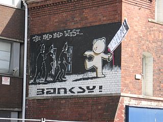
<i>The Mild Mild West</i> Mural by Banksy in Bristol, England

The Mild Mild West is a mural by graffiti artist Banksy, sited on No. 80 Stokes Croft, Bristol. It depicts a teddy bear throwing a Molotov cocktail at three riot police.

<span class="mw-page-title-main">Westmoreland House</span>

Westmoreland House was a building at Nos. 104–106 Stokes Croft, Bristol, next door to the Carriage Works.

References

  1. Foyle, Andrew (2004). Bristol (Pevsner Architectural Guides: City Guides). Yale University Press. p.  31. ISBN   978-0300104424.
  2. "The Carriage Works". National Heritage List for England. Historic England. Retrieved 8 August 2016.
  3. "Old Carriage Works". Bristol Opening Doors. Archived from the original on 17 February 2015. Retrieved 8 August 2016.
  4. "Stories of Westmorland House: An oral and visual history". Carriageworks. Retrieved 8 August 2016.
  5. Lowbridge, Caroline. "Bristol's Stokes Croft: Battle over 'home' of Banksy". BBC. Retrieved 8 August 2016.
  6. "No.104 The Carriage Works". historicengland.org.uk. Retrieved 2 May 2007.
  7. "Carriage Works, 104, Stokes Croft, Bristol - Bristol, City of (UA)". Heritage at Risk. Historic England. Archived from the original on 12 August 2016. Retrieved 8 August 2016.
  8. Vicki Mathias (11 June 2013). "Preferred developer named for Bristol's Carriageworks". This is Bristol. Archived from the original on 20 June 2013. Retrieved 12 June 2013.
  9. "Landmark regeneration scheme in Bristol". Assael. Archived from the original on 20 August 2016. Retrieved 8 August 2016.
  10. Onions, Ian (14 October 2015). "Plan for Carriageworks' site in Stokes Croft gets the go ahead". Bristol Post. Archived from the original on 1 November 2015. Retrieved 8 August 2016.
  11. "Bristol's Stokes Croft buildings redevelopment plan approved". BBC. Retrieved 8 August 2016.
  12. "Westmoreland House in Stokes Croft has started being demolished". Bristol Post. 21 November 2018. Retrieved 18 March 2020.