
Sir George Gipps was the Governor of the British colony of New South Wales for eight years, between 1838 and 1846. His governorship oversaw a tumultuous period where the rights to land were bitterly contested in a three way struggle between the colonial government, Aboriginal people and wealthy graziers known as squatters. The management of other major issues such as the end of convict transportation, large immigration programs and the introduction of majority elected representation also featured strongly during his tenure. Gipps is regarded as a man who brought a high moral and intellectual standard to the position of governor, but was ultimately defeated in his aims by the increasing power and avarice of the squatters.
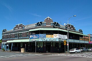
Charlestown is a suburb of the City of Lake Macquarie, Greater Newcastle, New South Wales, Australia, and the largest suburb in the Lake Macquarie locality. It is approximately 10 kilometres (6 mi) west-south-west of the central business district of Newcastle.

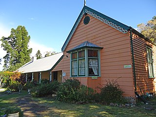
Morpeth is a suburb of the city of Maitland in the Hunter Region of New South Wales, Australia. It is on the southern banks of the Hunter River at the border between the City of Maitland and Port Stephens Council LGAs. The major population centre, where almost all residents of the suburb reside, is the historical town of Morpeth which takes its name from Morpeth, Northumberland, near Newcastle upon Tyne, in England.
Charles Throsby was an English surgeon who, after he migrated to New South Wales in 1802, became an explorer, pioneer and parliamentarian. He opened up much new land beyond the Blue Mountains for colonial settlement.

Wickham railway station is a former railway station which was located in the Newcastle suburb of Wickham, New South Wales. Situated on the Newcastle railway line, it was serviced by Central Coast & Newcastle Line and Hunter Line services until its closure. Wickham, along with Civic station, succeeded Honeysuckle station, which was closed in 1872, following its own replacement by Newcastle station. Following urban growth in the Newcastle region, both Wickham and Civic were opened to meet the growing demand for public transport in the region. The station's signal box, located at the station's western end at Stewart Avenue, was replaced in the 1960s with a building recognised as Australia's first television-equipped level crossing.

Mayfield is a north-western suburb of Newcastle, New South Wales, which takes its name from Ada May a daughter of the landowner there, John Scholey. Its boundaries are the Hunter River to the north, the Main Northern railway line to the south, the railway line to Newcastle Harbour to the east, and open ground to the west.

Budgewoi is a suburb located on the Central Coast of New South Wales, Australia, as part of the Central Coast Council local government area. Budgewoi is located 112 km by road north of the Sydney central business district.
Callaghan is a suburb of Newcastle, New South Wales, Australia 10 kilometres (6 mi) from Newcastle's central business district. It contains the main campus of the University of Newcastle, which is the entirety of the suburb. It is served by Warabrook railway station on NSW TrainLink's Hunter Line.
Hamilton is a suburb of Newcastle, New South Wales, Australia, located 4 kilometres (2.5 mi) from Newcastle's central business district. The main commercial centre is located around Beaumont Street and boasts a vibrant multicultural atmosphere providing an array of restaurants, retail, fashion and commercial outlets along with day-to-day services such as pharmacies, banks, florists, hairdressers, fruit shops and delicatessens.

Wallsend is a western suburb of Newcastle, New South Wales, Australia 11 kilometres (6.8 mi) from Newcastle's central business district. It is part of the City of Newcastle local government area.

Dudley is a southern coastal suburb of Newcastle, New South Wales, Australia, 13 kilometres (8 mi) southwest of Newcastle's central business district on the eastern side of Lake Macquarie. It is part of the City of Lake Macquarie local government area.
Cooks Hill is an inner city suburb of Newcastle, New South Wales, Australia. It is typified by its tree lined streets, rows of Victorian terrace housing, turn of the century timber cottages and corner pubs.
Tighe's Hill is a north-western suburb of Newcastle, New South Wales and was named after A.A.P. Tighe, an early resident, who in 1843 bought the estate. It is primarily a residential area, though it also includes the current Tighes Hill TAFE campus and a commercial area.
Islington is a suburb of the city of Newcastle in the Hunter Region of New South Wales, Australia. Located only 3.4 kilometres (2.1 mi) from the Newcastle CBD on one of Newcastle's major arterial roads, it was initially developed as a residential suburb. Today it includes a small industrial area and is adjacent to the Newcastle campus of the Hunter Institute of Technology. Its southeastern border is occupied entirely by the Main Northern railway line. The suburb has one railway station, which is shared with, and named after, adjacent Hamilton.
Mayfield North is a suburb of Newcastle, New South Wales, Australia.
Maryville is an inner suburb of Newcastle, New South Wales, Australia, located 4 kilometres (2.5 mi) northwest of Newcastle's central business district.

The Newcastle Tram System was an extensive network that operated between Newcastle and the outer suburb of Wallsend from 1887 to 1950. At its peak the line extended from the city to Speers Point and West Wallsend. The service was rarely profitable, and low utilisation for a variety of reasons including the convenience of buses led to it closing and the tracks being removed.
Tahlee is a heritage-listed former pastoral property of 68.8 hectares in the suburb of Tahlee situated on the north side of Port Stephens near Karuah in New South Wales, Australia. It is the original site of the Australian Agricultural Company and more recently the location of the former Tahlee Bible College. It was added to the New South Wales State Heritage Register on 2 April 1999.

Tahlee is a suburb of the Mid-Coast Council local government area in the Hunter and Mid North Coast regions of New South Wales, Australia, located on the northern shores of Port Stephens. The suburb is sparsely populated with the only significant population centre being the historic pastoral property of Tahlee, from which the suburb takes its name. The remainder of the suburb is primarily undeveloped bushland.

Carrington Pump House is a heritage-listed former hydraulic power station at 106 Bourke Street, Carrington, City of Newcastle, New South Wales, Australia. It was built from 1877 to 1878 by William H. Jennings. It is also known as Hydraulic Engine House and Crane Bases Nos. 7, 8, 9 and 10 and Carrington Hydraulic Power Station. It was added to the New South Wales State Heritage Register on 25 August 2017.


