Oakland County is a county in the U.S. state of Michigan. It is a principal county of the Detroit metropolitan area, containing the bulk of Detroit's northern suburbs. Its county seat is Pontiac, and its largest city is Troy. As of the 2020 Census, its population was 1,274,395, making it the second-most populous county in Michigan, and the largest county in the United States without a city of 100,000 residents.

Waterford Township is a charter township in the geographic center of Oakland County, Michigan, United States.

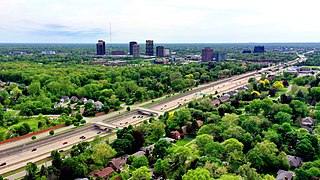
Bloomfield Township, officially the Charter Township of Bloomfield, is a charter township of Oakland County in the U.S. state of Michigan. As of the 2010 census, the township population was 41,070.
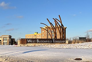
West Bloomfield Township is a charter township in Oakland County in the U.S. state of Michigan. A northwestern suburb of Detroit, West Bloomfield is located roughly 27 miles (43.5 km) from downtown Detroit. As of the 2020 census, the township had a population of 65,888.
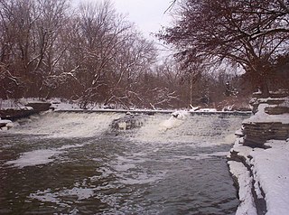
The River Rouge is a 127-mile river in the Metro Detroit area of southeastern Michigan. It flows into the Detroit River at Zug Island, which is the boundary between the cities of River Rouge and Detroit.

Southeast Michigan, also called southeastern Michigan, is a region in the Lower Peninsula of Michigan that is home to a majority of the state's businesses and industries as well as slightly over half of the state's population, most of whom are concentrated in Metro Detroit.

Dodge No. 4 State Park is a public recreation area covering 139 acres (56 ha) on the north shore of Cass Lake in Oakland County, northern Metro Detroit, Michigan. The state park occupies a mile of shoreline on the 1,280-acre (520 ha) lake.

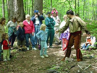
Sanilac Petroglyphs Historic State Park is a state park in the U.S. state of Michigan. The park, also known as ezhibiigadek asin consists of 240 acres (97 ha) in Greenleaf Township, Sanilac County, in Michigan's Thumb. It contains the largest collection of Native American petroglyphs in Michigan. The carvings were created in the pre-Columbian era and represent aspects of Native American spirituality. An interpretive hiking trail within the park passes along the nearby Cass River.
The Walled Lake Consolidated School District is a school district with its headquarters in the Educational Services Center in Walled Lake, Michigan in Greater Detroit. The district has 12 elementary schools, four middle schools, and three high schools which serve over 14,000 children.

Seven Lakes State Park is a public recreation area covering 1,434 acres (580 ha) one mile northwest of Holly in Holly Township, Oakland County, Michigan. The state park's 230 acres (93 ha) of water are found in six named lakes that include 170-acre Big Seven Lake, Little Seven Lake, and 44-acre Dickinson Lake.
Apple Island is a 35-acre (140,000 m2) island that lies in the middle of Orchard Lake, in Orchard Lake Village, Michigan. The island was formed during the region's last ice age, 10,000 to 12,000 years ago. Over 400 species of flora currently inhabit the island, including many rare varieties in Oakland County. Native Americans previously inhabited Apple Island, until ceding the island to the United States in the Treaty of Detroit. Currently, the West Bloomfield School District uses the island as an educational nature center.
Loon Lake is a freshwater lake located in Waterford Township, Michigan. It borders Dixie Highway on the west and is south of Walton Blvd. on the north. The sand-bottom lake is 243 acres, making it the 18th largest lake in Oakland County, Michigan and one of the largest in Waterford Township.
Elizabeth Lake is an unincorporated community in Oakland County in the U.S. state of Michigan. The community is located within Waterford Township. As an unincorporated community, Elizabeth Lake has no legally defined area or population statistics of its own, and it uses the Waterford 48328 ZIP Code.
Deer Lake is an all-sports, 137-acre (55 ha) lake along the main branch of the Clinton River. The lake, with a maximum depth of 63 feet (19 m), lies within Independence Township in Oakland County, Michigan.
Maceday Lake is an all-sports, 234-acre Oakland County, Michigan lake along the Clinton River.
Pine Lake is a private, all-sports, 395-acre lake in West Bloomfield Township, Oakland County, in the U.S. state of Michigan.
Lotus Lake is an all-sports, 185-acre (75 ha) Oakland County, Michigan lake along the Clinton River. Most of the lake lies within Waterford Township, however the northern portion of the lake is in Independence Township.

Leggett Bay is located in Waterford Township, Michigan, United States. The 25-acre bay within Lake Oakland (Michigan) lies north of Walton Blvd. near Clintonville Rd. At its deepest point, the bay is 10 feet deep.


