Castillos

Last updated
Castillos
City
Castillos, Rocha 1.jpg
Uruguay location map.svg
Red pog.svg
Castillos
Location in Uruguay
Coordinates: 34°11′56″S53°51′27″W / 34.19889°S 53.85750°W / -34.19889; -53.85750 Coordinates: 34°11′56″S53°51′27″W / 34.19889°S 53.85750°W / -34.19889; -53.85750
CountryFlag of Uruguay.svg  Uruguay
Department Flag of Rocha Department.svg  Rocha
Founded1866
Founded byHermogenes Lopez Formoso
Elevation
44 m (144 ft)
Population
 (2011 Census)
  Total7,541
Time zone UTC -3
Postal code
27200
Dial plan +598 4475 (+4 digits)
Climate Cfa
Castillos Castillos, Rocha 3.jpg
Castillos

Castillos is a small city in the Rocha Department of southeastern Uruguay.

Contents

Location

The city is located on the junction of Route 9 with Route 16, about 56 kilometres (35 mi) northeast of the city of Rocha. Other settlements in the area include Barrio Torres, about one kilometre southeast of Castillo, La Esmeralda, several kilometres to the northeast and Aguas Dulces several kilometres to the southeast along the Route 16.

Geography

Castillo is located in the eastern part of the department of Rocha. The land is low lying, located not far from the coast, with an average altitude of 44 metres. Laguna de Castillos is located to the southwest of the city, while north of it is the Cerro de los Rocha.

History

It was founded on 19 April 1866 under the name "San Vicente de Castillos", derived from the chapel San Vicente Mártir de Castillos. On 3 May 1909, its status was elevated to "Villa" (town) by decree Ley N° 3.453, [1] and on 3 November 1952, to "Ciudad" (city) by decree Ley N° 11.875. [2]

Population

In 2011 Castillos had a population of 7,541. [3]

YearPopulation
19083,896
19635,947
19757,260
19856,836
19967,346
20047,649
20117,541

Source: Instituto Nacional de Estadística de Uruguay [1]

Landmarks

The main plaza of the town is called Plaza Artigas and there is a cemetery in the southeast of town near the junction of Routes 9 and 16. Most of the streets are named after prominent dates in Uruguayan history and heroic figures, e.g. 25 de Mayo and General Rivera.

Government

As of 2011, the local mayor is Raúl Servetto. [4]

Places of worship

Notable people

Related Research Articles

<span class="mw-page-title-main">Minas, Uruguay</span> Capital city in Lavalleja, Uruguay

Minas is the capital of the Lavalleja Department in Uruguay. As of the census of 2011, it is the twelfth-most populated city in the country.

<span class="mw-page-title-main">Pan de Azúcar, Uruguay</span> City Municipality in Maldonado, Uruguay

Pan de Azúcar is a city in the southwest of the Maldonado Department in Uruguay. It takes its name from a nearby hill, topped by a huge cross.

<span class="mw-page-title-main">San Carlos, Uruguay</span> City & Municipality. in Maldonado, Uruguay

San Carlos is a city in the Maldonado Department of southern Uruguay. "San Carlos" is also the name of the municipality to which the city belongs. The municipality includes the following zones: San Carlos, El Tesoro, La Barra, Edén Rock, El Chorro, Manantiales, Balneario Buenos Aires, Punta Piedras, Santa Mónica, San Vicente, El Edén, Paso de la Cantera, Las Cañas, Carapé, Mataojo, Guardia Vieja, Pago de la Paja, Partido Norte, Partido Oeste, Cañada Bellaca, Corte de la Leña, Punta del Campanera, Puntas de Mataojo, and Laguna José Ignacio.

<span class="mw-page-title-main">Chuy</span> City in Rocha, Uruguay

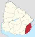
Chuy is a city in the extreme east of Uruguay, in the Rocha Department, 340 kilometres (211 mi) northeast of Montevideo. It lies on the border with Brazil, separated from its Brazilian sister town of Chuí only by a shared avenue that serves as the border, and by the Arroyo Chuy (stream) to the east. Chuy's population is currently 9,675 residents as of 2011.

<span class="mw-page-title-main">Rocha, Uruguay</span> Capital city in Rocha, Uruguay

Rocha is the capital city of the Rocha Department in Uruguay.

<span class="mw-page-title-main">Tarariras</span> City in Colonia, Uruguay

Tarariras, is a small city in the south of the Colonia Department of southern Uruguay.

<span class="mw-page-title-main">Empalme Olmos</span> Village in Canelones Department, Uruguay

Empalme Olmos is a village in the Canelones Department of southern Uruguay.

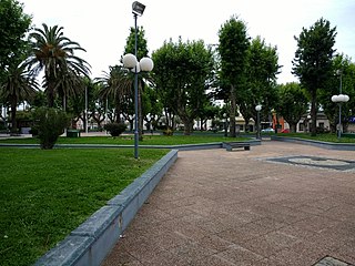
Santa Rosa is a small city in the Canelones Department of southern Uruguay.

Ombúes de Lavalle is a small city located in the north of Colonia Department in southwestern Uruguay. It is named after the Argentine General Juan Lavalle. The term «Ombúes» is the Spanish plural for «Ombú», a tree originary of the Pampas region, in southern South America, and a national symbol of both Argentina and Uruguay.

<span class="mw-page-title-main">Alejandro Gallinal</span> Village in Florida Department, Uruguay

Alejandro Gallinal or Cerro Colorado is a village in the Florida Department of southern-central Uruguay.

<span class="mw-page-title-main">José Pedro Varela, Uruguay</span> City in Lavalleja, Uruguay

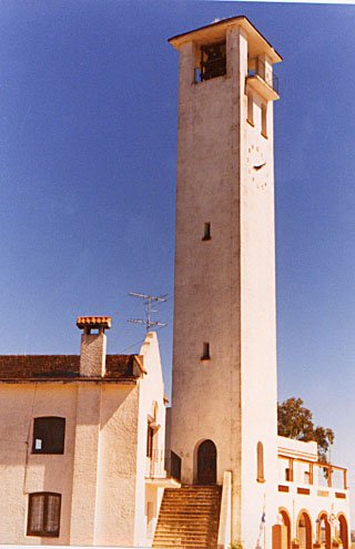
José Pedro Varela is a small city in the north of Lavalleja Department of southeastern Uruguay. It is named after the sociologist and politician José Pedro Varela.

<span class="mw-page-title-main">La Paloma, Rocha</span> City in Rocha, Uruguay

La Paloma is a small city in the Rocha Department of southeastern Uruguay.

Lascano is a small town in the Rocha Department of southeastern Uruguay.

Velázquez is a small town in the Rocha Department of southeastern Uruguay.

<span class="mw-page-title-main">La Coronilla</span> Village in Rocha Department, Uruguay

La Coronilla is a village in the Rocha Department of southeastern Uruguay.

<span class="mw-page-title-main">Route 3 (Uruguay)</span> Road in Uruguay

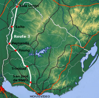
Route 3 is a national route of Uruguay. In 1975, it was assigned the name General José Artigas, the foremost national hero of Uruguay. It is one of the most important highways in the country along with Route 5, connecting the south coast near Rafael Perazza with Bella Unión in the extreme northwest. The road is approximately 592 kilometres (368 mi) in length.

<span class="mw-page-title-main">Route 8 (Uruguay)</span> Road in Uruguay

Route 8 is a national route of Uruguay. In 1975, it was assigned the name Brigadier General Juan Antonio Lavalleja, a national hero of Uruguay. It connects Montevideo with Aceguá in the northeast.

<span class="mw-page-title-main">Route 9 (Uruguay)</span> Road in Uruguay

Route 9 is a national route of Uruguay. In 1975, it was assigned the name Coronel Leonardo Olivera, a national hero of Uruguay. It connects Dr. Francisco Soca with Chuy in the northeast.

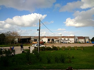
Ituzaingó is a small town of San José Department of southern Uruguay.

San Luis al Medio is a village in the Rocha Department of southeastern Uruguay.

References

  1. 1 2 "Statistics of urban localities (1908–2004) (see also "San Vicente de Castillos")" (PDF). INE. 2012. Retrieved 5 September 2012.[ dead link ]
  2. "LEY N° 11.875". República Oriental del Uruguay, Poder Legislativo. 1952. Archived from the original on 4 March 2016. Retrieved 5 September 2012.
  3. "Censos 2011 Cuadros Rocha". INE. 2012. Archived from the original on 2012-11-14. Retrieved 25 August 2012.
  4. "Inicio / MUNICIPIOS DE URUGUAY". Congreso de Intendes. Archived from the original on 8 March 2012. Retrieved 4 June 2011.