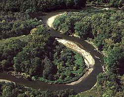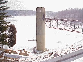
The Cuyahoga River is a river in the United States, located in Northeast Ohio, that feeds into Lake Erie. The river is famous for having been so polluted that it "caught fire" in 1969. The event helped to spur the environmental movement in the US.

Taughannock Falls State Park is a 750-acre (3.0 km2) state park located in the Town of Ulysses in Tompkins County, New York in the United States. The park is northwest of Ithaca near Trumansburg.

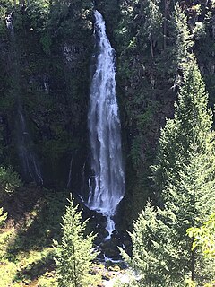
Barr Creek Falls, is a waterfall located in the Rogue River Canyon within the Prospect State Scenic Viewpoint in Jackson County, in the U.S. state of Oregon. The waterfall is located at the south end of Barr Creek as it plunges into the Rogue River over a carved cliff surrounded by walls of petrified volcanic ash as a consequence of the Mount Mazama eruption. The waterfall has also been called Bear Creek Falls. The waterfall gets its name from the creek which was called "Barr" for the presence of a fence that prevented cattle from straying out of the local Red Blanket Ranch and that ran adjacent to the creek.

Washington Township is one of twelve townships in Warren County, Indiana, United States. It is the most populous township in the county; according to the 2010 census, its population was 2,298, with 1,898 of those living in Williamsport, and it contained 1,011 housing units. It has the highest population density of the Warren County townships at about 120 inhabitants per square mile (46/km2).
The Black River is a 41.1-mile-long (66.1 km) river on the Upper Peninsula of the U.S. state of Michigan, flowing mostly in Gogebic County into Lake Superior at 46°40′03″N90°02′57″W. Its source at 46°18′54″N90°01′15″W is a boreal wetland on the border with Iron County, Wisconsin. The northern section of the river, 14 miles (23 km) within the boundaries of the Ottawa National Forest, was designated a National Wild and Scenic River in 1992.

Feather Falls is a rural unincorporated community in Butte County, California north and east of Lake Oroville. It lies at an elevation of 2982 feet. It is home to Feather Falls Elementary School, a K-8 facility. It takes its name from nearby Feather Falls, which was recently measured to be 410 feet tall. This concurs with the USGS Brush Creek 7½" quadrangle information.

Mill Creek Falls, is a waterfall located in the Rogue River Canyon within the Prospect State Scenic Viewpoint in Jackson County, in the U.S. state of Oregon. The waterfall is located at the south end of Mill Creek as it plunges into the Rogue River over a carved cliff surrounded by walls of petrified volcanic ash consequence of Mount Mazama eruption.

Poland is an unincorporated community in eastern Cass Township, Clay County, Indiana, United States. It lies along State Road 42 southeast of the city of Brazil, the county seat of Clay County. Its elevation is 696 feet (212 m). Although Poland is unincorporated, it has a post office, with the ZIP code of 47868.

The Ocqueoc River is stream in Presque Isle County in the northeastern part of the lower peninsula in the U.S. state of Michigan. It is 34.2 miles (55.0 km) long and encompasses a watershed of approximately 94,394 acres (382.00 km2).

There are 24 named waterfalls in Ricketts Glen State Park in the U.S. state of Pennsylvania along Kitchen Creek as it flows in three steep, narrow valleys, or glens. They range in height from 9 feet (2.7 m) to the 94-foot (29 m) Ganoga Falls. Ricketts Glen State Park is named for R. Bruce Ricketts, a colonel in the American Civil War who owned over 80,000 acres (32,000 ha) in the area in the late 19th and early 20th centuries, but spared the old-growth forests in the glens from clearcutting. The park, which opened in 1944, is administered by the Bureau of State Parks of the Pennsylvania Department of Conservation and Natural Resources (DCNR). Nearly all of the waterfalls are visible from the Falls Trail, which Ricketts had built from 1889 to 1893 and which the state park rebuilt in the 1940s and late 1990s. The Falls Trail has been called "the most magnificent hike in the state" and one of "the top hikes in the East".
Mill Creek, also previously known as Tierken Kill, is a tributary to the Hudson River. Poetanock was the Native American name for the stream. From its source just west of Snyders Lake in East Greenbush the stream travels southwest, then north and west to the Hudson River. The stream has two waterfalls, the Upper Falls on the Mill Brook, and the Lower Falls on the Mill Brook. Its mouth on the Hudson River is directly opposite Albany New York at what was Van Rensselaer Island, in the City of Rensselaer.

There are at least 120 named waterfalls in Montana. A waterfall is a place where flowing water rapidly drops in elevation as it flows over a steep region or a cliff. Waterfalls are most commonly formed when a river is young.
Upper Chush Falls is a 200-foot (61 m) waterfall on Whychus Creek, in the Cascade Range southwest of Sisters in the U.S. state of Oregon. Chush Falls, a 50-foot (15 m) waterfall, is further downstream on the same creek. Lying between Chush and Upper Chush is a third waterfall, The Cascade. These and several other falls on tributaries in the vicinity are within the Three Sisters Wilderness. The Northwest Waterfall Survey lists the fall's average flow at 40 cubic feet per second (1.1 m3/s). The highest flows occur between May and August.

Yakso Falls is a 70-foot (21 m) waterfall on Little River, in the Cascade Range east of Roseburg in the U.S. state of Oregon. The waterfall is about 27 miles (43 km) from the unincorporated community of Glide along Little River Road, which becomes Forest Road 27.

Salt Creek is a tributary, 30 miles (48 km) long, of the Middle Fork Willamette River in Lane County in the U.S. state of Oregon. It is named for salt springs along its banks that are used as licks by deer. The stream originates as an outflow of Lower Betty Lake in the forested Cascade Range just southeast of Waldo Lake. From its source, Salt Creek flows generally south, through Gold Lake, to Route 58, which it then follows mainly northwest for about 26 miles (42 km) to its mouth at the Middle Fork Willamette River just below Hills Creek Dam. At Salt Creek Falls—roughly 4 miles (6.4 km) west of Willamette Pass and a little more than 22 miles (35 km) upstream from the mouth—the stream plunges 286 feet (87 m), discharging an average of 50,000 U.S. gallons (190,000 L) of water per minute, or 111 cubic feet per second (3.1 m3/s). Below the falls, the creek enters a narrow canyon shaped by glaciation and basalt lava flows from higher in the Cascades. McCredie Hot Springs, at the former community of McCredie Springs, are natural hot springs along the lower half of Salt Creek beside Route 58.

Buttermilk Creek is a tributary of the Susquehanna River in Lackawanna County and Wyoming County, in Pennsylvania, in the United States. It is approximately 6.8 miles (10.9 km) long and flows through Newton Township in Lackawanna County and Falls Township in Wyoming County. The watershed of the creek has an area of 26.1 square miles (68 km2). The creek is a perennial stream and is not designated as an impaired waterbody. Major geographical features in its watershed include the Buttermilk Falls in its lower reaches, as well as Fords Lake and Lake Winola.

Mill Run is a tributary of the Susquehanna River in Wyoming County, Pennsylvania, in the United States. It is approximately 3.5 miles (5.6 km) long and flows through Tunkhannock Township and Overfield Township. The stream is not designated as an impaired waterbody. In its upper reaches, it flows through glacial drift, while in its lower reaches, it passes over a waterfall. Lakes in the stream's watershed include Flow Pond.


