Caves of Meghalaya

Last updated

Cave expedition in Meghalaya Expedition is in progress in Meghalayan Caves.jpg
Cave expedition in Meghalaya
Mawsmai Cave well near Cherrapunji, well cave Mawsmai Cave Meghalaya.JPG
Mawsmai Cave well near Cherrapunji, well cave

The Caves of Meghalaya comprise a large number of caves in the Jaintia, Khasi Hills, and Garo Hills districts in the Indian state of Meghalaya, and are amongst the longest caves in the world. Of the ten longest and deepest caves in India, the first nine are in Meghalaya, while the tenth is in Mizoram. The longest is Krem Liat Prah in the Jaintia Hills, which is 30,957 m (101,600 ft) long. [1] [2] [3] The word "Krem" means cave in the local Khasi language. [4]

Contents

The exploration of the Caves of Meghalaya is currently undertaken for both scientific and recreational pursuits, [5] ) and there are still many unexplored and partially explored caves in the state. [6] The annual caving expeditions organized by Meghalaya Adventurers Association (MAA) are known as the "Caving in the Abode of the Clouds Project". [6] [7] Because they are located primarily in limestone formations, the caves continue to come under threat from the limestone mining industry. [4]

History

According to the Bengal gazette, Krem Mawmluh was the first cave to be explored by a British subject, Lt. Yule, in 1844. [8] Siju Cave in Garo Hills was studied in 1922 when 1,200 metres (3,900 ft) was explored and four species of cave life forms were identified. [9] After the British Raj period extensive interest has been generated in caving as an adventure sport in the state. Since the 1990s, an exclusive organization known as the Meghalaya Adventurers Association (MAA) (located in Shillong) has been carrying out annual explorations in association with European speleologists, cavers from India, experts from other regions of the world, the Indian Army and the Indian Navy, [2] [6] [10] bringing to light a large number and length of caves in Meghalaya, relative to other known karst regions of the country. [10]

Numbers and size of caves

As of March 2015, 1,580 caves and cave locations have been identified in Meghalaya, of which 980 caves have been fully or partially explored, for a total length of 427 kilometres (265 mi) caves explored. [11] With an explored length of 30,957 metres (101,565 ft), Krem Liat Prah in Jaintia Hills is the longest cave in Meghalaya, as well as India, and is listed among the longest caves in the world. [3] [12] Krem Liat Prah contains a huge passage called the "Aircraft Hangar." [1] Since the MAA was established in 1994, the explored caves account for only about 5% of the total underground passages in the state of Meghalaya. [13]

Conservation

Limestone mining for the cement industry is a major threat to the Caves of Meghalaya, [4] causing a major collapse of the Krem Mawmluh cave, the seventh longest cave in the state of Meghalaya. The "cave-in" stimulated public awareness of the potential threat mining places to the rich scientific, tourism and ecological heritage. Ecologists and speleologists pressured the Government of Meghalaya to take effective steps to stop limestone mining in the vicinity of the limestone caves in the state. [4] During the mid-1990s, a cement plant was planned close to the Siju Cave (called the Bat Cave), near Balphakram National Park in the Garo Hills. This project generated strong opposition from the local community, supported by international scientists, as the cave hosts many rare species of bats. After considerable public pressure was applied, the Ministry of Environment and Forests finally withheld clearance for the project. [14]

List of twenty longest caves in Meghalaya

SystemLengthLocationFormationRemarks
Krem Liat Prah 30,957 m (101,600 ft) [3] [12] Jaintia Hills LimestoneIn the Shnongrim Ridge. Huge trunk passage called the Aircraft Hangar. Longest cave in the Indian Subcontinent. [1]
  • Krem KotSati
  • Kotsati – Umlawan Cave System
21,530 m (70,640 ft) [3] Lumshnong village, Jaintia Hills Limestone24 entrances, both horizontal and vertical. Needs to swim to enter the caves [1]
  • Krem Tyngheng
  • Diengjem
21,250 m (69,720 ft) [15] Jaintia Hills LimestoneNear Sammasi village. many side passages and very impressive. [3]
  • Krem Umthloo-Synrang Labbit
  • Synrang-Pamiang
18,181 m (59,650 ft) [3] Chiehruphi village, on NH 44, Jaintia Hills LimestoneDendritic pattern of stream cave passage. Many entrances. "Titanic Hall" chamber with coloured formations in orange, red, black, grey, blue, green and white. [1]
  • Krem Chympe
  • Piel Khlieng Pouk
12,434 m (40,790 ft) [5] From village Khaddum to Sielkan, Jaintia Hills LimestoneA river cave. 50 natural dams or gours, 6–8 metres (20–26 ft) high. Large colony of bats. [1]
  • Krem Shrieh
  • Tangnub
8,862 m (29,070 ft) [1] Tangnub village, Jaintia Hills LimestoneAlso known as Very large vertical entrance shaft of 97 metres (318 ft) depth leads to fine stream passage and plethora of high fossil passages. [1]
Krem Tyngheng8,671 m (28,450 ft) [5] Jaintia HillsLimestone
7,194 m (23,600 ft) [5] Khasi HillsLimestoneFilled with water needs wading, ceiling is 2.5 feet (0.76 m), formations of stalactite, stalagmite, and rock fossils. Also large number of bats. [16] A speleothem in Mawmluh Cave indicates a dramatic worldwide climate event around 2250 BC, and has been selected by the International Commission on Stratigraphy as the boundary stratotype of the Meghalayan stage/age of the late Holocene. [17]
  • Krem Lymput
  • Nongjri
6,641 m (21,790 ft) [5] Nongjri village, Khasi HillsLimestoneAttraction is from a small entrance leads to 1 kilometre (0.62 mi) passage called "Way to Heaven," and further to a Mughal Room (more than 25 metres (82 ft) wide, 25 metres (82 ft) high, and 75 metres (246 ft) long). [1]
Krem Rongdangngai Mondil Kol5,831 m (19,130 ft) [5] Jaintia HillsLimestone
  • Krem Shyrong Labbit
  • Shyieng Khlieh
5,715 m (18,750 ft) [5] Jaintia HillsLimestone
Tetengkil Balwakol5,681 m (18,640 ft) [5] Nengkhong village, Garo Hills Limestonetwo circular entrances of 1 metre (3 ft 3 in) dia expanding to walking height passages with dendric river flow. [1]
Krem Umsynrang5,612 m (18,410 ft) [5] Jaintia HillsLimestone
4,772 m (15,660 ft) [5] Siju village, Garo HillsLimestoneIt is in the vertical side of the Simsang River. [18] Also known as "bat cave". Has attractive stalagmites and stalactites. It has a Di's chamber. [1] The cave has been extensively researched and is well known. [19]
Krem Risang4,565 m (14,980 ft) [5] Jaintia HillsLimestone
Krem Synrang Ngap4,172 m (13,690 ft) [5] Jaintia HillsLimestoneInitial reaches consist of calcite bosses to reach a major junction leading to an inlet tunnel converging to a smaller section of passage beyond which are potholed galleries with cave pearl-like sandstone pebbles in the floor [20]
Krem Synrang Labbit3,933 m (12,900 ft) [5] Jaintia HillsLimestone
Krem Wah Ryngo – Khongrang3,416 m (11,210 ft) [5] Jaintia HillsLimestone
Krem Iawe3,398 m (11,150 ft) [5] Shnongrim-Tangnub Ridge, Jaintia HillsLimestoneDaylight lit very wide pothole entrance. A number of attractive fossil passages. [1]
Krem Mawshun3,339 m (10,950 ft) [5] Near church Lelad, Khasi HillsLimestoneDendritic master river cave. Has many decorated high level passages. [1]

IUGS geological heritage site

In respect of the Krem Mawmluh Cave site being the 'GSSP of the youngest unit of the geologic time scale associated with dramatic climate changes with implications on human civilisation' the International Union of Geological Sciences (IUGS)' included the 'GSSP of the Meghalayan Stage in the Mawmluh Cave' in its assemblage of 100 'geological heritage sites' around the world in a listing published in October 2022. The organisation defines an 'IUGS Geological Heritage Site' as 'a key place with geological elements and/or processes of international scientific relevance, used as a reference, and/or with a substantial contribution to the development of geological sciences through history.' [21]

See also

Related Research Articles

<span class="mw-page-title-main">Meghalaya</span> State in northeastern India

Meghalaya is a state in northeast India. Meghalaya was formed on 21 January 1972 by carving out two districts from the state of Assam: (a) the United Khasi Hills and Jaintia Hills and (b) the Garo Hills. The population of Meghalaya as of 2014 is estimated to be 3,211,474. Meghalaya covers an area of approximately 22,429 square kilometres, with a length-to-breadth ratio of about 3:1.

<span class="mw-page-title-main">West Garo Hills district</span> District of Meghalaya in India

West Garo Hills is an administrative district in Garo Hills of the state of Meghalaya in India. Tura town is the administrative headquarters of the district. The district occupies an area of 3714 km². In 2011 its population was 643,291. As of 2011 it is the second most populous district of Meghalaya, after East Khasi Hills.
<span class="mw-page-title-main">Williamnagar</span> City in Meghalaya, India

Williamnagar, formerly known as Simsanggre, is the headquarters of East Garo Hills district in the state of Meghalaya in India.

<span class="mw-page-title-main">Garo Hills</span> Mountain range in Bangladesh and India

The Garo Hills are part of the Garo-Khasi range in Meghalaya, India. They are inhabited by the Garo people. It is one of the wettest places in the world. The range is part of the Meghalaya subtropical forests ecoregion.

<span class="mw-page-title-main">Meghalaya subtropical forests</span> Ecoregion of India

The Meghalaya subtropical forests is an ecoregion of Northeast India. The ecoregion covers an area of 41,700 square kilometers (16,100 sq mi), and despite its name, comprise not only the state of Meghalaya, but also parts of southern Assam, and a tiny bit of Nagaland around Dimapur and adjacent Bangladesh. It also contains many other habitats than subtropical forests, but the montane subtropical forests found in Meghalaya is an important biome, and was once much more widespread in the region, and for these reasons chosen as the most suitable name. The scientific designation is IM0126.

Benarat Cavern is a cave system situated in Mount Benarat at the northern end of Mulu National Park in Malaysia. As of 2011, it is the third-longest known cave in Asia at 50 km.

Krem Liat Prah is the longest natural cave in South Asia.

<span class="mw-page-title-main">Cave research in India</span>

Cave research, encompassing the study of speleology and biospeleology, is still in its infancy in India. Although there are thousands of caves in India, research expeditions occur in few states. The Siju Cave in Meghalaya is the first limelighted natural cave from India. Several studies were carried out in this cave in the early 20th century. The Kotumsar Cave in Central India is one of the most explored caves of India, and biologists have classified many types of cavernicoles, i.e. trogloxenes, troglophiles and troglobites, from this cave.

<span class="mw-page-title-main">Belum Caves</span> Caves and archaeological site in India

The Belum Caves, located in Nandyala district of Andhra Pradesh's Rayalaseema region, is the second largest cave system on the Indian subcontinent, known for its speleothems, such as stalactite and stalagmite formations. The Belum Caves have long passages, galleries, spacious caverns with fresh water and siphons. This cave system was formed over the course of tens of thousands of years by the constant flow of underground water from the now-disappeared river Chitravathi. The cave system reaches its deepest point at the point known as Pataalaganga. Belum Caves have a length of 3,229 m (10,593.8 ft), making them the second largest caves on the Indian Subcontinent after the Krem Liat Prah caves in Meghalaya. It is one of the centrally protected Monuments of National Importance.

<span class="mw-page-title-main">Nohsngithiang Falls</span> Waterfall in Meghalaya, India

Nohsngithiang Falls is a seven-segmented waterfall located 1 kilometre (0.62 mi) south of Mawsmai village in East Khasi Hills district in the Indian state of Meghalaya. The water falls from a height of 315 metres (1,033 ft) and has an average width of 70 metres (230 ft). making it one of the tallest waterfalls in India.

<span class="mw-page-title-main">Hynniewtrep National Liberation Council</span> Militant organization

The Hynniewtrep National Liberation Council is a militant organization operating in Meghalaya, India. It claims to represent the Khasi-Jaintia tribal people, and its aim is to free Meghalaya from the alleged domination of outsiders from the Indian mainland. It was proscribed in India on 16 November 2000, but the ban was later lifted, before banning it again in 2019.

Williamson Ampang Sangma, a Garo leader, former Chief Minister of Meghalaya, twenty-first state of India on 21 January 1972. He was also the first ever Governor of Mizoram among the Garos in 1989.
<span class="mw-page-title-main">West Jaintia Hills district</span> District of Meghalaya in India

West Jaintia Hills is an administrative District in the state of Meghalaya in India. The united district was created on 22 February 1972 and occupied an area of 3819 km2. It had a population of 272,185. The district is part of the Meghalaya subtropical forests eco-region. With the bifurcation of the erstwhile Jaintia Hills District into East and West Jaintia Hills Districts, West Jaintia Hills District came into existence on 31 July 2012 with its headquarters at Jowai. Jowai is the host of all the heads of important governmental offices and establishments, educational institutions, hospitals, banking institutions, etc.

<span class="mw-page-title-main">Insurgency in Meghalaya</span>

The Insurgency in Meghalaya is a frozen armed conflict between India and a number of separatist rebel groups which was taking place in the state of Meghalaya. The Insurgency in Meghalaya is part of the wider Insurgency in Northeast India, and was fueled by demands of the Khasi, Synteng and Garo people for a separate state.

<span class="mw-page-title-main">Siju Cave</span> Cave in North East India

Siju Cave, also known as Bat Cave in English, is located in the North East Indian state of Meghalaya near the Napak Lake and Simsang River game reserve. It is a limestone cave and is famous for its stalagmites and stalactites.

Krem Synrang Pamiang is a cave located in the Jaintia Hills district of Meghalaya state, India. It is the third longest cave of India, with 14,157 m of surveyed passage.

The Meghalayan age is the name given in 2018, by the International Commission on Stratigraphy, to the current age or latest geologic age – or uppermost stage of the Quaternary. It is also the upper, or latest, of three subdivisions of the Holocene epoch or series. This way of breaking down time is based only on geology; for example it is unrelated to the three age system of historical periods into which human development is sometimes divided.

Bullita Cave, also known as Burkes Backyard Cave, is a cave located in Gregory National Park of the Northern Territory, Australia. It is one of the longest surveyed caves in both Australia and the world.

Mawmluh Cave is a maze cave in the state of Meghalaya in northeast India. At 7.2 km in length, it is the fourth longest cave in the Indian subcontinent. The cave, which has several entrances, has formed at the junction between an early Eocene dolomite and a sandstone formation. It contains numerous stalactites, stalagmites, columns and drapes, collectively termed speleothems.
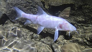
<i>Neolissochilus pnar</i> Species of fish

Neolissochilus pnar is a species of subterranean cyprinid in the genus Neolissochilus. It is the largest known subterranean fish, a title formerly held by the blind cave eel.

References

  1. 1 2 3 4 5 6 7 8 9 10 11 12 13 14 "Caves". Tourism Department, Government of Meghalaya.
  2. 1 2 Kaur, Preetinder (9 April 2014). "Subject Matter: Speleology:Explorers' delight". The Tribune India.
  3. 1 2 3 4 5 6 Daly 2013, p. 123.
  4. 1 2 3 4 "Cave-in proves ecologists right- Limestone mining causes part of India's seventh longest cave to collapse". The Telegraph India. 28 April 2008. Archived from the original on 3 February 2013.
  5. 1 2 3 4 5 6 7 8 9 10 11 12 13 14 15 16 "Caves in Meghalaya (As on February 2006)". Meghalaya Daily. February 2006.
  6. 1 2 3 "What is Caving". Adventure & Nature Network Pvt. Ltd. Archived from the original on 4 July 2015.
  7. "Exploration 2000: Caving in the Abode of the Clouds Project". Indian caving Organization.
  8. "The biodiversity of Krem Mawkhyrdop of Meghalaya, India, on the verge of extinction" (PDF).
  9. Daly 2013, p. 40.
  10. 1 2 "Scuttle Flies (Diptera: Phoridae) from Caves in Meghalaya, India" (PDF). Journal of Cave and Karst Studies.
  11. "2015 Meghalaya Caving Expedition Continues to Find New Caves". cavingnews.com. 30 March 2015.
  12. 1 2 "Worlds Longest Caves". caverbob.com. 4 June 2015.
  13. "Longest/Deepest Limestone Caves of Indian Subcontinent" (PDF). Ambient Science. 2014.
  14. Bengt G. Karlsson (15 May 2011). Unruly Hills: A Political Ecology of India's Northeast. Berghahn Books. pp. 182–. ISBN   978-0-85745-105-7.
  15. Daly 2013, p. 71.
  16. "Caving for beginners – Meghalaya". The Outdoor Journal. 20 August 2013.
  17. Formal subdivision of the Holocene Series/Epoch
  18. Kamal Ramprit Dikshit; Jutta K Dikshit (21 October 2013). North-East India: Land, People and Economy. Springer Science & Business Media. pp. 124–. ISBN   978-94-007-7055-3.
  19. Brian D. Kharpran Daly (January 2013). Caves for the Uninitiated. Strategic Book Publishing. pp. 40–. ISBN   978-1-61897-470-9.
  20. "Meghalaya". Bristol Exploration Club.
  21. "The First 100 IUGS Geological Heritage Sites" (PDF). IUGS International Commission on Geoheritage. IUGS. Retrieved 10 November 2022.
  22. "Discovering 1,700 Caves in Meghalaya: A Remarkable Achievement Praised by PM Modi - Fashion World 365". 27 August 2023. Retrieved 27 August 2023.

Bibliography