Cedarville, Ohio

Last updated

Cedarville, Ohio
Cedarville Opera House.jpg
Cedarville's historic opera house
OHMap-doton-Cedarville.png
Location of Cedarville, Ohio
Map of Greene County Ohio Highlighting Cedarville Village.png
Location of Cedarville in Greene County
Coordinates: 39°45′05″N83°48′40″W / 39.75139°N 83.81111°W / 39.75139; -83.81111
Country United States
State Ohio
County Greene
Government
   Mayor John Cody Jr.[ citation needed ]
Area
[1]
  Total1.35 sq mi (3.51 km2)
  Land1.31 sq mi (3.39 km2)
  Water0.04 sq mi (0.12 km2)
Elevation
[2]
1,047 ft (319 m)
Population
 (2020)
  Total4,257
  Density3,252.10/sq mi (1,255.79/km2)
Time zone UTC-5 (Eastern (EST))
  Summer (DST) UTC-4 (EDT)
ZIP code
45314
Area code(s) 937, 326
FIPS code 39-12784 [3]
GNIS feature ID2397584 [2]
Website cedarville.us

Cedarville is a village in Greene County, Ohio, United States. The village is within the Dayton Metropolitan Statistical Area. The population was 4,257 at the 2020 census.

Contents

History

Cedarville was settled by Irish and Scottish immigrants in 1799. Cedarville was originally known as Milford, and under the latter name was platted in 1816. [4] This was because of postal confusion with the city of Milford, Ohio. A post office called Massies Creek was established in 1837, and the name was changed to Cedarville in 1843. [5] The present name is for cedar trees near the original town site. [6]

For many years beginning in the 1880s, public life in Cedarville centered around the downtown Cedarville Opera House; it survives to the present day, [7] and is listed on the National Register of Historic Places. [8]

Geography

According to the United States Census Bureau, the village has a total area of 1.32 square miles (3.42 km2), of which 1.28 square miles (3.32 km2) is land and 0.04 square miles (0.10 km2) is water. [9]

Demographics

Historical population
CensusPop.Note
1860 688
1870 7539.4%
1880 1,18156.8%
1890 1,35514.7%
1900 1,189−12.3%
1910 1,059−10.9%
1920 1,028−2.9%
1930 940−8.6%
1940 1,03410.0%
1950 1,29225.0%
1960 1,70231.7%
1970 2,34237.6%
1980 2,79919.5%
1990 3,21014.7%
2000 3,82819.3%
2010 4,0195.0%
2020 4,2575.9%
U.S. Decennial Census [10]

2010 census

As of the census [11] of 2010, there were 4,019 people, 686 households, and 411 families living in the village. The population density was 3,139.8 inhabitants per square mile (1,212.3/km2). There were 759 housing units at an average density of 593.0 per square mile (229.0/km2). The racial makeup of the village was 94.4% White, 2.3% African American, 0.1% Native American, 1.1% Asian, 0.3% from other races, and 1.7% from two or more races. Hispanic or Latino of any race were 2.2% of the population.

There were 686 households, of which 26.5% had children under the age of 18 living with them, 47.7% were married couples living together, 9.3% had a female householder with no husband present, 2.9% had a male householder with no wife present, and 40.1% were non-families. 28.4% of all households were made up of individuals, and 12.3% had someone living alone who was 65 years of age or older. The average household size was 2.45 and the average family size was 2.96.

The median age in the village was 21 years. 9.2% of residents were under the age of 18; 66.4% were between the ages of 18 and 24; 8.4% were from 25 to 44; 9.8% were from 45 to 64; and 6% were 65 years of age or older. The gender makeup of the village was 46.5% male and 53.5% female.

2000 census

As of the census [3] of 2000, there were 3,828 people, 681 households, and 420 families living in the village. The population density was 3,594.6 inhabitants per square mile (1,387.9/km2). There were 722 housing units at an average density of 678.0 per square mile (261.8/km2). The racial makeup of the village was 95.06% White, 1.99% African American, 0.39% Native American, 0.81% Asian, 0.03% Pacific Islander, 0.31% from other races, and 1.41% from two or more races. Hispanic or Latino of any race were 0.94% of the population.

There were 681 households, out of which 28.8% had children under the age of 18 living with them, 51.2% were married couples living together, 7.6% had a female householder with no husband present, and 38.2% were non-families. 26.1% of all households were made up of individuals, and 9.1% had someone living alone who was 65 years of age or older. The average household size was 2.55 and the average family size was 3.08.

The village's population primarily consists of college-age students, with 10.4% of residents being under the age of 18, 65.0% from 18 to 24, 10.7% from 25 to 44, 8.4% from 45 to 64, and 5.5% who were 65 years of age or older. The median age was 21 years. For every 100 females there were 85.9 males. For every 100 females age 18 and over, there were 83.8 males.

The median income for a household in the village was $37,200, and the median income for a family was $44,234. Males had a median income of $32,500 versus $22,813 for females. The per capita income for the village was $9,499. About 5.4% of families and 13.8% of the population were below the poverty line, including 5.6% of those under age 18 and 4.3% of those age 65 or over.

Education

Postcard of the village's Carnegie Library, currently in use by Cedarville University as a Fine Arts building Postcard of Carnegie Library, Cedarville, OH - DPLA - 5de47387e387d4ea4222c5080d3ce798.pdf
Postcard of the village's Carnegie Library, currently in use by Cedarville University as a Fine Arts building

The Cedar Cliff Local School District operates three public schools combined in one building in the village: Cedarville Elementary School, Cedarville Middle School, and Cedarville High School. [12] The Cedar Cliff Local School District gets its name from the two towns which it serves, Cedarville and Clifton. [13]

Cedarville University, a Baptist institution, has been in operation at Cedarville since 1887. [14]

Cedarville has a public library, a branch of the Greene County Public Library. [15]

Arts and culture

CedarFest

To celebrate its distinction as the birthplace of James H. Kyle, Cedarville commemorates Labor Day with CedarFest, [16] an annual festival including a parade, a performance by the Cedarville High School Marching Band, pancake breakfast at the fire station, carnival games and rides, a community church service, and exhibitions of local cuisine. The weekend is capped by a fireworks display on the Sunday before Labor Day in Cedar Park.

Little Town of Lights

The Little Town of Lights is held annually on the first weekend of December. [17] Residents coordinate their outdoor lighted decorations (traditionally empty gallon milk jugs with a candle placed inside) and also compete for the best display. There are also hay rides, photo opportunities with Santa Claus, outdoor caroling and samples of local cuisine. There is a live Nativity scene complete with live animals located outside of Grace Baptist Church, where they also offer homemade cookies.

Notable people

Related Research Articles

<span class="mw-page-title-main">Greene County, Ohio</span> County in Ohio, United States

Greene County is located in the southwestern portion of Ohio. As of the 2020 census, the population was 167,966. Its county seat is Xenia and its largest city is Beavercreek. The county was established on March 24, 1803 and named for General Nathanael Greene, an officer in the Revolutionary War. Greene County is part of the Dayton, OH Metropolitan Statistical Area.

<span class="mw-page-title-main">Cedarville, Illinois</span> Village in Illinois, United States

Cedarville is a village in Stephenson County, Illinois, United States. The population was 741 at the 2010 census, up from 719 in 2000. It is the birthplace of social activist Jane Addams, the 1931 Nobel Peace Prize winner.
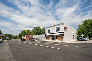
<span class="mw-page-title-main">Leo-Cedarville, Indiana</span> Town in Indiana, United States

Leo-Cedarville is a town in Cedar Creek Township, Allen County, Indiana, United States. The population was 3,603 at the 2010 census.
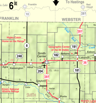
<span class="mw-page-title-main">Cedar, Kansas</span> City in Smith County, Kansas

Cedar is a city in Smith County, Kansas, United States. As of the 2020 census, the population of the city was 11.
<span class="mw-page-title-main">Sabina, Ohio</span> Village in Ohio, United States

Sabina is a village in Clinton County, Ohio, United States. As of the 2020 census, the village had a total population of 2,499.

<span class="mw-page-title-main">Summitville, Ohio</span> Village in Ohio, United States

Summitville is a village in southwestern Columbiana County, Ohio, United States. The population was 110 at the 2020 census. It is part of the Salem micropolitan area, 27 miles (43 km) miles southeast of Canton and 32 miles (51 km) southwest of Youngstown.

<span class="mw-page-title-main">Grandview Heights, Ohio</span> City in Ohio, United States

Grandview Heights, or simply Grandview, is a city in Franklin County, Ohio, United States. The population was 8,085 at the 2020 census.
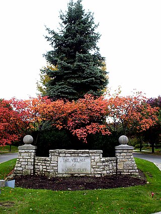
<span class="mw-page-title-main">Marble Cliff, Ohio</span> Village in Ohio, United States

Marble Cliff is a village in Franklin County, Ohio, United States. The population was 634 at the 2020 census.

<span class="mw-page-title-main">Metamora, Ohio</span> Village in Ohio, United States

Metamora is a village in Fulton County, Ohio, United States. The population was 566 at the 2020 census.

<span class="mw-page-title-main">Bowersville, Ohio</span> Village in Ohio, United States

Bowersville is a village in Greene County, Ohio, United States. The population was 261 at the 2020 census. It is part of the Dayton Metropolitan Statistical Area.

<span class="mw-page-title-main">Jamestown, Ohio</span> Village in Ohio, United States

Jamestown is a village in Greene County, Ohio, United States. The population was 2,052 at the 2020 census.

<span class="mw-page-title-main">Hanging Rock, Ohio</span> Village in Ohio, United States

Hanging Rock is a village in Lawrence County, Ohio, United States, along the Ohio River. The population was 204 at the 2020 census.
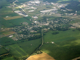
<span class="mw-page-title-main">Hebron, Ohio</span> Village in Ohio, USA

Hebron is a village in Licking County, Ohio, United States. The population was 2,326 at the 2020 census.
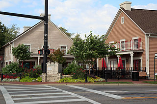
<span class="mw-page-title-main">Centerville, Ohio</span> City in Ohio, United States

Centerville is a city in Montgomery County, Ohio, United States. A core suburb of Metro Dayton, its population was 24,240 as of the 2020 census.

<span class="mw-page-title-main">Riverside, Ohio</span> City in Ohio, United States

Riverside is a city in Montgomery County, Ohio, United States. The population was 24,474 at the 2020 census. A suburb of Dayton, it is part of the Dayton metropolitan area.

<span class="mw-page-title-main">Glenford, Ohio</span> Village in Ohio, United States

Glenford is a village in Perry County, Ohio, United States. The population was 165 at the 2020 census.

<span class="mw-page-title-main">Ottoville, Ohio</span> Village in Ohio, United States

Ottoville is a village in Putnam County, Ohio, in the United States. The population was 966 at the 2020 census.

<span class="mw-page-title-main">McArthur, Ohio</span> Village in Ohio, United States

McArthur is a village in and the county seat of Vinton County, Ohio, United States. It is located 27 miles (43 km) southeast of Chillicothe. The population was 1,783 at the 2020 census.

<span class="mw-page-title-main">Clifton, Ohio</span> Village in Ohio, United States

Clifton is a village in Clark and Greene counties in the U.S. state of Ohio and is home to the Clifton Mill, one of the largest water-powered grist mills still in existence. The population was 131 at the 2020 census.
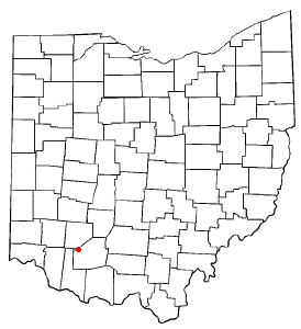
<span class="mw-page-title-main">Lynchburg, Ohio</span> Village in Ohio, United States

Lynchburg is a village in Clinton and Highland counties in the U.S. state of Ohio. The population was 1,510 at the 2020 census.
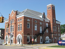
References

  1. "ArcGIS REST Services Directory". United States Census Bureau. Retrieved September 20, 2022.
  2. 1 2 U.S. Geological Survey Geographic Names Information System: Cedarville, Ohio
  3. 1 2 "U.S. Census website". United States Census Bureau . Retrieved January 31, 2008.
  4. Dills, R. S. (1881). History of Greene County: Together with Historic Notes on the Northwest, and the State of Ohio. Odell & Mayer. p. 548.
  5. U.S. Geological Survey Geographic Names Information System: Cedarville Post Office
  6. Broadstone, Michael A. (1918). History of Greene County, Ohio: Its People, Industries and Institutions, Volume 1. B.F. Bowen. p. 363.
  7. Owen, Lorrie K., ed. Dictionary of Ohio Historic Places. Vol. 1. St. Clair Shores: Somerset, 1999, 537.
  8. "National Register Information System". National Register of Historic Places . National Park Service. July 9, 2010.
  9. "US Gazetteer files 2010". United States Census Bureau. Archived from the original on January 25, 2012. Retrieved January 6, 2013.
  10. "Census of Population and Housing". Census.gov. Retrieved June 4, 2015.
  11. "U.S. Census website". United States Census Bureau . Retrieved January 6, 2013.
  12. "Homepage". Cedar Cliff Local Schools. Retrieved February 25, 2018.
  13. "District". Cedar Cliff Local Schools. Retrieved February 20, 2020.
  14. "History of Cedarville University". Cedarville University. Retrieved February 25, 2018.
  15. "Locations". Greene County Public Library. Retrieved February 25, 2018.
  16. "Typical CedarFest Schedule". Archived from the original on September 7, 2008. Retrieved February 25, 2018.
  17. "Cedarville Little Town of Lights". DaytonLocal. Retrieved February 25, 2018.