Related Research Articles

Bridgend County Borough is a county borough in the south-east of Wales. The county borough has a total population of 139,200 people, and contains the town of Bridgend, after which it is named. Its members of the Senedd are Sarah Murphy MS, representing the Bridgend Constituency, and Huw Irranca-Davies MS representing the Ogmore Constituency, and its members of the UK parliament are Jamie Wallis and Chris Elmore.

Bridgend is a constituency represented in the House of Commons of the UK Parliament since 2019 by Jamie Wallis, a Conservative.

Ogmore is a constituency created in 1918 represented in the House of Commons of the UK Parliament by Chris Elmore of the Labour Party.

Vaynor is a village and community in Merthyr Tydfil County Borough in Wales, United Kingdom. The population of the community at the 2011 census was 3,551.
Bryncethin is a small village and electoral ward in the County Borough of Bridgend, South Wales, located just north of Junction 36 of the M4 Motorway and approximately 3 miles north of the county town of Bridgend. The population of the ward was 1,319 in 2011.
Pen-y-fai is a village in the county borough of Bridgend, Wales within the Bridgend electoral ward area and the community of Newcastle Higher. The ward population taken at the 2011 census was 2,447.

Cornelly is a community and electoral ward in Bridgend County Borough, South Wales. As of 2011 the population of the Cornelly ward was 7,059.
Llangeinor is a small village located in the Garw Valley around 5 miles (8 km) north of Bridgend in Bridgend County Borough, Wales. The ward population taken at the 2011 census was 1,243. The entire village is now protected as part of a conservation area.

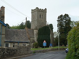
Cefn Cribwr is a village and community in Bridgend County Borough in south Wales. The village is located about 5 miles (8 km) from the centre of Bridgend town, and in-between Bridgend and Pyle.

Garw Valley is a community and coterminous electoral ward in the north of Bridgend County Borough, South Wales. As the name suggests, it follows and encompasses the valley of the River Garw. The community includes the village of Blaengarw at the head of the valley, followed by Pontycymer and Llangeinor on the river, with Bettws between the Garw and the Llynfi in the south. Garw Valley is bordered to the west by Maesteg, Llangynwyd Middle and Llangynwyd Lower; to the east by Ogmore Valley and to the south by Ynysawdre and St Bride's Minor.

Llanfrynach is a village and community in the county of Powys, Wales, and the historic county of Brecknockshire. The population of the community as taken at the 2011 census was 571. It lies just to the southeast of Brecon in the Brecon Beacons National Park. The village sits astride the Nant Menasgin, a right bank tributary of the River Usk. The B4558 passes just to its north and the Monmouthshire and Brecon Canal also passes around the village. The Welsh name signifies the 'church of Brynach'. The community includes the hamlets of Llanhamlach and Groesffordd.
Coity Higher is a community in Bridgend County Borough, south Wales. It contains the north western suburbs of Bridgend which includes the villages of Litchard and Coity. The southern boundary of the community adjoins the community of Brackla, while the northern border is defined by the M4 motorway. Notable buildings and landmarks within the community include Coity Castle, Parc Prison, the 14th century Church of St Mary, Pendre Hospital, Ty Mawr House and a burial chamber. At the 2001 census, the community's population was 835, being re-measured at 6,078 t the 2011 Census.
Laleston is a village and a community in Bridgend County Borough, south Wales, directly west of Bridgend town centre. The village takes its name from the Norman Lageles family who settled in the area. Buildings of note in the village include St David's Church, which still possesses features dating back to the 13th and 14th centuries, the Great House which was built in the early 16th century and Horeb Welsh Presbyterian Church (1831).

Newcastle is an area and electoral ward of the town of Bridgend, Wales. The area includes the medieval Newcastle Castle. The ward elects councillors to Bridgend Town Council and Bridgend County Borough Council.
Morfa is an electoral ward in the town of Bridgend, Wales. The ward elects councillors to Bridgend Town Council and, until 2022, Bridgend County Borough Council.
Oldcastle is an area and electoral ward of the town of Bridgend, Wales, to the south of the town centre. The ward elects councillors to Bridgend Town Council and Bridgend County Borough Council.

Penprysg is a residential area of the town of Pencoed in Bridgend County Borough, Wales.

Rest Bay is an electoral ward in the town of Porthcawl in Bridgend County Borough, Wales. It is on the coast overlooking bay and beach of the same name.
Litchard is a village and residential district north of Bridgend, Wales. It is also an electoral ward in the Coity Higher community, as well as a former ward to Bridgend County Borough Council.
References
- ↑ "Ward population 2011" . Retrieved 11 April 2015.
- ↑ "The County Borough of Bridgend (Electoral Arrangements) Order 1998". legislation.gov.uk. The National Archives. 23 November 1998. Retrieved 12 April 2019.
- ↑ "Election maps". Ordnance Survey . Retrieved 12 April 2019.