The bridge viewed from downstream north bank (Carmarthenshire right, Ceredigion left)
A bridge over the River Teifi at Cenarth has existed at least since 1188, when it was mentioned in the writings of Gerald of Wales.[3][4] The present bridge was constructed between 1785 and 1787[5] by Messrs Watkins and Webb.[6] It was designed by David Edwards (born 1748), who also built the Llandeilo Yr Ynys bridge near Nantgaredig earlier in 1786 and the later Newport Bridge.[5][7]
The bridge was designed to carry horse-drawn vehicles and has three stone arches which span 11.6m (38ft), 11.9m (39ft) and 12.2m (40ft).[5] The bridge is made of ashlar masonry and rubble stone with the parapet coping in rough slate. The design includes two cylindrical holes (perforated spandrels) 6ft (1.8m) in diameter, one either side of the central span. The holes were included in the design to reduce the weight of the structure and also to allow floodwaters to pass through them, instead of going over the top of the bridge: while the river appears to flow only under the southern arch, when in full flood the Teifi flows through all three arches.[8] This feature was used by Edwards's father William, who used six holes in the Old Bridge at Pontypridd to reduce the weight and pressure on the centre section.[9]
The accounts for the local quarter sessions show that in 1787 David Edwards was paid £2.12s.2d ster. for half his fee.[6] Therefore his total fee for the bridge was £5.4s.4d. In 2014, this would have been worth between £6,600 and £9,100.[5]
The bridge was widened in 1852 by Richard Kyrke Penson to make the right-angled bend at the north end easier to negotiate.[5]
The bridge joins two counties, Carmarthenshire and Ceredigion. It forms part of the former turnpike, now the A484 road, from Carmarthen to Cardigan. It is 4.75m (15.6ft) wide, but it has no footpaths. It is still being used by motor traffic in the 2010s with a speed limit of 20 miles per hour (32 kilometres per hour).
The bridge was Grade II* listed in the 1960s, with the Carmarthenshire southern end listed on 21 September 1964 and the Ceredigion northern end listed later on 23 June 1967.[6][10] The bridge is also a Scheduled Ancient Monument.[11]
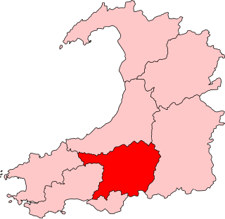
Carmarthenshire is a county in the south-west of Wales. The three largest towns are Llanelli, Carmarthen and Ammanford. Carmarthen is the county town and administrative centre. The county is known as the "Garden of Wales" and is also home to the National Botanic Garden of Wales.
Ceredigion ( ), historically Cardiganshire, is a county in the west of Wales. It borders Gwynedd across the Dyfi estuary to the north, Powys to the east, Carmarthenshire and Pembrokeshire to the south, and the Irish Sea to the west. Aberystwyth is the largest settlement and, together with Aberaeron, is an administrative centre of Ceredigion County Council.
Carmarthen is the county town of Carmarthenshire and a community in Wales, lying on the River Towy 8 miles (13 km) north of its estuary in Carmarthen Bay. The population was 14,185 in 2011, down from 15,854 in 2001, but gauged at 16,285 in 2019. It has a claim to be the oldest town in Wales – Old Carmarthen and New Carmarthen became one borough in 1546. It was the most populous borough in Wales in the 16th–18th centuries, described by William Camden as "chief citie of the country". Growth stagnated by the mid-19th century as new settlements developed in the South Wales Coalfield.
Cardigan is a town and community in the county of Ceredigion, Wales. Positioned on the tidal reach of the River Teifi at the point where Ceredigion meets Pembrokeshire, Cardigan was the county town of the historic county of Cardiganshire. Cardigan is the second-largest town in Ceredigion. The largest town, Aberystwyth, is one of the two administrative centres; the other is Aberaeron.
Newcastle Emlyn is a town on the River Teifi, straddling the counties of Ceredigion and Carmarthenshire in West Wales. It is also a community entirely within Carmarthenshire, bordered by those of Llangeler and Cenarth, also in Carmarthenshire, and by Llandyfriog in Ceredigion. Adpar is the part of town on the Ceredigion side of the River Teifi. It was formerly called Trefhedyn and was an ancient Welsh borough in its own right. The area including Adpar had a population of 1,883 according to the 2011 census.
Cenarth is a village, parish and community in Carmarthenshire, on the border between Ceredigion and Carmarthenshire, and close to the border with Pembrokeshire, Wales. It stands on the banks of the River Teifi, 6 miles (9.7 km) east of Cardigan and 4 miles (6.4 km) west of Newcastle Emlyn, and features the Cenarth Falls, a popular visitor attraction, and several other listed structures including an 18th-century corn mill incorporating the National Coracle Centre.
The River Teifi in Wales forms the boundary for most of its length between the counties of Ceredigion and Carmarthenshire, and for the final 3 miles (4.8 km) of its total length of 76 miles (122 km), the boundary between Ceredigion and Pembrokeshire. Its estuary is northwest of Cardigan, known in Welsh as Aberteifi, meaning 'mouth of the Teifi'. Teifi has formerly been anglicised as "Tivy".
William Edwards was a Welsh Methodist minister who also practised as a stonemason, architect and bridge engineer.
Llechryd is a rural village on the A484 road approximately 3 miles (4.8 km) from Cardigan, Ceredigion, Wales. Situated on the north bank of the tidal River Teifi, Llechryd is the first point upstream of Cardigan where crossing is possible. Most of the village has developed along the A484, with some estates branching off into the valley.
Beulah is a small village, wider community and electoral ward located halfway between the market town of Newcastle Emlyn and the seaside resort of Aberporth in Ceredigion, Wales.
The Teifi Valley Railway is a 2 ft narrow gauge railway occupying a section of the former standard gauge Great Western Railway line between Llandysul and Newcastle Emlyn. After the closure of the former line by British Rail in 1973, a preservation group built and periodically extended a narrow-gauge railway along the route, westwards from Henllan, eventually operating a 3 kilometres (1.9 mi) long line as a tourist attraction.
Carmarthen East and Dinefwr is a constituency of the Senedd. It elects one Member of the Senedd by the first past the post method of election. It is one of eight constituencies in the Mid and West Wales electoral region, which elects four additional members, in addition to eight constituency members, to produce a degree of proportional representation for the region as a whole.
The A475 road in Wales links Newcastle Emlyn in Carmarthenshire with Lampeter in Ceredigion; a distance of 19 miles (31 km).
Afon Cych is a tributary of the River Teifi in south-west Wales. It is 13 km long, passes through a number of small settlements on the border between Pembrokeshire and Carmarthenshire, and is significant in Welsh legend.
The Old Bridge, which is now also known as the William Edwards Bridge or Pontypridd Bridge, was originally known as the New Bridge or Newbridge, is an arched single-span footbridge that spans the River Taff at Pontypridd in Wales. The bridge was built by William Edwards and was completed in 1756. The bridge now has statutory protection as a scheduled ancient monument and is grade I listed.
The Cenarth Falls is a cascade of waterfalls just upstream of the road bridge in the village of Cenarth in Ceredigion, bordering Carmarthenshire and Pembrokeshire, Wales.
Adpar, formerly Trefhedyn, is a village in Ceredigion, Wales, in the community of Llandyfriog, now considered as a part of Newcastle Emlyn to which it is joined by a bridge across the River Teifi. In ancient times Adpar was a borough in its own right.
Henllan is a village in Ceredigion, Wales.
Carmarthen Bridge is the modern 1930s road bridge crossing the River Tywi in Carmarthen, Wales, carrying the A484 road.
Pont Treseli or Pont Tre-seli is a Grade II-listed single-arch stone bridge spanning Afon Cych at Abercych, Pembrokeshire, Wales. It carries the B4332 road across the boundary between Pembrokeshire and Carmarthenshire. Pont Treseli was also the name of one of several discrete settlements that now make up the linear village of Abercych.
This page is based on this Wikipedia article Text is available under the CC BY-SA 4.0 license; additional terms may apply. Images, videos and audio are available under their respective licenses.