Pictures
 Near Wintringham
 Near Hunmanby
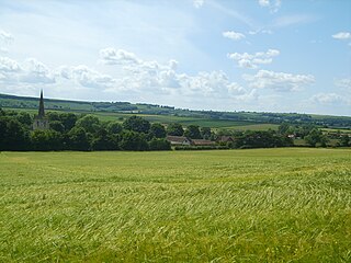
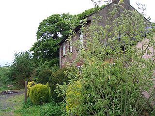
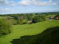 Near North Grimston
| Centenary Way, North Yorkshire | |
|---|---|
| Length | 83 mi (134 km) |
| Location | Yorkshire, England |
| Designation | UK National Trail |
| Trailheads | York Minster, North Yorkshire 53°57′43″N1°04′55″W / 53.962°N 1.082°W and Filey, North Yorkshire 54°12′36″N0°17′31″W / 54.210°N 0.292°W |
| Use | Hiking |
| Season | All year |
The Centenary Way is a route devised to celebrate the 100th anniversary of North Yorkshire County Council. It was opened by Chris Brasher in 1989 to mark the Centenary of the governance by County Councils.
The route runs across the Howardian Hills and Yorkshire Wolds via Castle Howard and Wharram Percy, linking York and the Foss Walk with the Yorkshire Wolds Way and Cleveland Way National Trails.
Meeting the Derwent and Foss, the walk combines riverside walks in deep valleys with forest tracks. Part of the route overlaps with the Yorkshire Wolds Way which also ends at Filey along with the Cleveland Way.
Start: SE603522 – York, North Yorkshire
Finish: TA126817 – Filey Brigg, North Yorkshire
Waymark: Letters CW on standard waymarks
The route of the Centenary Way passes close to or through the following places:
Places in italics are slightly off the main route.


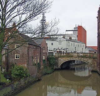
The River Foss is in North Yorkshire, England. It is a tributary of the River Ouse. It rises in the Foss Crooks Woods near Oulston Reservoir close to the village of Yearsley and runs south through the Vale of York to the Ouse in the centre of York. The name most likely comes from the Latin word Fossa, meaning ditch. It is mentioned in the Domesday Book. The York district was settled by Norwegian and Danish people, so parts of the place names could be old Norse. Referring to the etymological dictionary "Etymologisk ordbog", ISBN 82-905-2016-6 deals with the common Danish and Norwegian languages – roots of words and the original meaning. The old Norse word Fos (waterfall) means impetuous. The River Foss was dammed, and even though the elevation to the River Ouse is small, a waterfall was formed. This may have led to the name Fos which became Foss.

The Yorkshire Wolds are hills in the counties of the East Riding of Yorkshire and North Yorkshire in Northern England. They are the northernmost chalk hills in the UK and within lies the northernmost chalk stream in Europe, the Gypsey Race.

Filey is a seaside town and civil parish in North Yorkshire, England. It is located between Scarborough and Bridlington on Filey Bay. Although it was a fishing village, it has a large beach and became a popular tourist resort. According to the 2011 UK census, Filey parish had a population of 6,981, in comparison to the 2001 UK census population figure of 6,819, and a population of 6,870 in 1991.

Wharram Percy is a deserted medieval village and former civil parish near Wharram-le-Street, now in the parish of Wharram, on the western edge of the chalk Wolds of North Yorkshire, England. It is about 1 mile (1.6 km) south of Wharram-le-Street and is signposted from the Beverley to Malton road (B1248). Wharram Percy was part of the East Riding of Yorkshire until the 1974 boundary changes. In 1931 the parish had a population of 40.

The A64 is a major road in North and West Yorkshire, England, which links Leeds, York and Scarborough. The A64 starts as the A64(M) ring road motorway in Leeds, then towards York it becomes a high-quality dual carriageway until it is east of the city, where it becomes a single carriageway for most of its route to Scarborough.
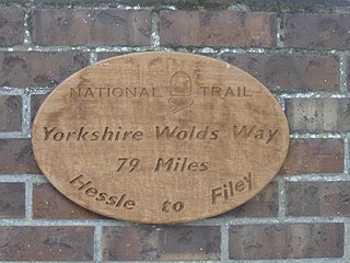
The Yorkshire Wolds Way is a National Trail in Yorkshire, England. It runs 79 miles (127 km) from Hessle to Filey, around the Yorkshire Wolds. At Filey Brigg, it connects with the Cleveland Way, another National Trail. In 2007 the Yorkshire Wolds Way celebrated the 25th anniversary of its official opening which took place on 2 October 1982.

Hunmanby is a large village and civil parish in North Yorkshire, England. It was part of the East Riding of Yorkshire until 1974. From 1974 to 2023 it was in the Scarborough district of the shire county of North Yorkshire. In 2023 the district was abolished and North Yorkshire became a unitary authority. It is on the edge of the Yorkshire Wolds, 3 miles (4.8 km) south-west of Filey, 9 miles (14 km) south of Scarborough and 9 miles (14 km) north of Bridlington. The village is on the Centenary Way.

The Cleveland Way is a National Trail in the historic area of Cleveland in North Yorkshire, Northern England. It runs 110 miles (177 km) between Helmsley and the Brigg at Filey, skirting the North York Moors National Park.
Wintringham is a village and civil parish in North Yorkshire, England. The village is near the A64 road and 6 miles (9.7 km) east of Malton.

The Malton and Driffield Junction Railway, later known as the Malton and Driffield branch was a railway line in Yorkshire that ran between the towns of Malton, North Yorkshire and Driffield in the East Riding of Yorkshire.
Wharram railway station was opened by the Malton and Driffield Railway in May 1853, serving the village of Wharram-le-Street in North Yorkshire, England, although the area was in the East Riding of Yorkshire at the time. The station was also near the deserted medieval village of Wharram Percy and adjacent to Wharram chalk quarry.

The Ebor Way is a 70-mile (112 km) long-distance footpath from Helmsley, North Yorkshire to Ilkley, West Yorkshire, via the city of York, England. It takes its name from Eboracum, the Roman name for York.
The East Riding of Yorkshire is a local government district with unitary authority status, and is a ceremonial county of England. It is named after the historic East Riding of Yorkshire which was one of three ridings alongside the North Riding and West Riding, which were constituent parts a Yorkshire ceremonial and administrative county until 1974. From 1974 to 1996 the area of the modern East Riding of Yorkshire constituted the northern part of Humberside.
The Minster Way is a 50-mile (80 km) walking route between the Minsters of Beverley and York in England. It crosses the chalk hills of the Yorkshire Wolds, as well as a wide variety of the East Riding of Yorkshire countryside. Part of the route follows the Yorkshire Wolds Way National Trail across Sylvan Dale before diverting to Millington, Bishop Wilton and Stamford Bridge, where it follows the River Derwent into the Plain of York as far as the River Ouse.

The Wilberforce Way is a 60-mile (97 km) walking route between Hull in the East Riding of Yorkshire and York. The walk has been devised so that it can be walked in its entirety or as thirteen smaller walks. It has been described as having sufficient places of worship on the route for it to be used as a walk of pilgrimage.

The Chalkland Way is a 40-mile (64 km) circular walking route in the East Riding of Yorkshire and North Yorkshire, England. The route covers the chalky hills and valleys of the western Yorkshire Wolds, with the common starting point in the town of Pocklington.

Wharram is a civil parish in North Yorkshire, England. It lies on the Yorkshire Wolds, 6 miles (10 km) south-east of Malton. The principal settlement is the village of Wharram-le-Street, and the parish also includes the deserted medieval village of Wharram Percy and the deserted medieval villages of Raisthorpe and Burdale, some 3 miles (5 km) south of Wharram-le-Street. The population of the parish was estimated at 120 in 2016.
| | This North Yorkshire location article is a stub. You can help Wikipedia by expanding it. |