Centerville, Gallia County, Ohio

Last updated

Centerville, Ohio
Centerville Lodge 371 F&AM.jpg
Masonic lodge building on State Street
OHMap-doton-Centerville Gallia County.png
Location of Centerville, Gallia County, Ohio
Map of Gallia County Ohio Highlighting Centerville Village.png
Location of Centerville in Gallia County
Coordinates: 38°53′53″N82°26′45″W / 38.89806°N 82.44583°W / 38.89806; -82.44583
Country United States
State Ohio
County Gallia
Township Raccoon
Area
[1]
  Total0.10 sq mi (0.26 km2)
  Land0.10 sq mi (0.26 km2)
  Water0.00 sq mi (0.00 km2)
Elevation
[2]
676 ft (206 m)
Population
 (2020)
  Total87
  Density870.00/sq mi (335.06/km2)
Time zone UTC-5 (Eastern (EST))
  Summer (DST) UTC-4 (EDT)
FIPS code 39-13169 [3]
GNIS feature ID1085657 [2]

Centerville, also known as Thurman, is a city in western Gallia County, Ohio, United States. The city lies adjacent to the Gallia - Jackson county line. It is located adjacent to U.S. Route 35 at the eastern terminus of State Route 279. [4]

Contents

It is part of the rural Point Pleasant micropolitan area. The population was 87 at the 2020 census.

Name

A view entering Centerville while traveling west on SR 279 CentervilleOHJuly2007.JPG
A view entering Centerville while traveling west on SR 279

Although the village is officially named "Centerville," [2] it is also commonly known as "Thurman" — the name that the Board on Geographic Names ruled in favor of using to refer to the community — and as "Ridgeway." Its official name has also been spelled "Centreville." [2]

History

Centerville was platted in 1835. [5] The community originally was settled chiefly by Welsh immigrants. [6]

Geography

According to the United States Census Bureau, the village has a total area of 0.10 square miles (0.26 km2), all land. [7]

Demographics

Historical population
CensusPop.Note
1880 272
1890 215−21.0%
1900 198−7.9%
1910 143−27.8%
1920 96−32.9%
1930 12732.3%
1940 113−11.0%
1950 14225.7%
1960 25176.8%
1970 114−54.6%
1980 14829.8%
1990 128−13.5%
2000 1344.7%
2010 103−23.1%
2020 87−15.5%
U.S. Decennial Census [8]

2010 census

As of the census [9] of 2010, there were 103 people, 43 households, and 31 families living in the village. The population density was 1,030.0 inhabitants per square mile (397.7/km2). There were 52 housing units at an average density of 520.0 per square mile (200.8/km2). The racial makeup of the village was 98.1% White, 1.0% African American, and 1.0% from two or more races.

There were 43 households, of which 18.6% had children under the age of 18 living with them, 53.5% were married couples living together, 7.0% had a female householder with no husband present, 11.6% had a male householder with no wife present, and 27.9% were non-families. 25.6% of all households were made up of individuals, and 11.7% had someone living alone who was 65 years of age or older. The average household size was 2.40 and the average family size was 2.87.

The median age in the village was 44.3 years. 12.6% of residents were under the age of 18; 12.7% were between the ages of 18 and 24; 28.2% were from 25 to 44; 24.4% were from 45 to 64; and 22.3% were 65 years of age or older. The gender makeup of the village was 52.4% male and 47.6% female.

2000 census

As of the census [3] of 2000, there were 134 people, 50 households, and 40 families living in the village. The population density was 1,350.8 inhabitants per square mile (521.5/km2). There were 52 housing units at an average density of 524.2 per square mile (202.4/km2). The racial makeup of the village was 96.27% White, 0.75% African American, and 2.99% from two or more races.

There were 50 households, out of which 40.0% had children under the age of 18 living with them, 68.0% were married couples living together, 6.0% had a female householder with no husband present, and 20.0% were non-families. 16.0% of all households were made up of individuals, and 8.0% had someone living alone who was 65 years of age or older. The average household size was 2.68 and the average family size was 3.03.

In the village, the population was spread out, with 27.6% under the age of 18, 9.7% from 18 to 24, 21.6% from 25 to 44, 26.9% from 45 to 64, and 14.2% who were 65 years of age or older. The median age was 37 years. For every 100 females there were 103.0 males. For every 100 females age 18 and over, there were 94.0 males.

The median income for a household in the village was $35,625, and the median income for a family was $35,938. Males had a median income of $36,250 versus $20,833 for females. The per capita income for the village was $15,169. There were 20.0% of families and 15.4% of the population living below the poverty line, including 10.9% of under eighteens and 20.0% of those over 64.

Education

Public education in the village of Centerville is provided by the Gallia County Local School District.

Related Research Articles

<span class="mw-page-title-main">Gallia County, Ohio</span> County in Ohio, United States

Gallia County is a county located in the U.S. state of Ohio. As of the 2020 census, the population was 29,220. Its county seat and largest village is Gallipolis.

<span class="mw-page-title-main">Centerville, Minnesota</span> City in Minnesota, United States

Centerville is a city in Anoka County, Minnesota, United States. The population was 3,896 at the 2020 census.

<span class="mw-page-title-main">Ithaca, Ohio</span> Village in Ohio, United States

Ithaca is a village in Darke County, Ohio, United States. The population was 81 at the 2020 census.

<span class="mw-page-title-main">Lithopolis, Ohio</span> Village in Ohio, United States

Lithopolis is a village in Fairfield and Franklin counties in the U.S. state of Ohio. The population was 2,134 at the 2020 census.

<span class="mw-page-title-main">Cheshire, Ohio</span> Village in Ohio, United States

Cheshire is a village in Gallia County, Ohio, United States, along the Ohio River. The population was 123 at the 2020 census. It is part of the rural Point Pleasant micropolitan area.

<span class="mw-page-title-main">Crown City, Ohio</span> Village in Ohio, United States

Crown City is a village in Gallia County, Ohio, United States, along the Ohio River. The population was 424 at the 2020 census.

<span class="mw-page-title-main">Rio Grande, Ohio</span> Village in Ohio, United States

Rio Grande is a village in Gallia County, Ohio, United States. The population was 724 at the 2020 census. It is part of the rural Point Pleasant micropolitan area. Although the town is named after the river in the southern United States, its name is pronounced "Rye-O Grand" rather than the traditional Spanish pronunciation.

<span class="mw-page-title-main">Vinton, Ohio</span> Village in Ohio, United States

Vinton is a village in Gallia County, Ohio, United States. The population was 224 at the 2020 census. It is part of the rural Point Pleasant micropolitan area.

<span class="mw-page-title-main">Addyston, Ohio</span> Village in Ohio, United States

Addyston is a village in Miami Township, Hamilton County, Ohio, United States. Located along the Ohio River, it is a western suburb of the neighboring city of Cincinnati. The population was 927 at the 2020 census.

<span class="mw-page-title-main">Cleves, Ohio</span> City in Ohio, United States

Cleves is a village in Miami Township, Hamilton County, Ohio, United States. Located along the Ohio River, it is a western suburb of Cincinnati. The population was 3,414 at the 2020 census.

<span class="mw-page-title-main">Evendale, Ohio</span> Village in Ohio, United States

Evendale is a village in Hamilton County, Ohio, United States, within the Cincinnati metropolitan area. The population was 2,669 at the 2020 census.

<span class="mw-page-title-main">Mowrystown, Ohio</span> Village in Ohio, United States

Mowrystown is a village in Highland County, Ohio, United States. The population was 385 at the 2020 census.

<span class="mw-page-title-main">Gann, Ohio</span> Village in Ohio, United States

Brinkhaven, once known as Mount Holly and Gann, is a village in Knox County, Ohio, United States. The population was 114 at the 2020 census.

<span class="mw-page-title-main">Centerville, Ohio</span> City in Ohio, United States

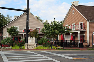
Centerville is a city in Montgomery County, Ohio, United States. A core suburb of Metro Dayton, its population was 24,240 as of the 2020 census.

<span class="mw-page-title-main">Darbyville, Ohio</span> Village in Ohio, United States

Darbyville is a village in Pickaway County, Ohio, United States. The population was 186 at the 2020 census.

<span class="mw-page-title-main">Macksburg, Ohio</span> Village in Ohio, United States

Macksburg is a village in Washington County, Ohio, United States, along the West Fork of Duck Creek. The population was 120 at the 2020 census. The village is about 28 miles (45 km) south of Cambridge, Ohio.

<span class="mw-page-title-main">Centerville, Manitowoc County, Wisconsin</span> Town in Wisconsin, United States

Centerville is a town in Manitowoc County, Wisconsin, United States. The population was 713 at the 2000 census. The town is divided by I-43 and surrounds the Village of Cleveland.

<span class="mw-page-title-main">Wilson, Ohio</span> Village in Ohio, United States

Wilson is a village in Belmont and Monroe counties in the U.S. state of Ohio. The population was 129 at the 2020 census. It is part of the Wheeling metropolitan area.

<span class="mw-page-title-main">Gratiot, Ohio</span> Village in Ohio, United States

Gratiot is a village in Licking and Muskingum counties in the U.S. state of Ohio. The population was 215 at the 2020 census.

<span class="mw-page-title-main">Verona, Ohio</span> Village in Ohio, United States

Verona is a village in Montgomery and Preble counties in the U.S. state of Ohio. The population was 403 at the 2020 census. It is part of the Dayton Metropolitan Statistical Area.

References

  1. "ArcGIS REST Services Directory". United States Census Bureau. Retrieved September 20, 2022.
  2. 1 2 3 4 U.S. Geological Survey Geographic Names Information System: Centerville, Gallia County, Ohio
  3. 1 2 "U.S. Census website". United States Census Bureau . Retrieved January 31, 2008.
  4. Rio Grand, Ohio, 7.5 Minute Topographic Quadrangle, USGS, 2023
  5. History of Gallia County: Containing a Condensed History of the County; Biographical Sketches; General Statistics; Miscellaneous Matters &c. St. Peter's Episcopal Church. 1882. p. 25.
  6. Overman, William Daniel (1958). Ohio Town Names. Akron, OH: Atlantic Press. p. 25.
  7. "US Gazetteer files 2010". United States Census Bureau. Archived from the original on January 25, 2012. Retrieved January 6, 2013.
  8. "Census of Population and Housing". Census.gov. Retrieved June 4, 2016.
  9. "U.S. Census website". United States Census Bureau . Retrieved January 6, 2013.