
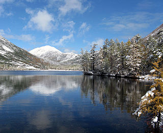
The Bryansk Forest Nature Reserve, also known as Bryansky Les, is a nature reserve in Bryansk Oblast, Russia, along the Nerussa River near the Russian border with Ukraine.

Central Tsernozemsky Nature Reserve is a Russian 'zapovednik' that protects for scientific study a collection of selected sites of black soil prairie in the southwestern part of the Central Uplands within the middle of the forest-steppe zone. The six sites of the reserve spread out to the southeast of the city of Kursk, in the Medvensky District, Manturovsky District, Gorshechensky District of Kursk Oblast. It covers an area of 5,287 ha (20.41 sq mi).
The Okhotsk-Manchurian taiga ecoregion is an area of coniferous forests in the Russian Far East, covering the Amur River delta, the west coast of the Okhotsk Sea, and the rugged extension of the northern Sikhote-Alin Mountains that run southwest-to-northeast through the Primorsky and Khabarovsk regions. It is the southernmost taiga forest in Eurasia. The ecoregion is distinguished from surrounding ecoregions by the slightly warmer climate due to the maritime influence and the shield of the mountains to the west, and by the mixing of flora and fauna species from Okhotsk-Kamchatka communities to the north and Manchurian species from the south. The forest at lower altitudes is "light taiga", and "dark taiga" at higher altitudes.
The Sakhalin Island taiga ecoregion covers most of Sakhalin Island, the largest island of Russia, which is separated from the mainland by the Sea of Okhotsk and the Sea of Japan. The region is one of taiga, coniferous and mixed broad leaf forest landscape, with mixed larch forests at the lower elevations and shrubs at higher elevations. The vegetation is influenced by a maritime climate that is relatively warmer than the colder continental taiga in Siberia to the west. A long, thin island, 1,000 km by 200 km, Sakhalin is connected to the mainland by ice bridges in the winter, so it shares certain flora and fauna species. It is in the Palearctic realm, and mostly in the taiga biome with a Humid continental climate, cool summer climate. It covers 403,504 km2 (155,794 sq mi).

The Southeast Tibet shrub and meadows are a montane grassland ecoregion that cover the southeast and eastern parts of the Tibetan Plateau in China. The meadows in this region of Tibet are in the path of the monsoon rains and are wetter than the other upland areas of the Tibetan Plateau. The "high cold" alpine terrain is one of high species diversity, due to the relatively high levels of precipitation for the region. Precipitation is lower in the northwest, and hence the vegetation thins from shrub to meadow or even desert.

Polissia Nature Reserve is a protected nature reserve of Ukraine dedicated to the conservation and scientific study of representative woodland marshes of the Pinsk Marshes in the Polissia region. The reserve is in the administrative districts of Olevsk and Ovruch in Zhytomyr Oblast
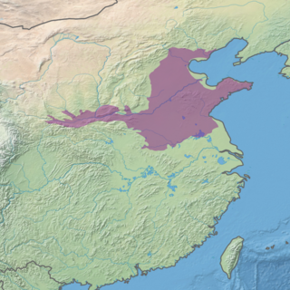
The Huang He Plain mixed forests ecoregion covers the flat lower ranges of the Yellow River. This area is generally known as the North China Plain. While there is some forest habitat, the region has mostly been converted to agriculture, being one of the most populous areas in the world.

The Pamir alpine desert and tundra ecoregion covers the high plateau of the Pamir Mountains, at the central meeting of the great mountain ranges of Central Asia: Himalaya, Karakoram, Hindu Kush, Kunlun, and Tian Shan. It is a region of relatively high biodiversity due to its central location and high elevation differentials, but it also acts as a barrier between the climate and habitats of north and south Asia.

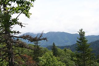
The Changbai Mountains mixed forests ecoregion covers the Changbai Mountains and surrounding foothills in China and North Korea. The region features extensive and naturally preserved deciduous and conifer forests. The region exhibits high biodiversity due to its relative isolation, temperate climate with high rainfall, and centrality to central Chinese, Siberian, and European floral communities. In 1979, a significant portion of the ecoregion was designated the Changbaishan Biosphere Reserve by UNESCO.
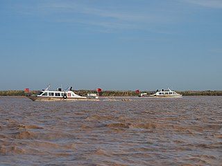
The Bohai Sea saline meadow ecoregion covers the coastal deltas of the Yellow River and the Luan River where they enter the Bohai Sea in China. The saline meadows and intertidal mudflats provide an important stopping-over point for birds migrating on the East Asian–Australasian Flyway. The region is under heavy ecological pressure from human development.
The Central Tibetan Plateau alpine steppe ecoregion covers the high alpine plateau that stretches over 1,600 kilometres (1,000 mi) across the Tibetan Plateau to Qinghai Lake in China. Because of the high altitude—much it over 5,000 metres (16,000 ft)—the region is a cold, arid desert that is only 20% covered with steppe and meadow vegetation. The area has been relatively free from human development due to the hostile climate and unsuitability for agriculture. The ecosystem is relatively intact, and supports herds of wild antelope, sheep, deer, and gazelles.

The Qilian Mountains subalpine meadows ecoregion covers the high meadows and shrubland of the Qilian Mountains, on the northeastern edge of the Tibetan Plateau in central China. These mountains form a divide between the dry regions of the Gobi Desert to the north, and the Qaidam Basin and the Tibetan Plateau to the south. While the habitat supports populations of marmots, grouse and some rare mammal species, the grasslands of the region are under pressure from over-grazing by domestic livestock.

The Qin Ling Mountains deciduous forests ecoregion covers the Qin Mountains, which run west-to-east across central China. The mountains effectively divide the biological regions of China into north and south. To the north is the Yellow River basin, a loess-soil region of temperate deciduous forests. To the south is the Yangtze River basic, a subtropical forest region. In between, the Qin Mountains support many rare and endemic species, including the Giant panda and the Sichuan snub-nosed monkey.
The Manchurian mixed forests ecoregion covers the forested hills surrounding the river plains of northern China, Russia, North Korea, and South Korea. The ecoregion supports a number of rare species due to the relative isolation, the diversity of habitat, with mixed forests of deciduous Mongolian oak and conifers of Korean pine. Because mountains rise above the region on three sides, with plains and wetlands below, the area supports high biodiversity as a transition zone.

The Alashan Plateau semi-desert ecoregion covers the southwestern portion of the Gobi Desert where precipitation in the mountains is sufficient for a short part of the summer to support sparse plant life. The terrain is basin and range, with elevations from 1,000 to 2,500 metres. The region straddles the China–Mongolian border, with the Tibetan Plateau to the south, and the more arid regions of the Gobi to the north and east.

The Yarlung Tsangpo arid steppe ecoregion covers the river valley of the Yarlung Tsangpo River on the southern edge of Tibet. The river runs parallel to the northern borders of Nepal, Bhutan and India, between the Himalayas to the south and the Tibet Plateau to the north. The river valleys are the most populated areas of Tibet, putting pressure on wildlife. The area ranges from cold desert in the west to steppe shrub land in the east; the few trees are in the lowest river valleys to the east.

The Altai steppe and semi-desert ecoregion, as its name indicates, sits in a transition zine between steppe and semi-desert, supporting sparse grass and shrublands. The area is relatively undeveloped, with agriculture mostly represented by grazing livestock. There are a few shallow lakes in depressions used by migratory birds.

The Northern Annamites rain forests ecoregion covers the rugged and relatively unexplored northern Annamite Mountains of central Laos and Vietnam. There are high numbers of endemic plant species, and the relative remoteness and isolation of the area supports many rare and endangered animals. Rainfall is somewhat less than the lowland rainforest of the lower elevations in Vietnam, and the temperatures slightly cooler due to the higher elevation.

The Central Persian desert basins ecoregion covers the arid steppe and desert basins of central Iran, stretching into northwestern Afghanistan. The ecoregion extends over the Central Iranian Plateau, which is surrounded by mountain ranges and has no outlets to the sea. Much of the terrain is hot sand-and-gravel desert and large salt flats. The vegetation includes many specialized species of halophytes (salt-tolerant), xerophytes (drought-tolerant), and psammophile (sand-loving) plants.
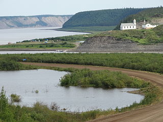
The Northwest Territories taiga ecoregion (WWF:NA0614) is located in the Northwest Territories and Yukon provinces of Canada. It covers forest and tundra along the Mackenzie River Valley and the surrounding highlands in the southern portion of the valley.


